Safety Score: 2,7 of 5.0 based on data from 9 authorites. Meaning we advice caution when travelling to United States.
Travel warnings are updated daily. Source: Travel Warning United States. Last Update: 2024-05-03 08:06:06
Delve into Lafayette Square
Lafayette Square in St. Louis (Missouri) is a city located in United States about 710 mi (or 1,142 km) west of Washington DC, the country's capital town.
Current time in Lafayette Square is now 11:16 PM (Friday). The local timezone is named America / Chicago with an UTC offset of -5 hours. We know of 10 airports closer to Lafayette Square, of which 4 are larger airports. The closest airport in United States is Lambert St Louis International Airport in a distance of 12 mi (or 20 km), North-West. Besides the airports, there are other travel options available (check left side).
There is one Unesco world heritage site nearby. It's Cahokia Mounds State Historic Site in a distance of 15 mi (or 24 km), East. Also, if you like playing golf, there are some options within driving distance. We saw 1 points of interest near this location. In need of a room? We compiled a list of available hotels close to the map centre further down the page.
Since you are here already, you might want to pay a visit to some of the following locations: St Louis, Clayton, Belleville, Waterloo and Saint Charles. To further explore this place, just scroll down and browse the available info.
Local weather forecast
Todays Local Weather Conditions & Forecast: 25°C / 77 °F
| Morning Temperature | 16°C / 61 °F |
| Evening Temperature | 26°C / 79 °F |
| Night Temperature | 19°C / 66 °F |
| Chance of rainfall | 1% |
| Air Humidity | 64% |
| Air Pressure | 1014 hPa |
| Wind Speed | Gentle Breeze with 7 km/h (5 mph) from South |
| Cloud Conditions | Overcast clouds, covering 100% of sky |
| General Conditions | Light rain |
Saturday, 4th of May 2024
20°C (69 °F)
18°C (65 °F)
Heavy intensity rain, gentle breeze, overcast clouds.
Sunday, 5th of May 2024
22°C (72 °F)
20°C (67 °F)
Moderate rain, gentle breeze, overcast clouds.
Monday, 6th of May 2024
27°C (80 °F)
20°C (68 °F)
Light rain, moderate breeze, scattered clouds.
Hotels and Places to Stay
Marriott St. Louis Grand
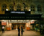
St. Louis Union Station a Curio by Hilton
Oakwood at Pointe 400
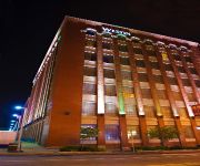
The Westin St. Louis
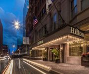
Hilton St Louis Downtown at the Arch
Embassy Suites by Hilton St Louis Downtown
Hilton St. Louis at the Ballpark
a Tribute Portfolio Hotel Magnolia Hotel St. Louis
Napoleon's Retreat Bed and Breakfast
Hotel Lumiere
Videos from this area
These are videos related to the place based on their proximity to this place.
Zadorov, Steen, Ennis, Cole fight Buffalo Sabres vs St. Louis Blues Nov 11 2014 NHL
Nikita Zadorov vs Ian Cole fight and Alexander Steen vs Tyler Ennis fight. PBP John Forslund, Pierre McGuire color. NBCSN Feed. 2ND PERIOD 13:11 STL Ian Cole served by Magnus Paajarvi ...
St. Louis, Rails & Ol' Man River
Mitte des 19. Jahrhunderts gehörten Dampfschiffe auf dem Ol'Man River zum Alltag. Später übernahmen Dampfzüge die meisten Transporte. Heute ist diese Epoche noch auf vielen ...
Amtrak Texas Eagle Crossing St Louis Bridge
Amtrak Texas Eagle Crossing St Louis Bridge going Northbound viewed from train end. The MacArthur Bridge over the Mississippi River between St. Louis, Missouri and East St. Louis, Illinois...
Full OT Detroit Red Wings vs St. Louis Blues Jan 15 2015 NHL
Full OT Detroit Red Wings vs St. Louis Blues Jan 15 2015 NHL PBP John Kelly, color Darren Pang. FSMW Feed. https://www.facebook.com/HDHockeyVideos.
St. Louis Eagles 2013 15 year old team [sportscenter edition]
the 2013 Nike Memorial Day Classic in Atlanta, Basketball Highlights of the up coming super stars from St. Louis Mo. Filmed & Edited by Lanell Turner aka The Record Play'a from Record Play'a...
Tour St. Louis Children's Hospital
Join Michelle as she takes you on a tour of St. Louis Children's Hospital. Learn about the many services we provide and how to find them when you're at the hospital. Some of the important...
The Magic House in Kirkwood Mo. (St. Louis) A Must Watch!
The Kids had a great time at the Magic House in Kirkwood, Mo. The place is absolutely fantastic. It's the kind of place you can go and have fun all day long.
St Louis Gateway Station Amtrak Platform
St Louis Missouri Gateway Station Amtrak platform area train watching.
**Special** Chasing UP #844
Chasing UP #844 from Washington to St. Louis MO. UP 844: 4-8-4 UPP 809: Tank Car (Jim Adams) UP 1982: SD70ACe (Mopac Heritage Unit) UPP 9336: Box Car Car (Art Lockman) UPP 209: ...
Back to School
The Divas take a field trip to Susannah's former High School with Goodwill client Ronisha to share the secrets of looking fabulous while staying on a budget. The students put their fashion...
Videos provided by Youtube are under the copyright of their owners.
Attractions and noteworthy things
Distances are based on the centre of the city/town and sightseeing location. This list contains brief abstracts about monuments, holiday activities, national parcs, museums, organisations and more from the area as well as interesting facts about the region itself. Where available, you'll find the corresponding homepage. Otherwise the related wikipedia article.
MetroLink (St. Louis)
MetroLink is the light rail transit system in the Greater St. Louis area of Missouri and the Metro East area of Illinois. The entire system currently consists of two lines (Red Line and Blue Line) connecting Lambert-St. Louis International Airport and Shrewsbury, MO with Scott Air Force Base near Shiloh, Illinois through downtown St. Louis. The system features 37 stations and carries an average of 51,716 people each weekday.
Lafayette Square, St. Louis
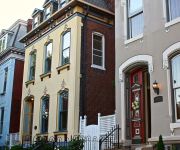
Lafayette Square is a neighborhood in St. Louis, Missouri that is bounded on the north by Chouteau Avenue, on the south by Interstate 44, on the east by Truman Parkway and on the west by South Jefferson Avenue. It surrounds Lafayette Park, which is the city's oldest public park, created by ordinance in 1836. The neighborhood is one of the oldest in St. Louis. When the neighborhood was developed, it was one of the most fashionable in St. Louis.
Union Station (St. Louis MetroLink)
Union Station is a St. Louis MetroLink station. This station is adjacent to Union Station (a shopping center) in St. Louis, Missouri. It was one of six MetroLink stations in the Downtown St. Louis Ride Free Zone at lunch time on weekdays prior to the 2009 service reduction. The station is on the 18th Street side of Union Station.
Civic Center (St. Louis MetroLink)
Civic Center is a St. Louis MetroLink station. The station is located near the Scottrade Center, home of the St. Louis Blues, Sheraton City Center Hotel, Soldiers Memorial, and the Saint Louis Public Library Central Library. It was one of six MetroLink stations in the Downtown St. Louis Ride Free Zone at lunch time on weekdays prior to the 2009 service reduction. The station serves the St.
Scottrade Center
Scottrade Center (originally Kiel Center and formerly Savvis Center) is a 19,150 seat arena located in downtown St. Louis, Missouri, opened in 1994. It is the home of the St. Louis Blues of the National Hockey League. Besides ice hockey, the arena features a range of arena programming, including professional wrestling, concerts, ice shows, family shows, and other sporting events. It hosts approximately 175 events per year, drawing nearly two million guests annually.
LaSalle Park
LaSalle Park is an integral part of the three-neighborhood "Old Frenchtown" area—LaSalle Park, Lafayette Square and Soulard—bordering the southern edge of downtown St. Louis. It was formed as a "new" neighborhood, legally distinct from the larger Soulard district, through the efforts of local company Ralston Purina, which has its world headquarters in LaSalle Park, and the city of St. Louis, Missouri. LaSalle Park contains a mixture of Victorian and Federalist architecture.
Downtown West, St. Louis
Downtown West is a neighborhood of St. Louis, Missouri. It is, as the name suggests, a section of downtown that is further inland, west from the banks of the Mississippi river. St. Louis City Hall, the Peabody Opera House, the Scottrade Center arena, and St. Louis Union Station are all located in Downtown West.
McKinley Heights, St. Louis
The McKinley Heights Neighborhood is an historic conservation district located in the near South Side of the City of St. Louis. The neighborhood is bounded by I-44 to the north, Jefferson Avenue to the west, and I-55 and Gravois Boulevard to the east and south. There are restaurants and entertainment in the adjacent Soulard and Lafayette Square neighborhoods. Three bus routes provide a commute downtown or throughout the City. There are three churches, the top Junior High School in the St.
Peabody–Darst–Webbe, St. Louis
Peabody–Darst–Webbe is a neighborhood of St. Louis, Missouri. It is also called the Near Southside neighborhood. Peabody–Darst–Webbe is an area bounded by S. Tucker Blvd. on the east, Chouteau Ave. on the north, Dolman Street on the west, and the I-55/I-44 interchange on the south. Between 1990 and 2000 the neighborhood led the city of St. Louis in population decline, declining 44% over the course of the decade.
Ewing Yard (St. Louis MetroLink)
The Ewing Yard (also known as Jefferson Avenue Yard) is a rail yard for the St. Louis MetroLink light rail system in Greater St. Louis. One of the Bi-State Development Agency's major operation and maintenance facilities, the yard maintains the fleet of SD-400 and SD-460 electric light rail vehicles. Located in St. Louis, Missouri, the yard sits on land bounded by Jefferson Avenue to the west, Scott Avenue to the north, and Ewing Avenue to the east.
Aloe Plaza
Aloe Plaza is part of the Terminus section of the St. Louis Gateway Mall. It is two blocks in size and sits directly in front of Union Station. It is bounded by Market, Chestnut, 18th, and 20th streets. The plaza is dominated by the Carl Milles fountain The Meeting of the Waters.
Gateway Multimodal Transportation Center
The Gateway Multimodal Transportation Center, also known as Gateway Transportation Station or Gateway Station, is a rail and bus terminal station in downtown St. Louis, Missouri. Opened in 2008 and operating 24 hours a day, it serves Amtrak, St. Louis MetroLink, MetroBus regional buses, Greyhound cross-country buses, and taxis. Missouri's largest rail transportation station, it is located one block east of St. Louis Union Station. Gateway Station cost $31.4 million to build.





!['St. Louis Eagles 2013 15 year old team [sportscenter edition]' preview picture of video 'St. Louis Eagles 2013 15 year old team [sportscenter edition]'](https://img.youtube.com/vi/tzRhlCApUTg/mqdefault.jpg)


