Safety Score: 2,7 of 5.0 based on data from 9 authorites. Meaning we advice caution when travelling to United States.
Travel warnings are updated daily. Source: Travel Warning United States. Last Update: 2024-05-18 08:26:29
Explore Lakeshore East
The district Lakeshore East of West End in Orleans Parish (Louisiana) is located in United States about 962 mi south-west of Washington DC, the country's capital.
If you need a place to sleep, we compiled a list of available hotels close to the map centre further down the page.
Depending on your travel schedule, you might want to pay a visit to some of the following locations: New Orleans, Gretna, Chalmette, Davis (historical) and Hahnville. To further explore this place, just scroll down and browse the available info.
Local weather forecast
Todays Local Weather Conditions & Forecast: 26°C / 78 °F
| Morning Temperature | 21°C / 69 °F |
| Evening Temperature | 29°C / 84 °F |
| Night Temperature | 24°C / 74 °F |
| Chance of rainfall | 41% |
| Air Humidity | 77% |
| Air Pressure | 1012 hPa |
| Wind Speed | Fresh Breeze with 13 km/h (8 mph) from South-East |
| Cloud Conditions | Overcast clouds, covering 100% of sky |
| General Conditions | Very heavy rain |
Sunday, 19th of May 2024
27°C (80 °F)
25°C (78 °F)
Sky is clear, light breeze, clear sky.
Monday, 20th of May 2024
30°C (86 °F)
25°C (76 °F)
Sky is clear, gentle breeze, clear sky.
Tuesday, 21st of May 2024
31°C (88 °F)
24°C (75 °F)
Sky is clear, gentle breeze, clear sky.
Hotels and Places to Stay
New Orleans Marriott Metairie at Lakeway
Hosteeva Conti Street Suites
Courtyard New Orleans Metairie
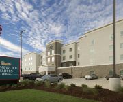
Homewood Suites by Hilton Metairie New Orleans
Canal Street Inn Bed and Breakfast
La Quinta Inn New Orleans Causeway
Residence Inn New Orleans Metairie
Holiday Inn METAIRIE NEW ORLEANS AIRPORT
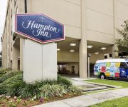
Hampton Inn Metairie
MIDTOWN HOTEL NEW O
Videos from this area
These are videos related to the place based on their proximity to this place.
Renovated Lakefront Boathouse - 7938 Breakwater
For more details click here: http://www.visualtour.com/showvt.asp?t=2963995 7938 Breakwater Drive New Orleans, LA 70124 $399000, 3 bed, 3.5 bath, 2456 SF, MLS# 939075 This fantastic, ...
Quick look @ New Orleans City Park newest feature the Great Lawn
Abraham Walker video blogs about City Park's "Great Lawn". It's a beautiful place to unwind after a long day or play a game of pitch and catch with some friends. The one question that bugs...
Parade of Homes 2012 - The Best Use of Narrow Lots - 6931 Catina St.
This 2012 Parade of Homes spotlight features a Lakeview home built by Guidry Custom Homes that utilizes an open layout and a large island to create more space between the kitchen and living...
Gabriel Arce - UNO's got talent winner 2012
Gabriel Arce blowing us away with a Corazon Partido Cover at UNO's got talent He won at the University of New Orleans!
LA State BJJ Tourney / Feb 8, 2014 / NoGi Finals / Win by Triangle Choke
Dane Shaffer Jr Teen 13-15 Beginner 110 and up.
Delft3D_FLOW_Lec01_Grid Generation
Series of Delft3D FLOW Tutorials by Sina Amini. Grid Generation using RGFGRID FMI Center for Environmental Modeling, Pontchartrain Institute of Environmental Sciences, University of New Orleans.
my friend on lsd first time
my friend took LSD. hes walking around with a camera then he hands the camera to a girl who records him sneaking into the bathroom and putting on a creepy mask and scaring the shit out of me...
SABS Group (IELP Students (UNO)): Crazy Customer
This is a reality TV Show created by three IELP students at the University of New Orleans.
Luxury Real Estate Located on 1004 Falcon Rd Metairie 70005 | One Of A Kind Exclusive Metairie
Luxury Real Estate Located on 1004 Falcon Rd Metairie 70005 | One Of A Kind Exclusive Metairie.
Videos provided by Youtube are under the copyright of their owners.
Attractions and noteworthy things
Distances are based on the centre of the city/town and sightseeing location. This list contains brief abstracts about monuments, holiday activities, national parcs, museums, organisations and more from the area as well as interesting facts about the region itself. Where available, you'll find the corresponding homepage. Otherwise the related wikipedia article.
University of New Orleans
The University of New Orleans, often referred to locally as UNO, is a medium-sized public urban university located on the New Orleans Lakefront within New Orleans, Louisiana, United States. It is a member of the University of Louisiana System and the Urban 13 association.
Pontchartrain Beach
Pontchartrain Beach was an amusement park located in New Orleans, Louisiana, on the south shore of Lake Pontchartrain. It was founded by Harry J. Batt Sr. and later mananged by his son, Harry J. Batt Jr. It opened in 1928, across Bayou St. John from an existing amusement resort at Old Spanish Fort. Pontchartrain Beach's original location is the present-day lakefront neighborhood of Lake Terrace.
17th Street Canal
The 17th Street Canal is a drainage canal in Greater New Orleans, Louisiana, that flows into Lake Pontchartrain. The canal forms a significant portion of the boundary between the city of New Orleans and Metairie, Louisiana. The canal has also been known as the Metairie Outlet Canal and the Upperline Canal.
London Avenue Canal
The London Avenue Canal is a drainage canal in New Orleans, Louisiana, used for pumping rain water into Lake Pontchartrain. The Canal runs through the 7th Ward of New Orleans from the Gentilly area to the Lakefront. The Canal was constructed in the first half of the 19th century, commissioned by Alexander Milne, who owned large tracts of land that would later become part of the city of New Orleans but were at the time mostly swamp.
Tad Gormley Stadium
Tad Gormley Stadium (originally City Park Stadium) is a multi-purpose outdoor stadium, located in City Park, in New Orleans, Louisiana, named for Frank "Tad" Gormley. It has been used for football, track & field, and soccer. It played host to the 1992 US Olympic Track & Field Trials for the 1992 Summer Olympics. Its most frequent use is for high school football, which attracts a large following in the South.
New Orleans Botanical Garden
The New Orleans Botanical Garden is a botanical garden located in City Park, New Orleans, Louisiana.
Orleans Canal
The Orleans Canal is a drainage canal in New Orleans, Louisiana. The current version of the canal is about 2 km long, running along the up-river side of City Park, through the Lakeview and Lakeshore neighborhood, and into Lake Pontchartrain. It is part of the system used to pump rain water out of the streets of the city into the Lake. The Canal has also been known as the Orleans Avenue Canal, the Orleans Outfall Canal, the Orleans Tail Race, and early on, the Girod Canal,
City Park (New Orleans)
City Park, a 1,300 acre (5.3 km²) public park in New Orleans, Louisiana, is the 6th-largest and 7th-most-visited urban public park in the United States. City Park is approximately 50% larger than Central Park in New York City, the municipal park recognized by Americans nationwide as the archetypal urban greenspace.
New Basin Canal
The New Basin Canal, also known as the New Orleans Canal and the New Canal, was a shipping canal in New Orleans, Louisiana from the 1830s through the 1940s. The New Basin Canal was constructed by the New Orleans Canal and Banking Company, incorporated in 1831 with a capital of 4 million United States dollars.
Navarre, New Orleans
Navarre is a neighborhood of the city of New Orleans. A subdistrict of the Lakeview District Area, its boundaries as defined by the City Planning Commission are: I-610, Canal Boulevard and Florida Boulevard to the north, Orleans Avenue to the east, City Park Avenue to the south and the Pontchartrain Expressway and Pontchartrain Boulevard to the west.
Lakeview, New Orleans
Lakeview is a neighborhood of the city of New Orleans. A subdistrict of the Lakeview District Area, its boundaries as defined by the City Planning Commission are: Robert E. Lee Boulevard to the north, Orleans Avenue to the east, Florida Boulevard, Canal Boulevard and I-610 to the south and Pontchartrain Boulevard to the west.
Holy Cross School (New Orleans)
Holy Cross School is a high school and middle school founded in 1849 by the Congregation of Holy Cross in New Orleans, Louisiana. The main founder of Holy Cross is Blessed Father Basil Moreau, who was just recently beatified. Holy Cross High was originally named St. Isadore's College. The school's founding principle is the school code, "The Holy Cross Man.
St. Bernard Projects
St. Bernard Projects was a neighborhood of the city of New Orleans and was one of the Housing Projects of New Orleans. A subdistrict of the Mid-City District Area, its boundaries as defined by the City Planning Commission were: Harrison Avenue to the north, Paris Avenue to the east, Lafreniere Street and Florida Avenue to the south and Bayou St. John to the west.
Mount Carmel Academy (Louisiana)
Mount Carmel Academy or Mt. Carmel is an all-girls parochial high school in New Orleans, Louisiana, United States. It is located in the Roman Catholic Archdiocese of New Orleans.
West End, New Orleans
West End (also referred to as West Lakeview) is a neighborhood of the city of New Orleans. A subdistrict of the Lakeview District Area, its boundaries as defined by the City Planning Commission are: Lake Pontchartrain to the north, the New Basin Canal and Pontchartrain Boulevard to the east, Veterans Boulevard to the south and the 17th Street Canal to the west. The area was largely built on land reclaimed from Lake Pontchartrain in the 1830s.
Demourelles Island
Demourelles Island (French: Île des Demourelles) is a small island in the Bayou St. John in New Orleans, Louisiana. It is located at 30.00167N, -90.08389W. The bayou at this point is paralleled on both sides by St. Bernard Ave. and Wisner Ave. , and crossed by Harrison Ave. The island itself is accessed by Park Island Drive.
City Park, New Orleans
City Park is a neighborhood of the city of New Orleans, USA. A subdistrict of the Lakeview District Area, its boundaries as defined by the City Planning Commission are: Robert E. Lee Boulevard to the north, Bayou St. John to the east, Orleans Avenue, North Carrollton Avenue and Toulouse Street to the south and City Park and Orleans Avenues to the west. The neighborhood is named after and dominated by City Park (New Orleans).
Lakeshore/Lake Vista, New Orleans
Lakeshore/Lake Vista is a neighborhood of the city of New Orleans. A subdistrict of the Lakeview District Area, its boundaries as defined by the City Planning Commission are: Lake Pontchartrain to the north, Bayou St. John to the east, Robert E. Lee Boulevard to the south and Pontchartrain Boulevard and the New Basin Canal to the west. The neighborhood is composed of the Lakeshore and Lake Vista subdivisions, built on land reclaimed from Lake Pontchartrain.
Lakewood, New Orleans
Lakewood is a neighborhood of the city of New Orleans. A subdistrict of the Lakeview District Area, its boundaries as defined by the City Planning Commission are: Veterans Memorial Boulevard to the north, Pontchartrain Boulevard and the Pontchartrain Expressway to the east, Last, Quince, Hamilton, Peach, Mistletoe, Dixon, Cherry and Palmetto Streets to the south and the 17th Street Canal to the west.
Filmore, New Orleans
Filmore is a neighborhood of the city of New Orleans. A subdistrict of the Gentilly District Area, its boundaries as defined by the City Planning Commission are: Robert E. Lee Boulevard to the north, London Avenue Canal to the east, Press Drive, Paris Avenue and Harrison Avenue to the south and Bayou St. John to the west.
Lake Terrace/Lake Oaks, New Orleans
Lake Terrace/Lake Oaks is a neighborhood of the city of New Orleans. A subdistrict of the city's Gentilly District Area, its boundaries as defined by the City Planning Commission are: Lake Pontchartrain to the north, the Industrial Canal to the east, Leon C. Simon Drive, Elysian Fields Avenue, New York Street, the London Avenue Canal and Robert E. Lee Boulevard to the south and Bayou St. John to the west.
St. Anthony, New Orleans
St. Anthony is a neighborhood of the city of New Orleans. A subdistrict of the Gentilly District Area, its boundaries as defined by the City Planning Commission are: New York Street to the north, Elysian Fields Avenue to the east, Mirabeau Avenue to the south and the London Avenue Canal to the west. The neighborhood is part of the Gentilly section of the city as well as the city's 7th Ward.
Benjamin Franklin High School (New Orleans)
Benjamin Franklin High School is a public magnet high school in New Orleans, Louisiana, USA. Commonly nicknamed "Franklin" or "Ben Franklin", this school should not be confused with Franklin High School in Franklin, Louisiana. Ben Franklin was founded in 1957 as a school for gifted children. In 1990, it moved to its current location on the campus of the University of New Orleans (UNO) in the Lake Terrace/Lake Oaks neighborhood of Orleans Parish, near Lake Pontchartrain.
Carousel Gardens Amusement Park
Carousel Gardens is a seasonally operated amusement park located in New Orleans, Louisiana at New Orleans City Park. It features many rides including an antique carousel, the Live Oak Ladybug Rollercoaster, and a miniature train that tours the park. There are two new rides, a Ferris wheel and a drop tower called the Coney Tower.
John F. Kennedy High School (New Orleans)
John F. Kennedy High School was a high school located in the Lakefront area of New Orleans, Louisiana, in the United States. The school closed down subsequent to Hurricane Katrina in the fall of 2005. The school's last graduating class was the class of 2005.


