Safety Score: 2,7 of 5.0 based on data from 9 authorites. Meaning we advice caution when travelling to United States.
Travel warnings are updated daily. Source: Travel Warning United States. Last Update: 2024-05-04 08:22:41
Discover Montegut
The district Montegut of in Saint John the Baptist Parish (Louisiana) with it's 1,786 citizens Montegut is a subburb in United States about 978 mi south-west of Washington DC, the country's capital city.
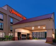
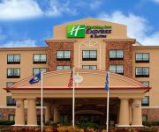
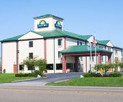
If you need a hotel, we compiled a list of available hotels close to the map centre further down the page.
While being here, you might want to pay a visit to some of the following locations: Edgard, Hahnville, Davis (historical), Convent and Thibodaux. To further explore this place, just scroll down and browse the available info.
Local weather forecast
Todays Local Weather Conditions & Forecast: 29°C / 85 °F
| Morning Temperature | 20°C / 69 °F |
| Evening Temperature | 28°C / 82 °F |
| Night Temperature | 23°C / 73 °F |
| Chance of rainfall | 0% |
| Air Humidity | 55% |
| Air Pressure | 1015 hPa |
| Wind Speed | Gentle Breeze with 7 km/h (4 mph) from North |
| Cloud Conditions | Scattered clouds, covering 49% of sky |
| General Conditions | Scattered clouds |
Sunday, 5th of May 2024
27°C (81 °F)
22°C (71 °F)
Light rain, moderate breeze, broken clouds.
Monday, 6th of May 2024
29°C (84 °F)
22°C (72 °F)
Scattered clouds, moderate breeze.
Tuesday, 7th of May 2024
31°C (88 °F)
23°C (74 °F)
Scattered clouds, moderate breeze.
Hotels and Places to Stay
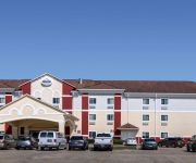
BEST WESTERN LAPLACE INN- LAPLACE
Hampton Inn LaPlace
TownePlace Suites Laplace
Holiday Inn Express & Suites LA PLACE
Days Inn New Orleans/LaPlace
LAPLACE MOTEL
Quality Inn La Place
DAYS INN LAPLACE- NEW ORLEANS
Suburban Extended Stay
Videos from this area
These are videos related to the place based on their proximity to this place.
2013 Dodge Dart LaPlace LA
Click here for price : http://riverlandchryslerjeepdodge.vshoc.com/7qbhjl?vin=1C3CDFCA0DD132364 We have been honored to serve the LaPlace LA area , we promise that your experience at...
2012 Jeep Wrangler LaPlace LA
Click here for price : http://riverlandchryslerjeepdodge.vshoc.com/7qbhjl?vin=1C4BJWDG3CL112617 We have been honored to serve the LaPlace LA area , we promise that your experience at...
2012 Chrysler Town Country Baton Rouge LA
Click here for price : http://riverlandchryslerjeepdodge.vshoc.com/7qbhjl?vin=2C4RC1GG8CR375815 We have been honored to serve the laplace LA area , we promis...
2012 Chrysler Town Country Baton Rouge LA
Click here for price : http://riverlandchryslerjeepdodge.vshoc.com/7qbhjl?vin=2C4RC1BG5CR233638 We have been honored to serve the laplace LA area , we promis...
2012 Chrysler Town Country Baton Rouge LA
Click here for price : http://riverlandchryslerjeepdodge.vshoc.com/7qbhjl?vin=2C4RC1BG7CR126820 We have been honored to serve the laplace LA area , we promis...
2012 Chrysler Town Country New Orleans LA
Click here for price : http://riverlandchryslerjeepdodge.vshoc.com/7qbhjl?vin=2C4RC1BG8CR400591 We have been honored to serve the laplace LA area , we promis...
Pre-Owned 2013 Chrysler Town Country New Orleans LA
Click here for price : http://riverlandchryslerjeepdodge.vshoc.com/7qbhjl?vin=2C4RC1BG0DR518667 We have been honored to serve the laplace LA area , we promis...
2012 Chrysler Town Country Houma LA
Click here for price : http://riverlandchryslerjeepdodge.vshoc.com/7qbhjl?vin=2C4RC1BG3CR237722 We have been honored to serve the laplace LA area , we promis...
Preowned 2013 Chrysler Town Country Baton Rouge LA
Click here for price : http://riverlandchryslerjeepdodge.vshoc.com/7qbhjl?vin=2C4RC1BG1DR519438 We have been honored to serve the laplace LA area , we promis...
2013 Chrysler Town Country New Orleans LA
Click here for price : http://riverlandchryslerjeepdodge.vshoc.com/7qbhjl?vin=2C4RC1BG6DR747533 We have been honored to serve the laplace LA area , we promis...
Videos provided by Youtube are under the copyright of their owners.
Attractions and noteworthy things
Distances are based on the centre of the city/town and sightseeing location. This list contains brief abstracts about monuments, holiday activities, national parcs, museums, organisations and more from the area as well as interesting facts about the region itself. Where available, you'll find the corresponding homepage. Otherwise the related wikipedia article.
St. John the Baptist Parish, Louisiana
St. John the Baptist Parish (SJBP, French: Paroisse de Saint-Jean-Baptiste) is a parish located in the U.S. state of Louisiana. The parish seat is Edgard, an unincorporated area and the parish capital as well as the largest city is LaPlace, an unincorporated area. St. John the Baptist Parish is one of the original 19 parishes of the Territory of Orleans, which later became the State of Louisiana. In 2010, its population was 45,924. St.
Destrehan, Louisiana
Destrehan is a census-designated place (CDP) in St. Charles Parish, Louisiana, United States. The population was 11,535 at the 2010 census, an increase of 275 over the 2000 tabulation of 11,260. It is 79 percent white. The community is named after Jean N. Destréhan (1754–1823) who served as President of the Territorial Council and was appointed to the United States Senate in 1812, but resigned before he took his seat.
Boutte, Louisiana
Boutte is a census-designated place (CDP) in St. Charles Parish, Louisiana, United States. The population was 3,075 at the 2010 census. Pronounced BOO-TEE.
Hahnville, Louisiana
Hahnville is a census-designated place (CDP) in and the parish seat of St. Charles Parish, Louisiana, United States. The population was 2,792 at the 2000 census. For the origin of Hahnville, see Michael Hahn (1830–1886).
Killona, Louisiana
Killona is a census-designated place (CDP) in St. Charles Parish, Louisiana, United States. The population was 797 at the 2000 census.
Luling, Louisiana
Luling is a census-designated place (CDP) in St. Charles Parish, Louisiana, United States. The population was 11,512 at the 2000 census.
Montz, Louisiana
Montz is a census-designated place (CDP) in St. Charles Parish, Louisiana, United States. The population was 1,120 at the 2000 census.
Norco, Louisiana
Norco is a census-designated place (CDP) in St. Charles Parish, Louisiana, United States. The population was 3,579 at the 2000 census. The community is home to a major Shell petroleum refinery. Its name is derived from the New Orleans Refining Company.
New Sarpy, Louisiana
New Sarpy is a census-designated place (CDP) in St. Charles Parish, Louisiana, United States. The population was 1,568 at the 2000 census.
Edgard, Louisiana
Edgard is a census-designated place (CDP) in and the parish seat of St. John the Baptist Parish, Louisiana, United States. The population was 2,637 at the 2000 census. It is part of the New Orleans–Metairie–Kenner Metropolitan Statistical Area. Edgard is part of the German Coast of Louisiana.
Garyville, Louisiana
Garyville is a census-designated place (CDP) in St. John the Baptist Parish, Louisiana, United States. The population was 2,775 at the 2000 census. It is part of the New Orleans–Metairie–Kenner Metropolitan Statistical Area. Garyville has the distinction of being the location of the most recent oil refinery built in the United States in 1976 by Marathon Petroleum Company.
LaPlace, Louisiana
LaPlace is a census-designated place (CDP) in St. John the Baptist Parish, Louisiana, United States, along the east bank of the Mississippi River in the New Orleans metropolitan area. The population is 32,134 at the 2010 census. LaPlace is the southern terminus of Interstate 55, where it joins with Interstate 10, and of US 51, where it terminates at the junction with US 61. LaPlace is located 25 miles west of New Orleans. The nickname is "Andouille Capital of the World" (for the food).
Reserve, Louisiana
Reserve is a census-designated place (CDP) in St. John the Baptist Parish, Louisiana, United States, on the east bank of the Mississippi River. The population was 9,111 at the 2000 census. It is part of the New Orleans–Metairie–Kenner Metropolitan Statistical Area.
Wallace, Louisiana
Wallace is a census-designated place (CDP) in St. John the Baptist Parish, Louisiana, United States. The population was 570 at the 2000 census. It is part of the New Orleans–Metairie–Kenner Metropolitan Statistical Area. The rural community is on the west bank of the Mississippi River and easily accessible to Interstate 10 via the Gramercy Bridge. It is the site of Evergreen Plantation, designated a National Historic Landmark in 1992 in part because of its 22 surviving quarters.
St. Charles Parish, Louisiana
St. Charles Parish (French: Paroisse de Saint-Charles) is a parish located in the U.S. state of Louisiana. The parish seat is Hahnville. In 2010, its population was 52,780. In the eighteenth and nineteenth century, this was part of the German Coast, an area along the east bank of the Mississippi River that was settled by numerous German pioneers in the 1720s.
Port of South Louisiana
The Port of South Louisiana is the largest volume shipping port in the Western Hemisphere and 9th largest in the world. It is the largest bulk cargo port in the world. It extends 54 miles (87 km) along the Mississippi River between New Orleans, Louisiana and Baton Rouge, Louisiana, centering approximately at LaPlace, Louisiana, which serves as the Port's headquarters location. This port is critical for grain shipments from the Midwest, handling some 60% of all raw grain exports.
WFNO
WFNO, branded as "LaFabulosa 830", is a Spanish contemporary outlet serving the New Orleans, Louisiana, area. The station is owned by Sunburst Media Louisiana, and broadcasts at 830 kHz with 5000 watts of daytime and 750 watts of nighttime power.
WCKW
WCKW is an American radio station licensed to serve the community of Garyville, Louisiana, USA. The station is owned by Covenant Network.
Bonnet Carré Spillway
The Bonnet Carré Spillway is a flood control operation in the Lower Mississippi Valley. Located in St. Charles Parish, Louisiana - about 12 miles west of New Orleans - it allows floodwaters from the Mississippi River to flow into Lake Pontchartrain and thence into the Gulf of Mexico. The construction of the spillway was completed in 1931.
Gramercy Bridge
The Gramercy Bridge (officially the Veterans Memorial Bridge), is a cantilever bridge over the Mississippi River connecting Gramercy, Louisiana in St. James Parish with St. John the Baptist Parish. It is the second newest Mississippi River bridge in Louisiana (due to the completion of the John James Audubon Bridge), one of many built to replace the ferry system following a 1976 accident that killed 78 when a ferry sank after being struck by a ship.
Hale Boggs Memorial Bridge
The Hale Boggs Memorial Bridge (also known as the Luling-Destrehan Bridge) is a cable-stayed bridge over the Mississippi River in St. Charles Parish, Louisiana. It is named for the late United States Congressman Hale Boggs. The bridge was dedicated by Governor David C. Treen and Bishop Stanley Ott of Baton Rouge and opened to traffic on October 8, 1983 connecting Louisiana Highway 18 on the West Bank and Louisiana Highway 48 on the East Bank.
German Coast
The German Coast was a region of early Louisiana settlement located above New Orleans on the east side of the Mississippi River – specifically, from east to west, in St. Charles, St. John the Baptist, and St. James parishes of present-day Acadiana. The four settlements along the coast were Karlstein, Hoffen, Meriental, and Augsburg. Originally, the Germans settled at the Arkansas Post. However, the conditions were intolerable.
MV George Prince ferry disaster
The MV George Prince ferry disaster was a nautical disaster that occurred in the Mississippi River in St. Charles Parish, Louisiana, United States, on the morning of October 20, 1976 (1976-10-20). The ferry George Prince was struck by the Norwegian tanker SS Frosta, which was traveling upriver. The collision occurred at mile post 120.8 above Head of Passes, less than three-quarters of a mile from the construction site of the bridge which would replace the ferry seven years later.
St. Charles Catholic High School (Laplace, Louisiana)
St. Charles Catholic High School is a private, Roman Catholic high school near Laplace, Louisiana. It is located in the Roman Catholic Archdiocese of New Orleans.
Destrehan High School
Destrehan High School is a public high school located in Destrehan, Louisiana, United States. The St. Charles Parish school serves all students on the East bank of the Mississippi River in grades 9 through 12.


