Safety Score: 2,7 of 5.0 based on data from 9 authorites. Meaning we advice caution when travelling to United States.
Travel warnings are updated daily. Source: Travel Warning United States. Last Update: 2024-04-28 08:22:10
Delve into Davis (historical)
Davis (historical) in Saint Charles Parish (Louisiana) is a city located in United States about 976 mi (or 1,571 km) south-west of Washington DC, the country's capital town.
Current time in Davis (historical) is now 01:33 PM (Sunday). The local timezone is named America / Chicago with an UTC offset of -5 hours. We know of 8 airports closer to Davis (historical), of which 6 are larger airports. The closest airport in United States is Louis Armstrong New Orleans International Airport in a distance of 6 mi (or 9 km), North-East. Besides the airports, there are other travel options available (check left side).
Also, if you like playing golf, there are some options within driving distance. In need of a room? We compiled a list of available hotels close to the map centre further down the page.
Since you are here already, you might want to pay a visit to some of the following locations: Hahnville, New Orleans, Edgard, Gretna and Chalmette. To further explore this place, just scroll down and browse the available info.
Local weather forecast
Todays Local Weather Conditions & Forecast: 29°C / 84 °F
| Morning Temperature | 22°C / 71 °F |
| Evening Temperature | 26°C / 79 °F |
| Night Temperature | 22°C / 72 °F |
| Chance of rainfall | 0% |
| Air Humidity | 55% |
| Air Pressure | 1017 hPa |
| Wind Speed | Fresh Breeze with 13 km/h (8 mph) from North |
| Cloud Conditions | Scattered clouds, covering 34% of sky |
| General Conditions | Light rain |
Sunday, 28th of April 2024
29°C (84 °F)
19°C (66 °F)
Moderate rain, fresh breeze, scattered clouds.
Monday, 29th of April 2024
27°C (81 °F)
21°C (71 °F)
Moderate rain, gentle breeze, few clouds.
Tuesday, 30th of April 2024
30°C (86 °F)
21°C (70 °F)
Broken clouds, gentle breeze.
Hotels and Places to Stay
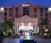
Radisson Hotel New Orleans Airport
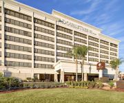
DoubleTree by Hilton New Orleans Airport
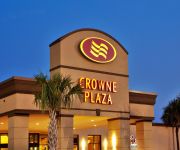
Crowne Plaza NEW ORLEANS-AIRPORT
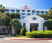
Hilton New Orleans Airport
Fairfield Inn & Suites Kenner New Orleans Airport
RAMADA LULING
La Quinta Inn and Suites New Orleans Airport
LEXINGTON HOTEL NEW ORLEANS AIRPORT
Comfort Suites Airport
Econo Lodge Kenner
Videos from this area
These are videos related to the place based on their proximity to this place.
A Projectile in the Fourth Dimension
Watch as I demonstrate the process of travelling in time on my bike. ©2013 Christian Chesnut All Rights Reserved As of September 14, 2013.
Hope & Keith Barnhill from South Carolina
Clouse Realty very satisfied clients, Hope & Keith Barnhills. Originally from South Carolina the Barnhills were initially nervous about moving to the New Orleans area and not knowing anybody....
Elizabeth Took Energy Efficiency to the Next Level With Sunlight Contractors
Elizabeth had Sunlight Contractors install a solar hot water heater and solar panels. She was so impressed with their work, she had them come out and insulate her attic and crawlspace with...
Dropkik - Three Wrung Ladder - Practice
Visit My Bands Youtube and Facebook Pages http://www.youtube.com/user/Dropkikmusic http://www.facebook.com/Dropkikmusic.
Missions Month 2015 - Crescent City Community Church
Pastor Doug Daspit from Crescent City Community Church discusses Philippians and Mentors during Missions Month at Bible Center Church in Luling, LA.
Romans 14:1 - 15:13 - Accepting Others
Pastor Gary McCall continues the sermon series on the book of Romans at Bible Center Church in Luling, LA.
Romans 16:17-19 - Watch out for Toxic People
Pastor Gary McCall continues the sermon series on the book of Romans at Bible Center Church in Luling, LA.
Videos provided by Youtube are under the copyright of their owners.
Attractions and noteworthy things
Distances are based on the centre of the city/town and sightseeing location. This list contains brief abstracts about monuments, holiday activities, national parcs, museums, organisations and more from the area as well as interesting facts about the region itself. Where available, you'll find the corresponding homepage. Otherwise the related wikipedia article.
Ama, Louisiana
Ama is a census-designated place (CDP) in St. Charles Parish, Louisiana, United States. Ama is on the West Bank of the Mississippi River, just west of the Jefferson Parish, Louisiana line. The population was 1,285 at the 2000 census.
Luling, Louisiana
Luling is a census-designated place (CDP) in St. Charles Parish, Louisiana, United States. The population was 11,512 at the 2000 census.
St. Rose, Louisiana
Saint Rose (usually written as St. Rose) is a census-designated place (CDP) in St. Charles Parish, Louisiana, United States. St. Rose is on the East Bank of the Mississippi River two miles (3 km) north of the Jefferson Parish, Louisiana border, and is part of the Greater New Orleans Metropolitan area. The population was 6,540 at the 2000 census.
St. Charles Parish, Louisiana
St. Charles Parish (French: Paroisse de Saint-Charles) is a parish located in the U.S. state of Louisiana. The parish seat is Hahnville. In 2010, its population was 52,780. In the eighteenth and nineteenth century, this was part of the German Coast, an area along the east bank of the Mississippi River that was settled by numerous German pioneers in the 1720s.
German Coast
The German Coast was a region of early Louisiana settlement located above New Orleans on the east side of the Mississippi River – specifically, from east to west, in St. Charles, St. John the Baptist, and St. James parishes of present-day Acadiana. The four settlements along the coast were Karlstein, Hoffen, Meriental, and Augsburg. Originally, the Germans settled at the Arkansas Post. However, the conditions were intolerable.
MV George Prince ferry disaster
The MV George Prince ferry disaster was a nautical disaster that occurred in the Mississippi River in St. Charles Parish, Louisiana, United States, on the morning of October 20, 1976 (1976-10-20). The ferry George Prince was struck by the Norwegian tanker SS Frosta, which was traveling upriver. The collision occurred at mile post 120.8 above Head of Passes, less than three-quarters of a mile from the construction site of the bridge which would replace the ferry seven years later.


