Safety Score: 2,7 of 5.0 based on data from 9 authorites. Meaning we advice caution when travelling to United States.
Travel warnings are updated daily. Source: Travel Warning United States. Last Update: 2024-05-04 08:22:41
Delve into Holy Cross
The district Holy Cross of in Orleans Parish (Louisiana) is a subburb in United States about 962 mi south-west of Washington DC, the country's capital town.
If you need a hotel, we compiled a list of available hotels close to the map centre further down the page.
While being here, you might want to pay a visit to some of the following locations: Chalmette, Gretna, New Orleans, Davis (historical) and Hahnville. To further explore this place, just scroll down and browse the available info.
Local weather forecast
Todays Local Weather Conditions & Forecast: 30°C / 87 °F
| Morning Temperature | 21°C / 70 °F |
| Evening Temperature | 28°C / 82 °F |
| Night Temperature | 23°C / 74 °F |
| Chance of rainfall | 0% |
| Air Humidity | 45% |
| Air Pressure | 1016 hPa |
| Wind Speed | Moderate breeze with 10 km/h (6 mph) from North |
| Cloud Conditions | Broken clouds, covering 58% of sky |
| General Conditions | Broken clouds |
Monday, 6th of May 2024
32°C (90 °F)
24°C (74 °F)
Scattered clouds, moderate breeze.
Tuesday, 7th of May 2024
32°C (89 °F)
25°C (77 °F)
Scattered clouds, moderate breeze.
Wednesday, 8th of May 2024
33°C (91 °F)
25°C (77 °F)
Overcast clouds, moderate breeze.
Hotels and Places to Stay
ELYSIAN FIELDS INN
Lamothe House
Courtyard New Orleans Westbank/Gretna
Maison de Macarty
Inn on Ursulines
Lion's Inn Bed and Breakfast
The Saint Philip Hotel
Chateau Hotel
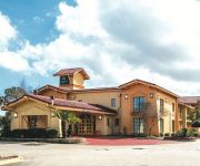
La Quinta Inn New Orleans West Bank / Gretna
HOTEL PROVINCIAL
Videos from this area
These are videos related to the place based on their proximity to this place.
Chalmette Battlefield New Orleans
I took these videos after we had finished the 199th anniversary commemoration of the Battle of New Orleans in January 2014. I have one correction to make. (I misheard on the tour.) Jackson...
Chalmette Battlefield- New Orleans
Famous Chalmette Battlefield that made Andrew Jackson famous during the War of 1812!
Chalmette National Cemetery, Near New Orleans
This veteran's cemetery was built on the location of the famous battle from the War of 1812. (It was really a campaign, and not just a battle.) Near New Orleans, Louisiana. There is actually...
Battle of New Orleans Re-enactment 2012
In January 2012, I attended the Wreath Laying a & Salute ceremony at the re-enactment of the Battle of New Orleans at Chalmette Battlefield & National Cemetery. I was particularly impressed...
Feeding Nutria Some Bread
Went to Chalmette Park (Sidney D. Torres Memorial Park) to feed some ducks, but only the nutria seemed to care for the bread we brought.
CNC Machines In Louisiana | All Service Machine Shop, Inc
http://allservicems.com/ All Service Machine Shop, Inc is a full-service, 24-hour specialty machine repair and fabrication shop. The versatile performance capabilities of our equipment coupled...
Duck Blind Camo Hydrographics
Trying out Duck Blind Camo from Kansas Hydrographics over Biscuit and Light Tan base. Which base do you prefer?
IRENE & THE MIKES REUNION
On February 16, 2015 in Old Arabi at The Old Arabi Bar, Irene Sage and Michael Darby and a group of other musicians got together to play an IRENE and THE MIKES REUNION show. It also was...
Historic Green
Residents of New Orleans' Holy Cross Neighborhood and the Lower Ninth Ward are embarking on a unique journey to preserve their history, incorporate sustainable design and return the community...
Videos provided by Youtube are under the copyright of their owners.
Attractions and noteworthy things
Distances are based on the centre of the city/town and sightseeing location. This list contains brief abstracts about monuments, holiday activities, national parcs, museums, organisations and more from the area as well as interesting facts about the region itself. Where available, you'll find the corresponding homepage. Otherwise the related wikipedia article.
Arabi, Louisiana
Arabi is a census-designated place (CDP) in St. Bernard Parish, Louisiana, United States. It lies on the eastern bank of the Mississippi River, between the Lower 9th Ward of New Orleans and Chalmette within the Greater New Orleans metropolitan area. The population was 8,093 at the 2000 census.
Battle of New Orleans
The Battle of New Orleans took place on January 8, 1815 and was the final major battle of the War of 1812. American forces, commanded by Major General Andrew Jackson, defeated an invading British Army intent on seizing New Orleans and the vast territory the United States had acquired with the Louisiana Purchase. The Treaty of Ghent, having been signed on December 24, 1814, was ratified by the Prince Regent on December 30, 1814 and the United States Senate on February 16, 1815.
Algiers, New Orleans
Algiers is a community within the city of New Orleans. It is the portion of Orleans Parish on the West Bank of the Mississippi River. Algiers is also known as the 15th Ward, one of the 17 Wards of New Orleans.
Faubourg Marigny
Faubourg Marigny (recently being referred to by new residents as The Marigny) is a neighborhood of the city of New Orleans. A subdistrict of the Bywater District Area, its boundaries as defined by the City Planning Commission are: North Rampart Street and St. Claude Avenue to the north, Franklin Avenue to the east, the Mississippi River to the south and Esplanade Avenue to the west.
Bywater, New Orleans
Bywater is a neighborhood of the city of New Orleans. A subdistrict of the Bywater District Area, its boundaries as defined by the City Planning Commission are: Florida Avenue to the north, the Industrial Canal to the east, the Mississippi River to the south and Franklin Avenue Street to the west. Bywater is part of the Ninth Ward of New Orleans, but is located along the natural levee of the Mississippi River, sparing the area from significant flooding.
WUPL
WUPL, virtual channel 54, is the MyNetworkTV-affiliated television station for the Greater New Orleans, Louisiana area. It is licensed to the Northshore community of Slidell. It is currently owned by the Belo Corp. , in a duopoly with CBS affiliate WWL-TV.
WPXL-TV
WPXL-TV is the local Ion Television (formerly Pax TV and i) affiliate in New Orleans, Louisiana, owned by Ion Media Networks. It broadcasts on virtual channel 49.
WHNO
WHNO is a television station in New Orleans, Louisiana, broadcasting locally on virtual channel 20 as a LeSEA owned-and-operated station. As an affiliate of LeSEA, the station airs a mix of Christian, family-friendly, classic and local sports programming. Additionally, WHNO also owns and operates SportsNOLA. com, an Louisiana independent sports website.
WEZB
WEZB, aka B-97 today, is a mainstream Contemporary hit radio (CHR or "Top 40") radio station in New Orleans, Louisiana. The station is owned by Entercom and they broadcast their format at 97.1 MHz with an effective radiated power (ERP) of 100,000 watts. The station broadcasts in high definition through two stations, HD-1 (WEZB-HD, New Orleans) and HD-2 Rhythmic Contemporary.
WKBU
WKBU, aka Bayou 95.7, is a classic rock radio station serving the New Orleans area in the US. The Entercom station is licensed to New Orleans, Louisiana and broadcast at 95.7 MHz with an ERP of 100 kW. WKBU has an HD-2 station which format consists of live concerts of "Bayou 95.7"'s classic rock artists.
WBSN-FM
WBSN-FM is a Contemporary Christian outlet in New Orleans, Louisiana. The station, which operates at 89.1 MHz with an ERP of 11 kW, is owned by Providence Educational Foundation, which signed the outlet on the air in 1979.
Algiers Point
Algiers Point is a location on the Lower Mississippi River in New Orleans, Louisiana. In river pilotage, Algiers Point is simply one of the many points of land around which the river flows—albeit a significant one. Since the 1970s, the name Algiers Point has also referred to the neighborhood in the immediate vicinity of that point.
Agriculture Street Landfill
The Agriculture Street Landfill was a dump in New Orleans, Louisiana. The area was later developed for residential use, with unfortunate environmental consequences. It became a Superfund cleanup site.
Claiborne Avenue Bridge
The Claiborne Avenue Bridge, officially known as the Judge William Seeber Bridge, is a vertical lift bridge in New Orleans, Louisiana over the Industrial Canal. It was built by the Louisiana Department of Highways (later renamed the Department of Transportation and Development) and opened to vehicular traffic in 1957. The bridge has suffered numerous disasters: A barge hit the bridge in 1993, Hurricane Katrina damaged it in 2005, and a car plunged into the canal in 2008 due to a malfunction.
Desire Projects
Desire Projects is a neighborhood and a former housing project of the city of New Orleans. A subdistrict of the Bywater District Area, its boundaries as defined by the City Planning Commission are: Higgins Boulevard to the north, Alvar Street to the east, Florida Boulevard to the south and Desire Street, Oliver White Avenue, Pleasure Street and Piety Street to the west.
Florida Projects
Florida Projects is a neighborhood and a housing project of the city of New Orleans. A subdistrict of the Bywater District Area, its boundaries as defined by the City Planning Commission are: Florida Boulevard to the north, Mazant Street to the east, North Dorgenois Street to the south and Congress, Law and Gallier Streets to the west.
Aurora Gardens Academy
Aurora Gardens Academy was a private school located in lower Algiers, on the Westbank of New Orleans, Louisiana at 2200 Hudson Place adjacent to the Mississippi River. The school was founded by the Scullin family in the early 1960s and closed in 1994. Part of the Aurora Gardens property was used in the Battle of New Orleans. This was the only school in the New Orleans area that used the Carden Method of phonetics.
Naval Support Activity New Orleans
The Naval Support Activity, New Orleans was a former United States Navy installation. During its time in operation, it was the largest military installation in greater New Orleans. It hosts activities for other branches of service and federal agencies. The installation met the needs of military personnel, both in and behind the battle. Home to nearly 3900 active-duty and 2,700 civilian personnel, the facility spreads over both banks of the Mississippi River.
St. Claude Avenue Bridge
The St. Claude Avenue Bridge is a bascule bridge with four vehicular lanes over the Industrial Canal in New Orleans, Louisiana. This was originally a combination railroad and automobile bridge, with two pairs of railroad tracks in the center of the lift span and automobile lanes straddling it. The railroad is no longer there, its place on the bridge taken by additional vehicular lanes. One lane in each direction passes through the truss of the bridge and one lane passes alongside the truss.
Jackson Barracks
Jackson Barracks is the headquarters of the Louisiana National Guard. It is located in the Lower 9th Ward of New Orleans, Louisiana. The base was established in 1834 and was known as New Orleans Barracks prior to July 7, 1866 when it was renamed in honor of Andrew Jackson. It was listed on the National Register of Historic Places in 1976.
Florida Area, New Orleans
Florida Area is a neighborhood of the city of New Orleans. A subdistrict of the Bywater District Area, its boundaries as defined by the City Planning Commission are: Florida Boulevard, Gallier, Law, Congress and North Dorgenois Streets to the north, Mazant Street to the east, North Galvez Street to the south and Montegut Street, Law Street and Almonaster Avenue to the west.
St. Claude, New Orleans
St. Claude is a neighborhood of the city of New Orleans. A subdistrict of the Bywater District Area, its boundaries as defined by the City Planning Commission are: Law, Montegut and North Galvez Streets to the north, Lesseps Street to the east, Burgundy Street, Clouet Street and St. Claude Avenue to the south and Franklin Avenue to the west.
Holy Cross, New Orleans
Holy Cross is a neighborhood of the city of New Orleans. A subdistrict of the Lower Ninth Ward District Area, its boundaries as defined by the City Planning Commission are: St. Claude Avenue to the north, St. Bernard Parish to the east, the Mississippi River to the south and the Industrial Canal to the west.
Andrew Jackson Fundamental Magnet High School
Andrew Jackson Fundamental Magnet High School (now known as Andrew Jackson Middle School was a magnet high school located in Chalmette in the area of St. Bernard Parish, Louisiana, United States. It is a part of St. Bernard Parish Public Schools. Andrew Jackson formerly held a school of 1075 students. August 29, 2005, Andrew Jackson was severely damaged by Hurricane Katrina. As of 2006, the school re-opened not as a high school, but a middle school.
K47JO-D
K47JO-D is a low-power digital television station in New Orleans, Louisiana, broadcasting locally on UHF channel 47 as an owned-and-operated affiliate of the Home Shopping Network.


