Safety Score: 2,7 of 5.0 based on data from 9 authorites. Meaning we advice caution when travelling to United States.
Travel warnings are updated daily. Source: Travel Warning United States. Last Update: 2024-05-04 08:22:41
Explore Gentilly Terrace
Gentilly Terrace in Orleans Parish (Louisiana) is a city in United States about 961 mi (or 1,547 km) south-west of Washington DC, the country's capital.
Local time in Gentilly Terrace is now 05:56 PM (Saturday). The local timezone is named America / Chicago with an UTC offset of -5 hours. We know of 8 airports in the vicinity of Gentilly Terrace, of which 6 are larger airports. The closest airport in United States is Louis Armstrong New Orleans International Airport in a distance of 12 mi (or 20 km), West. Besides the airports, there are other travel options available (check left side).
Also, if you like golfing, there are multiple options in driving distance. If you need a place to sleep, we compiled a list of available hotels close to the map centre further down the page.
Depending on your travel schedule, you might want to pay a visit to some of the following locations: New Orleans, Gretna, Chalmette, Davis (historical) and Hahnville. To further explore this place, just scroll down and browse the available info.
Local weather forecast
Todays Local Weather Conditions & Forecast: 29°C / 85 °F
| Morning Temperature | 21°C / 70 °F |
| Evening Temperature | 27°C / 81 °F |
| Night Temperature | 23°C / 74 °F |
| Chance of rainfall | 0% |
| Air Humidity | 51% |
| Air Pressure | 1015 hPa |
| Wind Speed | Moderate breeze with 9 km/h (6 mph) from North |
| Cloud Conditions | Scattered clouds, covering 43% of sky |
| General Conditions | Scattered clouds |
Saturday, 4th of May 2024
30°C (86 °F)
23°C (74 °F)
Broken clouds, moderate breeze.
Sunday, 5th of May 2024
32°C (89 °F)
23°C (74 °F)
Scattered clouds, moderate breeze.
Monday, 6th of May 2024
32°C (89 °F)
25°C (76 °F)
Scattered clouds, moderate breeze.
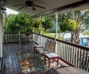
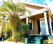
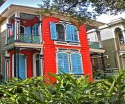
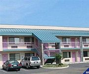
Hotels and Places to Stay
ELYSIAN FIELDS INN
Royal Street Inn and R Bar
Lion's Inn Bed and Breakfast
Melrose Mansion
R&B Bed and Breakfast
La Belle Esplanade
Lamothe House
RED CARPET INN AND SUITES NEW ORLEANS
OLDE TOWN INN
French Quarter Suites Hotel
Videos from this area
These are videos related to the place based on their proximity to this place.
NOBTS Funnel Cloud Sighting
On Saturday, May 16th, 2009 a funnel cloud was sighted near the campus of the New Orleans Baptist Theological Seminary. This video captures a sighting from a third floor campus apartment. Watch...
New Orleans Railroad Drawbridge Opening
A railroad drawbridge over the Lake Pontchartrain entrance to the New Orleans Industrial Canal opening after a train has passed.
Seabrook Current vs Tug 2
IHNC at Lake Pontchartrain, New Orleans under Seabrook Bridge, 11 Sept 2008. Hurricane Ike was in the southeastern Gulf of Mexico (~350 miles from New Orleans) as a Category 2 storm at the...
Saints NFC Championship Field Goal from My Seat!!!!!
Video Shot by James Leitz, who as an 8 year old boy attended the first Saints game they ever Won in 1967. We have reached a goal we never thought was attainable. Everything from this point...
Seabrook Current vs Tug 3
IHNC at Lake Pontchartrain, New Orleans under Seabrook Bridge, 11 Sept 2008. Hurricane Ike was in the southeastern Gulf of Mexico (~350 miles from New Orleans) as a Category 2 storm at the...
Seabrook Current vs Tug 4
IHNC at Lake Pontchartrain, New Orleans under Seabrook Bridge, 11 Sept 2008. Hurricane Ike was in the southeastern Gulf of Mexico (~350 miles from New Orleans) as a Category 2 storm at the...
Riding dirty on the Mississippi
This is what happens when you let a n00b at the helm. Initial findings of fact from the Eighth District Coast Guard investigation were: #1 There were no mechanical or electrical issues...
The NOLA Project's A Truckload of Ink
The NOLA Project's First Show of the 2013-2014 Season is Jim Fitzmorris' thrilling new play, 'A Truckload of Ink,' running September 5-21 at the University of New Orleans. Tickets on sale now...
William Jacobs Family Super 8mm Film New Orleans
William Sr., Thelma, William Jr., Mark, Richie, Robbie, Mitch, Kirk, Philip, Richard, Sue, Pam, Susan, and Madeline Jacobs; Mary and Leon Riche; Mickey, Joyce, Patty, Cindy, and Debbie Henderson;...
Gabriel Arce - UNO's got talent winner 2012
Gabriel Arce blowing us away with a Corazon Partido Cover at UNO's got talent He won at the University of New Orleans!
Videos provided by Youtube are under the copyright of their owners.
Attractions and noteworthy things
Distances are based on the centre of the city/town and sightseeing location. This list contains brief abstracts about monuments, holiday activities, national parcs, museums, organisations and more from the area as well as interesting facts about the region itself. Where available, you'll find the corresponding homepage. Otherwise the related wikipedia article.
London Avenue Canal
The London Avenue Canal is a drainage canal in New Orleans, Louisiana, used for pumping rain water into Lake Pontchartrain. The Canal runs through the 7th Ward of New Orleans from the Gentilly area to the Lakefront. The Canal was constructed in the first half of the 19th century, commissioned by Alexander Milne, who owned large tracts of land that would later become part of the city of New Orleans but were at the time mostly swamp.
Pontchartrain Park, New Orleans
Pontchartrain Park is a neighborhood of the city of New Orleans. A subdistrict of the Gentilly District Area, its boundaries as defined by the City Planning Commission are: Leon C. Simon Drive to the north, the Industrial Canal to the east, Dreux Avenue to the south and Peoples Avenue to the west.
8th Ward of New Orleans
The 8th Ward is a section of New Orleans, Louisiana. It is one of the Downtown Wards of New Orleans, with a Creole history. The 8th Ward is a narrow strip stretching from the Mississippi River on the south to Lake Pontchartrain in the north. East, or "down," is the 9th Ward, the boundary being Franklin Avene, Almonaster Avenue, then People's Avenue, and a line straight north into the Lake at part of the University of New Orleans campus.
5th Ward of New Orleans
The 5th Ward or Fifth Ward is a division of the city of New Orleans, Louisiana, one of the 17 Wards of New Orleans.
Brother Martin High School
Brother Martin High School is an all-male, Catholic, college preparatory school located in New Orleans, Louisiana, United States operated by the Brothers of the Sacred Heart. It was established in 1869 by the Brothers of the Sacred Heart, establishing the school as St. Aloysius College. It is located in the Roman Catholic Archdiocese of New Orleans.
Milneburg, New Orleans
Milneburg is a neighborhood of the city of New Orleans. A subdistrict of the Gentilly District Area, its boundaries as defined by the City Planning Commission are: Leon C. Simon Drive to the north, People's Avenue to the east, Filmore Avenue to the south and Elysian Fields Avenue to the west, putting it within the 8th Ward of New Orleans. The Milneburg neighborhood takes its name from Milneburg, a historic town and neighborhood formerly located a short distance north of the modern neighborhood.
Gentilly Woods, New Orleans
Gentilly Woods is a neighborhood of the city of New Orleans. A subdistrict of the Gentilly District Area, its boundaries as defined by the City Planning Commission are: Dreux Avenue to the north, Industrial Canal to the east, Gentilly Boulevard to the south and People's Avenue to the west.
Dillard, New Orleans
Dillard is a neighborhood of the city of New Orleans. A subdistrict of the Gentilly District Area, its boundaries as defined by the City Planning Commission are: Mirabeau Avenue to the north, Elysian Fields Avenue to the east, Benefit Street and I-610 to the south and Paris Avenue, Pratt Drive and the London Avenue Canal to the west.
Gentilly Terrace, New Orleans
Gentilly Terrace is a neighborhood of the city of New Orleans. A subdistrict of the Gentilly District Area, its boundaries as defined by the City Planning Commission are: Filmore Avenue to the north, People's Avenue to the east, Dahlia Walk and Benefit Street to the south and Elysian Fields Avenue to the west.
St. Anthony, New Orleans
St. Anthony is a neighborhood of the city of New Orleans. A subdistrict of the Gentilly District Area, its boundaries as defined by the City Planning Commission are: New York Street to the north, Elysian Fields Avenue to the east, Mirabeau Avenue to the south and the London Avenue Canal to the west. The neighborhood is part of the Gentilly section of the city as well as the city's 7th Ward.


