Safety Score: 2,7 of 5.0 based on data from 9 authorites. Meaning we advice caution when travelling to United States.
Travel warnings are updated daily. Source: Travel Warning United States. Last Update: 2024-05-14 08:25:02
Delve into Redwood Park
Redwood Park in San Mateo County (California) is a town located in United States about 2,436 mi (or 3,921 km) west of Washington DC, the country's capital town.
Time in Redwood Park is now 06:41 PM (Tuesday). The local timezone is named America / Los Angeles with an UTC offset of -7 hours. We know of 8 airports closer to Redwood Park, of which 4 are larger airports. The closest airport in United States is San Francisco International Airport in a distance of 13 mi (or 21 km), North. Besides the airports, there are other travel options available (check left side).
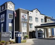
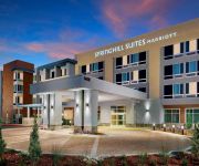
Also, if you like the game of golf, there are some options within driving distance. We saw 10 points of interest near this location. In need of a room? We compiled a list of available hotels close to the map centre further down the page.
Since you are here already, you might want to pay a visit to some of the following locations: Redwood City, San Francisco, Oakland, San Jose and Santa Cruz. To further explore this place, just scroll down and browse the available info.
Local weather forecast
Todays Local Weather Conditions & Forecast: 21°C / 69 °F
| Morning Temperature | 11°C / 52 °F |
| Evening Temperature | 16°C / 61 °F |
| Night Temperature | 11°C / 52 °F |
| Chance of rainfall | 0% |
| Air Humidity | 53% |
| Air Pressure | 1011 hPa |
| Wind Speed | Light breeze with 5 km/h (3 mph) from East |
| Cloud Conditions | Clear sky, covering 0% of sky |
| General Conditions | Sky is clear |
Wednesday, 15th of May 2024
21°C (69 °F)
10°C (51 °F)
Sky is clear, gentle breeze, clear sky.
Thursday, 16th of May 2024
20°C (68 °F)
10°C (51 °F)
Sky is clear, light breeze, clear sky.
Friday, 17th of May 2024
19°C (66 °F)
10°C (50 °F)
Sky is clear, gentle breeze, clear sky.
Hotels and Places to Stay
Holiday Inn Express & Suites BELMONT
CA San Carlos Country Inn and Suites by Radisson
BW INN
Fairfield Inn & Suites San Francisco San Carlos
SpringHill Suites Belmont Redwood Shores
TownePlace Suites Redwood City Redwood Shores
Hotel San Carlos
Americas Best Value Inn
Sequoia Inn
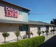
DELUXE INN REDWOOD CITY
Videos from this area
These are videos related to the place based on their proximity to this place.
Fortune Most Powerful Women Mentee Julia Kibore, Kenya
Julia Kibore speaks on what women really need! Access to finances, access to markets, access to information and to overcome social/cultural barriers! Hear her story... Julia is being mentored...
2008 WOODSIDE RODEO GIRLS BREAKAWAY ROPING
Girls breakaway roping at the 2008 Mounted Patrol 4th of July Junior (NorCal) Rodeo at Woodside California.
2008 WOODSIDE RODEO CALF RIDING
Calf riding at the 2008 4th of July Mounted Patrol Junior Rodeo (NorCal) at Woodside california.
2008 WOODSIDE RODEO STEER RIDING
The Steer Riding Event at the 2008 4th of July Mounted Patrol Junior Rodeo (NorCal) at Woodside California.
2008 WOODSIDE RODEO TEAM ROPING EVENT
The Team Roping Event at the 2008 Mounted Patrol 4th of July Rodeo (NorCal) at Woodside California.
20 Patrol Court , Woodside, CA
www.20patrolcourt.com This 3 bed, 2 ½ bath, 3150 sq. ft. retreat is located on a prime 2.47 acre lot with gorgeous panoramic views of rolling hills. Beautif...
2008 WOODSIDE RODEO POLE BENDING
Pole Bending Races at the 2008 4th of July Mounted Patrol Junior Rodeo (NorCal) at Woodside California.
2008 WOODSIDE RODEO ROYALTY
2008 Woodside Mounted Patrol 4th of July Junior Rodeo. Entrance of the rodeo royalty into the arena.
2008 WOODSIDE RODEO CONTESTANTS ENTRY
Entry of the contestants to the Mounted Patrol 2008 4th of July Nor Cal Junior Rodeo at Woodside California.
Videos provided by Youtube are under the copyright of their owners.
Attractions and noteworthy things
Distances are based on the centre of the city/town and sightseeing location. This list contains brief abstracts about monuments, holiday activities, national parcs, museums, organisations and more from the area as well as interesting facts about the region itself. Where available, you'll find the corresponding homepage. Otherwise the related wikipedia article.
Skeggs Point, California
Skeggs Point is a scenic turnout in San Mateo County along State Route 35 between Kings Mountain and State Route 84. The feature is marked with a guide sign along the road and is listed on the USGS 7.5 minute quadrangle, "Woodside, California" as well as in the National Geographic Names Database. The area is about three miles (five kilometers) west, and 2,000 feet (600 m) above the town of Woodside.
Kings Mountain, California
Kings Mountain is an unincorporated community in San Mateo County, California, located along State Route 35 (Skyline Boulevard) between Skeggs Point and Pise Mountain. This is about seven miles (11 km) north of Woodside Road (SR84). In the U.S. Geological Survey, National Geographic Names Database, the area is identified only as a geographic feature of type "summit" and not as a populated place. The community is inside area code 650 and uses the Woodside ZIP Code 94062.
BCPA Flight 304
British Commonwealth Pacific Airlines (BCPA) Flight 304/44 was flown by a Douglas DC-6 named Resolution and registered VH-BPE, on a flight from Sydney, Australia, to Vancouver, British Columbia in Canada, with scheduled stops at Nadi, Canton Island, Honolulu and San Francisco. It crashed during its initial approach towards San Francisco International Airport on 29 October 1953, killing all 19 people on board, including the American pianist William Kapell.
Grabtown Gulch
Grabtown Gulch is a valley in San Mateo County, California. It contains a stream which is a tributary of Purisima Creek. Grabtown Gulch (Purissima Redwoods OSP): Gulch below the site of the trading center and lumber camp of Grabtown on Tunitas Rd. , originally called Gilbert's Camp in the 1880s. The origin of the name is attributed to the tendency of its inhabitants to lay claim to land and/or anything of value that wasn't nailed down.
Soda Gulch
Soda Gulch is a valley in San Mateo County, California. It contains a small stream which is a tributary of Purisima Creek. {{#invoke:Coordinates|coord}}{{#coordinates:37.4338290|N|122.3449712|W|region:US-CA_type:landmark_source:gnis|||| |primary |name= }}
El Corte de Madera Creek
El Corte de Madera Creek is a small river in the Santa Cruz Mountains, San Mateo County, northern California. It is a tributary of San Gregorio Creek. The creek flows about 7 miles, from its source in Kings Mountain near Skeggs Point on Skyline Boulevard (CA 35), to its confluence with San Gregorio Creek about 2.7 miles east of San Gregorio Creek.
Rancho Cañada de Raymundo
Rancho Cañada de Raymundo was a 12,545-acre Mexican land grant in present-day San Mateo County, California given August 4, 1840 to Raimundo (also known as Raymundo), a native of Baja California, who was sent out by the padres of Mission Santa Clara to capture runaway Mission Indians in 1797. On the 1856 Rancho de las Pulgas and 1868 Easton maps, the valley of Laguna Creek was referred to as the Cañada de Raymundo. Laguna Creek was also alternatively known as Cañada Raimundo Creek.
KHB49
KHB49 (sometimes referred to as San Francisco All Hazards) is a NOAA Weather Radio station that serves the San Francisco Bay Area and can be heard 40 miles into the Pacific Ocean. It is programmed from the National Weather Service forecast office in Monterey, California with its transmitter located in Mt. Pise. It broadcasts weather and hazard information for the following counties: Alameda, Contra Costa, Marin, Napa, San Francisco, San Mateo, Santa Clara, and Sonoma.


