Safety Score: 3,4 of 5.0 based on data from 9 authorites. Meaning please reconsider your need to travel to South Africa.
Travel warnings are updated daily. Source: Travel Warning South Africa. Last Update: 2024-04-26 08:02:42
Delve into Woodstock
The district Woodstock of Cape Town in City of Cape Town (Western Cape) is a subburb in South Africa about 812 mi south-west of Pretoria, the country's capital town.
If you need a hotel, we compiled a list of available hotels close to the map centre further down the page.
While being here, you might want to pay a visit to some of the following locations: Stellenbosch, Malmesbury, Paarl, Moorreesburg and Hermanus. To further explore this place, just scroll down and browse the available info.
Local weather forecast
Todays Local Weather Conditions & Forecast: 22°C / 71 °F
| Morning Temperature | 16°C / 61 °F |
| Evening Temperature | 23°C / 74 °F |
| Night Temperature | 17°C / 62 °F |
| Chance of rainfall | 0% |
| Air Humidity | 56% |
| Air Pressure | 1021 hPa |
| Wind Speed | Moderate breeze with 12 km/h (7 mph) from North-West |
| Cloud Conditions | Clear sky, covering 0% of sky |
| General Conditions | Sky is clear |
Saturday, 27th of April 2024
22°C (72 °F)
20°C (67 °F)
Light rain, moderate breeze, clear sky.
Sunday, 28th of April 2024
21°C (69 °F)
16°C (60 °F)
Sky is clear, gentle breeze, clear sky.
Monday, 29th of April 2024
17°C (63 °F)
14°C (57 °F)
Broken clouds, moderate breeze.
Hotels and Places to Stay
SOUTHERN SUN THE CULLINAN
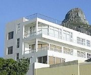
BANTRY BEACH LUXURY SUITES
Villa Coloniale
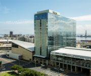
The Westin Cape Town
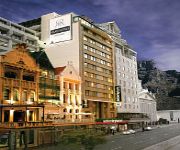
The Adderley Hotel
Oceana Palms Luxury Guest House
Three Cities Mandela Rhodes Place
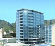
DoubleTree by Hilton Cape Town - Upper Eastside Hotel
Canal Quays Luxury Apartments
Fountains Hotel
Videos from this area
These are videos related to the place based on their proximity to this place.
Suedafrika - Republic of South Africa Travel Channel
Südafrika ist das wirtschaftlich am stärksten entwickelte Land Afrikas. Es ist aber nicht nur reich an Rohstoffen, sondern auch an afrikanischer Kultur und ist mit wunderschönen Landschaften...
Bad Driving - Albert Road, Woodstock, Cape Town
Watch how the driver of this BMW decides .... "Naaaaah, I don't want to stop at this traffic light now, moving along, moving along." DLAPC Rating: 8/10 BMW 3 series old skool in bloo: CA518-347.
City Movie Scene - The Making Of Run With The Wind
City Movie Scene The Making Of "Run With The Wind" Check out www.citymoviescene.com.
I am by Jared Bremner HD) (Edit)
Digital story created by final year Education students reflecting on their journey to becoming teachers.
Veliswa's story
Digital story created by final year Education students reflecting on their journey to becoming teachers.
Noni's story
Digital story created by final year Education students reflecting on their journey to becoming teachers.
Ready to safe somebody's life by Shafique Waggie
Digital story created by final year Education students reflecting on their journey to becoming teachers.
Rafiq Hendricks Digital Story
Digital story created by final year Education students reflecting on their journey to becoming teachers.
Letters to teacher by Andrea
Digital story created by final year Education students reflecting on their journey to becoming teachers.
Videos provided by Youtube are under the copyright of their owners.
Attractions and noteworthy things
Distances are based on the centre of the city/town and sightseeing location. This list contains brief abstracts about monuments, holiday activities, national parcs, museums, organisations and more from the area as well as interesting facts about the region itself. Where available, you'll find the corresponding homepage. Otherwise the related wikipedia article.
Devil's Peak (Cape Town)
Devil's Peak is part of the mountainous backdrop to Cape Town, South Africa. When looking at Table Mountain from the Victoria & Alfred Waterfront, or when looking at the standard picture postcard view of the mountain, the skyline is from left to right: the spire of Devil's Peak, the flat mesa of Table Mountain, the dome of Lion's Head and Signal Hill. The central districts of Cape Town are nestled within this natural amphitheatre.
HMS Sceptre (1781)
HMS Sceptre was a 64-gun third-rate ship of the line of the Royal Navy, launched on 8 June 1781 at Rotherhithe.
District Six
District Six is the name of a former inner-city residential area in Cape Town, South Africa. It is best known for the forced removal of over 60,000 of its inhabitants during the 1970s by the apartheid regime.
Disa Park
Disa Park is one of the most notorious pieces of architecture in the Vredehoek area of Cape Town, South Africa. Built by the construction company Murray and Roberts in the 1960s, these three 17 story, cylindrical towers, called Blinkwater, Platteklip and Silverstroom, are nestled on the slopes of Table Mountain, and are almost universally proclaimed to be a blemish on the face of the majestic mountain. The three towers are popularly known to Capetonians as "The Pepper Pots" or "Tampon Towers".
AFDA, The South African School of Motion Picture Medium and Live Performance
AFDA the South African School of Motion Picture Medium and Live Performance is a film school located on campuses in Auckland Park, Johannesburg, and Observatory, Cape Town, South Africa. AFDA is South Africa's only full member of CILECT and therefore all AFDA degrees are recognized internationally.
Rhodes Memorial
Rhodes Memorial on Devil's Peak in Cape Town, South Africa, is a memorial to English-born South African politician Cecil John Rhodes (1853-1902) designed by Sir Herbert Baker.
Good Hope Centre
The Good Hope Centre in Cape Town, South Africa (1976) by Pier Luigi Nervi, is an exhibition hall and conference centre, with the exhibition hall comprising an arch with tie-beam on each of the four vertical facades and two diagonal arches supporting two intersecting barrel-like roofs which in turn were constructed from pre-cast concrete triangular coffers with in-situ concrete beams on the edges.
Cape Town railway station
Cape Town railway station is the main railway station of the city of Cape Town, South Africa. It is located along Adderley and Strand Streets in the city's central business district.
Purple Rain Protest
The Purple Rain Protest, Purple Rain Revolt or Purple Rain Riot was an anti-apartheid protest held in Cape Town on 2 September 1989, four days before South Africa's racially segregated parliament held its elections. A police water cannon with purple dye was turned on thousands of Mass Democratic Movement supporters who poured into the city in an attempt to march on South Africa's Parliament.
Anglican Diocese of Cape Town
The Anglican Diocese of Cape Town, South Africa, came into being in 1847 with the consecration of the first bishop, Robert Gray, and later expanded to become the Church of the Province of Southern Africa, now called the Anglican Church of Southern Africa. Since it is the mother diocese of the Anglican Church in southern Africa, the bishop of Cape Town is archbishop and metropolitan, and presides at synods of the Anglican Church of Southern Africa.
Strand Street (Cape Town)
Strand Street is one of the main streets in the central business district of Cape Town, South Africa. It runs northwest-southeast through the centre from Green Point to Woodstock, passing the Golden Acre shopping centre, the Cape Town railway station, the central bus terminal, and the Castle of Good Hope.
Adderley Street
Adderley Street is a famous street in Cape Town, South Africa. It is considered the main street of the central business district (downtown) of Cape Town. The Christmas lights, night markets, main train station and numerous shops and restaurants and office towers are on this thoroughfare.
Military history of South Africa
The history of South Africa chronicles a vast time period and complex events from the dawn of history until the present time. It covers civil wars and wars of aggression and of self-defense both within South Africa and against it. It includes the history of battles fought in the territories of modern South Africa in neighboring territories, in both world wars and in modern international conflicts.
Bush Radio (South Africa)
Bush Radio is a popular and pioneering community radio station in South Africa. It broadcasts from Cape Town on 89.5 MHz FM, with a music and talk format aimed at the 18 to 39 age group.
Roman Catholic Archdiocese of Cape Town
The Roman Catholic Metropolitan Archdiocese of Cape Town (Latin: Archidioecesis Civitatis Capitis) is an ecclesiastical territory or diocese of the Roman Catholic Church in South Africa. It was erected as the Apostolic Vicariate of Cape of Good Hope on 18 June 1818 by Pope Pius VII, and renamed as the Apostolic Vicariate of Cape of Good Hope, Western District on 30 July 1847 and as the Apostolic Vicariate of Cape Town on 13 June 1939.
Grand Parade (Cape Town)
The Grand Parade is the main public square in Cape Town, South Africa. The square is surrounded by the Cape Town City Hall, the Castle of Good Hope, and the Cape Town railway station. The square is generally used as a market place and parking area but has also been the venue of major political rallies. It was the first place where Nelson Mandela addressed South Africans following his release from prison in 1990 and also following his election as president on 9 May 1994.
South African Heritage Resources Agency
The South African Heritage Resources Agency (SAHRA) is the national administrative body responsible for the protection of South Africa's cultural heritage. It was established through the National Heritage Resources Act, number 25 of 1999 and replaced the National Monuments Council. {{#invoke:Coordinates|coord}}{{#coordinates:33|55|47|S|18|25|21|E| |primary |name= }}
Redoubt Duijnhoop
The Redoubt Duijnhoop was a square demi-bastioned clay and timber Redoubt built fort constructed at the mouth of the Salt River, leading into Table Bay, South Africa in January–February 1654. It formed part of the defences of the Vereenigde Oost-Indische Compagnie 'VOC' replenishment station, which had been established under Jan van Riebeeck in 1652. The purpose of the station was to supply ships travelling between the Netherlands and the Dutch East Indies.
Fine Music Radio
Fine Music Radio is a radio station that is based within the Artscape Theatre Centre in Cape Town, South Africa. Founded in 1995, Fine Music Radio focuses mainly on Classical Music and Jazz, and broadcasts on the frequency 101.3 FM.
Hospital Bend
Hospital Bend is a major freeway junction, located to the east of the central business district of Cape Town, South Africa. It is the junction between the N2 national route and the M3 metropolitan expressway. Its unusual design led to notoriety as a traffic bottleneck and a frequent accident location; between March 2008 and early 2010 it underwent major roadworks to address these issues. It takes its name from the fact that it curves around the grounds of Groote Schuur Hospital.
Woodstock railway station (Cape Town)
Woodstock railway station is a Metrorail railway station in Woodstock, Cape Town. It is the first station after the Cape Town terminus on the old main line to Bellville. Services on all of Metrorail's lines pass through the station. The station building, located between Porter Street to the north and Grey Street to the south, is elevated above the six tracks that pass through. The station has three island platforms, each serving a pair of tracks.
Salt River railway station
Salt River railway station is a Metrorail railway station in Salt River, Cape Town. It is the second station from the Cape Town terminus on the old main line to Bellville, and the junction where the Southern Line branches from the main line. Services on all of Metrorail's lines pass through the station. The station has three island platforms and one side platform, serving a total of seven tracks. The station building is located on Foundry Street to the south of the tracks.
Fort de Goede Hoop
The Fort de Goede Hoop ('Fort of Good Hope') was the first military building to be erected in what is now Cape Town. It was built in 1652, and was in use until 1674 when it was superseded by the Castle of Good Hope. The Fort was built by the Verenigde Oost Indische Compagnie, when it established a replenishment station under Jan van Riebeeck on the shore of Table Bay in 1652. Constructed of earth and timber, it was square, with a pointed bastion at each corner.
Trams in Cape Town
Cape Town, South Africa, has had two tramway networks forming part of its public transport arrangements. Both networks are now long closed.
Heritage Western Cape
Heritage Western Cape (HWC) is a provincial heritage resources authority established by the Minister of Cultural Affairs and Sport of the government of the Western Cape Province of South Africa. It is a public entity set up under the terms of the National Heritage Resources Act. It is mandated to care for that part of South Africa's national estate that is of provincial and local significance in the Western Cape .


