Safety Score: 3,4 of 5.0 based on data from 9 authorites. Meaning please reconsider your need to travel to South Africa.
Travel warnings are updated daily. Source: Travel Warning South Africa. Last Update: 2024-04-24 08:14:40
Touring Fresnaye
The district Fresnaye of Cape Town in City of Cape Town (Western Cape) is a subburb located in South Africa about 814 mi south-west of Pretoria, the country's capital place.
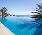
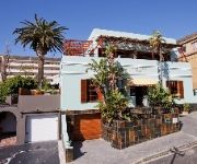
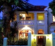
Need some hints on where to stay? We compiled a list of available hotels close to the map centre further down the page.
Being here already, you might want to pay a visit to some of the following locations: Stellenbosch, Malmesbury, Paarl, Moorreesburg and Hermanus. To further explore this place, just scroll down and browse the available info.
Local weather forecast
Todays Local Weather Conditions & Forecast: 19°C / 67 °F
| Morning Temperature | 15°C / 59 °F |
| Evening Temperature | 20°C / 68 °F |
| Night Temperature | 17°C / 63 °F |
| Chance of rainfall | 0% |
| Air Humidity | 72% |
| Air Pressure | 1019 hPa |
| Wind Speed | Light breeze with 4 km/h (3 mph) from North-East |
| Cloud Conditions | Scattered clouds, covering 42% of sky |
| General Conditions | Scattered clouds |
Thursday, 25th of April 2024
19°C (66 °F)
17°C (62 °F)
Overcast clouds, fresh breeze.
Friday, 26th of April 2024
21°C (71 °F)
16°C (61 °F)
Sky is clear, fresh breeze, clear sky.
Saturday, 27th of April 2024
19°C (66 °F)
18°C (65 °F)
Light rain, gentle breeze, clear sky.
Hotels and Places to Stay
The Clarendon - Bantry Bay
O on Kloof Boutique Hotel & Spa
Compass House Boutique Villa
Sundown Manor Guest House
Sweet Ocean View Guesthouse
The Verge Aparthotel
The Glen Boutique Hotel
The Bantry Bay Suite Hotel
Cascades on the Promenade
Rhonda's Manor
Videos from this area
These are videos related to the place based on their proximity to this place.
Cape Town Tandem Paragliding off Lion's Head
Tandem Paragliding jumped from Lion's Head in Cape Town with Karla from Absolute Weddings and Events. Wow what a day! The conditions were perfect and the ocean was so beautiful, so absolutely ...
Day 37 - ROMANTIC HELICOPTER FLIP { NAC Helicopters Cape Town }
Day 37/365 - Today was an amazing day! Myself and Carlinn took FULL advantage of the Valentines Day special that NAC Helicopters Cape Town are running in February and we were treated to...
Signal Hill Paragliding takeoffs (Cape Town)
Mark, Jono, Ian, Ashleigh and Michelle taking off from Signal Hill in Cape Town on January 13, 2013.
Shooting Star over a Misty City Time-Lapse { 30 January 2015 }
It was around 10pm on Thursday the 29th of January 2015 that I called my buddy Nick up and asked him if he was keen to go on a night hike up Lions Head because the mist looked like it was coming...
The Holiday Club | Fairest Cape | Royal Atlantic
http://bit.ly/1di5DlY - Sometimes, a getaway means going into the heart of one of the most beautiful cities in the world and if that is right up your alley, then the Royal Atlantic is perfect for you.
Cape Town's Bo Kaap
slide show about Cape Town's Bo Kaap. brought to you by: http://www.travelcomments.com - your online travel guide through Southern Africa.
Signal Hill Road (Cape Town) - Mountain Passes of South Africa
For full details on this pass, as well as all the passes and poorts of South Africa, including GPS, technical, safety, historical and tourism information, plus a fully interactive, dual view...
Videos provided by Youtube are under the copyright of their owners.
Attractions and noteworthy things
Distances are based on the centre of the city/town and sightseeing location. This list contains brief abstracts about monuments, holiday activities, national parcs, museums, organisations and more from the area as well as interesting facts about the region itself. Where available, you'll find the corresponding homepage. Otherwise the related wikipedia article.
Parliament of South Africa
The Parliament of South Africa is South Africa's legislature and under the country's current Constitution is composed of the National Assembly and the National Council of Provinces. It has undergone many transformations as a result of the country's tumultuous history. From 1910 to 1994, it was elected mainly by South Africa's white minority, before the first elections with universal suffrage were held in 1994.
Noon Gun
The Noon Gun has been a historic time signal in Cape Town, South Africa since 1806. The gun is situated on Signal Hill, close to the centre of the city.
Signal Hill (Cape Town)
Signal Hill aka Lion's Rump (or Seinheuwel in Afrikaans), is a landmark flat-topped hill located in Cape Town, next to Lion's Head and Table Mountain. The hill is also known as "The Lion's Flank", but this term is obsolete. Together with Lion's Head, Signal Hill looks like a lion sphinx. Signal flags were used to communicate weather warnings as well as anchoring instructions to visiting ships in order to ensure that they prepared adequately for stormy weather while in the bay.
Lion's Head (Cape Town)
Lion's Head is a mountain in Cape Town, South Africa, between Table Mountain and Signal Hill. Lion's Head peaks at 669 metres above sea level. The peak forms part of a dramatic backdrop to the city of Cape Town and is part of the Table Mountain National Park.
Cape Talk
567 CapeTalk is a commercial AM radio station based in Cape Town, South Africa, broadcasting on AM/MW 567 to Cape Town. The station is also webcast via its website. It claims to be Cape Town's number one news and talk station, offering news, sport, business and actuality programming, with plenty of phone-in debates. It was established in 1997. The station is owned by Primedia. 567 CapeTalk's sister station is TalkRadio 702, a Johannesburg based AM/FM radio station.
Gallery Mau Mau
Gallery Mau Mau (1996–1998) was a counter-culture "art space" situated in Cape Town, South Africa. Although short-lived, the experimental space provided low-cost access to the arts for artists of all races, broke boundaries and defined the period in which a visual arts culture saw enormous growth in the city. It was run by cultural activist David Robert Lewis, multimedia artist Adam Lieber, musician and disk jockey Nick Birkby and fine artist Chris Slack.
City Bowl
The City Bowl is a part of Cape Town in South Africa. It is a natural amphitheatre-shaped area bordered by Table Bay and defined by the mountains of Signal Hill, Lion's Head, Table Mountain and Devil's Peak.
Cape Town Stadium
The Cape Town Stadium in Cape Town, South Africa is a newly built stadium that was used for the 2010 FIFA World Cup. During the planning stage, it was known as the Green Point Stadium, which was the name of the previous stadium on the site, and this name was also used frequently during World Cup media coverage.
Anglican Diocese of Cape Town
The Anglican Diocese of Cape Town, South Africa, came into being in 1847 with the consecration of the first bishop, Robert Gray, and later expanded to become the Church of the Province of Southern Africa, now called the Anglican Church of Southern Africa. Since it is the mother diocese of the Anglican Church in southern Africa, the bishop of Cape Town is archbishop and metropolitan, and presides at synods of the Anglican Church of Southern Africa.
Tot Nut van het Algemeen
Tot Nut van het Algemeen (trans. 'For the good of all'), commonly known as Tot Nut, was a Dutch-medium school in Cape Town from 1804 to 1870. The school catered for all nationalities and played an important role in educating the Dutch-speaking children of the Cape Colony. Its curriculum included modern and ancient languages, literature, mathematics drawing and vocal music. The school also maintained a preparatory section for infants.
Iziko South African Museum
The Iziko SA Museum is a South African national museum which located in Cape Town. The museum was founded in 1825, the first in the country. It has been on its present site in the Company's Garden since 1897. The museum houses important African zoology, palaeontology and archaeology collections.
Michaelis School of Fine Art
Michaelis School of Fine Art was founded in 1925, and is the Fine Arts department of the University of Cape Town. It is located at 31-37 Orange Street in Cape Town on Hiddingh Campus adjacent to the Cape Town Company Gardens. Associate Professor Stephen Inggs is the Director of the Michaelis School of Fine Art at the University of Cape Town. He is also co-founder of the Katrine Harries Print Cabinet with Pippa Skotnes.
Roman Catholic Archdiocese of Cape Town
The Roman Catholic Metropolitan Archdiocese of Cape Town (Latin: Archidioecesis Civitatis Capitis) is an ecclesiastical territory or diocese of the Roman Catholic Church in South Africa. It was erected as the Apostolic Vicariate of Cape of Good Hope on 18 June 1818 by Pope Pius VII, and renamed as the Apostolic Vicariate of Cape of Good Hope, Western District on 30 July 1847 and as the Apostolic Vicariate of Cape Town on 13 June 1939.
Greenmarket Square
Greenmarket Square is a historical square in the centre of old Cape Town, South Africa. The square was built in 1696, when a burgher watch house was erected here. In 1761, the watch house was demolished and the Old Town House built in the site. This building functioned as the city hall for a while. Over the years, the square has served as a slave market, a vegetable market, a parking lot and more recently, an informal flea market trading mainly African souvenirs, crafts and curios.
Hoërskool Jan van Riebeeck
Hoërskool Jan van Riebeeck is an Afrikaans high school in Cape Town, South Africa. It was founded in 1926 by J.J. Jordaan. The school is situated at the foot of Table Mountain right next to the historical Welgemeend in Cape Town. The school has an enrolment of approximately 600 pupils, who are divided into three houses: Reijger, Dromedaris and De Goede Hoop, named after the three ships that Jan van Riebeeck landed in Cape Town in 1652.
St. George's Cathedral, Cape Town
St George's Cathedral (in full, The Cathedral Church of St George the Martyr) is the Anglican cathedral in Cape Town, South Africa. It is the seat of the Archbishop of Cape Town. The cathedral was designed by Sir Herbert Baker and the foundation stone was laid in 1901. The cathedral replaced a church built in 1834 on the same site, and is still incomplete.
Yeshiva of Cape Town
The Yeshiva of Cape Town is a kollel and yeshiva established in 1994. Its full title is "The Rabbi Cyril and Ann Harris Yeshiva of Cape Town", named for the late Chief Rabbi. It is based in the Beit Midrash Morasha community, in the suburb of Sea Point, Cape Town. The Yeshiva's ideology is Religious Zionist / Centrist Orthodox.
Huguenot Memorial Building
The Huguenot Memorial Building, located at 48 Queen Victoria Street, Cape Town, is a provincial heritage site in Cape Town in the Western Cape province of South Africa. In 1980 it was described in the Government Gazette as “ This predominantly Edwardian building was erected by the Synod of the Dutch Reformed Church to commemorate the arrival of the French Huguenots (1688). The foundation stone was laid on 24 August 1899 and the building was officially opened on 15 October 1903.
Gardens Commercial High School
Gardens Commercial High School is a coeducational inner city Secondary School in Cape Town, South Africa with learners aged 12 – 18 years. In 2006 the school was designated a Business, Commerce and Management (BCM) Focus School. As such, Gardens Commercial is part of an education intervention that aims to redress the Apartheid education system.
Western Cape High Court
The Western Cape High Court, Cape Town (formerly the Cape Provincial Division and commonly known as the Cape High Court) is one of the High Courts of South Africa. Located in central Cape Town, it has general jurisdiction over the Western Cape province. The court consists of 31 judges, led by Judge President John Hlophe.
Leeuwenhof
Leeuwenhof is an estate in the Gardens area of Cape Town, South Africa. It is the official residence of the Premier of the Western Cape. Leeuwenhof was originally a farmhouse dating to the time of the Dutch East India Company's rule of Cape Town. It includes a Slave Quarters which has been renovated and used to house an exhibition about slavery in Cape Town.
Green Point Stadium
The Green Point Stadium in Cape Town, South Africa was an 18,000 seat multi-purpose stadium. The stadium was used mainly for football matches, and was the home ground of Santos Football Club and Ajax Cape Town at different points. It also hosted music concerts including Janet Jackson, Michael Jackson, Whitney Houston, Def Leppard, Bon Jovi, U2, Metallica, Paul Simon, Robbie Williams, the Coca Cola Colab Massive Mix & the 2003 46664 Concert for the benefit of AIDS victims.
Nurul Islam Mosque
The Nurul Islam Mosque is a mosque in the Bo-Kaap area of Cape Town, South Africa. When it was founded in 1844, the structure could hold 150 worshipers. Renovated in 2001, it can now hold 700 worshipers.
Labia Theatre
The Labia Theatre is an independent movie house located in Gardens, Cape Town, South Africa. The theatre has two locations, the original 68 Orange Street location which features four screens and two modern screens in the Lifestyle Centre at 50 Kloof Street. The Labia Theatre is the oldest independent art-repertory cinema in the country. The original building was once an Italian Embassy ballroom and was opened by Princess Labia in May 1949 as a theatre for the staging of live performances.
Glen Beach
Glen Beach lies immediately to the north of Camps Bay Beach in Cape Town, South Africa. The two beaches are only divided by a rock outcrop that extends from the land to the shore-line. As summer months progress, sand deposits tend to build up at the shore-line, widening both Glen and Camps Bay beaches until the two beaches merge - until winter when the sand deposits are eroded by winter storms. Glen Beach is famous for its beach-break surfing, which local surfers dominate with intense fervor.


