Safety Score: 3,4 of 5.0 based on data from 9 authorites. Meaning please reconsider your need to travel to South Africa.
Travel warnings are updated daily. Source: Travel Warning South Africa. Last Update: 2024-04-27 08:23:39
Delve into Weltevreden Valley
The district Weltevreden Valley of in City of Cape Town (Western Cape) is a district located in South Africa about 811 mi south-west of Pretoria, the country's capital town.
In need of a room? We compiled a list of available hotels close to the map centre further down the page.
Since you are here already, you might want to pay a visit to some of the following locations: Cape Town, Stellenbosch, Paarl, Malmesbury and Hermanus. To further explore this place, just scroll down and browse the available info.
Local weather forecast
Todays Local Weather Conditions & Forecast: 21°C / 70 °F
| Morning Temperature | 18°C / 64 °F |
| Evening Temperature | 17°C / 63 °F |
| Night Temperature | 16°C / 60 °F |
| Chance of rainfall | 0% |
| Air Humidity | 59% |
| Air Pressure | 1013 hPa |
| Wind Speed | Moderate breeze with 11 km/h (7 mph) from South |
| Cloud Conditions | Clear sky, covering 8% of sky |
| General Conditions | Sky is clear |
Monday, 29th of April 2024
19°C (66 °F)
17°C (62 °F)
Few clouds, gentle breeze.
Tuesday, 30th of April 2024
17°C (63 °F)
14°C (58 °F)
Light rain, gentle breeze, overcast clouds.
Wednesday, 1st of May 2024
18°C (64 °F)
16°C (61 °F)
Overcast clouds, light breeze.
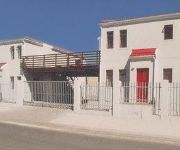
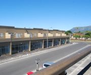
Hotels and Places to Stay
Verde Hotel
The Noble Lodge
Sisero 1 Khayelitsha
Regency Self Catering Serviced Apartments
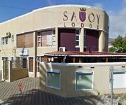
Savoy Lodge
Videos from this area
These are videos related to the place based on their proximity to this place.
Inside Luxury Travel - Cape Town - Flying in a Fighter Jet
Inside Luxury Travel - Cape Town - Flying in a Fighter Jet www.insideluxurytravel.com.
AZANIA BAND - GHETTOSOUND REGGAE HIGH SCHOOL !!!
It's all about playing REAL REGGAE MUZIK SEEN !!! At the Ghettosound Studio ina Nyanga (Cape Town / South Afreeka) you can live a serious journey in di heart of Afreecan Reggae Vibration with...
Bad Driving - N2 outgoing near Borcherds Quarry off-ramp, Cape Town
Watch how the driver of this BMW X3 is clearly in a rush and ignoring the rules of the road.... no matter how "legal" he may try and make it appear. If only a little more patience was used,...
Comair Ltd Boeing 737 BA6424 ZS-OAA Cape Town Airport (Slow lounge) - O.R Tambo Airport
SLOW - Cape Town International Airport (Domestic): 0:16 FlySafair B737-4Y0 ZS-JRE Emergency landing: 16:29 British Airways flight is operated by Comair ZS-OAA: 5:32 I had the all business class...
BAE Blackburn Buccaneer - Cape Town
A brief (but not slow) cockpit view from a legacy nuclear bomber jet plane over Cape Town and surrounding areas.
BA - Comair Ltd Boeing 737 ZS-OAA Cape Town Airport (lounge) - O.R Tambo Airport
SLOW - Cape Town International Airport (Domestic): 0:16 FlySafair B737-4Y0 ZS-JRE Emergency landing: 16:29 British Airways flight is operated by Comair ZS-OAA: 5:32 I had the all business class...
South African Airways A340-600 takeoff from Cape Town
Cape Town International Airport Flight 334 to Johannesburg Aircraft ZS-SNF March 15, 2013.
Mango 737-800 Landing at Cape Town International Airport
Very smooth landing in Cape Town completing a 2 hour flight from Johannesburg.
SAEP High schools ENVIRONMENT PROJECT:betterplaceproject - Computer.m4v
South African Education and Environment project, SAEP. THE '4Rs' High school's Environment project which SAEP is conducting in Phillipi,Cape town.
Videos provided by Youtube are under the copyright of their owners.
Attractions and noteworthy things
Distances are based on the centre of the city/town and sightseeing location. This list contains brief abstracts about monuments, holiday activities, national parcs, museums, organisations and more from the area as well as interesting facts about the region itself. Where available, you'll find the corresponding homepage. Otherwise the related wikipedia article.
Cape Flats
The Cape Flats (Afrikaans: Die Kaapse Vlakte) is an expansive, low-lying, flat area situated to the southeast of the central business district of Cape Town. To many people in Cape Town, the area is known simply as 'The Flats'. Described by some as 'apartheid's dumping ground', from the 1950s the area became home to people the apartheid government designated as non-White.
University of the Western Cape
The University of the Western Cape is a public university located in the Bellville suburb of Cape Town, South Africa. It was established in 1960 by the South African government as a university for Coloured people only. Other universities near Cape Town are the University of Cape Town, and the Stellenbosch University (originally for Afrikaans speaking whites). The establishing of UWC was a direct effect of the Separate University Education Bill of 1957.
International Peace University of South Africa
International Peace University of South Africa was formed when the Islamic College of Southern Africa (ICOSA) and Darul Arqam Islamic Institute (DAII) merged.
Cape Peninsula University of Technology
Cape Peninsula University of Technology, a university in Cape Town, South Africa, is the only university of Technology in the Western Cape province, and is also the largest university in the province, with over 32,000 students.
Elsieskraal River
The Elsieskraal River is a small river that flows through the Cape Town metropolitan area, in South Africa. It rises in the Tygerberg Hills and flows in a generally south westerly direction to its confluence with the Black River just south of Pinelands. 65% of the course of the Elsieskraal River has been canalised to prevent flooding. Its catchment is part of the Central Management Area of the City of Cape Town.
Saint James Church massacre
The Saint James Church massacre was a massacre perpetrated on St James Church in Kenilworth, Cape Town on 25 July 1993 by four cadres of the Azanian People's Liberation Army (APLA). 11 members of the congregation were killed and 58 wounded. In 1998 the attackers were granted amnesty for their participation by the Truth and Reconciliation Commission.
Seal Island, South Africa
Seal Island is a small land mass located 5.7 km off the northern beaches of False Bay, near Cape Town, in South Africa. The island is so named because of the great number of Cape Fur Seals that occupy it. It is home to sea birds too and it is likely that non-marine species (in no great number)fly there to breed as well (see external link to the Avian Demographic Unit at the University of Cape Town).
Athlone Stadium
Athlone Stadium is a stadium in Athlone on the Cape Flats in Cape Town, South Africa. It is used mostly for football matches and is the home ground of Santos Cape Town. The stadium holds 30,000 people and was built in 1972. The stadium was upgraded in the lead up to the 2010 FIFA World Cup with the intention of using it as a training venue. The estimated cost of the upgrade was R297 million.
Philippi Stadium
The Philippi Stadium is located in Cape Town, Western Cape, South Africa and is used for soccer matches. The Phillipi Stadium precinct was developed as a practice venue and fan park for the 2010 FIFA World Cup. The cost is estimated at R90 million and will include retail and commercial components. The venue which currently seats 2,000 and includes an athletics and cycle track, will be replaced by the new 10,000 seat football stadium.
Alexander Sinton Secondary School
Alexander Sinton Secondary School, also known as Alexander Sinton High School is an English-medium school in Athlone, South Africa, a suburb of Cape Town, South Africa. As of 2006 it had some 1,113 students and was staffed by 35 educators. http://www. khanya. co. za/schools/khanyaschool. php?emisno=0105483311. In 2006 the Western Cape Education Department designated it one of 10 "Arts and Culture focus schools" to be set up over the following three years. http://curriculum. wcape. school.
Belhar Secondary School
Belhar Secondary School is an Afrikaans/English mixed medium school in Bellville, Western Cape, South Africa. As of 2006 it had some 1,274 students http://wcedemis. wcape. gov. za/ibi_apps/WFServlet?IBIF_ex=INERSCHOOLN&EMIS_NO=0101323500 and was staffed by 35 educators. http://www. khanya. co. za/schools/khanyaschool. php?emisno=0101323500. In 2006 the Western Cape Education Department designated it one of 10 "Arts and Culture focus schools" to be set up over the following three years.
Baphumelele Children's Home
Baphumelele Children's Home was founded in 2001 as a refuge and place of safety for orphaned and other vulnerable children from the Cape Flats. The home is one of the first in the township of Khayelitsha, one of the largest in South Africa. The founder of Baphumelele, Rosie Mashale, is a trained primary school teacher. She has been selected as a Mama Afrika by Clover. She has also been selected as a finalist in the Cape Times V&A Waterfront Woman of Worth Awards.
Norwood, Western Cape
Norwood is a suburb of Cape Town, in the Western Cape province of South Africa.
Belhar
Belhar is a suburb of the City of Cape Town, South Africa, in the Cape Flats area. It is known for being the place where the Belhar Confession was formulated.
Kenwyn, Cape Town
Kenwyn is a suburb of Cape Town, South Africa.
Mzoli's
Mzoli's (also known as Mzoli's Palace, Mzoli's Meat, or Mzoli's Butchery) is a butchery in Gugulethu, a township on the outskirts of Cape Town, South Africa. Since Mzoli's opened in early 2003, the restaurant has become a popular gathering spot for Cape Town residents and a tourist attraction. Amongst Gugulethu's residents, Mzoli's Place has a reputation for public drunkenness and disrespect for the local community. Mzoli's is named after the founder and owner, Mzoli Ngcawuzele.
N2 Gateway
The N2 Gateway Housing Pilot Project is a large housebuilding project under construction in Cape Town, South Africa. It has been labeled by the national government's former Housing Minister Lindiwe Sisulu as “the biggest housing project ever undertaken by any Government.
Christel House South Africa
Christel House South Africa is a school located in Cape Town, South Africa. The school was opened in January 2002. A new facility was recently built and dedicated in March 2009. Christel House South Africa provides education from kindergarten to the 12th grade. The school has more than 600 students and 64 total staff members. Christel House South Africa operates 250 days out of the year. Also, the school was given a perfect score from the UMALUSI, an agency that accredits independent schools.
Zeekoevlei
Zeekoevlei is a major freshwater lake on the Cape Flats near Cape Town, Western Cape Province, South Africa. The name means "hippopotamus vlei," with "vlei" being Afrikaans for "lake", and "zeekoe" (i.e. "sea-cow") being an archaic spelling of the Afrikaans for hippopotamus. Zeekoevlei Nature Reserve (established in June 2000) is based on the lake. It is separated by a peninsula from the Rondevlei Nature Reserve and preserves endangered Cape Lowland Freshwater Wetland ecosystems.
Crawford railway station (Cape Town)
Crawford railway station is a Metrorail station that serves the suburbs of Rondebosch East and Crawford in Cape Town, South Africa. It is served by trains on the Cape Flats Line. The station, which is located between First Avenue in Rondebosch East and Allister Road in Crawford, has two side platforms and a station building at ground level on the west side of the tracks. The platforms are connected by two pedestrian subways.
Murder of Anni Dewani
Anni Dewani (née Hindocha, 12 March 1982 - 13 November 2010) was a Swedish-born ethnic Lohana Hindu woman who, while on her honeymoon in South Africa, was kidnapped and then murdered whilst taking a slum tourism trip through Gugulethu township near Cape Town on 13 November 2010. Taxi driver Zola Robert Tongo later admitted guilt on the charges of murder in a plea bargain, and was sentenced on 7 December 2010, to 18 years in jail.
Windsor High School (Cape Town)
Windsor High School is situated in the suburb of Rondebosch East in Cape Town, South Africa. First established in 1935, it moved into its present building in 1938 and was known as Lansdowne High. Its first incarnation under the old apartheid system was as a school exclusively reseved for the white population group. In 1981 the Lansdowne High name was changed in favour of the current Windsor High School, named after the school board held an open competition to rename the school.
Range High School (Cape Town)
Range High School is an Afrikaans medium school in Matroosfontein, Western Cape, South Africa.
Erica Park
Erica Park, sometimes also referred to as Erica Park Stadium, is a multi-use stadium, situated in the Belhar suburb of Cape Town, at the Western Cape Province in South Africa. Until June 2010, the stadíum was known as the sole home venue of Ikapa Sporting, but since then, the club -for unknown reasons- preferred instead to play their home games in the Wynberg suburb.
University of the Western Cape Stadium
University of the Western Cape Stadium, commonly abbreviated and referred to as UWC Stadium, and sometimes also referred to as University of the Western Cape Sports Ground, is a multi-use stadium, situated in the Bellville suburb of Cape Town, at the Western Cape Province in South Africa. The exact location, is at the Southeastern corner of University of the Western Cape, only 300m from the Unibell railway station.


