Safety Score: 3,4 of 5.0 based on data from 9 authorites. Meaning please reconsider your need to travel to South Africa.
Travel warnings are updated daily. Source: Travel Warning South Africa. Last Update: 2024-04-26 08:02:42
Discover Mouille Point
The district Mouille Point of Cape Town in City of Cape Town (Western Cape) is a district in South Africa about 812 mi south-west of Pretoria, the country's capital city.
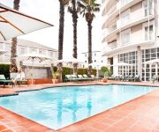
Looking for a place to stay? we compiled a list of available hotels close to the map centre further down the page.
When in this area, you might want to pay a visit to some of the following locations: Stellenbosch, Malmesbury, Paarl, Moorreesburg and Hermanus. To further explore this place, just scroll down and browse the available info.
Local weather forecast
Todays Local Weather Conditions & Forecast: 22°C / 71 °F
| Morning Temperature | 16°C / 61 °F |
| Evening Temperature | 23°C / 74 °F |
| Night Temperature | 17°C / 62 °F |
| Chance of rainfall | 0% |
| Air Humidity | 56% |
| Air Pressure | 1021 hPa |
| Wind Speed | Moderate breeze with 12 km/h (7 mph) from North-West |
| Cloud Conditions | Clear sky, covering 0% of sky |
| General Conditions | Sky is clear |
Saturday, 27th of April 2024
22°C (72 °F)
20°C (67 °F)
Light rain, moderate breeze, clear sky.
Sunday, 28th of April 2024
21°C (69 °F)
16°C (60 °F)
Sky is clear, gentle breeze, clear sky.
Monday, 29th of April 2024
17°C (63 °F)
14°C (57 °F)
Broken clouds, moderate breeze.
Hotels and Places to Stay
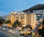
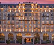
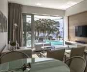
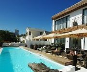
ROMNEY PARK LUXURY SUITES & WELLNESS CEN
Cape Royale Luxury Hotel
South Beach Camps Bay
Cape Diem Lodge
DysArt Boutiquehotel
The Commodore
The Glam
Latitude Luxury Penthouse
Avatara
Protea Hotel Cape Town Waterfront Breakwater Lodge
Videos from this area
These are videos related to the place based on their proximity to this place.
WordCamp Cape Town 2013
On 7 November 2013 we hosted WordCamp Cape Town at the Cape Town stadium and by all accounts the day was a huge success. You can watch videos of all the talks on the official event playlist...
Signal Hill Paragliding takeoffs (Cape Town)
Mark, Jono, Ian, Ashleigh and Michelle taking off from Signal Hill in Cape Town on January 13, 2013.
Two Oceans Aquarium, Waterfront, Cape Town - South Africa Travel Channel
English see below [dt.] Das Two Oceans Aquarium an der Waterfront in Kapstadt, Südafrika ist eine der beliebtesten Attraktionen der Stadt. Benannt nach den beiden bei Kapstadt zusammentreffenden.
Waterfront, Cape Town - Südafrika, South Africa Travel Channel
Waterfront, Cape Town, South Africa http://www.myvideomedia.com English see below [dt.] Die moderne Infrastruktur der Waterfront in Kapstadt, Südafrika entstand Anfang der 90er Jahre als...
Maria Scarpello - Working and Traveling Fulltime with WordPress
Maria Scarpello's talk from WordCamp Cape Town 2013 *** Download the slides here: ...
Video De Waterkant Cape town .De Waterkant Village , Kapstadt
De Waterkant is, in truth, a modernised rendition of the Bo-Kaap and lies just next to this same suburb, a trendy area that has maintained, and even accentuated, the colourful, bright semi-detached...
Cape Town De Waterkant Village Kapstadt
What can you expect if you visit De Waterkant Village in Cape Town? De Waterkant Village is truly the fun capital of Cape Town and a necessary experience on every visitors itinerary.
The Holiday Club | Fairest Cape | Royal Atlantic
http://bit.ly/1di5DlY - Sometimes, a getaway means going into the heart of one of the most beautiful cities in the world and if that is right up your alley, then the Royal Atlantic is perfect for you.
Signal Hill Road (Cape Town) - Mountain Passes of South Africa
For full details on this pass, as well as all the passes and poorts of South Africa, including GPS, technical, safety, historical and tourism information, plus a fully interactive, dual view...
Videos provided by Youtube are under the copyright of their owners.
Attractions and noteworthy things
Distances are based on the centre of the city/town and sightseeing location. This list contains brief abstracts about monuments, holiday activities, national parcs, museums, organisations and more from the area as well as interesting facts about the region itself. Where available, you'll find the corresponding homepage. Otherwise the related wikipedia article.
Victoria & Alfred Waterfront
The Victoria & Alfred Waterfront in the historic heart of Cape Town's working harbour is South Africa's most-visited destination, having the highest rate of foreign tourists of any attraction in the country.
Noon Gun
The Noon Gun has been a historic time signal in Cape Town, South Africa since 1806. The gun is situated on Signal Hill, close to the centre of the city.
Signal Hill (Cape Town)
Signal Hill aka Lion's Rump (or Seinheuwel in Afrikaans), is a landmark flat-topped hill located in Cape Town, next to Lion's Head and Table Mountain. The hill is also known as "The Lion's Flank", but this term is obsolete. Together with Lion's Head, Signal Hill looks like a lion sphinx. Signal flags were used to communicate weather warnings as well as anchoring instructions to visiting ships in order to ensure that they prepared adequately for stormy weather while in the bay.
Long Street (Cape Town)
Long Street is a major street located in the City Bowl section of Cape Town, South Africa. It is famous as a bohemian hang out and the street is lined with many book stores, various ethnic restaurants and bars. Restaurants include African restaurants such as Zula, and Indian restaurants such as Masala Dosa. Long Street exhibits a diversified culture and attracts tourists from all over the world.
Cape Talk
567 CapeTalk is a commercial AM radio station based in Cape Town, South Africa, broadcasting on AM/MW 567 to Cape Town. The station is also webcast via its website. It claims to be Cape Town's number one news and talk station, offering news, sport, business and actuality programming, with plenty of phone-in debates. It was established in 1997. The station is owned by Primedia. 567 CapeTalk's sister station is TalkRadio 702, a Johannesburg based AM/FM radio station.
Gallery Mau Mau
Gallery Mau Mau (1996–1998) was a counter-culture "art space" situated in Cape Town, South Africa. Although short-lived, the experimental space provided low-cost access to the arts for artists of all races, broke boundaries and defined the period in which a visual arts culture saw enormous growth in the city. It was run by cultural activist David Robert Lewis, multimedia artist Adam Lieber, musician and disk jockey Nick Birkby and fine artist Chris Slack.
Cape Town Stadium
The Cape Town Stadium in Cape Town, South Africa is a newly built stadium that was used for the 2010 FIFA World Cup. During the planning stage, it was known as the Green Point Stadium, which was the name of the previous stadium on the site, and this name was also used frequently during World Cup media coverage.
Two Oceans Aquarium
The Two Oceans Aquarium is an aquarium located at the Victoria & Alfred Waterfront in Cape Town, Western Cape, South Africa. The aquarium opened on the 13 November 1995 and comprises seven exhibition galleries with large viewing windows:. The enchantment of this particular zoo is due to its location, where the Indian and Atlantic ocean meet. Atlantic Ocean Gallery - This gallery allows you to discover the life of the Atlantic Ocean.
Cape Town railway station
Cape Town railway station is the main railway station of the city of Cape Town, South Africa. It is located along Adderley and Strand Streets in the city's central business district.
Purple Rain Protest
The Purple Rain Protest, Purple Rain Revolt or Purple Rain Riot was an anti-apartheid protest held in Cape Town on 2 September 1989, four days before South Africa's racially segregated parliament held its elections. A police water cannon with purple dye was turned on thousands of Mass Democratic Movement supporters who poured into the city in an attempt to march on South Africa's Parliament.
Anglican Diocese of Cape Town
The Anglican Diocese of Cape Town, South Africa, came into being in 1847 with the consecration of the first bishop, Robert Gray, and later expanded to become the Church of the Province of Southern Africa, now called the Anglican Church of Southern Africa. Since it is the mother diocese of the Anglican Church in southern Africa, the bishop of Cape Town is archbishop and metropolitan, and presides at synods of the Anglican Church of Southern Africa.
Strand Street (Cape Town)
Strand Street is one of the main streets in the central business district of Cape Town, South Africa. It runs northwest-southeast through the centre from Green Point to Woodstock, passing the Golden Acre shopping centre, the Cape Town railway station, the central bus terminal, and the Castle of Good Hope.
Adderley Street
Adderley Street is a famous street in Cape Town, South Africa. It is considered the main street of the central business district (downtown) of Cape Town. The Christmas lights, night markets, main train station and numerous shops and restaurants and office towers are on this thoroughfare.
Tot Nut van het Algemeen
Tot Nut van het Algemeen (trans. 'For the good of all'), commonly known as Tot Nut, was a Dutch-medium school in Cape Town from 1804 to 1870. The school catered for all nationalities and played an important role in educating the Dutch-speaking children of the Cape Colony. Its curriculum included modern and ancient languages, literature, mathematics drawing and vocal music. The school also maintained a preparatory section for infants.
Greenmarket Square
Greenmarket Square is a historical square in the centre of old Cape Town, South Africa. The square was built in 1696, when a burgher watch house was erected here. In 1761, the watch house was demolished and the Old Town House built in the site. This building functioned as the city hall for a while. Over the years, the square has served as a slave market, a vegetable market, a parking lot and more recently, an informal flea market trading mainly African souvenirs, crafts and curios.
St. George's Cathedral, Cape Town
St George's Cathedral (in full, The Cathedral Church of St George the Martyr) is the Anglican cathedral in Cape Town, South Africa. It is the seat of the Archbishop of Cape Town. The cathedral was designed by Sir Herbert Baker and the foundation stone was laid in 1901. The cathedral replaced a church built in 1834 on the same site, and is still incomplete.
Grand Parade (Cape Town)
The Grand Parade is the main public square in Cape Town, South Africa. The square is surrounded by the Cape Town City Hall, the Castle of Good Hope, and the Cape Town railway station. The square is generally used as a market place and parking area but has also been the venue of major political rallies. It was the first place where Nelson Mandela addressed South Africans following his release from prison in 1990 and also following his election as president on 9 May 1994.
Yeshiva of Cape Town
The Yeshiva of Cape Town is a kollel and yeshiva established in 1994. Its full title is "The Rabbi Cyril and Ann Harris Yeshiva of Cape Town", named for the late Chief Rabbi. It is based in the Beit Midrash Morasha community, in the suburb of Sea Point, Cape Town. The Yeshiva's ideology is Religious Zionist / Centrist Orthodox.
Western Cape High Court
The Western Cape High Court, Cape Town (formerly the Cape Provincial Division and commonly known as the Cape High Court) is one of the High Courts of South Africa. Located in central Cape Town, it has general jurisdiction over the Western Cape province. The court consists of 31 judges, led by Judge President John Hlophe.
Green Point Stadium
The Green Point Stadium in Cape Town, South Africa was an 18,000 seat multi-purpose stadium. The stadium was used mainly for football matches, and was the home ground of Santos Football Club and Ajax Cape Town at different points. It also hosted music concerts including Janet Jackson, Michael Jackson, Whitney Houston, Def Leppard, Bon Jovi, U2, Metallica, Paul Simon, Robbie Williams, the Coca Cola Colab Massive Mix & the 2003 46664 Concert for the benefit of AIDS victims.
Nurul Islam Mosque
The Nurul Islam Mosque is a mosque in the Bo-Kaap area of Cape Town, South Africa. When it was founded in 1844, the structure could hold 150 worshipers. Renovated in 2001, it can now hold 700 worshipers.
Little Hearts Festival
The Little Hearts Festival, was a three-day music festival held in Cape Town, South Africa, held between 5 – 7 December 2008 in aid of three children's charities: Cotland’s Baby Sanctuary, CHOC, and Red Cross War Memorial Children's Hospital. The festival featured the performances of twenty-four artists at the V&A Waterfront Amphitheatre.
Fort de Goede Hoop
The Fort de Goede Hoop ('Fort of Good Hope') was the first military building to be erected in what is now Cape Town. It was built in 1652, and was in use until 1674 when it was superseded by the Castle of Good Hope. The Fort was built by the Verenigde Oost Indische Compagnie, when it established a replenishment station under Jan van Riebeeck on the shore of Table Bay in 1652. Constructed of earth and timber, it was square, with a pointed bastion at each corner.
Trams in Cape Town
Cape Town, South Africa, has had two tramway networks forming part of its public transport arrangements. Both networks are now long closed.
Heritage Western Cape
Heritage Western Cape (HWC) is a provincial heritage resources authority established by the Minister of Cultural Affairs and Sport of the government of the Western Cape Province of South Africa. It is a public entity set up under the terms of the National Heritage Resources Act. It is mandated to care for that part of South Africa's national estate that is of provincial and local significance in the Western Cape .


