Safety Score: 3,2 of 5.0 based on data from 9 authorites. Meaning please reconsider your need to travel to Romania.
Travel warnings are updated daily. Source: Travel Warning Romania. Last Update: 2024-05-21 08:19:37
Touring Băile Codlea
The district Băile Codlea of Codlea in Municipiul Codlea (Judeţul Braşov) is a subburb located in Romania about 94 mi north of Bucharest, the country's capital place.
Need some hints on where to stay? We compiled a list of available hotels close to the map centre further down the page.
Being here already, you might want to pay a visit to some of the following locations: Holbav, Dumbravita, Vulcan, Ghimbav and Cristian. To further explore this place, just scroll down and browse the available info.
Local weather forecast
Todays Local Weather Conditions & Forecast: 21°C / 71 °F
| Morning Temperature | 12°C / 53 °F |
| Evening Temperature | 21°C / 70 °F |
| Night Temperature | 11°C / 53 °F |
| Chance of rainfall | 0% |
| Air Humidity | 41% |
| Air Pressure | 1015 hPa |
| Wind Speed | Gentle Breeze with 8 km/h (5 mph) from North |
| Cloud Conditions | Overcast clouds, covering 95% of sky |
| General Conditions | Overcast clouds |
Wednesday, 22nd of May 2024
12°C (54 °F)
11°C (52 °F)
Light rain, gentle breeze, overcast clouds.
Thursday, 23rd of May 2024
21°C (70 °F)
14°C (56 °F)
Overcast clouds, light breeze.
Friday, 24th of May 2024
22°C (72 °F)
15°C (58 °F)
Broken clouds, gentle breeze.
Hotels and Places to Stay
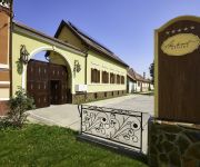
Resort Ambient
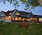
Conacul Ambient
Videos from this area
These are videos related to the place based on their proximity to this place.
Bal la Vulcan cu formatia Arkade, Liviu Ciricu si Nelu Albu
Pentru nunti , botezuri si alte petreceri contactati-ne la 0745691325.
Bal la Vulcan cu formatia Arkade, Liviu Ciricu si Flaviu Cristea
Pentru nunti , botezuri si alte petreceri contactati-ne la 0745691325.
SCENETA DE CRACIUN 2012 copii speciali din comuna Vulcan BRASOV
Sceneta realizata cu ocazia sarbatorilor de iarna.
The Black Stork (Ciconia nigra) Romania, Dumbravita - Delta din Carpati
Dumbravita Fishing Complex Natura 2000 & Ramsar Site is one of the best Romanian foraging area for Black Stork during autumn migration. This is also a very interesting birdwatching location...
Excursie la Lacul Dumbravita 20 mai 2014
Excursie la Lacul Dumbravita 20 mai 2014. Cu copii de la gadiniţa din Crizbav.
Videos provided by Youtube are under the copyright of their owners.
Attractions and noteworthy things
Distances are based on the centre of the city/town and sightseeing location. This list contains brief abstracts about monuments, holiday activities, national parcs, museums, organisations and more from the area as well as interesting facts about the region itself. Where available, you'll find the corresponding homepage. Otherwise the related wikipedia article.
Burzenland
The Burzenland is a historic and ethnographic area in southeastern Transylvania, Romania with a mixed population. Since the exodus of most of the German-speaking Transylvanian Saxons in the 20th century, this region has been predominantly inhabited by Romanians.
Biserica Neagră
Biserica Neagră or Black Church is a cathedral in Brașov, a city in south-eastern Transylvania, Romania. It was built by the German community of the city and stands as the main Gothic style monument in the country, as well as being the largest and one of the most important Lutheran places of worship in the region.
Feldioara
Feldioara is a Romanian commune located in Transylvania, very close to Braşov (about 10 miles or 15 kilometers). It is composed of three villages: Colonia Reconstrucţia (Bohntelep), Feldioara and Rotbav (Rothbach; Szászveresmart). At the 2011 census, 88.8% of inhabitants were Romanians, 6.9% Hungarians and 3.5% Roma. It has a medieval fortress long believed to have been built by the Teutonic Knights.
Stadionul Silviu Ploeşteanu
Stadionul Silviu Ploeșteanu, previously known as Stadionul Tineretului, is a multi-purpose stadium in Brașov, Romania. It is currently used mostly for football matches and is the home ground of FC Brașov. It was named after Silviu Ploeșteanu, an emblematic former manager of the club.
Braşov Airport
Braşov-Ghimbav International Airport is an airport currently under construction in Ghimbav, near Braşov, Romania right by the future A3 motorway. Planned costs of the project are around one hundred million euros. The airport will be designed to handle medium-sized aircraft with a capacity of one million people per year. The terminal will be built modularly, allowing future construction. Intelcan Canada inaugurated the construction of the airport on April 15, 2008.
Tâmpa, Braşov
Tâmpa is a mountain, part of the Postăvarul Massif, located in the southern part of the Eastern Carpathians (alternatively categorized as in the Curvature Carpathians) and almost entirely surrounded by the city of Braşov. Its elevation is 960 m (995 m according to some sources), almost 400 m above the city. The mountain is mostly made up of limestone formations, having risen up gradually from the Earth's crust.
St. Nicholas Church, Brașov
Saint Nicholas Church (Romanian: Biserica Sfântul Nicolae) is a Romanian Orthodox church in Braşov, dominating the historic district of Şchei. The church was established in 1292. It was mentioned in a Papal bull issued in 1399 by Pope Boniface IX. Starting in 1495, the church was rebuilt in stone by the locals, with help from Vlad Călugărul, Voivode of Wallachia. More help was provided around 1512 by Neagoe Basarab. Initially built in the Gothic style, it was later redone in the Baroque style.
Stadionul Municipal (Brașov)
Stadionul Municipal is a proposed football stadium next to the Castra of Brașov in Braşov, Romania. Construction started in 2008, and was to be completed in 2010, but the project stopped after demolishing the old stadium due to a lack of funds.
Cristian, Brașov
Cristian is a commune in Braşov County, Romania. It is composed of a single village, Cristian. At the 2002 census, 95.3% of inhabitants were Romanians, 2.9% Transylvanian Saxons and 1.8% Hungarians. 93.1% were Romanian Orthodox, 2.6% Lutheran, 1.7% Christian Evangelical, 0.8% Reformed and 0.5% Roman Catholic. \t\t \t\t\tNeustadt02. JPG \t\t\t Lutheran fortified church \t\t\t \t\t \t\t \t\t\tNeustadt10. JPG \t\t\t Former Lutheran parish house \t\t\t \t\t \t\t \t\t\tNeustadtBV11.
Crizbav
Crizbav is a commune in Braşov County, Romania. It is composed of two villages, Crizbav and Cutuş. At the 2011 census, 83.1% of inhabitants were Romanians and 16.1% Hungarians. {{#invoke: Navbox | navbox }} {{#invoke:Coordinates|coord}}{{#coordinates:45|49|N|25|28|E|region:RO_type:city_source:GNS-enwiki|| |primary |name= }}
Dumbrăvița, Brașov
Dumbrăviţa is a commune in Braşov County, Romania. It is composed of two villages, Dumbrăviţa and Vlădeni.
Hălchiu
Hălchiu is a commune in Braşov County, Romania. It is composed of two villages, Hălchiu and Satu Nou. At the 2011 census, 77.4% of inhabitants were Romanians, 16.4% Hungarians, 4.8% Roma and 1.4% Germans. {{#invoke: Navbox | navbox }} {{#invoke:Coordinates|coord}}{{#coordinates:45|46|N|25|33|E|region:RO_type:city_source:GNS-enwiki|| |primary |name= }}
Holbav
Holbav is a commune in Braşov County, Romania. It is composed of a single village, Holbav, part of Vulcan Commune until 2004, when it was split off. {{#invoke: Navbox | navbox }} {{#invoke:Coordinates|coord}}{{#coordinates:45|39|N|25|23|E|region:RO_type:city_source:GNS-enwiki|| |primary |name= }}
Poiana Mărului
Poiana Mărului (German: Obstwald am Bleschenbach) is a commune in Braşov County, Romania. It is composed of a single village of the same name. {{#invoke: Navbox | navbox }}
Transilvania University of Brașov
Transilvania University of Brașov (UTBv) is a state institution of higher education in Brașov, Romania. It has sixteen faculties, a total of 25,000 students and 800 teachers. The University offers 103 days license areas, 12 areas for Distance Education, and 5 areas for higher reduced frequency, as well as 17 graduate programs and 14 doctoral programs.
Stadionul Municipal (Brașov, old)
Municipal Stadium was a multi-use stadium next to the Castra of Brașov in Braşov, Romania. It was used mostly for football matches, different teams from Braşov having played on it. The stadium had a capacity of 30,000 people.
Strada sforii
Strada sforii (Romanian for 'String street', German: Fadengasse) is the narrowest street in the city of Braşov, Romania. It is believed to be one of the narrowest streets in Europe (Spreuerhofstraße, in Germany, and Parliament Street, in England, are narrower). It is situated near Șchei Gate and it is perpendicular to Strada Cerbului (Stag Street). It was initially built as a corridor that firemen could use, and it is first mentioned in 17th century documents.
Black Tower (Brașov)
Located on a large rock on Warthe Hill, the role of the Black Tower of Braşov, Romania was to deny enemy soldiers to approach the city walls, which, in this case, were no further than 5 meters (the pass was only widened in 1819-1820).
Battle of Braşov
The Battle of Braşov (German: Battle of Kronstadt; Hungarian: Battle of Brassó) was fought on July 17, 1603, between the troops of Wallachia led by Radu Şerban and the Habsburg Empire on one side and the Transylvanian troops led by Mózes Székely on the other side.
Andrei Mureşanu High School
Andrei Mureşanu High School is a high school in the Schei neighborhood of Braşov, Romania. It is situated close to Piata Unirii and the Saint Nicholas Church. The school is named after the famous Romanian poet Andrei Mureşanu who also composed the lyrics of the national hymn of Romania, "Desteapta-te romane". The high school is not only a high school – it also includes an elementary and a middle school, but both are situated in another building, very close to the high school.
Battle of Zernest
The Battle of Zernest was fought on 11 August 1690, near the city of Zernest in Transylvania (today part of Romania), between the allied forces of Transylvania and the Holy Roman Empire, and the allied forces of the Ottoman Empire, Tatar allies and Hungarian Kurucs. Imre Thököly aspired to proclaim himself Prince of Transylvania, and allied with the Turks he had campaigned unsuccessfully in 1686 and 1688 to win the Transylvanian crown. In 1690 he launched another campaign.
Perșani Mountains
The Perşani Mountains is a mountain range in central Romania. Geologically the Perşani Mountains are part of the Căliman-Harghita Mountains of the Inner Eastern Carpathians. Within Romania, however, it's traditional to divide the Eastern Carpathians in Romanian territory into three geographical groups (north, center, south) instead. The Romanian categorization includes the Perşani Mountains within the central Carpathians of Moldavia and Transylvania (Munţii Carpaţi Moldo-Transilvani).
2010 IAF Sikorsky CH-53 crash
The 2010 Israeli Air Force Sikorsky CH-53 crash refers to an aviation accident which occurred on 26 July 2010, when an Israeli Air Force Sikorsky CH-53 Sea Stallion Yas'ur helicopter crashed during a training flight in the Carpathian mountains, near the city of Brasov in Romania. The accident took place during a joint Romanian-Israeli aviation military exercise code-named "Blue Sky 2010".


