Safety Score: 2,5 of 5.0 based on data from 9 authorites. Meaning we advice caution when travelling to Ireland.
Travel warnings are updated daily. Source: Travel Warning Ireland. Last Update: 2024-05-04 08:22:41
Explore Cherry Orchard
The district Cherry Orchard of Ballyfermot in Dublin City (Leinster) with it's 7,924 inhabitants Cherry Orchard is located in Ireland about 2,705 mi north-west of Qeshlaq, the country's capital.
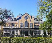
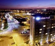
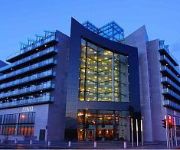
If you need a place to sleep, we compiled a list of available hotels close to the map centre further down the page.
Depending on your travel schedule, you might want to pay a visit to some of the following locations: Tallaght, Dublin, Swords, Naas and Navan. To further explore this place, just scroll down and browse the available info.
Local weather forecast
Todays Local Weather Conditions & Forecast: 15°C / 59 °F
| Morning Temperature | 8°C / 46 °F |
| Evening Temperature | 14°C / 57 °F |
| Night Temperature | 7°C / 45 °F |
| Chance of rainfall | 0% |
| Air Humidity | 62% |
| Air Pressure | 1007 hPa |
| Wind Speed | Gentle Breeze with 6 km/h (4 mph) from South-West |
| Cloud Conditions | Broken clouds, covering 69% of sky |
| General Conditions | Broken clouds |
Monday, 6th of May 2024
14°C (56 °F)
9°C (47 °F)
Light rain, light breeze, overcast clouds.
Tuesday, 7th of May 2024
12°C (54 °F)
7°C (45 °F)
Overcast clouds, light breeze.
Wednesday, 8th of May 2024
16°C (61 °F)
10°C (50 °F)
Broken clouds, light breeze.
Hotels and Places to Stay
Citywest Hotel
The Louis Fitzgerald
Red Cow Moran
Hilton Dublin Kilmainham
Castleknock Hotel & Country Club
Crowne Plaza DUBLIN - BLANCHARDSTOWN
Green Isle Conference and Leisure
Kingswood Hotel Citywest
Maldron Hotel and Leisure Centre Tallaght
The Lucan Spa Hotel
Videos from this area
These are videos related to the place based on their proximity to this place.
Irish SMEs Networking Event with whatswhat.ie and Radio Nova
The nice guys over at whatswhat.ie and Radio Nova decided to host a networking event with a difference recently in the Red Cow Moran Hotel. Aimed at small to medium-sized businesses from around.
Days Hotel Dublin Parkwest, Twin Room
This is a video walkthru of a twin room in the Days Hotel in Dublin city Parkwest. For more details on our hotel rooms please visit the Dublin Parkwest hotels room page here: http://www.dayshotelpa...
Days Hotel Dublin Parkwest Reception
This is a video walkthru of the reception in the Days Hotel in Dublin city Park West. For more details on our hotel rooms, features and amenties please visit the Dublin Park West hotels on...
two luas pass one another on the red line by red cow
two luas pass one another on the red line by red cow.
Irish Rail - Iarnród Éireann Commuter train arrives at..
Heuston station, Dublin, Ireland 31.7.2008.
Days Hotel Dublin Park West - Conference Room
This is a video walkthrough of a Days Hotel Dublin Park West Conference Room which is perfect for your business meeting and conference needs. The flexible layout and complete selection of ...
BARNEY LOOK ALIKES
Irish couple start there jouney in the life of vlogging jason aka URUTUBEBROTHER has been a huge fan of vlogging and finally gets to make his own. this is vlog number FIND US ON FACEBOOK...
Videos provided by Youtube are under the copyright of their owners.
Attractions and noteworthy things
Distances are based on the centre of the city/town and sightseeing location. This list contains brief abstracts about monuments, holiday activities, national parcs, museums, organisations and more from the area as well as interesting facts about the region itself. Where available, you'll find the corresponding homepage. Otherwise the related wikipedia article.
TV3 (Ireland)
TV3 is a privately owned free-to-air television network operated within Ireland. The channel is owned by Tullamore Beta Ltd. , a subsidiary of Doughty Hanson & Co. The channel launched on 20 September 1998 becoming the country's first commercial broadcaster. As of 2011, TV3 is the second most watched channel in Ireland competing with RTÉ Television's RTÉ One for the title of Ireland's most watched channel.
South Dublin
South Dublin (Irish: Áth Cliath Theas) is a county in Ireland. It is part of the Dublin Region and is also located in the province of Leinster. It is named after the city of Dublin. South Dublin County Council is the local authority for the county. In 2011, the population of the county was 265,205 making it the third most populous county in the state.
Inchicore
Inchicore is a suburb of Dublin, the capital of Ireland.
Liffey Valley Shopping Centre
Liffey Valley Shopping Centre is a shopping centre, that is located in Clondalkin in Dublin 22. The centre opened in 1998 and is located at the junction of the M50 motorway and N4 road. The centre was a replacement for a much larger complex mooted for the site, known as Quarryvale.
Castleknock College
Castleknock College is a private (fee-paying), secondary school for boys aged between 13 and 18, which is situated in the residential suburb of Castleknock, 8 km west of the city centre in Dublin, Ireland.
Red Cow interchange
The Red Cow interchange is a major road junction in west Dublin, Ireland on the M50, meeting the N7 Naas Road at a free-flow grade separated junction which incorporates a light railway line. The N7 route commences at this junction, junction 1 on the N7 and junction 9 on the M50, and the Naas Road from the city centre via Inchicore to the Red Cow interchange comprises part of the R110 and the R810. The junction is the busiest road junction in Ireland.
Castleknock Castle
Castleknock Castle is a ruined Norman castle located on the grounds of present-day Castleknock College, Castleknock, Dublin, Ireland.
The King's Hospital
The King's Hospital is a Church of Ireland co-educational fee-paying boarding and day school situated in Palmerstown, Dublin, Ireland. Founded in 1669, it is one of the oldest schools in Ireland and was also known as the Blue Coat School. Although priority is given to those of the main Protestant tradition, as a Christian school, it is attended by students of other denominations and faiths. The school's colours are navy and gold.
Ballymount
Ballymount (Irish: Baile an Mhóta, meaning "town of the moat"), is located on the south side of Dublin, near the mainly residential areas of Walkinstown to the east, Tallaght to the west and Greenhills to the south. Ballymount is accessed by a number of public bus routes from Dublin city centre, and via the Red Cow Stop on the Red Luas Line, and it houses one of the largest industrial zones in Ireland. This area is divided by the M50 motorway.
Chapelizod
Chapelizod (Irish: Séipéal Iosóid, meaning "Iseult's Chapel") is a picturesque Irish village preserved within the city of Dublin, Ireland. It lies in the verdant wooded valley of the River Liffey, on the way to the slopes of the Strawberry Beds, below the Phoenix Park. The village is associated with Iseult of Ireland and the location of Iseault's chapel. Chapelizod is under the administration of Dublin City Council.
Coolmine railway station
Coolmine railway station serves Coolmine, County Dublin, Ireland. It lies on the Dublin to Maynooth and Dublin Docklands to M3 Parkway railway station commuter routes. A large car park is located next to the station, making it a popular park and ride location.
Castleknock Community College
Castleknock Community College, is an Irish secondary school located in Castleknock, County Dublin. Established in 1995, the school is part of the "County Dublin Vocational Education Committee". The college is a co-educational post-primary school catering to an ever-increasing population growth within the Barony of Castleknock. A comprehensive academic curriculum is promoted in addition to a wide-ranging programme of extra-curricular activities.
St. Brigid's National School Castleknock
St. Brigid's National School is a mixed, primary national Catholic school, located off Beechpark Avenue in Castleknock, Dublin, Ireland. A notable famous past student is Colin Farrell.
Round Towers GAA (Clondalkin)
Round Towers is a Gaelic Athletic Association (GAA) associated with the Dublin County Board club based in Clondalkin, Co. Dublin. The Club plays the Gaelic games of Gaelic football, Hurling in both men's and women's codes.
St. Patricks (Palmerstown) GAA
St. Patricks are a Gaelic Athletic Association club located in Chapelizod and Palmerstown Dublin, Ireland. Today the club are among the best in the Dublin. The club was founded in 1961 and took its name because that was the Patrician year. The club colours came about as one of the founders, Peter Kavanagh, had two sets of jerseys, one green and the other red. Originally the main colours were to be green and white (the colours of St.
Clondalkin/Fonthill railway station
Clondalkin/Fonthill railway station (also known as Fonthill Road on Irish Rail Information screens) serves the suburb of Clondalkin in County Dublin. It opened on 13 October 2008,. and is located on the R113 road (in particular, the section known as the Fonthill Road), west of Clondalkin, between Ronanstown and the Nangor Road. It is served by South Western Commuter services.
Newlands Cross
Newlands Cross is a well-known crossroads in SW Dublin in the county of South Dublin. It is the point where the N7 National Route to the South West and Mid West crosses an orbital local route, the R113. Traditionally Newlands Cross was regarded as the place where Dublin City ended and the "country" began, though it is now inside the urban area. Dublin people and especially the Dublin based broadcast and print media were/are sometimes accused of being unaware of the world beyond Newlands Cross.
Park West, Dublin
Park West (Irish: Páirc an Iarthair) is a large business campus within greater Ballyfermot, notably Cherry Orchard, Dublin, Ireland, with some residential development.
Dublin South FM
'Dublin South FM' is a community-based radio service for South Dublin, which broadcasts seven days a week from 1100 - 2300 on the frequency 93.9 FM. The station features community arts programmes, music programmes and local news and current affairs programmes specifically for the region. Originally pirate, Dublin South FM is now licensed and regulated by the Broadcasting Commission of Ireland.
Kilnamanagh
Kilnamanagh (Irish: Cill na Manach) is a suburban residential area in Tallaght, South Dublin, Ireland.
Moyle Park College
Moyle Park College is a secondary school in Clondalkin, South Dublin, Ireland. The school was established by the Marist Brothers in 1957 and grew rapidly, as did the population of the local area. In 2007 Moyle Park College celebrated its Golden Jubilee. On 13 October a ceremony was held in the sports hall to mark the occasion. This was attended by the then President of Ireland Mary McAleese who also opened the Golden Jubilee Garden.
Ballyfermot College of Further Education
Ballyfermot College of Further Education (also known as BCFE) is an educational institution in Ballyfermot, Dublin, Ireland. BCFE is a college of further and higher education providing vocational education. MANAGEMENT Ballyfermot College of Further Education is managed by the City of Dublin Vocational Education Committee (CDVEC) with a local Board of Management representative of the community/special interest, industry/services and commerce, students and staff.
St. Joseph's Boys National School
St. Josephs Boys National School is located on Boot Road in Clondalkin, County Dublin, Ireland. It was established in 1811, in the early stages of modern educational development in Ireland. It was announced in December 2010, Mr O' Toole would be retiring as the principal of St. Josephs and that Mr. Desmond would take over as principal. Mr O' Toole left as principal on December 21, 2010, he was supposed to leave as principal December 23, 2010, but due to the snow, he couldn't.
Kylemore College
Kylemore College is a secondary school in Ballyfermot, Dublin, Ireland. It is a gender mixed school and is a T.E.C. school.
Scoil Ide, Clondalkin
Scoil Ide is a school located on Boot Road in Clondalkin, County Dublin, Ireland. It was established in TBS, in the early stages of modern educational development in Ireland.


