Delve into Berrinba
The district Berrinba of Logan City in Logan (Queensland) is a district located in Australia about 576 mi north-east of Canberra, the country's capital town.
In need of a room? We compiled a list of available hotels close to the map centre further down the page.
Since you are here already, you might want to pay a visit to some of the following locations: Brisbane, Sunshine Coast, Carrolls Creek, and . To further explore this place, just scroll down and browse the available info.
Local weather forecast
Todays Local Weather Conditions & Forecast: 24°C / 76 °F
| Morning Temperature | 14°C / 58 °F |
| Evening Temperature | 21°C / 69 °F |
| Night Temperature | 16°C / 60 °F |
| Chance of rainfall | 0% |
| Air Humidity | 50% |
| Air Pressure | 1022 hPa |
| Wind Speed | Gentle Breeze with 6 km/h (3 mph) from West |
| Cloud Conditions | Broken clouds, covering 81% of sky |
| General Conditions | Light rain |
Wednesday, 1st of May 2024
23°C (73 °F)
17°C (62 °F)
Light rain, gentle breeze, broken clouds.
Thursday, 2nd of May 2024
23°C (74 °F)
17°C (63 °F)
Light rain, gentle breeze, broken clouds.
Friday, 3rd of May 2024
21°C (69 °F)
17°C (63 °F)
Light rain, gentle breeze, overcast clouds.
Hotels and Places to Stay
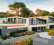
Flinders Hotel
Johnson Road Motel
Calamvale Suites and Conference Centre
The Glen Hotel and Suites
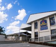
BEST WESTERN SUNNYBANK STAR
Springwood Motor Inn
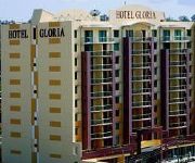
Gloria
Springwood Hotel
Brisbane Gateway Resort
Logan City Motor Inn
Videos from this area
These are videos related to the place based on their proximity to this place.
Great South East - Logan City Parks
Channel Seven - 'Great South East' video segment showcasing Logan City's park's and wildlife. Includes Berrinba Wetlands, Daisy Hill Koala Centre and Conservation Park.
Logan City Council Eat Safe - Cinema Advertising
Logan City Council have introduced the Eat Safe program, which allows food businesses in the city to receive a star rating based on their food safety practices. This spot was produced by Brisbane...
Discover great deals in the city of Logan
Whether you're looking for new ways to entertain the kids, get your heart racing or soothe the soul, Logan City is full of hidden gems just waiting to be explored! From gorgeous parklands and...
Discover more great deals in the city of Logan
If you're looking for things to do with the family these holidays, check out what Logan City has to offer! It's full of hidden gems just waiting to be explored and you'll find loads of ideas...
Discover the city of Logan
Whether you're looking for new ways to entertain the kids, get your heart racing or soothe the soul, the city of Logan is full of hidden gems just waiting to be discovered!
All Suburbs Representatives talking about, Marsden more at www.allsuburbsrealestate.com.au
Logan City is a huge area and a popular suburbs is Marsden. The reason Marsden is so attractive to buyers is for a number of reasons. 1. The affordability is excellent with homes starting...
ECCL SUNDAY MARKETS - International Hot Foods Court
BUSHTUNE INTERNATIONAL assist other Not-For-Profit organizations. Here we are working with ETHNIC COMMUNITIES COUNCIL of LOGAN (www.ECCL.org.au) in Woodridge,Logan City, Australia.
Fit 4 Life - REVIEWS - Logan, Qld Personal Trainer Reviews
Reviewed Fit 4 Life is a top reviewed personal trainer in Logan, Qld. This video shows some of the excellent reviews and testimonials that have been offered by their happy...
Great South East - Beenleigh Historical Village
The City of Logan has a rich heritage in early settlement history. Why not take the time to stroll through the vibrant display at Beenleigh Historical Village today?
Mayes in May 2013
Take a step back in time at Logan's most historic address, Mayes Cottage in celebration of the city's heritage. There will be something for the whole family to enjoy at the free and fun-filled...
Videos provided by Youtube are under the copyright of their owners.
Attractions and noteworthy things
Distances are based on the centre of the city/town and sightseeing location. This list contains brief abstracts about monuments, holiday activities, national parcs, museums, organisations and more from the area as well as interesting facts about the region itself. Where available, you'll find the corresponding homepage. Otherwise the related wikipedia article.
Logan City
Logan City is a local government area in South East Queensland, Australia. The city is situated between the City of Brisbane to the north and Gold Coast to the south. The city also borders the Scenic Rim, the City of Ipswich and Redland City.
Trinder Park railway station
Trinder Park is a railway station on the Beenleigh Line of Brisbane, Australia. It is part of the Queensland Rail City network. It is in Zone 5 of the TransLink integrated public transport system. It was the site of a fatal collision in 1985 between two electric multiple units due to a signal failure. Pictures can be viewed here Trinder Park EMU Derailment 1985
Woodridge railway station
Woodridge is a railway station on the Beenleigh Line of Brisbane, Australia. It is part of the Queensland Rail City network. It is in Zone 5 of the TransLink integrated public transport system.
Kingston railway station, Brisbane
Kingston is a railway station on the Beenleigh Line of Brisbane, Australia. It is part of the Queensland Rail City network. It is in a transition precinct between Zone 5 and Zone 6 of the TransLink integrated public transport system. Nearby landmarks include the Kingston Buttery Factory, as well as the Kingston Park Raceway.
Division of Rankin
The Division of Rankin is an Australian Electoral Division in Queensland. The division was created in 1984 and is named for Annabelle Rankin, the first Queensland woman elected to the Senate. In its original form, Rankin covered the Gold Coast hinterland including Lamington National Park and the major town of Beaudesert as well as some outer metropolitan areas of Brisbane. In this situation it was a marginal seat held by the Labor party.
Stretton, Queensland
Stretton is a suburb on the south side of Brisbane, Australia. It is 17 kilometres from the Brisbane Central Business District, and borders the suburbs of Calamvale, Sunnybank Hills, Karawatha, Kuraby, and Drewvale.
Browns Plains Grand Plaza bus station
The Browns Plains Grand Plaza Bus Station, at Browns Plains, is serviced by TransLink bus routes. It is part of the Grand Plaza Shopping Centre and is a major interchange for TransLink's Southern Region. It is in a transition precinct between Zone 5 and Zone 6 of the TransLink integrated public transport system.
Woodridge, Queensland
Woodridge is a suburb of Logan City in the South East of Queensland, Australia, It has a population of 20,650 as of the 2011 census.
Browns Plains, Queensland
Browns Plains is a suburb of Logan City, Queensland, Australia.
Berrinba, Queensland
Berrinba is a suburb in the Brisbane metropolitan area in Queensland, Australia. It is split between the Brisbane and Logan City local government areas. The naming of the suburb Berrinba is originated from an Aboriginal word meaning to indicate towards the south for example to the left of a speaker with the sunrise behind him/her.
Heritage Park, Queensland
Heritage Park is a suburb of Logan City, Queensland, Australia.
Logan Central, Queensland
Logan Central is a suburb of Logan City, Queensland, Australia. Once forming part of Woodridge, Logan Central is the official central business district of Logan City and is a major activity centre, with many shops and local businesses operating in the area, mostly along the Wembley Road corridor. Woodridge railway station is located in Logan Central.
Kingston, Queensland
Kingston is a suburb of Logan City, Queensland, Australia. Kingston is a predominantly residential suburb, with a low mix of commercial and retail areas. It is the home of the Kingston Butter Factory. Kingston was also the site of an environmental disaster similar to Love Canal in Niagara Falls in the USA.
Marsden, Queensland
Marsden is a suburb of Logan City, Queensland, in Australia. At the 2011 Australian census the suburb had a population of 11,278. The northern boundary of the suburb roughly runs parallel to the Logan Motorway.
Park Ridge, Queensland
Park Ridge is a suburb of Logan City,part of the Brisbane metropolitan region, Queensland, Australia. Park Ridge lies to Logan's west and enjoys a rural setting. There are manicured acreage properties buffered by pretty bushland and the suburb holds great appeal for horse lovers.
Regents Park, Queensland
Regents Park is a suburb of Logan City,part of the Brisbane metropolitan region, Queensland, Australia. The size of Regents Park is approximately 5 km²(476 hectares). It has 5 parks covering nearly 12% of the total area.
Karawatha, Queensland
Karawatha is an outer suburb of Brisbane, Australia. It is 22 km south-east of the CBD. The naming of the suburb Karawatha originates from an Aboriginal word meaning a place with pine trees. Karawatha is a sparsely populated suburb with few structures and the majority of the land used as undeveloped park land, known as Karawatha Forest.
Drewvale, Queensland
Drewvale is an outer suburb of Brisbane, Australia. It is 28 kilometres south of the CBD and borders with Logan City. Drewvale is located at the interchange of the Gateway and Logan Motorways. It is the most southern suburb of Brisbane.
Islamic College of Brisbane
The Islamic College of Brisbane (ICB) is a co-educational P-12 school in the suburb of Karawatha, Brisbane, Queensland Australia. It offers teaching from Prep year to year twelve.
Karawatha Forest
Karawatha Forest or Karawatha nature reserve is approximately 1000 hectares of bushland in the Brisbane suburbs of Karawatha and Stretton, Australia. The Karawatha Forest Protection Society was formed to ensure that the bushland was protected from development and is owned and managed by the Brisbane City Council (BCC).
Calamvale Creek
Calamvale Creek is a small natural creek that runs through the Brisbane suburb of Calamvale, in Queensland, Australia. It is the local name for part of a longer channel known as Scrubby Creek. Calamvale Creek is the downstream part of the Golden Pond wetlands system, which Brisbane City Council constructed in the late 1990s to treat stormwater that runs into the creek, and to provide a small wildfowl habitat in an urban setting. http://calamvalecreek. awardspace. com/
Marsden State High School
Marsden State High School (MSHS) is a secondary school in Logan City, Queensland for students between years 8 and 12. Marsden State High School is located on Muchow Road between the suburbs of Marsden and Waterford West. The school was established in 1987 and, as of 2011, has 1,789 students. From the school's opening, in 1987, until 2010, the motto was Success Through Industry, however, since 2010 the motto has been Empowering Individuals, Expanding Horizons, Creating Futures.
Kingston College (Queensland)
Kingston College is a college located in Kingston, a suburb of Logan City, Queensland, Australia. It incorporates a center for continuing secondary education.
St Paul's Primary School Woodridge
In 1969 a new Catholic School, St Paul's Primary School, opened in Woodridge. St Paul’s School is situated in Logan City 30 km south of Brisbane CBD. It is locate at 3 St Paul's Drive, Woodridge Queensland, Australia.
Mayes Cottage
Mayes Cottage is an historic house and museum in Kingston, Queensland, Australia. Built in 1887, Mayes Cottage was originally home to the Mayes family and known as "Pleasant Place". The house—located at 36 Mawarra Street—was built 16 years after John and Emily Mayes first arrived in Australia. John and Emily Mayes and their two small children, Joshua and Ruth, arrived in Brisbane from England aboard the SS Indus in 1871.


