Delve into Shailer Park
The district Shailer Park of Logan City in Logan (Queensland) is a subburb in Australia about 579 mi north-east of Canberra, the country's capital town.
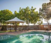
If you need a hotel, we compiled a list of available hotels close to the map centre further down the page.
While being here, you might want to pay a visit to some of the following locations: Brisbane, Sunshine Coast, Carrolls Creek, and . To further explore this place, just scroll down and browse the available info.
Local weather forecast
Todays Local Weather Conditions & Forecast: 24°C / 75 °F
| Morning Temperature | 14°C / 57 °F |
| Evening Temperature | 21°C / 69 °F |
| Night Temperature | 16°C / 61 °F |
| Chance of rainfall | 0% |
| Air Humidity | 51% |
| Air Pressure | 1022 hPa |
| Wind Speed | Gentle Breeze with 6 km/h (3 mph) from West |
| Cloud Conditions | Broken clouds, covering 74% of sky |
| General Conditions | Light rain |
Wednesday, 1st of May 2024
23°C (73 °F)
17°C (63 °F)
Light rain, gentle breeze, broken clouds.
Thursday, 2nd of May 2024
23°C (74 °F)
17°C (63 °F)
Light rain, gentle breeze, overcast clouds.
Friday, 3rd of May 2024
21°C (69 °F)
17°C (63 °F)
Light rain, gentle breeze, overcast clouds.
Hotels and Places to Stay
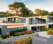
Flinders Hotel
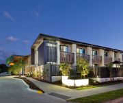
The Glen Hotel and Suites
Logan City Motor Inn
McNevins Loganholme Motel
Springwood Motor Inn
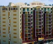
Gloria
Springwood Hotel
Brisbane Gateway Resort
Econo Lodge Waterford
SPRINGWOOD TOWER APARTMENT HOTEL
Videos from this area
These are videos related to the place based on their proximity to this place.
55 Adelong Rd, Shailer Park 0434 169 033 The Mark Coleman Team RE/MAX
55 Adelong Rd, Shailer Park is marketed by Mark Coleman. Call Mark today on 0434 169 033 RE/MAX Only a step inside this gorgeous residence allows you to fully appreciate the warm and ...
8 Eginbah Court, Shailer Park 0434 169 033 The Mark Coleman Team RE/MAX
is marketed by Mark Coleman. Call Mark today on 0434 169 033 RE/MAX Located in a quiet cul-de-sac in the prestigious “Koolan precinct”, this wonderful family...
Another Shailer Park property SOLD by The Mark Coleman Team 0434 169 033 RE/MAX Territory Smakk
Sold 7 Carissa Street Shailer Park property has been sold by Mark Coleman RE/MAX agent. This video was created by Smakk Media video production for real estat...
Sold by Mark Coleman RE/MAX Territory Shailer Park Real Estate and Property management
Sold Sold Sold 53 Dane Court Shailer Park Marketed by The Mark Coleman Team 0434 169 033 Sold Sold YouTube: http://www.youtube.com/TheMarkColemanTeam Want to know where this property ...
147 Barokee Drive, Tanah Merah 0434 169 033 The Mark Coleman Team RE/MAX
147 Barokee Drive, Tanah Merah is marketed by Mark Coleman. Call Mark today on 0434 169 033 RE/MAX Situated at the very peak of Barokee Drive and enjoying the most breathtaking views to the...
SOLD by The Mark Coleman Team RE/MAX real estate agents Shailer Park
Sold 15 Voltaire Street Shailer Park for sale and proudly marketed by the award winning Mark Coleman Team. Call them today on 0434169033 Directions http://goo.gl/maps/rVuRk Perfectly Located...
22 Beagle Street, Shailer Park 0434 169 033 The Mark Coleman Team RE/MAX
22 Beagle Street, Shailer Park is marketed by Mark Coleman. Call Mark today on 0434 169 033 RE/MAX Situated on a substantial 1346m2 block and enjoying tranquil bushland views, this smart ...
SOLD by MARK COLEMAN RE/MAX Plus Springwood Queensland REAL ESTATE Valuers & Agents
SOLD SOLD SOLD SOLD 23 -25 Marillana Court, Shailer Park Marketed by Mark Coleman 0434 169 033 SOLD SOLD SOLD LOCATION. LIFESTYLE. LUXURY Situated in an exclusive pocket and ...
Sold by The Mark Coleman Team RE/MAX Territory Shailer Park
Sold Sold Sold 5 Everlast Street Shailer Park Marketed by the Mark Coleman team 0434 169 033 Sold Sold Sold Location Perfect - Potential Plus! HERE is the DIRECTIONS for you: We are excited...
CORKS!!!
its a short video on just the flips ive been practising just needed to post something before my next city video.
Videos provided by Youtube are under the copyright of their owners.
Attractions and noteworthy things
Distances are based on the centre of the city/town and sightseeing location. This list contains brief abstracts about monuments, holiday activities, national parcs, museums, organisations and more from the area as well as interesting facts about the region itself. Where available, you'll find the corresponding homepage. Otherwise the related wikipedia article.
Venman Bushland National Park
Venman Bushland is a national park in Queensland, Australia, 22 km southeast of Brisbane.
Bethania, Queensland
Bethania is located in Logan City from March 15, 2008. It is situated on the main southern suburban railway and lies south of the Logan River. It occasionally suffers floods. A separate branch railway leaves the South Coast railway line at Bethania and runs to Beaudesert. It has been out of commission since August 2004.
Loganlea railway station
Loganlea is a railway station on the Beenleigh Line of Brisbane, Australia. It is part of the Queensland Rail City network. It is in Zone 6 of the TransLink integrated public transport system.
Bethania railway station
Bethania is a railway station on the Beenleigh Line of Brisbane, Australia. It is part of the Queensland Rail City network. It is in a transition precinct between Zone 6 and Zone 7 of the TransLink integrated public transport system. It is the branching point for the Beaudesert line.
Logan Hyperdome
Logan Hyperdome Shopping Centre in Shailer Park, Queensland is the largest shopping centre in Logan City and one of the largest single story shopping centres in Australia. The Queensland Police Service operates a police beat shopfront in the centre. The Logan City Council has a library in shopping centre. The Logan Hyperdome contains a food court with many outlets. Birch Carol & Coyle operate a cinema complex within the centre.
Cornubia, Queensland
Cornubia is a suburb of Logan City, Queensland, Australia. It is situated 30 kilometres south-east of Brisbane. The nearest largest landmark is the Logan Hyperdome shopping centre - one of the largest undercover shopping malls in Queensland. Cornubia is considered one of the most sought after suburbs in Logan City due to its bush setting and closeness to major shops (Logan Hyperdome) and first class educational institutions (John Paul College, Calvary Christian College).
Eden's Landing railway station
Eden's Landing is a railway station on the Beenleigh Line of Brisbane, Australia. It is part of the Queensland Rail City network. It is in Zone 7 of the TransLink integrated public transport system.
Loganholme bus station
The Loganholme Bus Station, at Shailer Park, is serviced by TransLink bus routes. It is part of the Logan Hyperdome and is a major interchange for TransLink's Southern Region. It is in Zone 6 of the TransLink integrated public transport system.
Chisholm Catholic College (Cornubia)
Chisholm Catholic College is a single campus co-educational Catholic high school in Cornubia, 32 km south-east of Brisbane, Australia, with approximately 700 year 8-12 students. Established in 1992, it is administered by Brisbane Catholic Education.
Metroad 6 (Brisbane)
Metroad 6 in Brisbane, Queensland, Australia, is a major urban road corridor. It connects Tanah Merah to Drewvale via the Logan Motorway.
John Paul College (Brisbane)
John Paul College is an independent, co-educational, non-ecumenical day school located in the Logan City suburb of Daisy Hill. It teaches over 2,500 students, under the direction of the Headmaster, Peter Foster. The campus covers 33 hectares and was established in 1982. The foundation principal was Cec Munns, who was also a member of the steering committee whch had urged the Brisbane Catholic Education Office to establish a Catholic secondary school in the area.
Daisy Hill, Queensland
Daisy Hill is a suburb of Logan City, Queensland, Australia. It lies between the Pacific Motorway and the Daisy Hill Conservation Park.
Loganholme, Queensland
Loganholme is a suburb of Logan City, Queensland, Australia. A major landmark in the area is the Logan Hyperdome shopping centre. A bus interchange is located adjacent to the Logan Hyperdome. The area is also home to the Loganholme State School.
Loganlea, Queensland
Loganlea is a suburb of Logan City, Queensland, Australia.
Meadowbrook, Queensland
Meadowbrook is a suburb of Logan City, Queensland, Australia. The Loganlea Golf Course and Logan campus of Griffith University are located in Meadowbrook. Logan Hospital is located in this suburb.
Priestdale, Queensland
Priestdale is a suburb of Logan City, Queensland, Australia. The Chung Tian Temple of Fo Guang Shan is in Priestdale.
Shailer Park, Queensland
Shailer Park is a suburb of Logan City, Queensland, Australia. It is a suburb of mainly middle class residential areas, and sits on hilly terrain between the Pacific Motorway and extensive forest and bushland to the north. The north-eastern part of the suburb is sometimes known as Kimberley Park, after a residential estate located in the area. Shailer Park is also a major centre for employment, entertainment, and leisure in southeast Queensland.
Tanah Merah, Queensland
Tanah Merah is a suburb of Logan City, Queensland, Australia. Tanah Merah means 'red earth' in Indonesian/Malay. This type of soil is found across the local area. The land was once owned by the Murray family who sold it off in sections to developers. The Murray farm still exists in Tanah Merah and is located at the end of Murrays Road. The Pacific Motorway borders the suburb and the Logan Motorway divides it.
Eagleby, Queensland
Eagleby is a suburb of Logan City in Queensland, Australia located on the southern bank of the Logan River at the juncture with the Albert which forms the southern and eastern boundary. Eagleby is northeast of Beenleigh, and was originally a suburb of Beenleigh. The postcode is 4207. There is a bus service, TransLink 563 that runs approximately 6:00am to 7:00pm weekdays with a reduced service on Saturdays.
Chung Tian Temple
Chung Tian Temple (中天寺, meaning Middle Heaven Temple) is a Zen Buddhist temple located at 1034 Underwood Road, Priestdale, Queensland. The temple is part of the Fo Guang Shan Buddhist monastic order. Construction of the temple began in January 1991 and it opened in June 1993. Chung Tian Temple was founded by Venerable Master Hsing Yun, who is also the founder of the Fo Guang Shan Buddhist order.
Slacks Creek, Queensland
Slacks Creek is a suburb of Logan City, Queensland, Australia. The creek that gave its name to the district was named after the Slack family who had a cattle run there before the days of closer settlement. The Aboriginal name for it was Mungaree, place of fishes, which is the name they gave to their property. In September 2006 Queensland's only IKEA store moved from its original home in the nearby suburb Rochedale South to its new location in Slacks Creek.
101FM (Brisbane)
101 FM is a community radio station broadcasting from Logan City, Queensland, with regular transmissions starting from November 1988. Their programs are based around two genres, easy listening and country music, though the programs vary, including jazz, big band and light classics. The stations transmitter is situated at Springwood and their coverage area includes the Sunshine Coast and Gold Coast.
Springwood State High School
Springwood State High School is a Queensland state school located in the Logan City suburb of Springwood. The school opened in 1977 to Grade 8 students with its official opening in 1978. Springwood State High School is situated on 55 acres of bushland and includes a lagoon which is used by senior Biology students. In addition to this, the school is home to many native animal species including Koalas, Wallabies and many species of birds.
Bay FM (Wynnum)
Bay FM (callsign 4BAY) is a community radio station serving Redland City & Wynnum/Manly (North to mouth of Brisbane river, South to Logan River and West to Burbank).
Logan Hospital
Logan Hospital is located at Cnr Armstrong and Loganlea Roads in Meadowbrook, Queensland, Australia. Logan Hospital has grown from a 48 bed hospital in 1990 to approximately 330 beds currently.


