Explore Eight Mile Plains
The district Eight Mile Plains of in Brisbane (Queensland) is located in Australia about 581 mi north-east of Canberra, the country's capital.
If you need a place to sleep, we compiled a list of available hotels close to the map centre further down the page.
Depending on your travel schedule, you might want to pay a visit to some of the following locations: Brisbane, Sunshine Coast, Carrolls Creek, and . To further explore this place, just scroll down and browse the available info.
Local weather forecast
Todays Local Weather Conditions & Forecast: 20°C / 68 °F
| Morning Temperature | 14°C / 57 °F |
| Evening Temperature | 18°C / 65 °F |
| Night Temperature | 14°C / 58 °F |
| Chance of rainfall | 1% |
| Air Humidity | 74% |
| Air Pressure | 1023 hPa |
| Wind Speed | Light breeze with 5 km/h (3 mph) from North-West |
| Cloud Conditions | Broken clouds, covering 70% of sky |
| General Conditions | Light rain |
Saturday, 18th of May 2024
22°C (72 °F)
13°C (56 °F)
Light rain, light breeze, clear sky.
Sunday, 19th of May 2024
19°C (67 °F)
12°C (53 °F)
Light rain, gentle breeze, clear sky.
Monday, 20th of May 2024
18°C (64 °F)
13°C (55 °F)
Sky is clear, light breeze, clear sky.
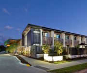
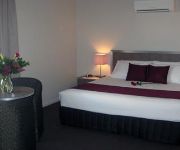
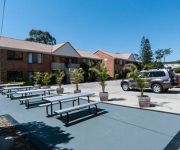
Hotels and Places to Stay
The Glen Hotel and Suites
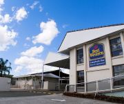
BEST WESTERN SUNNYBANK STAR
Hotel Chino
Johnson Road Motel
Comfort Inn & Suites Robertson Gardens
Calamvale Suites and Conference Centre
Flinders Hotel
Acacia Ridge Motel
Lancaster Court Motel
Annerley Motor Inn
Videos from this area
These are videos related to the place based on their proximity to this place.
Psalm 23 A Day in the Life of a Sheep – Philip L. Powell
A demonstration of the SHEPHERD'S HAND and of the SHEEP'S JOURNEY, each revealing the GRACE of God and the TRIALS of the sheep. Verse 1 The commencement the journey makes; Verses 2 ...
2014 Trial #1 Brothers v Sunnybank Colts, 1st Grade, Prem Grade
Change of seasons - there is still a bit of cricket about but the lads are ready to run!
Hakataya Ramen Garden City Opening - Lion Dance
I managed to catch part of the Lion Dance performance for the grand opening of Hakataya Ramen, Westfield Garden City.
2013 Brisbane Rugby Rd 2 Brothers v Sunnybank - 1st Grade & Premier Grade
Wet was the weather but wide and expansive was the footy.
Brisbane Holiday Village Accommodation - Official Video
Looking for the ultimate Queensland holiday destination? Look no further!! Award-winning Brisbane Holiday Village is the ideal choice for your next stay when visiting Brisbane. Whether it is...
Brisbane Holiday Village - Caravan & Camping Sites
http://www.brisbaneholidayvillage.com.au/site Brisbane Holiday Village offers affordable Brisbane caravan and tourist sites ranging from powered sites to powered ensuite sites (with private...
Brisbane Holiday Village - Metro Cabin Accommodation
http://www.brisbaneholidayvillage.com.au/cabins/metro-cabin Brisbane Holiday Village offers affordable holiday cabin accommodation in the greater Brisbane area to suit all budgets, tastes...
Brisbane Holiday Village - Alfresco Cabin Accommodation
http://www.brisbaneholidayvillage.com.au/cabins/alfresco-cabin Brisbane Holiday Village offers affordable holiday cabin accommodation in the greater Brisbane area to suit all budgets, tastes...
Brisbane Holiday Village - Vogue Cabin Accommodation
http://www.brisbaneholidayvillage.com.au/cabins/vogue-cabin Brisbane Holiday Village offers affordable holiday cabin accommodation in the greater Brisbane area to suit all budgets, tastes...
Videos provided by Youtube are under the copyright of their owners.
Attractions and noteworthy things
Distances are based on the centre of the city/town and sightseeing location. This list contains brief abstracts about monuments, holiday activities, national parcs, museums, organisations and more from the area as well as interesting facts about the region itself. Where available, you'll find the corresponding homepage. Otherwise the related wikipedia article.
Redeemer Lutheran College
Redeemer Lutheran College is a co-educational Lutheran primary and secondary school in Rochedale, Brisbane, Queensland. Founded in the early 1980s by Robin Kleinschmidt and other leading Lutherans in the south of Brisbane, the College currently educates students from years Prep to 12, with Prep–5 currently without permanent buildings pending council approval to commence construction. The current head of college is David Radke, who has been in this position since 2009.
Altandi railway station
Altandi is a railway station on the Beenleigh Line of Brisbane, Australia. It is part of the Queensland Rail City network. It is in Zone 4 of the TransLink integrated public transport system. Altandi is the closest station to the major Sunnybank Plaza Shopping Centre, located about 1.5 km away on Mains Road.
Runcorn railway station, Brisbane
Runcorn is a railway station on the Beenleigh Line of Brisbane, Australia. It is part of the Queensland Rail City network. It is in Zone 4 of the TransLink integrated public transport system.
Fruitgrove railway station
Fruitgrove is a railway station on the Beenleigh Line of Brisbane, Australia. It is part of the Queensland Rail City network. It is in a transition precinct between Zone 4 and Zone 5 of the TransLink integrated public transport system.
Kuraby railway station
Kuraby is a railway station on the Beenleigh Line of Brisbane, Australia. It is part of the Queensland Rail City network. It is in Zone 5 of the TransLink integrated public transport system. Nearby to the station is the Masjid Al Farooq Mosque, shops at Kuraby Square, and a recreational park.
Macgregor, Queensland
Macgregor is a suburb in Brisbane, Queensland, Australia. Its postal code is 4109. It is in the Australian Federal electorate of Moreton and its current member is the Honourable Mr Graham Perrett MP. Most of Macgregor is in the Queensland state electorate of Sunnybank, with only the northern tip of Macgregor in the state electorate of Yeerongpilly. The suburb of Macgregor was named after William MacGregor who was the Governor of Queensland from 1909 until 1914.
Clairvaux MacKillop College
Clairvaux MacKillop College is a secondary school located in Upper Mount Gravatt on the south side of Brisbane, Australia. With a student body of 1,200, it is a large Catholic Education school facility in Queensland. It houses the Edmund Rice Centre, which is used for the education of learning impaired students.
Mansfield State High School
Mansfield State High School is a co-educational government secondary school of approximately 1700 students. It is located in Mansfield, a suburb in the south of Brisbane, Australia. Opened in 1974, the school in more recent years has become known for its exceptional music, information technology, and french immersion programs. The previous principal, Murray Kay, joined the school in 1990, the same year that the French Immersion program began.
Upper Mount Gravatt, Queensland
Upper Mount Gravatt is a suburb in Brisbane, to the south of Mount Gravatt. It has increasingly become an important centre in the last 15 years. In terms of infrastructure, Logan Road and the Pacific Motorway run through it, in addition to the South-East Busway. Together with Indooroopilly in the west, Chermside, on the north-side, and Carindale in the southeast the suburb has been described as a mini-CBD.
Kuraby, Queensland
Kuraby is a suburb of Brisbane, Queensland, Australia. It is situated approximately 21 kilometres by road or 22.5 kilometres by rail south-east of the city of Brisbane. Beenleigh Road is the main road connecting the suburb to the motorways leading to the city and further parts of Brisbane and beyond. Kuraby is serviced by fast electric train service to the city and the Gold Coast, whilst a bus service takes commuters to the large shopping centres of Upper Mount Gravatt and Springwood.
Eight Mile Plains busway station
The Eight Mile Plains Busway Station, at Eight Mile Plains, is part of the South East Busway serviced by TransLink bus routes. It is currently the last station on the South East Busway, and is connected to the Springwood Bus Station by the Pacific Motorway used by Logan City Bus Service. It is in Zone 4 of the TransLink integrated public transport system.
Upper Mount Gravatt busway station
The Upper Mount Gravatt Busway Station, at Upper Mount Gravatt, is part of the South East Busway serviced by TransLink bus routes. It is beneath the existing bus interchange at Westfield Garden City and is heavily patronised. It opened to services at the end of April 2001. It is in a transition precinct between Zone 3 and Zone 4 of the TransLink integrated public transport system.
Springwood bus station
The Springwood Bus Station, at Springwood, is serviced by TransLink bus routes. It is a major interchange for TransLink's Southern Region, being an important stop for Logan City Bus Service routes between Brisbane and Loganholme. The architecture of the station is based upon the steel and glass designs of Brisbane's busway stations. It is in Zone 5 of the TransLink integrated public transport system.
Brisbane Adventist College
Brisbane Adventist College is a Preschool to Year 12 independent school with two campuses located in the Brisbane suburbs of Mansfield (primary school) and Wishart (secondary school). It is part of the Seventh-day Adventist Church education system. Brisbane Adventist College started as a Primary School in 1966. The Primary School was one of the first established in the Mt Gravatt area. A Secondary School was established in 1972 along Wishart Road.
Rochedale South, Queensland
Rochedale South is a suburb of Logan City, Queensland, Australia.
Underwood, Queensland
Underwood is a suburb located south-east of the Brisbane central business district in Queensland, Australia. Its Local Government Area is the Logan City Council. The origin of the suburb name is from William Underwood who was an early property owner in the area.
Runcorn, Queensland
Runcorn is a suburb on the south side of Brisbane, Queensland, and is about 19 kilometres from Brisbane’s central business district. Beenleigh and Warrigal Roads both run through the suburb and are the primary links towards inner city Brisbane and beyond. Much of the suburb is bordered by Bulimba Creek with the secondary source for the creek found within the suburb.
Wishart, Queensland
Wishart is a suburb of Brisbane, Australia. It is 14 km south-east of the CBD. The Brisbane Adventist College, Mansfield State High School and Primary Schools are located near to Wishart. Bulimba Creek flows through the suburb. Newnham Road in Wishart was originally part of a stock route from farming areas south of Brisbane to the Cannon Hill saleyards.
MacGregor State High School
MacGregor State High School (MSHS) is a co-educational, state secondary school, located in Macgregor, a southeastern suburb of Brisbane, Queensland Australia. The current principal is Karyn Hart and there are around 1,600 students that are enrolled in this school. It is a multicultural school.
Rochedale, Queensland
Rochedale is an outer suburb of the city of Brisbane, Australia. It is 17 kilometres south-east of the Brisbane central business district.
Westfield Garden City
Westfield Garden City, better known as Garden City, is one of Brisbane's major shopping centres, located in the suburb of Upper Mount Gravatt. The centre is operated by Westfield, and previously operated by AMP Limited before the takeover in 2003. Garden City was originally opened on October 1st, 1971 with a McDonnell & East department store, a Woolworths family centre and a David Jones department store that was relocated into the former Woolworths space.
Islamic College of Brisbane
The Islamic College of Brisbane (ICB) is a co-educational P-12 school in the suburb of Karawatha, Brisbane, Queensland Australia. It offers teaching from Prep year to year twelve.
Queensland State Archives
The Queensland State Archives is the custodian of the largest and most significant documentary heritage collection in Queensland and the lead agency for public recordkeeping. Established in 1959, Queensland State Archives promotes the implementation of appropriate recordkeeping principles and practices across public authorities and regulates the retention and disposal of public records.
Rochedale busway station
The Rochedale Busway Station is a proposed Busway Station to be built at Rochedale near Underwood Road as part of an extension to the South East Busway. The station will be serviced by TransLink bus routes. It will be the station between the existing Eight Mile Plains Station (currently the last station on the South East Busway) and Springwood Bus Station.
Queensland School for Travelling Show Children
The Queensland School for Travelling Show Children (QSTSC) is a publicly funded co-educational primary (K-7) school that provides distance education services to the children and families of itinerant business proprietors and workers on the agricultural show circuits in all states and territories of Australia except Western Australia.


