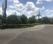
Explore Acacia Ridge
The district Acacia Ridge of in Brisbane (Queensland) is located in Australia about 580 mi north-east of Canberra, the country's capital.
If you need a place to sleep, we compiled a list of available hotels close to the map centre further down the page.
Depending on your travel schedule, you might want to pay a visit to some of the following locations: Brisbane, Sunshine Coast, Carrolls Creek, and . To further explore this place, just scroll down and browse the available info.
Local weather forecast
Todays Local Weather Conditions & Forecast: 23°C / 73 °F
| Morning Temperature | 16°C / 61 °F |
| Evening Temperature | 20°C / 68 °F |
| Night Temperature | 18°C / 65 °F |
| Chance of rainfall | 0% |
| Air Humidity | 57% |
| Air Pressure | 1024 hPa |
| Wind Speed | Moderate breeze with 11 km/h (7 mph) from North-West |
| Cloud Conditions | Broken clouds, covering 71% of sky |
| General Conditions | Light rain |
Friday, 3rd of May 2024
21°C (70 °F)
16°C (61 °F)
Moderate rain, gentle breeze, overcast clouds.
Saturday, 4th of May 2024
19°C (66 °F)
16°C (60 °F)
Light rain, gentle breeze, overcast clouds.
Sunday, 5th of May 2024
22°C (72 °F)
17°C (62 °F)
Light rain, gentle breeze, overcast clouds.
Hotels and Places to Stay
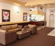
Johnson Road Motel
Flinders Hotel
Hotel Chino
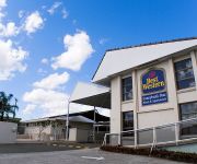
Comfort Inn & Suites Robertson Gardens
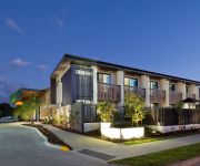
Calamvale Suites and Conference Centre
BEST WESTERN SUNNYBANK STAR
The Glen Hotel and Suites
Acacia Ridge Motel
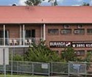
Buranda Lodge
Darra Motel and Conference Centre
Videos from this area
These are videos related to the place based on their proximity to this place.
Sunnybank Hills storm 31-1-2015
Thunderstorm on the 31-1-2015 at Sunnybank Hills.. near Jackson Road .
KINGS OF COUNTRY ROCK CREEDENCE VS EAGLES PROMO AGENTS EDITION
KINGS OF COUNTRY ROCK TOUR CREEDENCE VS EAGLES TRIBUTE SHOW FROM BRISBANE, QUEENSLAND, AUSTRALIA 2012, CLASSIC CREEDENCE HITS, EAGLES HITS.
NATE MUAVAE #3 vs Sunnybank 1st Half 24/06/2012.wmv
Nate playing centre for Waterford Demons U14s vs Sunnybank. 1st Half.
SOLD by LJ Hooker Brisbane Central real estate agent Simon Chang Chien
SOLD SOLD 8 Mitchell Street Sunnybank Marketed by Simon Chang Chien on 0422 315 746 SOLD Resort inspired! ... 2013M2 Corner block in the heart of Sunnybank! The essence of luxury living...
Sold by Alan Campbell 0414 777 338 RE/MAX Profile Brisbane a Smakk Media production
Sold 14 Alconah Street Sunnybank Alan Campbell 0414 777 338 RE/MAX Profile Real Estate Paddington, Bardon and Ashgrove. Directions: http://goo.gl/maps/rixdr YouTube Channel: ...
已售 米契尔街 8号, 新利班 by Simon Chang Chien LJ Hooker Brisbane Central
已售米契尔街8号, 新利班(8 Mitchell Street Sunnybank) LJ Hooker Brisbane Central Simon Chang Chien 0422 315 746 SOLD SOLD 这个属性现在已售幸运的8号, 是您梦寐以...
MD ELECTRICAL
Quality Electrical Solutions, servicing the Brisbane region. Fast service, reliable service, expert advice and competitive pricing. Providing Brisbane Electrical services.
Olivia Visits the Science Museum
Olivia (7 months) on her first trip to the interactive Science Museum at Southbank,Brisbane,Australia.
Endeavour Great Barrier Reef Cruise from Cairns and Brisbane River Cruise
Part of our Australian Holiday in 2002.
Videos provided by Youtube are under the copyright of their owners.
Attractions and noteworthy things
Distances are based on the centre of the city/town and sightseeing location. This list contains brief abstracts about monuments, holiday activities, national parcs, museums, organisations and more from the area as well as interesting facts about the region itself. Where available, you'll find the corresponding homepage. Otherwise the related wikipedia article.
Griffith University
Griffith University is a public research university in the southeastern region of the Australian state of Queensland. The university has five campuses located in the Gold Coast, Logan City and in the Brisbane suburbs of Mount Gravatt, Nathan and South Bank. Current total enrolment is approximately 43,000 with 4,000 full-time equivalent staff.
Salisbury railway station, Brisbane
Salisbury is a railway station on the Beenleigh Line of Brisbane, Australia. It is part of the QR Citytrain network. It is in Zone 3 of the TransLink integrated public transport system. There are two entrances via sets of stairs coming from Lillian Avenue and Dollis Street, unfortunately meaning there is no easy wheelchair/disabled access to this station. The station has an intensive surveillance system with cameras surrounding the station and the nearby carpark (off Lillian Avenue).
Coopers Plains railway station
Coopers Plains is a railway station on the Beenleigh Line of Brisbane, Australia. It is part of the Queensland Rail City network. It is in a transition precinct between Zone 3 and Zone 4 of the TransLink integrated public transport system.
Banoon railway station
Banoon is a railway station on the Beenleigh Line of Brisbane, Australia. It is part of the Queensland Rail City network. It is in Zone 4 of the TransLink integrated public transport system.
Sunnybank railway station
Sunnybank is a railway station on the Beenleigh Line of Brisbane, Australia. It is part of the Queensland Rail City network. It is in Zone 4 of the TransLink integrated public transport system.
Altandi railway station
Altandi is a railway station on the Beenleigh Line of Brisbane, Australia. It is part of the Queensland Rail City network. It is in Zone 4 of the TransLink integrated public transport system. Altandi is the closest station to the major Sunnybank Plaza Shopping Centre, located about 1.5 km away on Mains Road.
Runcorn railway station, Brisbane
Runcorn is a railway station on the Beenleigh Line of Brisbane, Australia. It is part of the Queensland Rail City network. It is in Zone 4 of the TransLink integrated public transport system.
Acacia Ridge, Queensland
Acacia Ridge is a suburb of Brisbane, Queensland, Australia. Acacia Ridge is 15 kilometres south of the central business district. The population in the 2001 census was 6648. Primarily residential, Acacia Ridge is also known for its heavy industrial area in the suburb's east, occupying much of the suburb's area east of Beaudesert Road. Acacia Ridge is home to one of Brisbane's few ice skating rinks.
Algester, Queensland
Algester is an outer suburb of Brisbane, Queensland, Australia. It is 18 kilometres south-west of the central business district. Algester was heavily developed from the mid 1970s and has also seen considerable recent development. It forms part of the Brisbane Agricultural Reserve, which once covered a large area of southern Brisbane. The suburb's name is a corruption of the name of the English town of "Alcester".
Division of Moreton
The Division of Moreton is an Australian Electoral Division in Queensland. The division was one of the original 75 divisions contested at the first federal election. It is named after Moreton Bay. The seat is very multicultural, with a significant Asian, South Eastern European and African population living in the electorate. The seat was in the hands of the Liberal Party and its predecessors for 86 years before Labor regained it in 1990.
Sunnybank Hills, Queensland
Sunnybank Hills is an outer southern suburb of Brisbane about 15 kilometres from Brisbane CBD, in Queensland, Australia. It is a large suburb, and adjoins the suburbs of Calamvale, Coopers Plains, Sunnybank, Macgregor, Algester, Acacia Ridge and Runcorn.
Sunnybank, Queensland
Sunnybank is now a suburb in Brisbane, Queensland, Australia much reduced in size from the previous suburb of Sunnybank. The separate Town of Sunnybank was absorbed into the City of Brisbane. This older Sunnybank area is still known locally as Sunnybank. Rolling hills and the headwaters for both Stable Swamp Creek and Bulimba Creek have drawn people and wildlife to the Sunnybank area.
Queensland Sport and Athletics Centre
The QSAC was formerly known as ANZ Stadium. ANZ now holds the naming rights for Sydney's Stadium Australia. The Queensland Sport and Athletics Centre (QSAC), more commonly known by its former names ANZ Stadium or QE II, is a major sporting facility on the south side of Brisbane, Queensland, Australia. From 1993 to 2003, QSAC was the home of the Brisbane Broncos, who play in National Rugby League.
John Tonge Centre
The John Tonge Centre is the mortuary for Queensland Health Forensic and Scientific Services (FSS - formerly Queensland Health Scientific Services) and responsible for conducting autopsies in Brisbane on people whose deaths make them subject to the Coroner's Act. Such deaths include accidents, suicides, homicides, deaths during surgery and anything for which a doctor is unwilling to issue a medical cause of death certificate for.
Queen Elizabeth II Jubilee Hospital
The Queen Elizabeth II Jubilee Hospital (QE II) is a public hospital located in Coopers Plains, Brisbane, Australia. The hospital was officially opened on 26 September 1980. The hospital originally was developed to be a site for future expansion of the Mater Children's Hospital, a center for servicing the needs of the Commonwealth Games held nearby and a range of other initiatives that never eventuated.
Sunnybank State High School
Sunnybank State High School is a Queensland Government State School located in the suburb of Sunnybank, approximately 15 kilometres south of the city of Brisbane, in Queensland, Australia. The school has its predominant frontage on Turton Street and is also bordered by Gager and Boorman Streets. This block is shared with the Sunnybank Bowls Club and a scout hall. The school has a high focus on academy and sports, with athletes making use of the school’s sports facilities.
Nathan, Queensland
Nathan is a southern suburb of Brisbane, Australia. It was named in 1967 after Sir Matthew Nathan, Governor of Queensland from 1920 to 1926. Nathan is home to Toohey Forest Conservation Park, Griffith University's Nathan campus and the Queensland Sport and Athletics Centre which hosted the opening ceremony of the 1982 Commonwealth Games. The Queensland Academy of Sport currently uses the facilities located at the stadium. The Mount Gravatt Cemetery is part of Nathan.
Archerfield, Queensland
Archerfield is an outer suburb of Brisbane, Australia. Archerfield is a sparsely populated suburb, with most of the land being occupied by Archerfield Airport.
Willawong, Queensland
Willawong is an outer suburb of Brisbane, Australia. It is 16 km south of the CBD. The Places Name Board gave the official name to the suburb in 1970. This suburb has one of the Brisbane Transport bus depots located within the suburb. Willawong is an Aboriginal word meaning ‘the junction of two creeks’. The suburb's boundary is mostly defined by the course of the two creeks, Oxley Creek and Blunder Creek. The Sydney–Brisbane rail corridor is aligned along the eastern edge of the suburb.
Coopers Plains, Queensland
Coopers Plains is an outer suburb of Brisbane, Australia. It is 11 kilometres south-west of the CBD.
Salisbury, Queensland
Salisbury is a suburb of Brisbane, Australia. It is 11 kilometres south of the Brisbane central business district. Salisbury was named after the residence of William Coote, an early Brisbane journalist and political figure, who lived in the area. The name was selected by the railway department when the Sunnybank/South Coast Railway Line opened in 1885. The book publishing company Boolarong Press has its headquarters in the suburb.
Pallara, Queensland
Pallara is an outer suburb of Brisbane, Australia. It is 19 km south of the CBD. The name means "flat land" and is derived from a non-local Aboriginal word spelt with one "l". The suburb is relatively undeveloped with electricity supply only reaching Pallara in 1961. In 1997, the Pallara Parklands were opened on a remediated dump.
Robertson, Queensland
Robertson is an outer suburb in the south of Brisbane, Australia. It is 13 kilometres south of the CBD.. It was officially named in July 1967 in memory of Doctor William Nathaniel Robertson who was a member of the University of Queensland Senate. It is one of several suburbs near the University of Queensland that are linked to the history of the University. including those of Robertson, Macgregor, and Griffith.
St Thomas More College, Sunnybank
St Thomas More College (STMC) is a Catholic, coeducational, secondary school located approximately 15 km south of Brisbane. It is a part of Brisbane Catholic Education.
Nyanda railway station
Nyanda is a disused railway station on QR Citytrain suburban network in Brisbane, the state capital of Queensland, Australia. It is located between Rocklea and Salisbury stations on the Beenleigh line. It opened in 1885 as Nyanda Crossing and was positioned so one person could manage the station and attend to the Beaudesert Road level crossing.


