Safety Score: 2,7 of 5.0 based on data from 9 authorites. Meaning we advice caution when travelling to United States.
Travel warnings are updated daily. Source: Travel Warning United States. Last Update: 2024-05-05 08:24:42
Touring Calhounville
Calhounville in Walla Walla County (Washington) is a town located in United States about 2,141 mi (or 3,446 km) west of Washington DC, the country's capital place.
Time in Calhounville is now 09:00 PM (Sunday). The local timezone is named America / Los Angeles with an UTC offset of -7 hours. We know of 9 airports nearby Calhounville, of which two are larger airports. The closest airport in United States is Walla Walla Regional Airport in a distance of 10 mi (or 15 km), North-East. Besides the airports, there are other travel options available (check left side).
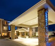
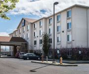
Also, if you like the game of golf, there are several options within driving distance. Need some hints on where to stay? We compiled a list of available hotels close to the map centre further down the page.
Being here already, you might want to pay a visit to some of the following locations: Walla Walla, Pendleton, Dayton, Pasco and La Grande. To further explore this place, just scroll down and browse the available info.
Local weather forecast
Todays Local Weather Conditions & Forecast: 14°C / 57 °F
| Morning Temperature | 7°C / 45 °F |
| Evening Temperature | 13°C / 55 °F |
| Night Temperature | 6°C / 44 °F |
| Chance of rainfall | 2% |
| Air Humidity | 60% |
| Air Pressure | 1010 hPa |
| Wind Speed | Fresh Breeze with 15 km/h (9 mph) from East |
| Cloud Conditions | Broken clouds, covering 80% of sky |
| General Conditions | Light rain |
Monday, 6th of May 2024
13°C (55 °F)
8°C (47 °F)
Overcast clouds, fresh breeze.
Tuesday, 7th of May 2024
13°C (55 °F)
8°C (47 °F)
Overcast clouds, moderate breeze.
Wednesday, 8th of May 2024
16°C (60 °F)
12°C (54 °F)
Sky is clear, light breeze, clear sky.
Hotels and Places to Stay
Hampton Inn - Suites Walla Walla
Holiday Inn Express WALLA WALLA
Morgan Inn And Suites
Comfort Inn & Suites
Videos from this area
These are videos related to the place based on their proximity to this place.
XR10 testing at the Walla Walla Rock crawling course
Trying to decide if I should stay with the Novak M2 dig or junk it for a tekin/rc punk combo.
Walla Walla Valley Honda ALS Ice Bucket Challenge
Partner Jared Hamilton and General Manager Blake Underriner were called out in the ALS Ice Bucket Challenge... And they both rose to the challenge!
UAV Senior Project - Walla Walla University
Flight testing of UAV designed and built by Andrew Jabola, Shannon Gott, and Chris Rasmussen for their engineering senior project. These flights were R/C controlled. Eventually instrumentation...
Walla Walla Valley Honda ALS Ice Bucket Challenge #2!
Jared and Blake decided they wanted to challenge more people to take the ALS Ice Bucket Challenge and took another bucket of ice water to see it happen!
MLS 109851 - 1537 Gray Lynn Dr, Walla Walla, WA
Your luxury home is waiting for you on its 3.69 acres! It?s sitting among the beautiful and well maintained homes on Gray Lynn Dr. boasting not only a great neighborhood http://www.coldwellbanker.c...
wind powered kinetic sculpture
This video was taken at walla walla community college. made by Andrew Carson. http://www.windsculpture.com/
M*A*S*H: Presented by DeSales Catholic High School
DeSales High School is proud to present our 2014 Fall production, M*A*S*H in just a few weeks! The play is written by Tim Kelly, from the book by Richard Hooker and directed by Eric C. Rohde....
College Place Storm 9.16.2013
9-15-13 storm that knocked out power on 4th Street. Branch Hitting Power Line: http://www.youtube.com/watch?feature=player_embedded&v=uFr3MQRvGfo#t=198.
Laundromat Supplier College Place WA Integrity Laundry Solutions LLC
Commercial laundry equipment demands a professional for required maintenance and repairs. Integrity Laundry Solutions LLC is a premier laundromat supplier th...
Videos provided by Youtube are under the copyright of their owners.
Attractions and noteworthy things
Distances are based on the centre of the city/town and sightseeing location. This list contains brief abstracts about monuments, holiday activities, national parcs, museums, organisations and more from the area as well as interesting facts about the region itself. Where available, you'll find the corresponding homepage. Otherwise the related wikipedia article.
Whitman massacre
The Whitman massacre (also known as the Walla Walla massacre and the Whitman Incident) was the murder on November 29, 1847 of Oregon missionaries Dr. Marcus Whitman and his wife Narcissa, along with eleven others. They were killed by Cayuse and Umatilla Native Americans. The incident began the Cayuse War. It took place in present-day southeastern Washington state, near the town of Walla Walla, and was one of the most notorious episodes in the U.S. settlement of the Pacific Northwest.
Ferndale, Oregon
Ferndale is an unincorporated community in Umatilla County, Oregon, United States. It is located near the Oregon-Washington border east of Oregon Route 339 and west of Oregon Route 11 about four miles north of Milton-Freewater. Ferndale was once a station on the Walla Walla Valley Railway (WWVR), which served the local fruit orchards, and the site of a fruit packing warehouse. The next station south on the line was at Sunnyside.
Pleasant View School (Milton-Freewater, Oregon)
Pleasant View School, also known as Pleasantview High School is a public alternative high school in Milton-Freewater, Oregon, United States.
Sunnyside, Umatilla County, Oregon
Sunnyside is an unincorporated community in Umatilla County, Oregon, United States. It is located about three miles north of Milton-Freewater, at the intersection of Oregon Route 332, which is also known as the Sunnyside-Umapine Highway, and Oregon Route 339. Sunnyside was once a station on the Walla Walla Valley Railway, which served the local fruit orchards, and the site of a Nebraska Bridge Supply and Lumber Co. planing mill from 1958-1963. There was also an Inland Fir Company sawmill.


