Safety Score: 2,7 of 5.0 based on data from 9 authorites. Meaning we advice caution when travelling to United States.
Travel warnings are updated daily. Source: Travel Warning United States. Last Update: 2024-05-17 08:07:57
Explore Larimers Corner
Larimers Corner in Snohomish County (Washington) is located in United States about 2,313 mi (or 3,722 km) west of Washington DC, the country's capital.
Local time in Larimers Corner is now 12:44 PM (Friday). The local timezone is named America / Los Angeles with an UTC offset of -7 hours. We know of 9 airports in the wider vicinity of Larimers Corner, of which 3 are larger airports. The closest airport in United States is Snohomish County (Paine Field) Airport in a distance of 6 mi (or 10 km), West. Besides the airports, there are other travel options available (check left side).
There is one Unesco world heritage site nearby. It's Olympic National Park in a distance of 21 mi (or 34 km), South-West. Also, if you like golfing, there are multiple options in driving distance. We found 10 points of interest in the vicinity of this place. If you need a place to sleep, we compiled a list of available hotels close to the map centre further down the page.
Depending on your travel schedule, you might want to pay a visit to some of the following locations: Everett, Seattle, Mount Vernon, Port Orchard and Coupeville. To further explore this place, just scroll down and browse the available info.
Local weather forecast
Todays Local Weather Conditions & Forecast: 13°C / 55 °F
| Morning Temperature | 7°C / 45 °F |
| Evening Temperature | 15°C / 58 °F |
| Night Temperature | 9°C / 49 °F |
| Chance of rainfall | 0% |
| Air Humidity | 55% |
| Air Pressure | 1020 hPa |
| Wind Speed | Gentle Breeze with 6 km/h (4 mph) from North-West |
| Cloud Conditions | Overcast clouds, covering 100% of sky |
| General Conditions | Light rain |
Friday, 17th of May 2024
9°C (47 °F)
6°C (43 °F)
Light rain, light breeze, overcast clouds.
Saturday, 18th of May 2024
14°C (57 °F)
6°C (43 °F)
Overcast clouds, light breeze.
Sunday, 19th of May 2024
20°C (68 °F)
8°C (46 °F)
Few clouds, gentle breeze.
Hotels and Places to Stay
GLOBETROT CORPORATE HOUSING
Econo Lodge Everett
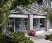
INN AT PORT GARDNER
Delta Hotels Seattle Everett
TRAVELODGE EVERETT CITY CENTER
Courtyard Seattle Everett Downtown
Hampton Inn Seattle-Everett
Sunrise Inn
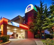
BEST WESTERN CASCADIA INN
Inn at Snohomish
Videos from this area
These are videos related to the place based on their proximity to this place.
Snohomish River Pink Salmon
In Washington State, odd-numbered years are Pink Salmon AKA "Humpy" years. This year's run to the Snohomish river system is estimated at 2.1 million fish. Join Gringo Pescador and myself as...
Chinook Helicopters at Harvey Field Snohomish
Chinook Helicopters take off from Harvey Field in Snohomish with troops headed for Yakima. Story Link: http://snohomishtimes.com/snohomishNEWS.cfm?inc=story&newsID=3796.
Snow Geese & Hail Storm / Snohomish, WA / Dec. 2, 2013
Watch Snow Geese arriving as a storm moves in; eventually culminating with hail. This video was shot during a 45-minute period in the early afternoon of December 2, 2013 on Springhetti Rd in...
Snow Geese arriving in Farm Field / Snohomish, WA
Large number of Snow Geese arriving in a farm field on a sunny afternoon on December 6, 2013. (more) BLOG POST: http://wp.me/p2D9sL-1yu SUBSCRIBE: ...
Skydive Snohomish - Aug 30th, 2009 -
Skydive Snohomish - Harvey Field, Snohomish, WA - I had the camera rubber-banned to my chest. This gave a really good perspective for exactly what you feel when you skydive. I unhooked the...
Clark Roberts Skydive At Skydive Snohomish 9-1-2012
Clark Roberts makes his first tandem skydive at Skydive Snohomish in Snohomish, Washington!
MLS 424000 - 3515 146th St, Mill Creek, WA
http://www.coldwellbanker.com/property?action=detail&brandType=CB&propertyId=273066026 Casual elegance describes this lovely Mill Creek home. An open, light-filled foyer and sweeping ...
Glacier Peak Grizzlies vs Stanwood Spartans Boys Soccer 2015
Glacier Peak Grizzlies vs Stanwood Spartans Boys Soccer 2015 Simulcast w/ Twin City Sports Network Radio HD Version.
Videos provided by Youtube are under the copyright of their owners.
Attractions and noteworthy things
Distances are based on the centre of the city/town and sightseeing location. This list contains brief abstracts about monuments, holiday activities, national parcs, museums, organisations and more from the area as well as interesting facts about the region itself. Where available, you'll find the corresponding homepage. Otherwise the related wikipedia article.
Cathcart, Washington
Cathcart is a census-designated place (CDP) in Snohomish County, Washington, United States. The population was 2,458 at the 2010 census. Based on per capita income, one of the more reliable measures of affluence, Cathcart ranks 45th of 522 areas in the state of Washington to be ranked. Cathcart was named for Isaac Cathcart, a businessman and Snohomish pioneer.
Silver Firs, Washington
Silver Firs is a census-designated place (CDP) in Snohomish County, Washington, United States. The population was 20,891 at the 2010 census. It lies northeast of the city of Mill Creek and north of the city of Seattle. Based on per capita income, one of the more reliable measures of affluence, Silver Firs ranks 69th of 522 areas in the state of Washington to be ranked.
Harvey Airfield
Harvey Airfield, a.k.a. Harvey Field, (Its identifier is S43), is a small airport located in Snohomish, Washington. The airfield has one 2,750-foot asphalt runway, one 2,660-foot turf runway and fourteen hangar bays. It covers an area of approximately 76 acres and is home to over 350 based aircraft including six helicopters and eight multi-engine planes, and nearly two dozen businesses including a hot-air balloon charter business.
Archbishop Murphy High School
Archbishop Thomas J. Murphy High School is a co-educational private Catholic college-preparatory high school located in Everett, Washington, USA. Founded as Holy Cross High School in 1988, Archbishop Murphy High School serves students grades nine through twelve and enrollment has increased from 23 students in 1988 to approximately 450 for Fall 2012.
Pioneer Trails
Pioneer Trails is a large neighborhood near Everett, Washington. It is located within the Seattle Hill-Silver Firs CDP. Pioneer Trails is also connected to Sun Meadows and Cascade Heights; the cluster is called Park Meadows. The neighborhood has a series of so-called "Trails" that have entrances around Pioneer Trails. It also has two small lakes and a few neighborhood recreational facilities. Nearby neighborhoods include Silver Lake to the northwest and Silver Firs to the southeast.
Glacier Peak High School
Glacier Peak High School is a high school at the south end of the Snohomish School District, established in 2008. The high school's colors are blue, silver and white, and the mascot is the grizzly bear. Glacier Peak was built to relieve overcrowding at Snohomish High School and is a 230,000-square-foot facility designed by NAC Architecture and built by Lydig Construction. Opening in an almost dilapidated state on September 11, 2001 for grades 1-3. , it was completely finished by January 2009.
Eastmont, Washington
Eastmont is a census-designated place (CDP) in Snohomish County, Washington, United States. The population was 20,101 at the 2010 census. Eastmont is one of two CDPs that were created out of the former Seattle Hill-Silver Firs CDP in 2010, the other being Silver Firs. Eastmont is the location of Community Transit's Eastmont Park & Ride, which is serviced by Sound Transit Express route 513.


