Safety Score: 2,7 of 5.0 based on data from 9 authorites. Meaning we advice caution when travelling to United States.
Travel warnings are updated daily. Source: Travel Warning United States. Last Update: 2024-05-04 08:22:41
Explore North Bonneville
North Bonneville in Skamania County (Washington) with it's 971 inhabitants is a city in United States about 2,313 mi (or 3,722 km) west of Washington DC, the country's capital.
Local time in North Bonneville is now 05:17 PM (Saturday). The local timezone is named America / Los Angeles with an UTC offset of -7 hours. We know of 8 airports in the vicinity of North Bonneville, of which 3 are larger airports. The closest airport in United States is Portland International Airport in a distance of 30 mi (or 49 km), West. Besides the airports, there are other travel options available (check left side).
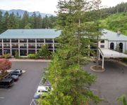
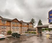
Also, if you like golfing, there are multiple options in driving distance. If you need a place to sleep, we compiled a list of available hotels close to the map centre further down the page.
Depending on your travel schedule, you might want to pay a visit to some of the following locations: Stevenson, Hood River, Vancouver, Oregon City and Portland. To further explore this place, just scroll down and browse the available info.
Local weather forecast
Todays Local Weather Conditions & Forecast: 3°C / 37 °F
| Morning Temperature | 2°C / 36 °F |
| Evening Temperature | 3°C / 37 °F |
| Night Temperature | 4°C / 39 °F |
| Chance of rainfall | 17% |
| Air Humidity | 100% |
| Air Pressure | 1011 hPa |
| Wind Speed | Light breeze with 5 km/h (3 mph) from East |
| Cloud Conditions | Overcast clouds, covering 100% of sky |
| General Conditions | Rain and snow |
Sunday, 5th of May 2024
4°C (40 °F)
3°C (38 °F)
Moderate rain, gentle breeze, overcast clouds.
Monday, 6th of May 2024
8°C (46 °F)
3°C (37 °F)
Light rain, gentle breeze, overcast clouds.
Tuesday, 7th of May 2024
10°C (50 °F)
5°C (41 °F)
Overcast clouds, light breeze.
Hotels and Places to Stay
Bonneville Hot Springs Resort & Spa
BEST WESTERN PLUS COLUMBIA RVR
Columbia Gorge Inn
Skamania Lodge
Videos from this area
These are videos related to the place based on their proximity to this place.
East end of the Bonneville Dam, from the Columbia River near Cascade Locks, OR.AVI
From the middle of the Columbia River in the Columbia River Gorge National Scenic Area. Filmed June 6, 2012.
rail grinder going by, 4k
This contraption is a machine that's doing railroad maintenance. I'm 90% sure it's doing rail grinding. This is in Washington along the Burlington Northern Santa Fe Railroad. This is at...
Bonneville Dam Fish Hatchery-Largest N American Fish species
A trip to the Bonneville dam fish hatchery in Northern Oregon on the banks of the great Columbia River. The dam hatches many rainbow trout, and houses many large north American white sturgeon,...
Fall Salmon Run Columbia River NW Oregon (below dam)
Took my boys to Bonneville Dam so they could see the salmon. Between touring the dam and the fish hatchery we stopped to look at a nearby fishing spot called Tanner Creek. This experience far...
Fluid Rush - Rodney Falls & Pool Of Winds, Washington
'Fluid Rush' - Life Is The Point NorthStarBrand.com - Photography & Imagery http://www.portlandhikersfieldguide.org/wiki/Pool_of_the_Winds_Hike.
Coho Salmon in Eagle Creek, Oregon
Coho Salmon migrating up Eagle Creek near Bonneville Dam about 45 miles east of Portland, Oregon. Taken on October 25th, 2009.
Eagle creek to Tunnel Falls hike
One of the most beautiful falls you will ever see. Tunnel falls, Oregon. I-84 east bound, exit 41.
Empty Coal Train with BNSF SD70ACe
An empty coal train races eastbound on the BNSF Fallbridge Subdivision with two SD70ACes on the point.
Dog Mountain to Portland, part 5, 4k
This is the trip from the trailhead to Dog Mountain in Washington to the Marquam Bridge in Portland, Oregon. This version crosses the Bridge of the Gods into Oregon. At 0:38 is a sign for...
Dog Mountain to Portland, part 6, 4k
This is the trip from the trailhead to Dog Mountain in Washington to the Marquam Bridge in Portland, Oregon. This version crosses the Bridge of the Gods into Oregon. At 6:04 is a freight...
Videos provided by Youtube are under the copyright of their owners.
Attractions and noteworthy things
Distances are based on the centre of the city/town and sightseeing location. This list contains brief abstracts about monuments, holiday activities, national parcs, museums, organisations and more from the area as well as interesting facts about the region itself. Where available, you'll find the corresponding homepage. Otherwise the related wikipedia article.
North Bonneville, Washington
North Bonneville is a city in Skamania County, Washington, United States. The population was 593 at the 2000 census and 956 at the 2010 census.
Bonneville Dam
Bonneville Lock and Dam consists of several run-of-the-river dam structures that together complete a span of the Columbia River between the U.S. states of Oregon and Washington at River Mile 146.1. The dam is located 40 miles east of Portland, Oregon, in the Columbia River Gorge. The primary functions of Bonneville Lock and Dam are electrical power generation and river navigation. The dam was built and is managed by the United States Army Corps of Engineers.
Eagle Creek (Multnomah County, Oregon)
Eagle Creek is a creek in Hood River County, Oregon, United States. The creek drains into the Columbia River in Multnomah County, with its outlet on the Columbia River Gorge. It is in the Mount Hood National Forest. The Eagle Creek Trail – the most popular trail in the Gorge – follows the creek. Tunnel Falls and Punch Bowl Falls, located on Eagle Creek, are remote and scenic waterfalls along the creek. The Historic Columbia River Highway crosses the creek's outlet to the Columbia River.
Wahclella Falls
Wahclella Falls is a waterfall along the Columbia River Gorge in Oregon. The Columbia River Highway splits around exit # 40 that leads to the Bonneville Dam. The parking and access area for Wahclella Falls is slightly down the hill and to the right (for eastbound traffic) of the entrance to the dam. Wahclella is at the midpoint of the well maintained trail number 436 loop that forms a 1.8-mile roundtrip.
List of rapids of the Columbia River
This is a list of rapids of the Columbia River, listed in upriver order. The river flows through Canada and the USA. Almost all of these rapids are now submerged in the reservoirs of dams. The list is not exhaustive; there were numerous minor rapids and riffles, many of which were never named.


