Safety Score: 2,7 of 5.0 based on data from 9 authorites. Meaning we advice caution when travelling to United States.
Travel warnings are updated daily. Source: Travel Warning United States. Last Update: 2024-05-03 08:06:06
Explore Maryhill
Maryhill in Klickitat County (Washington) with it's 58 inhabitants is a city in United States about 2,257 mi (or 3,632 km) west of Washington DC, the country's capital.
Local time in Maryhill is now 09:30 PM (Friday). The local timezone is named America / Los Angeles with an UTC offset of -7 hours. We know of 8 airports in the vicinity of Maryhill, of which 3 are larger airports. The closest airport in United States is Yakima Air Terminal McAllister Field in a distance of 62 mi (or 100 km), North. Besides the airports, there are other travel options available (check left side).
Also, if you like golfing, there is an option about 11 mi (or 17 km). away. If you need a place to sleep, we compiled a list of available hotels close to the map centre further down the page.
Depending on your travel schedule, you might want to pay a visit to some of the following locations: Goldendale, Moro, The Dalles, Hood River and Condon. To further explore this place, just scroll down and browse the available info.
Local weather forecast
Todays Local Weather Conditions & Forecast: 10°C / 49 °F
| Morning Temperature | 10°C / 51 °F |
| Evening Temperature | 4°C / 39 °F |
| Night Temperature | 2°C / 36 °F |
| Chance of rainfall | 15% |
| Air Humidity | 85% |
| Air Pressure | 999 hPa |
| Wind Speed | Moderate breeze with 10 km/h (6 mph) from East |
| Cloud Conditions | Overcast clouds, covering 100% of sky |
| General Conditions | Moderate rain |
Saturday, 4th of May 2024
5°C (42 °F)
4°C (40 °F)
Moderate rain, moderate breeze, overcast clouds.
Sunday, 5th of May 2024
5°C (41 °F)
3°C (37 °F)
Light rain, moderate breeze, overcast clouds.
Monday, 6th of May 2024
8°C (47 °F)
4°C (39 °F)
Scattered clouds, fresh breeze.
Hotels and Places to Stay
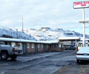
THREE RIVERS INN
Videos from this area
These are videos related to the place based on their proximity to this place.
Greyhound bus trip through northern U.S.: (3) Biggs Junction to Arlington, Oregon 2010-08-28
A Greyhound bus ride along the Columbia Gorge section of Interstate 84 in Oregon, with view of the dry Oregon and Washington countryside along the Columbia River from east of Biggs Junction...
2014-08-23 Biggs Junction wind farm in the late afternoon
Wind turbines spinning in the late afternoon breeze along the Columbia River.
Biggs Junction to Portland - 2 hours drive view in 4 min
Drive from Biggs Junction back to Beaverton on HW14th viewed at fast speed.
Columbia River Pusher Tug, Outlaw
The pusher tug Outlaw transits beneath the Sam Hill Memorial bridge on the Columbia River at Biggs, Oregon.
Union Pacific Soda Ash-March 21, 2012
I shot this eastbound Soda Ash across the Columbia River from Washington. Digital Cameras have a great zoom, however, I'm not positive it's a Soda Ash. I'm just guessing. In any event, as a...
Mary Hill Loops hill climb 2012
'the ANIMAL', from Team 61 Race Cars in Emmett,Idaho, sees Mary Hill loops road for the first time. An Excellent and FUN venue and a great bunch of folks in the Willamette Auto Club who put...
BNSF Train, Columbia River Gorge, Maryhill
C44-9W-4127, 5405 DPU ES44DC BNSF Grain train, passing through Maryhill, Fallbridge subdivision Columbia River Gorge Washington State side.
Columbia River Gorge C-130 flyover (Maryhill)
C-130H3 Hercules; Columbia River Gorge flyover (Maryhill Museum, Goldendale WA)
StoneHenge Sport Touring Mary Hill WA
This is a scale replica of Britain's Stonehenge. We were on the Mt St Helens memorial tour and this was our first destination. It's located south of Glendale, WA on the Columbia River. Sam...
Videos provided by Youtube are under the copyright of their owners.
Attractions and noteworthy things
Distances are based on the centre of the city/town and sightseeing location. This list contains brief abstracts about monuments, holiday activities, national parcs, museums, organisations and more from the area as well as interesting facts about the region itself. Where available, you'll find the corresponding homepage. Otherwise the related wikipedia article.
Maryhill, Washington
Maryhill is a census-designated place (CDP) in Klickitat County, Washington, United States. The population was 98 at the 2000 census.
Maryhill Loops Road
The Maryhill Loops Road was an experimental road in south central Washington, United States, built by Good Roads promoter Samuel Hill with the help of engineer and landscape architect Samuel C. Lancaster, climbing the Columbia Hills from the Columbia River and Spokane, Portland and Seattle Railway to his planned Quaker utopian community at Maryhill, Washington. Built in 1911 as the first asphalt road in the state, and bypassed by the present U.S.
Maryhill Stonehenge
The Maryhill Stonehenge is a full-size, astronomically-aligned replica of Stonehenge located in Maryhill, Washington. It was commissioned in the early 20th century by businessman Samuel Hill and dedicated on July 4, 1918 as a memorial to those that died in World War I. The memorial was completed in 1929.
Maryhill State Park
Maryhill State Park in Klickitat County, Washington is a camping park in the Washington State Park System. It consists of 99 acres with 4,700 feet of freshwater shoreline on the Columbia River. The Maryhill Stonehenge, a full-scale concrete replica of Stonehenge stands on a bluff not far from the park. Available activities include hiking, boating, fishing, swimming, waterskiing, beachcombing, birdwatching, wildlife viewing, windsurfing, and horseshoes.
White Creek Wind Farm
The White Creek Wind Farm is an electricity generating wind farm facility in Klickitat County, Washington, United States. It is owned by Last Mile Electric Cooperative and began operations in 2007. The facility has a generating capacity of 205 megawatts.


