Safety Score: 2,7 of 5.0 based on data from 9 authorites. Meaning we advice caution when travelling to United States.
Travel warnings are updated daily. Source: Travel Warning United States. Last Update: 2024-05-03 08:06:06
Discover West Blakely
West Blakely in Kitsap County (Washington) is a town in United States about 2,332 mi (or 3,752 km) west of Washington DC, the country's capital city.
Current time in West Blakely is now 08:14 PM (Friday). The local timezone is named America / Los Angeles with an UTC offset of -7 hours. We know of 9 airports near West Blakely, of which 3 are larger airports. The closest airport in United States is Boeing Field King County International Airport in a distance of 12 mi (or 19 km), South-East. Besides the airports, there are other travel options available (check left side).
There is one Unesco world heritage site nearby. It's Olympic National Park in a distance of 10 mi (or 17 km), North. Also, if you like playing golf, there are a few options in driving distance. We discovered 10 points of interest in the vicinity of this place. Looking for a place to stay? we compiled a list of available hotels close to the map centre further down the page.
When in this area, you might want to pay a visit to some of the following locations: Port Orchard, Seattle, Tacoma, Everett and Port Townsend. To further explore this place, just scroll down and browse the available info.
Local weather forecast
Todays Local Weather Conditions & Forecast: 11°C / 52 °F
| Morning Temperature | 11°C / 52 °F |
| Evening Temperature | 8°C / 46 °F |
| Night Temperature | 6°C / 43 °F |
| Chance of rainfall | 1% |
| Air Humidity | 90% |
| Air Pressure | 1001 hPa |
| Wind Speed | Gentle Breeze with 6 km/h (4 mph) from North |
| Cloud Conditions | Overcast clouds, covering 100% of sky |
| General Conditions | Light rain |
Saturday, 4th of May 2024
8°C (47 °F)
8°C (46 °F)
Light rain, moderate breeze, overcast clouds.
Sunday, 5th of May 2024
12°C (54 °F)
7°C (45 °F)
Light rain, moderate breeze, broken clouds.
Monday, 6th of May 2024
14°C (57 °F)
6°C (43 °F)
Light rain, gentle breeze, overcast clouds.
Hotels and Places to Stay
The Inn at Pleasant Beach
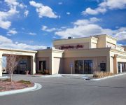
Hampton Inn Colby KS
Fairfield Inn & Suites Seattle Bremerton
Hampton Inn - Suites Bremerton
ISLAND INN
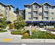
BEST WESTERN PLUS BAINBRIDGE
Videos from this area
These are videos related to the place based on their proximity to this place.
Day Trip to West Seattle
Carole Anne and Ron take their bikes on the Water Taxi to scenic West Seattle for a tour of the beaches on a beautiful August day. Featured are Alki Beach, Lincoln Park, The Bamboo Bar and...
Workout 14.3 Jason Appleberry Master's 45-49 Northwest Region CrossFit Games 2014 Open
Workout 14.3 Jason Appleberry Master's 45-49 Northwest Region CrossFit Games Open 2014 111 reps. Tiebreak 5:32.
Sediment and Water Column Sampling Techniques: VanVeen, Ponar, Niskin, Clam Bay, WA, 1996
EPA Region 10 scientific, polluted water divers document the level of seafloor disturbance of various sediment samplers, and demonstrate water column sampling. For more information see: http://www...
Seattle Real Estate - Some of my favorite places in Seattle
Seattle real estate - no matter what you like, Seattle has a great neighborhood for you! Here are just a few highlights!
Kelp crab feeding on Acorn barnacle
What do crabs eat? Underwater video taken from a canoe, of a Kelp crab feeding on a barnacle that it has pried off of a piling. A shrimp swims rapidly by. No one seems to know that crabs feed...
Mandi & Noel in Manchester (Adventures With Mandi, Vol.1)
Leisurely ride from Manchester to Port Orchard on an SV650 (Mandi) and an FZ6R (Noel). Audio: "Sky Falls Down" by OceanLab Camera: Drift HD170 (at 848x480-60p) Edited with Sony Vegas Movie...
Where Else? Bainbridge Island
Bainbridge Island is one of the northwest's best kept secrets...take a tour with Dennis Paige. Learn more at http://www.realestateonbainbridge.com.
Idyllic Bainbridge Island Waterfront Estate
Idyllic Bainbridge Island estate property for sale with 835ꞌ low bank waterfront and panoramic views of water, mountains and Seattle skyline. Classic shingled 2-story home with East Coast...
Pacific Northwest Real Estate on Bainbridge Island
Expressive architecture brought about by a no expense is spared attitude. 10499 sq. ft. Miller Hull designed home + 500 sq. ft. art studio. Specifically designed to be Feng Shui compliant....
Videos provided by Youtube are under the copyright of their owners.
Attractions and noteworthy things
Distances are based on the centre of the city/town and sightseeing location. This list contains brief abstracts about monuments, holiday activities, national parcs, museums, organisations and more from the area as well as interesting facts about the region itself. Where available, you'll find the corresponding homepage. Otherwise the related wikipedia article.
Manchester State Park (Washington)
Manchester State Park is a 111-acre state park with 3,400 feet of shoreline, located on Washington's Kitsap Peninsula. It was at one time a harbor defense installation for the protection of nearby Bremerton, then a fuel supply depot and Navy fire-fighting station. The park contains a former torpedo warehouse built in 1901, a mining casement and a gun battery.
Fort Ward Park
Fort Ward Park is a former state park located along Rich Passage on the southern end of Bainbridge Island in Washington. Fort Ward Park is part of the Bainbridge Island Metro Park and Recreation District, on land which the former military base, Fort Ward, was located. Covering 137 acres of dense forest and underbrush, it is an area full of beauty. Impressive views of Rich Passage, the Olympic Mountains and varied marine wildlife can be seen at the park.
Lynwood Center, Bainbridge Island, Washington
Lynwood Center is a community of Bainbridge Island, Washington. It is located on the south of the island, at the intersection of Point White Drive NE and Pleasant Beach Drive NE. Lynwood Center contains a number of shops, markets, restaurants and a historic movie theater.
West Blakely, Bainbridge Island, Washington
West Blakely is a community of Bainbridge Island, Washington. It is located on the south part of the island.
Eagledale Park
Eagledale Park is a 7-acre park located in the neighborhood of Eagledale on Bainbridge Island in the state of Washington, U.S.A.. Like several other parks on Bainbridge Island, Eagledale Park comprises land that was once a military installation. Today the park features tennis courts, an off-leash dog park, a picnic shelter, a children's play area, a sand volleyball court and a pottery studio. In the 1950s the site was used as part of the Project Nike anti-aircraft missile system.
Rich Passage
Rich Passage is a tidal strait in Puget Sound, allowing access to Bremerton, Washington, Sinclair Inlet, and Dyes Inlet, and separating Bainbridge Island from the Manchester area of the Kitsap Peninsula. Due to the activities at the Puget Sound Naval Shipyard, Rich Passage has a high volume of marine traffic. The Seattle-Bremerton ferry, part of the Washington State Ferries, travels the length of Rich Passage on its route.
IslandWood
IslandWood is a non-profit outdoor learning center located on Bainbridge Island in Washington. It was founded in 2001 to provide environmental education for young people living in King and Kitsap Counties. IslandWood's core program is called the School Overnight Program. Approximately 4000 fourth, fifth and sixth grade students attend the program each year.
Lynwood Theatre
The Lynwood Theatre is a moviehouse in Bainbridge Island, Kitsap County, Washington. The theatre specializes in showcasing independent and foreign films. The Lynwood Theatre opened its doors on July 3, 1936. It was the first theatre on Bainbridge Island to show "talkies. " The founders of the Lynwood Theatre, Edna and Emmanuel Olson, wanted to provide a modern alternative to the silent-picture cinemas which existed on Bainbridge Island in 1936.


