Safety Score: 2,7 of 5.0 based on data from 9 authorites. Meaning we advice caution when travelling to United States.
Travel warnings are updated daily. Source: Travel Warning United States. Last Update: 2024-05-16 08:19:50
Delve into Columbia Beach
Columbia Beach in Island County (Washington) is a town located in United States about 2,322 mi (or 3,737 km) west of Washington DC, the country's capital town.
Time in Columbia Beach is now 07:38 PM (Thursday). The local timezone is named America / Los Angeles with an UTC offset of -7 hours. We know of 10 airports closer to Columbia Beach, of which 4 are larger airports. The closest airport in United States is Snohomish County (Paine Field) Airport in a distance of 5 mi (or 9 km), South-East. Besides the airports, there are other travel options available (check left side).
There is one Unesco world heritage site nearby. It's Olympic National Park in a distance of 18 mi (or 29 km), South-West. Also, if you like the game of golf, there are some options within driving distance. We saw 10 points of interest near this location. In need of a room? We compiled a list of available hotels close to the map centre further down the page.
Since you are here already, you might want to pay a visit to some of the following locations: Everett, Seattle, Coupeville, Port Townsend and Mount Vernon. To further explore this place, just scroll down and browse the available info.
Local weather forecast
Todays Local Weather Conditions & Forecast: 16°C / 61 °F
| Morning Temperature | 8°C / 46 °F |
| Evening Temperature | 14°C / 58 °F |
| Night Temperature | 9°C / 49 °F |
| Chance of rainfall | 0% |
| Air Humidity | 43% |
| Air Pressure | 1019 hPa |
| Wind Speed | Gentle Breeze with 8 km/h (5 mph) from South-East |
| Cloud Conditions | Scattered clouds, covering 41% of sky |
| General Conditions | Light rain |
Friday, 17th of May 2024
9°C (48 °F)
6°C (43 °F)
Light rain, light breeze, overcast clouds.
Saturday, 18th of May 2024
13°C (55 °F)
7°C (45 °F)
Light rain, light breeze, broken clouds.
Sunday, 19th of May 2024
17°C (63 °F)
10°C (50 °F)
Scattered clouds, gentle breeze.
Hotels and Places to Stay
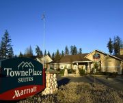
TownePlace Suites Seattle Everett/Mukilteo
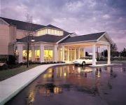
Hilton Garden Inn Seattle North/Everett
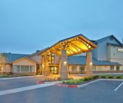
Staybridge Suites SEATTLE NORTH-EVERETT
SILVER CLOUD INN - MUKILTEO
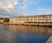
Inn at Langley
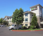
Extended Stay America Seattle Mukilteo
Videos from this area
These are videos related to the place based on their proximity to this place.
Mukilteo at Sunset
Various scenes shot at sunset along the beach in Mukilteo, WA on September 14, 2012. Camera: Canon 7D (kit lens) SUBSCRIBE: ...
15 pound Silver Salmon landed off Mukilteo, Washington
We caught this big boy right behind the boat as we were letting out the line after catching his little brother. We didn't even have the line in the downrigger when the fish took the hook. Caught...
Diving the Polyhedron at the Mukilteo T-Dock divesite
Explore the T-Dock dive site located in Mukilteo Washington. Look for the friendly wolfeel living at the Polyhedron (aka Geodome) structure. The area has several man made items which serve...
Mukilteo Pier Fishing
I went out to the pier at Mukilteo and didn't bring any bait so i was catching perch and using them as bait, worked great.
CA Sea Lions-Mukilteo-March 24, 2015
by Alisa Lemire Brooks Watching for Gray whales (never found) and this group of approx. 7 California Sea Lions suddenly appears... Mukilteo, Washington.
A Dive at Mukilteo
Some close up marine life shots and GoPro Hero3 views of Jim Copher and myself as we dive the Geodome dive site in Mukilteo Washington. Filmed December 2012.
Mukilteo in December
A variety of shots all taken along the beach in Mukilteo, WA on December 7, 2012. Scenery includes waterfowl, ferries, a lighthouse & jet aircraft. SUBSCRIBE: http://www.youtube.com/subscription_...
Mukilteo T-dock Dive
March 23, 2013 dive at Mukilteo T-dock. Went down to the Geodome, saw rockfish, seastars, octopus (not on video), wolf eel, and crabs. Fun Dive.....!
A Little Evening Railfanning, Mukilteo, WA
July 22, 2011. Went out to Mukilteo this evening. Saw four trains go by, caught three on video. Trains shown are an Amtrak Cascades train with a "cabbage" unit bringing up the rear, and...
Videos provided by Youtube are under the copyright of their owners.
Attractions and noteworthy things
Distances are based on the centre of the city/town and sightseeing location. This list contains brief abstracts about monuments, holiday activities, national parcs, museums, organisations and more from the area as well as interesting facts about the region itself. Where available, you'll find the corresponding homepage. Otherwise the related wikipedia article.
Clinton, Washington
Clinton is a community and census-designated place (CDP) located on southern Whidbey Island in Island County, Washington, United States. The town was named after Clinton, Michigan. As of the 2010 census, the village was 928. However, the post office serves at least 2,500 people. Clinton is the western terminus of the Whidbey Island (Clinton)-to-Mukilteo Washington State Ferries route. It is served by State Route 525 and several major county roads.
Gedney Island (Washington)
Gedney Island (aka Hat Island) is an island in Possession Sound in Snohomish County, Washington, US. The island lies in Possession Sound between the mainland city of Everett, Washington, and the southern part of Whidbey Island. Gedney Island has a land area of 1.768 km and a population of 26 people was reported as of the 2000 census. Gedney Island was first mentioned in the historical record by naturalist Archibald Menzies of the Vancouver Expedition in 1792.
Hat Island, Washington
Hat Island is a census-designated place (CDP) in Snohomish County, Washington, United States. The population was 41 at the 2010 census. The CDP occupies an island in Possession Sound called Hat Island, also known as Gedney Island. There is currently one walk-on ferry named the Hat Express which transports walk-on passengers to and from the island. The maximum capacity of the ferry is 88 passengers.


