Safety Score: 2,7 of 5.0 based on data from 9 authorites. Meaning we advice caution when travelling to United States.
Travel warnings are updated daily. Source: Travel Warning United States. Last Update: 2024-05-09 08:23:21
Delve into Plymouth
Plymouth in Benton County (Washington) is a town located in United States about 2,185 mi (or 3,517 km) west of Washington DC, the country's capital town.
Time in Plymouth is now 11:13 PM (Thursday). The local timezone is named America / Los Angeles with an UTC offset of -7 hours. We know of 9 airports closer to Plymouth, of which one is a larger airport. The closest airport in United States is Vista Field in a distance of 21 mi (or 33 km), North. Besides the airports, there are other travel options available (check left side).
Also, if you like the game of golf, there are some options within driving distance. We saw 2 points of interest near this location. In need of a room? We compiled a list of available hotels close to the map centre further down the page.
Since you are here already, you might want to pay a visit to some of the following locations: Pasco, Prosser, Heppner, Pendleton and Walla Walla. To further explore this place, just scroll down and browse the available info.
Local weather forecast
Todays Local Weather Conditions & Forecast: 24°C / 76 °F
| Morning Temperature | 14°C / 57 °F |
| Evening Temperature | 27°C / 81 °F |
| Night Temperature | 20°C / 68 °F |
| Chance of rainfall | 0% |
| Air Humidity | 40% |
| Air Pressure | 1019 hPa |
| Wind Speed | Light breeze with 3 km/h (2 mph) from North-West |
| Cloud Conditions | Clear sky, covering 0% of sky |
| General Conditions | Sky is clear |
Friday, 10th of May 2024
28°C (82 °F)
21°C (70 °F)
Few clouds, moderate breeze.
Saturday, 11th of May 2024
24°C (75 °F)
19°C (66 °F)
Sky is clear, fresh breeze, clear sky.
Sunday, 12th of May 2024
19°C (66 °F)
15°C (60 °F)
Scattered clouds, moderate breeze.
Hotels and Places to Stay
Umatilla Inn and Suites
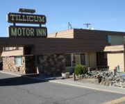
TILLICUM INN
Quality Inn Umatilla
Videos from this area
These are videos related to the place based on their proximity to this place.
Frank Hannon Band New York City (Pyscho Cab Ride!!!) Official Video
"New York City" (Pyscho Cab Ride!!!) Official Video Frank Hannon Band Frank Hannon - Guitar/Vocals Aaron Leigh - Bass/Backing Vocals Kelly Smith - Drums http://frankhannon.com/ http://facebook....
Road Trip Preparations
This video is for a project I did for my COM 111 class at BMCC. I hyper focus on details when preparing for a trip to avoid surprises. I have an obsession with orderliness, like borderline...
09 5/17/2014 Rail with Frank Hannon Gangbusters Hermiston OR
"Gangbusters" Rail 5/17/2014 Maverick's Hermiston, Oregon http://www.railonline.net/ https://www.facebook.com/pages/RAIL-the-Band/236046053251848 Video by TC.
Thunderstorm in Hermiston, Oregon - July 16, 2012
This video shows the sequence of events as a line of thunderstorms approached Hermiston on July 16, 2012. A very close strike was observed at 1:53 into the video.
Hermiston Jabbawockeez
Armando Contreras Dancing to Jabbawockeez In Hermiston OR Armand Larvie Middle School Talent Show.
Hermiston Severe Thunderstorm Apr. 23, 2012
A severe thunderstorm pounded Hermiston between 9:00 and 9:15 PM on Monday, Apr. 23, 2012. At the Hermiston airport, winds reached 59 mph at 9:00 PM, 60 mph at 9:08 PM, and 56 mph at 9:17...
March for ONE Oregon marches in Hermiston
In Hermiston, Oregon, a crowd of 300 marches in the chilly rain from city hall to El Chaparral Shopping Center in support of immigration reform.
Power Team (Big Country and Timber) @ Hermiston High School 2010
Big Country and Timber blow up hot water bottles @ Hermiston High School, Saturday November 20th 2010.
Heating Repair Hermiston OR
Eclipse Heating and Cooling has earned a reputation for being the best at what they do in the heating reapir and A/C repair and maintenance field, they put customer service as their top priority...
Videos provided by Youtube are under the copyright of their owners.
Attractions and noteworthy things
Distances are based on the centre of the city/town and sightseeing location. This list contains brief abstracts about monuments, holiday activities, national parcs, museums, organisations and more from the area as well as interesting facts about the region itself. Where available, you'll find the corresponding homepage. Otherwise the related wikipedia article.
Umatilla Bridge
The Umatilla Bridge is the collective name for a pair of bridges carrying Interstate 82/U.S. Route 395 across the Columbia River at the Washington State/Oregon border. The older bridge is a steel through truss cantilever bridge and only carries southbound traffic, with northbound traffic going on the newer bridge, a concrete arch bridge.
Umatilla High School (Oregon)
Umatilla High School is a public high school in Umatilla, Oregon, United States.
Lake Condon
Lake Condon was a temporary lake in the Pacific Northwest region of North America, formed periodically by the Missoula Floods from 15,000 to 13,000 BC. The restricted flow of waters from cataclysmic floods from Glacial Lake Missoula, and pluvial Lake Bonneville through the constriction of the Wallula Gap in the Horse Heaven Hills flowed into south-central Washington and north-central Oregon, and were backed up by the Columbia River Gorge, forming Lake Condon.


