Safety Score: 2,7 of 5.0 based on data from 9 authorites. Meaning we advice caution when travelling to United States.
Travel warnings are updated daily. Source: Travel Warning United States. Last Update: 2024-05-05 08:24:42
Delve into Bridlemile
The district Bridlemile of in Multnomah County (Oregon) is a subburb in United States about 2,349 mi west of Washington DC, the country's capital town.
If you need a hotel, we compiled a list of available hotels close to the map centre further down the page.
While being here, you might want to pay a visit to some of the following locations: Portland, Vancouver, Oregon City, Hillsboro and Saint Helens. To further explore this place, just scroll down and browse the available info.
Local weather forecast
Todays Local Weather Conditions & Forecast: 7°C / 44 °F
| Morning Temperature | 6°C / 43 °F |
| Evening Temperature | 8°C / 47 °F |
| Night Temperature | 8°C / 47 °F |
| Chance of rainfall | 13% |
| Air Humidity | 97% |
| Air Pressure | 1011 hPa |
| Wind Speed | Moderate breeze with 9 km/h (6 mph) from North |
| Cloud Conditions | Overcast clouds, covering 100% of sky |
| General Conditions | Moderate rain |
Monday, 6th of May 2024
11°C (52 °F)
7°C (45 °F)
Moderate rain, moderate breeze, overcast clouds.
Tuesday, 7th of May 2024
14°C (58 °F)
7°C (44 °F)
Light rain, gentle breeze, overcast clouds.
Wednesday, 8th of May 2024
15°C (60 °F)
9°C (49 °F)
Broken clouds, light breeze.
Hotels and Places to Stay
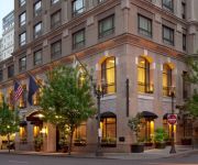
ABODA at Indigo at 12 West
Kimpton RiverPlace Hotel
The Porter Portland Curio Collection by Hilton
Dossier
The Duniway Portland a Hilton Hotel
The Heathman Hotel Portland
Rivers Edge Hotel and Spa
SENTINEL HOTEL
Hilton Portland Downtown
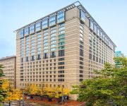
Portland Marriott Downtown Waterfront
Videos from this area
These are videos related to the place based on their proximity to this place.
2451 SW Bertha Blvd., Portland, OR 97239
http://2451swberthablvd.epropertysites.com?rs=youtube Remodeled Daylight Ranch in desirable Hillsdale neighborhood. 5 minutes to OHSU/Downtown and convenient...
Red Station Wagon, Oregon 824 EZT, ignores green lane
I took this with my helmet cam, 12/14/2010, about 8:45AM, eastbound Beaverton-Hillsdale Highway and Bertha Blvd, just before the Hillsdale commercial district. A red station wagon, 824 EZT,...
The after video of the weed patch at BH and 18th, Portland, Oregon, USA.
Maybe it was the complaint I submitted on July 13, but last week I noticed that the blackberry and weed patch at BH and 18th, which was growing into the bike lane, finally got mowed. "Look...
Portland Aerial Tram - city views all around
Rode the tram down the hill in Portland from the main Oregon Health & Science University (OHSU) campus and the city's South Waterfront district. I captured this video of the whole tram ride...
Portland Limo & Party Bus Service - JMI Limousine
http://www.JMILimousine.com We have the finest luxury limousines, party buses, town cars, private helicopter tours, extreme adventures, and the most affordable rates in Oregon and Southwest...
HD (bonus) SP 4449 Holiday Express Steam Train 12-11-11
SP4449 Holiday Express Train going south from Oaks Park Station. Hear the echo from the whistle off the hills Trains are operated on the Oregon Pacific Railroad and depart from Oaks Park...
2011 Bridge Pedal, Portland OR
Team Helen Wheels rocks the 6-bridge route of the Providence Bridge Pedal in Portland OR, August 2011. Team Helen Wheels is Dave, Terri, Auburn, Tim, Issac, Amber, Jordan, and Damien towing...
Comcast Contractors on Beaverton-Hillsdale Highway
Helmet camera video, 2/9/2011, about 8:40AM, Beaverton-Hillsdale Highway, just west of Dosch Road, Portland, Oregon. Two Comcast contractor trucks and a trailer with a cable spool were blocking...
Cleaning Blueberries...
Brought 15 pounds of fresh picked blueberries home and took about an hour to clean and bag them. Here's how I did it, with some direction from Nancy Cretsinger....
Videos provided by Youtube are under the copyright of their owners.
Attractions and noteworthy things
Distances are based on the centre of the city/town and sightseeing location. This list contains brief abstracts about monuments, holiday activities, national parcs, museums, organisations and more from the area as well as interesting facts about the region itself. Where available, you'll find the corresponding homepage. Otherwise the related wikipedia article.
Oregon Zoo
The Oregon Zoo, formerly the Washington Park Zoo, is a zoo in Portland, the largest city in the U.S. state of Oregon. Located 2 miles southwest of Downtown Portland, the zoo is inside Portland's Washington Park, and includes a narrow-gauge railway that connects to the International Rose Test Garden inside the park. Opened in 1888 after a private animal collector donated his animals to the City of Portland, the 64-acre zoo is now owned by the regional Metro government.
Portland Children's Museum
Portland Children's Museum is a children's museum located in Portland's Washington Park, adjacent to the Oregon Zoo. Founded in 1946, Portland Children's Museum is the sixth oldest children's museum in the world and the oldest West of the Mississippi. The 50,000 sq ft museum receives over a quarter of a million visits from children and their families every year. It is a non-profit organization with tax-exempt status and member of the Association of Children's Museums.
Washington Park (MAX station)
Washington Park is a station in the MAX Light Rail system of TriMet, served by the Blue and Red lines. It is located in Portland, Oregon and is a part of the Robertson Tunnel under Portland's West Hills. It is the fourth station westbound on the Westside MAX alignment. While it is the only completely underground station in the MAX system, at 260 feet below the surface it is the deepest transit station in North America. It is also one of the deepest in the world.
KGON
KGON is a radio station broadcasting a classic rock format. The station also broadcasts in HD featuring live rock performances. Licensed to Portland, Oregon, USA, the station serves the Portland OR/Vancouver WA area. The station is currently owned by Entercom Portland License, LLC.
KBFF
KBFF (95.5 FM, "Live 95-5") is an Mainstream Top 40 radio station licensed to Portland, Oregon, USA, and serving the Portland area. The station is currently owned by Alpha Broadcasting.
Washington Park (Portland, Oregon)
Washington Park is a public urban park in Portland, Oregon. It includes a zoo, forestry museum, arboretum, children's museum, rose garden, Japanese garden, amphitheatre, memorials, archery range, tennis courts, soccer field, picnic areas, playgrounds, public art, and many acres of wild forest with miles of trails.
Oregon Vietnam Veterans Memorial
The Oregon Vietnam Veterans Memorial is a 3.25 acre (30k m²) outdoor memorial dedicated to Oregonians who served in the Vietnam War. It is located in Portland, Oregon's Washington Park at {{#invoke:Coordinates|coord}}{{#coordinates:45.5120|N|122.71857|W||||| | |name= }}. The memorial was dedicated in 1987, inspired in 1982 by visits to the national Vietnam Veterans Memorial by five veterans and the parents of a Marine killed in Vietnam. Walker and Macy of Portland designed the memorial.
KBOO
KBOO is a non-profit organization, listener-funded FM Community radio station broadcasting from Portland, Oregon. The station's mission is to serve groups in its listening area who are underrepresented on other local radio stations and to provide access to the airwaves for people who have unconventional or controversial tastes and points of view. It broadcasts 24 hours a day, seven days a week, and has been on the air since 1968.
KNRK
KNRK is a commercial Modern AC-leaning Alternative rock music radio station in Portland, OR, broadcasting to the Portland, Oregon area on 94.7 FM. KNRK's studios are located near downtown Portland and its transmitter is located in Portland's west hills.
Washington Park and Zoo Railway
The Washington Park and Zoo Railway is a narrow-gauge recreational railroad in Portland, Oregon's Washington Park. It has a track gauge of 30 inches and rolling stock built to 5/8 scale. Opened in three stages in 1958, 1959 and 1960, it provides transportation between the Oregon Zoo, Hoyt Arboretum, International Rose Test Garden, and the World Forestry Center. The extended line is about 2 miles long. There is also a 1-mile loop within the zoo grounds.
KYCH-FM
KYCH-FM is a commercial broadcast radio station located in the Portland, Oregon area. The studio is near downtown Portland; the transmitter is atop Portland's west hills. KYCH airs an adult hits format branded as "97.1 Charlie FM".
KRYP
KRYP is a commercial broadcast FM radio station located in the Portland, Oregon area and owned by Salem Communications. KRYP is a Spanish language station playing regional Mexican music. The Spring 2008 Arbitron ratings saw KRYP become the Portland metropolitan area market leader, the first time a Spanish language radio station achieved that milestone.
KPDQ-FM
KPDQ-FM is a commercial broadcast radio station located in the Portland, Oregon area. The studio is in southeast Portland; the main transmitter is atop Portland's west hills. The station's frequency formerly was 93.7 MHz, but was changed in early 2006 to 93.9 MHz.
KWJJ-FM
KWJJ-FM (99.5 FM) is a commercial broadcast radio station located in the Portland, Oregon, area. The studio is near downtown Portland, while the main transmitter is atop Portland's Tualatin Mountains. KWJJ-FM airs a country music format.
KFIS
KFIS (104.1 FM, "The Fish") is a commercial broadcast radio station located in the Portland, Oregon area. The studio is in southeast Portland near Clackamas; the transmitter is atop Portland's Tualatin Mountains.
Hayhurst, Portland, Oregon
Hayhurst is a neighborhood in the Southwest section of Portland, Oregon, on the border with (and in some areas slightly extending into) Washington County. It borders Raleigh Hills and Beaverton (on the west), and the Portland neighborhoods of Bridlemile (on the north), Hillsdale (on the east), and Maplewood and Multnomah (on the south). The community of Vermont Hills lies in the southwestern part of the neighborhood .
Southwest Hills, Portland, Oregon
Southwest Hills is a neighborhood in the West Hills (Tualatin Mountains) in the southwest section of Portland, Oregon, United States. The northeastern part of the neighborhood, above Goose Hollow and Downtown Portland, is known as Portland Heights. Much of the western portion of the neighborhood lies outside of Portland city limits, in unincorporated Multnomah County. Neighborhood landmarks include Council Crest Park and Ainsworth Elementary School.
Doernbecher Children's Hospital
Doernbecher Children's Hospital is a children's hospital located in Portland, Oregon, and associated with Oregon Health & Science University. The first full-service children's hospital in the Pacific Northwest, Doernbecher provides full-spectrum pediatric care. The hospital opened in 1926 on Portland's Marquam Hill. Doernbecher Children's Hospital developed the nation's first academic children's eye clinic in 1949 and Oregon's first neonatal intensive care center in 1968.
Robertson Tunnel
The Robertson Tunnel is a twin-bore MAX Light Rail tunnel through the west hills of Portland, Oregon, utilized by the Blue and Red Lines. The tunnel is 2.9 miles long and consists of twin 21-foot -diameter tunnels. There is one station within the tunnel at Washington Park, which at 79 meters deep is the deepest subway station in the United States and the fifth deepest in the world. Trains are in the tunnel for about 5 minutes, which includes a stop at the Washington Park station.
Gabriel Park
Gabriel Park is a 90.65-acre public park in Portland, Oregon, United States. It features a baseball field, softball field, soccer field, basketball courts, tennis courts, skatepark, volleyball courts, disabled access play area, disabled access restrooms, dog off-leash area, paved and unpaved paths, reservable picnic sites, and WiFi. The park is located between the Maplewood, Multnomah, and Hillsdale neighborhoods of Southwest Portland at 45th Avenue and Vermont Street.
Oregon Health & Science University Emergency Heliport
Oregon Health & Science University Heliport is a private heliport located in Portland in Multnomah County, Oregon, United States at Oregon Health & Science University.
40-Mile Loop
The 40-Mile Loop is a partially completed greenway trail around and through Portland in the U.S. state of Oregon. It was proposed in 1903 by the Olmsted Brothers architecture firm as part of the development of Forest Park. One greenway expert calls it "one of the most creative and resourceful greenway projects in the country. " The name's "forty" was obsolete within a few decades after it was proposed.
Council Crest Park
Council Crest Park is a city park in southwest Portland in the U.S. state of Oregon. Amenities include paved and unpaved paths, a dog off-leash area, picnic tables, public art, a vista point, and a wedding site that can be reserved. The 43.51-acre park, operated by Portland Parks & Recreation, is open year-round from 5 a.m. to midnight. It was the site of an amusement park from 1907 until 1929.
Neveh Shalom Synagogue (Portland, Oregon)
Neveh Shalom is a synagogue affiliated with Conservative Judaism, located in Portland, Oregon, United States. It was founded in 1961, and currently has a congregation of over 1000 households. Neveh Shalom was formed by the merger of two existing Conservative congregations in 1961. One of those original synagogues (Ahavai Shalom) was founded in 1869 and the other (Neveh Zedek) in 1895.
Marquam Hill, Portland, Oregon
Marquam Hill is a populated hill located just south of Downtown Portland, Oregon, United States in the Homestead neighborhood. It is also called Pill Hill because it is home to Oregon Health & Science University, Portland VA Medical Center and Portland Shriners Hospital. Marquam Hill was named for Philip A. Marquam. It is classed by the United States Geological Survey as a populated place and not as a hill.


