Safety Score: 2,7 of 5.0 based on data from 9 authorites. Meaning we advice caution when travelling to United States.
Travel warnings are updated daily. Source: Travel Warning United States. Last Update: 2024-05-10 08:04:54
Delve into Arleta
The district Arleta of in Multnomah County (Oregon) is a subburb in United States about 2,344 mi west of Washington DC, the country's capital town.
If you need a hotel, we compiled a list of available hotels close to the map centre further down the page.
While being here, you might want to pay a visit to some of the following locations: Portland, Oregon City, Vancouver, Hillsboro and Saint Helens. To further explore this place, just scroll down and browse the available info.
Local weather forecast
Todays Local Weather Conditions & Forecast: 26°C / 79 °F
| Morning Temperature | 15°C / 59 °F |
| Evening Temperature | 24°C / 75 °F |
| Night Temperature | 15°C / 59 °F |
| Chance of rainfall | 0% |
| Air Humidity | 47% |
| Air Pressure | 1013 hPa |
| Wind Speed | Light breeze with 4 km/h (3 mph) from South-East |
| Cloud Conditions | Clear sky, covering 0% of sky |
| General Conditions | Sky is clear |
Sunday, 12th of May 2024
22°C (72 °F)
14°C (56 °F)
Sky is clear, gentle breeze, clear sky.
Monday, 13th of May 2024
17°C (62 °F)
10°C (49 °F)
Overcast clouds, gentle breeze.
Tuesday, 14th of May 2024
19°C (67 °F)
12°C (54 °F)
Sky is clear, light breeze, clear sky.
Hotels and Places to Stay
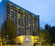
DoubleTree by Hilton Portland
MONARCH HOTEL AND CONFERENCE CENTER
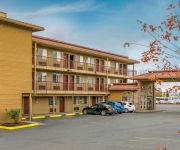
Econo Lodge at Port of Portland
Jupiter
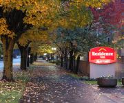
Residence Inn Portland Downtown/Convention Center
Courtyard Portland Southeast/Clackamas
Tiny Digs
Comfort Inn Portland
HOWARD JOHNSON PORTLAND ARPRT
Best Value Inns
Videos from this area
These are videos related to the place based on their proximity to this place.
Drill Down - PIL Rose City Invitational - February 28th, 2015
Drill Down from the PIL Rose City Invitational, Marshall High School, Portland Oregon.
Wild Bichons
Journey into the forest for an encounter between man and Bichon Frise. No humans were injured in the making of this film. Oh, and I love dogs.
Tricycle Riders on Mount Tabor in Portland, Oregon
Mount Tabor is the name of a volcanic cinder cone, the city park on the volcano, and the neighborhood of Southeast Portland, Oregon that surrounds it.
Killing Floor Slow-mo Compilation Christmas edition
Killing Floor Slow-mo Compilation Christmas edition or KFSMCCE :D I took a break(NOT!) I was sick (NOT!) I was on holiday(NOT!) I am a lazy bastard....jup :D.
Lane Basketball Nike Donation
Nike donated jerseys and shoes for the Portland Parks and Recreation basketball program throughout the city and here at Lane Middle School.
MY CASTLE OF QUIET
LIVE ON WMFU 4/9/14 JERSEY CITY, NJ http://my-castle-of-quiet.blogspot.com/2014/04/future-death-toll-live-tonight-on-my.html http://wfmu.org/playlists/shows/55175.
St. Anthony and Villa St. Margaret Slideshow
Take a tour of our campus. Senior Assisted Living Alzheimer's Care Senior Independent Living.
E36: West Coast Wrestling Connection on PDX-TV
Originally aired Saturday, January 24, 2015 Matt Striker returns in a match against "Hot Shot" Danny Duggan to determine the #1 Contender for Hammerstone's WCWC Pacific Northwest Heavyweight...
Commercial Industrial Roofing, Flat Roofing, Contractor Portland, Oregon
"Mention This Video Title and Get 10% Off Any Service." Commercial Industrial Roofing, Flat Roofing, Contractor Portland, Oregon...http://theportlandroofers.com Call Chad Westover & The Portland...
Videos provided by Youtube are under the copyright of their owners.
Attractions and noteworthy things
Distances are based on the centre of the city/town and sightseeing location. This list contains brief abstracts about monuments, holiday activities, national parcs, museums, organisations and more from the area as well as interesting facts about the region itself. Where available, you'll find the corresponding homepage. Otherwise the related wikipedia article.
Reed College
Reed College is a private and independent, liberal arts college located in southeast Portland, Oregon. Founded in 1908, Reed is a residential college with a campus located in Portland's Eastmoreland neighborhood, featuring architecture based on the Tudor-Gothic style, and a forested canyon nature preserve at its center.
Hawthorne, Portland, Oregon
The Hawthorne District in Portland, Oregon, is an area of Southeast Portland on SE Hawthorne Blvd. , particularly between 30th and 42nd Avenues. The area has numerous retail stores, including clothing shops, restaurants, bars, brewpubs and microbreweries. Hawthorne district is known for its young, liberal residents and pedestrian-friendly high density mixed-use development. The district has been known for having various social groups, such as Generation X, hippies and more recently, hipsters.
Blue Bridge (Oregon)
The Blue Bridge (also known as the Cross Canyon Bridge) is a curved pedestrian and bicycle bridge connecting the north and south halves of the Reed College campus in Portland, Oregon, United States. The bridge crosses Reed Lake, located within the 28-acre watershed on campus known as the "canyon"; this includes part of the course of Crystal Springs Creek, a tributary of Johnson Creek.
Warner Pacific College
Warner Pacific College is an urban, Christian liberal arts college located in Southeast Portland, Oregon, United States. Founded in 1937, the college is accredited by the Northwest Commission on Colleges and Universities. A private school, it is affiliated with the Church of God.
I-205 Transitway
The I-205 Transitway was a partially built busway along the wide right-of-way of the Interstate 205 freeway in Portland, Oregon. Although it never opened as a busway, its right-of-way is now in use by light rail lines. The transitway, which was physically separate from the parallel freeway lanes, was planned in the mid- and late-1970s as part of the final segment of I-205. Only a graded route with several entrance ramps and two underpass tunnels under I-205 were built.
Belmont, Portland, Oregon
The Belmont Area is a retail and residential district running along SE Belmont St. in the inner Southeast section of Portland, Oregon in a parallel fashion to the Hawthorne District, 6 blocks to the south. From west to east the area extends 48 blocks, from SE 12th Ave. to SE 60th Ave. , passing through the Buckman, Sunnyside, and Mount Tabor neighborhoods. The area is seven blocks wide, running from SE Belmont St. 4 blocks north to SE Stark St. and 3 blocks south to SE Salmon St. SE Belmont St.
Mount Scott Alternative High School
Mount Scott Alternative High School is an alternative high school in Portland, Oregon. It is designed to provide a non-traditional learning environment for high school students. Mount Scott currently conducts same-sex only classes, the goal being to make students as comfortable as possible. The school enrolls 80 students with an average teacher-to-student ratio of 1 to 15. Thematic, integrated courses are offered in languages, arts, math, social studies, science, health and P.E.
Village Free School
The Village Free School (VFS) is a non-profit private school located in Portland, Oregon, United States. The school offers enrollment to students ages 5–18. The educational philosophy at the Village Free School is based upon the idea that if children are given freedom and access to resources they will learn. Students at VFS choose what they want to learn and how they want to spend their time. Admissions are designed so that many ages are represented, and enrollment in each age group is limited.
Western Seminary
Western Seminary is an evangelical, non-denominational theological seminary with physical campuses in Portland, Oregon, as well as in San Jose and Sacramento in California. The Online campus also delivers training through web-driven distance education that emphasizes community and mentoring. The seminary offers Master’s Degrees in Divinity, Counseling, Intercultural Studies, Leadership and Theology along with Doctoral Programs in Ministry and Missiology.
KRRC
KRRC is the student-run radio station of Reed College in Portland, Oregon, United States. It used to broadcast a Variety format, with various students hosting shows in different formats. It was on the air from 10:00 AM to 2:00 AM daily. The station now airs online at krrcfm. com . The station is owned by the Reed Institute. KRRC has applied for an FCC construction permit to move to 91.1 MHz, increase ERP to 60 watts and decrease HAAT to -25.8 meters.
Springwater Corridor
The Springwater Corridor Trail is a bicycle and pedestrian rail trail in the Portland metropolitan area in Oregon, United States. It follows a former railway line of the same name from Boring through Gresham to Portland, where it ends south of the Eastbank Esplanade. Most of the trail, about 21 miles long, is paved, though about 1 mile overlaps city streets in Sellwood, and about 2 miles near Boring is gravel.
Southeast Main Street (MAX station)
The Southeast Main Street station is a light rail station on the MAX Green Line in Portland, Oregon. It is the first stop southbound on the I-205 MAX branch, following the Green Line's split from the Red and Blue lines at the Gateway Transit Center. The station is located at the intersection of SE 96th Avenue and Main Street. It is adjacent to Interstate 205, and is located near Mall 205, Adventist Medical Center, and surrounding businesses.
Southeast Division Street (MAX station)
The Southeast Division Street station is a light rail station on the MAX Green Line in Portland, Oregon. It is the 2nd stop southbound on the I-205 MAX branch. The station is located at the intersection of Interstate 205 and Division Street, and offers connections to the I-205 Bike Path. It is adjacent to the I-205 exit ramps to Powell Boulevard. This station has a center platform.
Southeast Powell Boulevard (MAX station)
The Southeast Powell Boulevard station is a light rail station on the MAX Green Line in Portland, Oregon. It is the 3rd stop southbound on the I-205 MAX branch. The station is located off of SE 92nd Avenue and Powell Boulevard. It is adjacent to Interstate 205, and offers connections to the I-205 Bike Path. This station has a center platform, and is surrounded by a park-and-ride facility.
Southeast Holgate Boulevard (MAX station)
Southeast Holgate Boulevard station is a light rail station on the MAX Green Line in Portland, Oregon. It is the 4th stop southbound on the I-205 MAX branch. The station is at the intersection of Interstate 205 and Holgate Boulevard. This station has a center platform, and is surrounded by a park-and-ride facility. Also Lents park is by the station on 92nd and SW Hogate Blvd.
Lents Town Center / Southeast Foster Road
The Lents Town Center/Southeast Foster Road station is a light rail station on the MAX Green Line in Portland, Oregon. It is the 5th stop southbound on the I-205 MAX branch. The station is at the intersection of Interstate 205 and Foster Road. It is located in the Lents neighborhood's town center business district. It also provides access to the Springwater Corridor, which was once a transit line to the suburbs and is now a dedicated bikeway through southeast Portland.
Southeast Flavel Street (MAX station)
The Southeast Flavel Street station is a light rail station on the MAX Green Line in Portland, Oregon. It is the 6th stop southbound on the I-205 MAX branch. The station is located at SE Flavel Street, adjacent below Interstate 205. This station has a center platform.
Southeast Fuller Road (MAX station)
The Southeast Fuller Road station is a light rail station on TriMet's MAX Green Line in Portland, Oregon, located between SE 82nd Avenue and Interstate 205. It is the 7th stop southbound on the Interstate 205 MAX branch. The station has a center platform and is surrounded by a park and ride facility.
Mount Tabor Theater
The Mt. Tabor Theater is a theater builit in 1913 in Portland, Oregon, United States. The theater was named after Mount Tabor, an extinct volcano within the city boundaries. This theater was originally a playhouse for burlesque and vaudeville.
Tideman Johnson Natural Area
Tideman Johnson Natural Area is a city park of about 7.7 acres in southeast Portland, in the U.S. state of Oregon. Located at Southeast 37th Avenue and Tenino Street along Johnson Creek, the site is named for a mid-19th century family named Johnson that encouraged public use of its land along the creek. The park has paved and unpaved paths for hiking. A loop trail and boardwalk off the Springwater Corridor runs through the park.
Kelly Butte Natural Area
Kelly Butte Natural Area is a city park of about 23 acres in southeast Portland in the U.S. state of Oregon, just east of Interstate 205. The park is named after pioneer Clinton Kelly, who settled the area east of the Willamette River in 1848. The butte contains a now-sealed concrete bunker built as a civil defense emergency operations center in 1955-56 and later used for emergency dispatching. It appears in the film A Day Called X.
Fubonn Shopping Center
The Fubonn Shopping Center is an enclosed shopping mall in Portland, Oregon. The mall claims to be the largest Asian mall in Oregon and lists 29 stores as tenants in November 2011. The mall is located at SE 82nd Avenue and Division Street. It is anchored by the Fubonn Supermarket, a large Asian grocery and housewares store. The Oregonian calls it "the eastside's answer to Uwajimaya". The mall was opened in 2006 by owner, President and CEO Michael Liu. Construction cost a reported $15 million.
Eastport Plaza
Eastport Plaza is a shopping mall located in Portland, Oregon on SE 82nd Avenue. Construction began on October 20, 1959 by the Anderson–Westfall Construction Company. It was one of the biggest construction projects in the Pacific Northwest at the time and cost $5 million dollars. It opened on October 27, 1960. It was a dead mall until recently, with most of the former stores moving to the new Clackamas Town Center during the 1990s.
Woodstock Park (Portland, Oregon)
Woodstock Park is a public park located in the Woodstock neighborhood of southeast Portland, Oregon, United States. Operated by Portland Parks & Recreation, the park was acquired in 1921 and measures 14.11 acres . SE 47th Avenue and SE 50th Avenue form the west and east boundaries; Woodstock Park is bounded by SE Steele Street to the north and by SE Harold Street and Woodstock School to the south.
Country Bill's
Country Bill's Restaurant was a family-owned American-style steakhouse and seafood restaurant located in the Woodstock neighborhood of southeast Portland, Oregon, United States. Adjacent to the restaurant was a bar known as CB's Lounge. The restaurant opened in 1964 when ownership transferred from Bill Blake to Ron Thomas' family. Though Thomas was not particularly fond of the business' name, established by Blake in 1960, he was unable to afford new signage and kept the lounge's title.


