Safety Score: 2,7 of 5.0 based on data from 9 authorites. Meaning we advice caution when travelling to United States.
Travel warnings are updated daily. Source: Travel Warning United States. Last Update: 2024-05-15 08:00:47
Discover Rosedale
Rosedale in Marion County (Oregon) is a city in United States about 2,371 mi (or 3,815 km) west of Washington DC, the country's capital city.
Local time in Rosedale is now 12:31 PM (Wednesday). The local timezone is named America / Los Angeles with an UTC offset of -7 hours. We know of 8 airports in the vicinity of Rosedale, of which one is a larger airport. The closest airport in United States is Mahlon Sweet Field in a distance of 51 mi (or 82 km), South. Besides the airports, there are other travel options available (check left side).
Also, if you like golfing, there are a few options in driving distance. Looking for a place to stay? we compiled a list of available hotels close to the map centre further down the page.
When in this area, you might want to pay a visit to some of the following locations: Salem, Albany, Dallas, Corvallis and McMinnville. To further explore this place, just scroll down and browse the available info.
Local weather forecast
Todays Local Weather Conditions & Forecast: 20°C / 68 °F
| Morning Temperature | 11°C / 51 °F |
| Evening Temperature | 21°C / 69 °F |
| Night Temperature | 11°C / 52 °F |
| Chance of rainfall | 0% |
| Air Humidity | 61% |
| Air Pressure | 1018 hPa |
| Wind Speed | Light breeze with 4 km/h (3 mph) from South-West |
| Cloud Conditions | Overcast clouds, covering 100% of sky |
| General Conditions | Overcast clouds |
Wednesday, 15th of May 2024
20°C (68 °F)
9°C (48 °F)
Few clouds, moderate breeze.
Thursday, 16th of May 2024
16°C (61 °F)
7°C (45 °F)
Sky is clear, light breeze, clear sky.
Friday, 17th of May 2024
19°C (65 °F)
7°C (44 °F)
Sky is clear, moderate breeze, clear sky.
Hotels and Places to Stay
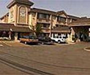
THE GRAND HOTEL IN SALEM
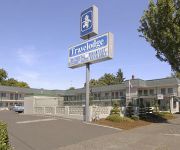
SALEM TRAVELODGE
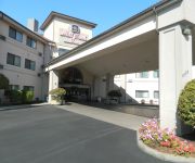
BEST WESTERN PLUS MILL CREEK
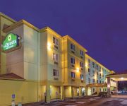
La Quinta Inn and Suites Salem
Residence Inn Salem
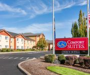
Comfort Suites Salem
Hampton Inn - Suites Salem
Phoenix Inn Suites South Salem
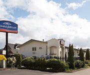
HOWARD JOHNSON INN SALEM
Videos from this area
These are videos related to the place based on their proximity to this place.
Salem Country Estate / Luxury homes and real estate
Country living just minutes from the city! Private, one level home on two acres, horse property potential. Elegant home with dramatic columns, soaring ceilings, hardwoods, granite, custom finishes....
Woodmansee city Park Ciudad Salem Oregon Julio 21 2012
http://preguntameaqui.com ESte es otro de mis videos donde visito parques para distraerme y caminar. Hoy les presentamos un que se llama Woodmansee City Park en la ciudad de Salem Oregon....
Park By Winco Salem Oregon
We have a Park close to Winco Store in South Salem . City Salem Oregon. Country United States. Date June 30 2012. Woodmansee city Park.
5018 Daniels St SE, Salem OR, 97306, 2 Bedrooms, 2 Bathrooms, 1,100 Sq Ft
Liberty Elementary School, Crossler Middle School, Sprague High School, 2 Bedrooms, 2 Bathrooms, Water is Paid for in Rent, Fenced Backyard, Newer Carpet, Refrigerator, Range, Microwave, Single ...
Beautiful August afternoon Salem, Oregon
Video created with the Socialcam app on iphone: http://socialcam.com.
HD PW 3006 Freight Train by Salem, OR
Portland-Western 3006, 2315, 2307, and 3004 mixed freight train going along River Rd S. on the Willamette river. If you like my videos, rate, comment and subscribe to my channel (Canon Vixia...
Valley Insurance Professionals - Intro Video
Enjoy LIFE... we've got the rest covered! Valley Insurance Professionals is an independent insurance agency in Salem, OR. Visit our website at www.valleyinsu...
Cambridge Neighborhood in Salem Oregon| Tomson Burnham, LLC
The Cambridge Neighborhood in South Salem is an upscale neighborhood that is tucked away off Kuebler. You can read more about the neighborhood at http://toms...
El sur de Salem oregon un parque cerca de la winco
http://preguntameaqui.com/ Hoy les muestro el sur de la ciudad de Salem Oregon. La fecha del video es en junio 30 2012, es un parque que está cerca de la tienda Winco. Hay una Winco en el...
Videos provided by Youtube are under the copyright of their owners.
Attractions and noteworthy things
Distances are based on the centre of the city/town and sightseeing location. This list contains brief abstracts about monuments, holiday activities, national parcs, museums, organisations and more from the area as well as interesting facts about the region itself. Where available, you'll find the corresponding homepage. Otherwise the related wikipedia article.
Sunnyslope, Salem, Oregon
Sunnyslope is a primarily residential neighborhood in Salem, Oregon, United States located in the far southwest part of the city. The neighborhood is bordered on the north by Browning Avenue, and on the east with Liberty Road. Sunnyslope is home to Sprague High School.
Sprague High School
Charles A. Sprague High School, known as Sprague High School, is a high school in the Sunnyslope neighborhood of Salem, Oregon, United States. The school is named after Charles A. Sprague, who served as Oregon's governor from 1939 to 1943.
Elkins Heliport
Elkins Heliport is a private heliport located south of Salem in Marion County, Oregon, USA.
Living Tongues Institute for Endangered Languages
The Living Tongues Institute for Endangered Languages (LTIEL) is an organization based in Salem, Oregon, United States that scientifically documents endangered languages, and assists communities with maintaining and revitalizing knowledge of their native languages. The institute is led by two linguists, Dr. Gregory D. S. Anderson and Dr. K. David Harrison.
South Hill Heliport
South Hill Heliport is a private Heliport located 5 miles south of Salem in Marion County, Oregon, USA.
Wagoner Airport
Wagoner Airport is a private airport located 6 miles north of Salem in Marion County, Oregon, USA.
Salem Hills
The Salem Hills are a range of hills spanning from southern Salem, Oregon, United States, south to Jefferson, west to the Willamette River and east to Turner and Marion. They have also been called the Ankeny Hills, Chemeketa Hills, Illahee Hills, Red Clay Hills, Red Hills, and the South Salem Hills.


