Safety Score: 2,7 of 5.0 based on data from 9 authorites. Meaning we advice caution when travelling to United States.
Travel warnings are updated daily. Source: Travel Warning United States. Last Update: 2024-05-13 08:03:22
Explore John Day
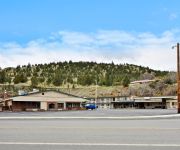
John Day in Grant County (Oregon) with it's 1,680 inhabitants is located in United States about 2,173 mi (or 3,497 km) west of Washington DC, the country's capital.
Local time in John Day is now 08:05 AM (Monday). The local timezone is named America / Los Angeles with an UTC offset of -7 hours. We know of 8 airports in the wider vicinity of John Day. The closest airport in United States is Roberts Field in a distance of 109 mi (or 176 km), West. Besides the airports, there are other travel options available (check left side).
Also, if you like golfing, there is an option about 0 mi (or 0 km). away. If you need a place to sleep, we compiled a list of available hotels close to the map centre further down the page.
Depending on your travel schedule, you might want to pay a visit to some of the following locations: Canyon City, Burns, Heppner, Baker City and La Grande. To further explore this place, just scroll down and browse the available info.
Local weather forecast
Todays Local Weather Conditions & Forecast: 18°C / 65 °F
| Morning Temperature | 9°C / 48 °F |
| Evening Temperature | 19°C / 66 °F |
| Night Temperature | 10°C / 50 °F |
| Chance of rainfall | 0% |
| Air Humidity | 31% |
| Air Pressure | 1012 hPa |
| Wind Speed | Fresh Breeze with 14 km/h (9 mph) from South-East |
| Cloud Conditions | Clear sky, covering 0% of sky |
| General Conditions | Sky is clear |
Monday, 13th of May 2024
18°C (64 °F)
10°C (50 °F)
Sky is clear, moderate breeze, clear sky.
Tuesday, 14th of May 2024
17°C (63 °F)
13°C (56 °F)
Sky is clear, gentle breeze, clear sky.
Wednesday, 15th of May 2024
22°C (71 °F)
13°C (56 °F)
Sky is clear, moderate breeze, clear sky.
Hotels and Places to Stay
BEST WESTERN JOHN DAY INN
Americas Best Value Inn
Videos from this area
These are videos related to the place based on their proximity to this place.
Cycle Oregon 2013 Day 7 Seneca to John Day 56mi. (short clip)
Cycle Oregon 2013 ended with a Grand Finale in the form of a wonderful 10 mile, 3000 foot descent from the Aldrich Mountains into the John Day River Valley. While I won't miss getting up at...
Cessna 172 Landing at John Day, OR GoPro
Landing runway 35 at KGCD Ogilvie Field Grant County Regional Airport. Nice day! Density altitude 5000'.
Emergency Landing at John Day, OR in a Glasair
Lots of narrative, fewer pictures (I was a little at the time). Hope you find this instructive. On a flight from Richland, WA to Salt Lake City, I smelled smoke in the cockpit and saw a very...
JOHN DAY RIVER FLOW 3000 2nd DAY BIG ROCKS
RAFTING ON JOHN DAY RIVER - 2nd DAY - FLOW 3300 -2700 CFS-on May 30 2014 -w/ NRS 18 Ft CAT.
Videos provided by Youtube are under the copyright of their owners.
Attractions and noteworthy things
Distances are based on the centre of the city/town and sightseeing location. This list contains brief abstracts about monuments, holiday activities, national parcs, museums, organisations and more from the area as well as interesting facts about the region itself. Where available, you'll find the corresponding homepage. Otherwise the related wikipedia article.
Blue Mountain Hospital
Blue Mountain Hospital offers medical services in John Day, Oregon, United States. Part of the Blue Mountain Hospital District, it was built in 1949 in Prairie City and re-built in 1960 in John Day. The hospital district, a non-profit managed by a local board of directors, includes Blue Mountain Nursing Home, a 52-bed unit in Prairie City. The hospital has three monitored intensive-care beds, two birthing suites, and two surgery suites for inpatient and outpatient surgeries.
National Register of Historic Places listings in Grant County, Oregon
KJDY (AM)
KJDY is a radio station licensed to serve John Day, Oregon, USA. The station, which began broadcasting in 1963, is currently owned by Blue Mountain Broadcasting Company.
Grant Union High School (John Day, Oregon)
Grant Union High School is a public high school in John Day, Oregon, United States.
KGNR
KGNR (91.9 FM, "Good News Radio") is a radio station broadcasting a Christian radio format. Licensed to John Day, Oregon, USA, the station is currently owned by Life Broadcasting, Inc.
Blue Mountain Alternative High School
Blue Mountain Alternative High School is a public alternative high school in John Day, Oregon, United States.
KSPL-LP
KSPL-LP is a low-power radio station broadcasting a religious format. Licensed to John Day, Oregon, USA, the station is currently owned by Valley View Broadcasting, Inc.
KOJD
KOJD (89.7 FM) is a radio station licensed to John Day, Oregon. The station is owned by Oregon Public Broadcasting, and airs OPBs news and talk programming, consisting of syndicated programming from NPR, APM and PRI, as well as locally-produced offerings. Main article: Oregon Public Broadcasting


