Safety Score: 2,7 of 5.0 based on data from 9 authorites. Meaning we advice caution when travelling to United States.
Travel warnings are updated daily. Source: Travel Warning United States. Last Update: 2024-05-09 08:23:21
Delve into Charleston
Charleston in Coos County (Oregon) is a city located in United States about 2,448 mi (or 3,939 km) west of Washington DC, the country's capital town.
Current time in Charleston is now 03:18 AM (Thursday). The local timezone is named America / Los Angeles with an UTC offset of -7 hours. We know of 9 airports closer to Charleston, of which one is a larger airport. The closest airport in United States is Southwest Oregon Regional Airport in a distance of 7 mi (or 11 km), North-East. Besides the airports, there are other travel options available (check left side).
Also, if you like playing golf, there are some options within driving distance. We saw 7 points of interest near this location. In need of a room? We compiled a list of available hotels close to the map centre further down the page.
Since you are here already, you might want to pay a visit to some of the following locations: Coquille, Gold Beach, Roseburg, Newport and Grants Pass. To further explore this place, just scroll down and browse the available info.
Local weather forecast
Todays Local Weather Conditions & Forecast: 22°C / 72 °F
| Morning Temperature | 8°C / 46 °F |
| Evening Temperature | 18°C / 64 °F |
| Night Temperature | 14°C / 57 °F |
| Chance of rainfall | 0% |
| Air Humidity | 35% |
| Air Pressure | 1018 hPa |
| Wind Speed | Moderate breeze with 9 km/h (6 mph) from South |
| Cloud Conditions | Clear sky, covering 0% of sky |
| General Conditions | Sky is clear |
Thursday, 9th of May 2024
22°C (71 °F)
11°C (52 °F)
Sky is clear, gentle breeze, clear sky.
Friday, 10th of May 2024
16°C (62 °F)
10°C (50 °F)
Scattered clouds, gentle breeze.
Saturday, 11th of May 2024
16°C (60 °F)
10°C (49 °F)
Few clouds, moderate breeze.
Hotels and Places to Stay
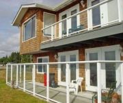
PLAINVIEW MOTEL
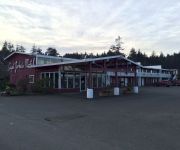
Captain John's Motel
Videos from this area
These are videos related to the place based on their proximity to this place.
2015 Black Rock 19B #008210
5 season travel trailer from Outdoors RV with aluminum frame construction and 2' this laminated sidewalls. Rear dinette with big rear window.. perfect for your favorite view campsite.
Crabbing on the Oregon Coast
Crabbing from docks on the Oregon Coast for tasty Dungeness crab. Size restrictions mean a lot of the crabs go back to the bay floor. Makes a great spectator sport for seals.(Mail Tribune /...
The Manfred Nystrom pulling a barge full of wood chips
Filmed January 2014 - While on Coos Bay doing a little crabbing I got to watch the Manfred Nystrom pull a barge full of wood chips past me. The day was warm and very little wind and just unbelievab...
Crabbing in Coos Bay Oregon
Some times the crabbing is really happening, and some times it is really hard work to get a good catch. But I've never been skunked! Not even a single legal crab on this day, it was pretty...
X-Plane 10 - From Bandon State to Southwest Oregon Airport
From Bandon State to Southwest Oregon Airport, RWY 22. ICAO Codes: S05/KOTH. Aircraft: Piper Archer III. Flight Simulator: X-Plane 10 3.0.
Time-lapse of Coos Bay Oregon January 24 2009
CoosBayWebCam.com presents January 24, 2009 as a time-lapse video. For an 800x448 wide-angle version of this time-lapse visit www.CoosBayWebCam.com.
Daio Excelsior - bulk wood chip cargo ship
Daio Excelsior is a Panama flagged wood chip carrier built in 1997. This is a pretty large ship at 200m x 32m with a gross tonnage of 39901t and net tonnage of 20152t. The ship was loading...
Time-lapse of Coos Bay Oregon on February 26 2009
CoosBayWebCam.com presents February 26, 2009 as a time-lapse video. For a full-sized 800x448 wide-angle version of this time-lapse or other daily time-lapses visit www.CoosBayWebCam.com.
Hoowee! Bull Poker--Coos Bay , 2008!
unaware of origin-- pay to sit in-- last one sitting wins pot(medical bills tend to exceed pot)
Videos provided by Youtube are under the copyright of their owners.
Attractions and noteworthy things
Distances are based on the centre of the city/town and sightseeing location. This list contains brief abstracts about monuments, holiday activities, national parcs, museums, organisations and more from the area as well as interesting facts about the region itself. Where available, you'll find the corresponding homepage. Otherwise the related wikipedia article.
Charleston, Oregon
Charleston is an unincorporated community in Coos County, Oregon, United States. It is located at the ocean entrance to Coos Bay. According to the local chamber of commerce, it is the area's "commercial and sport fishing center", and the community also provides services for the seafood processing and marine support industries. Charleston is the site of the Oregon Institute of Marine Biology and the United States Coast Guard Charleston Lifeboat Station.
ANT Coos Bay
The United States Coast Guard Aids To Navigation Team, ANT Coos Bay was established in 1976 and is located near the mouth of Coos Bay in the fishing and tourist community of Charleston, Oregon, southwest of the city of Coos Bay. ANT Coos Bay's area of responsibility ranges over 240 miles of the Oregon coast and includes 3 lighthouses, 18 primary buoys, 43 secondary buoys and 156 other lights, day beacons and fog signals.
Oregon Institute of Marine Biology
The Oregon Institute of Marine Biology (or OIMB) is the marine station of the University of Oregon. It is located in Charleston, Oregon at the mouth of Coos Bay. This 100-acre marine station was first deeded to the University of Oregon in 1931. However, university students had been studying marine science in the summer from tents at nearby Sunset Bay since 1924. Currently OIMB is home to several permanent faculty members and a number of graduate students.
Sunset Bay State Park
Sunset Bay State Park is a state park in the U.S. state of Oregon, administered by the Oregon Parks and Recreation Department. It is located about 0.4 miles south of Cape Arago Lighthouse, and 2.5 miles outside the town of Charleston on Coos Bay. The park offers a crescent shaped beach, tide pools, hiking trails and a year-round campground.


