Safety Score: 2,7 of 5.0 based on data from 9 authorites. Meaning we advice caution when travelling to United States.
Travel warnings are updated daily. Source: Travel Warning United States. Last Update: 2024-05-06 08:04:52
Explore Fern Hill
Fern Hill in Clatsop County (Oregon) is a city in United States about 2,394 mi (or 3,853 km) west of Washington DC, the country's capital.
Local time in Fern Hill is now 02:24 AM (Monday). The local timezone is named America / Los Angeles with an UTC offset of -7 hours. We know of 9 airports in the vicinity of Fern Hill, of which 4 are larger airports. The closest airport in United States is Tillamook Airport in a distance of 52 mi (or 83 km), South. Besides the airports, there are other travel options available (check left side).
There is one Unesco world heritage site nearby. It's Olympic National Park in a distance of 123 mi (or 198 km), North-East. Also, if you like golfing, there are multiple options in driving distance. We found 4 points of interest in the vicinity of this place. If you need a place to sleep, we compiled a list of available hotels close to the map centre further down the page.
Depending on your travel schedule, you might want to pay a visit to some of the following locations: Astoria, Cathlamet, South Bend, Tillamook and Montesano. To further explore this place, just scroll down and browse the available info.
Local weather forecast
Todays Local Weather Conditions & Forecast: 9°C / 49 °F
| Morning Temperature | 9°C / 48 °F |
| Evening Temperature | 10°C / 49 °F |
| Night Temperature | 9°C / 48 °F |
| Chance of rainfall | 8% |
| Air Humidity | 76% |
| Air Pressure | 1014 hPa |
| Wind Speed | Fresh Breeze with 17 km/h (11 mph) from North-East |
| Cloud Conditions | Overcast clouds, covering 100% of sky |
| General Conditions | Light rain |
Monday, 6th of May 2024
11°C (52 °F)
10°C (50 °F)
Light rain, moderate breeze, few clouds.
Tuesday, 7th of May 2024
12°C (53 °F)
9°C (48 °F)
Sky is clear, moderate breeze, clear sky.
Wednesday, 8th of May 2024
17°C (63 °F)
14°C (57 °F)
Sky is clear, gentle breeze, clear sky.
Hotels and Places to Stay
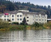
Comfort Suites Columbia River
Hampton Inn - Suites Astoria
Astoria Crest Motel
Videos from this area
These are videos related to the place based on their proximity to this place.
Astoria, OR: Vacation 2013
Astoria, OR: Vacation 2013. Also Seaside, OR and Long Beach, WA. Our 2014 Astoria Video: http://youtu.be/AgTa9kcyXjY (this is sort of a Part 2)....
VFR take-off Astoria, Oregon landing Dietz in a Beechcraft Bonanza G35
Inflight cockpit video of our VFR Flight from Astoria, Oregon (KAST) to Dietz Airpark (OR40) in a 1956 Beechcraft Bonanza G35. Dietz Airpark is a private airport community with a grass strip.
Down By The Goondocks In Astoria -- #Halfmerica
September 1, 2013: Now halfway through their 8000 mile cross-country road trip, Becka and Jon survive and Seattle power outage, and head south down the Pacific coast to explore the seaside...
Astoria, Oregon, Run on the Riverwalk
Daily Astorian photographer Alex Pajunas ran the half marathon Sunday, June 1 in the first Run on the Riverwalk event, sponsored by the Astoria Parks and Recreation Department. He wore a GoPro...
Sailboat Races - Astoria Regatta
http://www.discoverourcoast.com/ Sailboat races at the mouth of the Columbia River as part of the 2012 Astoria Regatta.
Stardust Charter Crash Chinook Fishing Astoria Bridge
Chinook, Chinook, fishing, Fishing, Astoria, bridge, antenna, boat, charter fishing, charter, stardust, bentrod, mule, deer, elk, mountain, ford, chevy, Toyota, motorhome, camping, Hammond...
View from top of Astoria Column, Astoria, Oregon
This video is shot from the top of Astoria Column, Astoria, Oregon, It has a Glider launch and a closeup view of the Astoria Megler Bridge.
These Sea Lions can be heard from the Goonies House; Astoria, OR 97103
What a nuisance. At least that's what fishermen have to say about them. They are also a problem in Westport too. One fisherman described them as gross. But this is Astoria with a large tourist...
TWC IntelliSTAR- Astoria, OR- Apr. 2, 2015- 5:27PM PDT
I changed the font from "Hit the Road" to "Akko", and I made a line shorter to fit only inside the map.
Videos provided by Youtube are under the copyright of their owners.
Attractions and noteworthy things
Distances are based on the centre of the city/town and sightseeing location. This list contains brief abstracts about monuments, holiday activities, national parcs, museums, organisations and more from the area as well as interesting facts about the region itself. Where available, you'll find the corresponding homepage. Otherwise the related wikipedia article.
John Day River (northwestern Oregon)
The John Day River is a tributary of the Columbia River, approximately 6 miles long, in northwestern Oregon in the United States. The river is one of two tributaries of the Columbia in Oregon to bear the name "John Day River". The other John Day River, east of the Cascade Range, is much longer and more well-known.
Tongue Point Naval Air Station
Tongue Point Naval Air Station is a former United States Navy air station located in Astoria, Oregon In 1919, the United States Congress approved the construction of a submarine and destroyer base on Tongue Point, a peninsula jutting into the Columbia River East of Astoria, Oregon. Construction was not started until 1921 and was completed in 1924. However, with the military downsizing following World War I, the base was never used.


