Safety Score: 2,7 of 5.0 based on data from 9 authorites. Meaning we advice caution when travelling to United States.
Travel warnings are updated daily. Source: Travel Warning United States. Last Update: 2024-04-29 08:03:39
Discover Lawton
Lawton in Washoe County (Nevada) is a town in United States about 2,273 mi (or 3,659 km) west of Washington DC, the country's capital city.
Current time in Lawton is now 11:06 AM (Monday). The local timezone is named America / Los Angeles with an UTC offset of -7 hours. We know of 11 airports near Lawton, of which 5 are larger airports. The closest airport in United States is Reno Tahoe International Airport in a distance of 7 mi (or 12 km), East. Besides the airports, there are other travel options available (check left side).
Also, if you like playing golf, there are a few options in driving distance. Looking for a place to stay? we compiled a list of available hotels close to the map centre further down the page.
When in this area, you might want to pay a visit to some of the following locations: Reno, Virginia City, Carson City, Minden and Yerington. To further explore this place, just scroll down and browse the available info.
Local weather forecast
Todays Local Weather Conditions & Forecast: 17°C / 62 °F
| Morning Temperature | 5°C / 42 °F |
| Evening Temperature | 14°C / 58 °F |
| Night Temperature | 7°C / 45 °F |
| Chance of rainfall | 0% |
| Air Humidity | 24% |
| Air Pressure | 1011 hPa |
| Wind Speed | Fresh Breeze with 16 km/h (10 mph) from East |
| Cloud Conditions | Clear sky, covering 0% of sky |
| General Conditions | Sky is clear |
Monday, 29th of April 2024
16°C (61 °F)
8°C (47 °F)
Sky is clear, fresh breeze, clear sky.
Tuesday, 30th of April 2024
10°C (50 °F)
8°C (46 °F)
Sky is clear, gentle breeze, clear sky.
Wednesday, 1st of May 2024
13°C (56 °F)
11°C (52 °F)
Few clouds, gentle breeze.
Hotels and Places to Stay
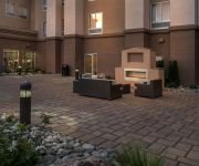
Hampton Inn - Suites - Reno West NV
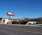
DESERT ROSE INN
BEST WESTERN PLUS BOOMTOWN HTL
MOTEL 6 RENO WEST
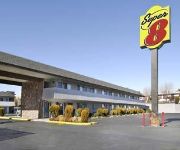
SUPER 8 MOTEL - RENO-UNIVERSIT
Videos from this area
These are videos related to the place based on their proximity to this place.
Before the Fire. Old Wood Bridge, Verdi, Nevada, Lincoln Highway
This is early July showing all that we have before the bridge burned, starting with a few slides, then a refer train, and a single power move. I'm not sure if anybody is aware of it, but on...
STEAM LOCOMOTIVE #844, UP 150 EXPRESS 2012. Patrick and Verdi, Nevada
Video includes two passes, the first in Patrick, Nv, McCarran Ranch Road crossing, and the second in East Verdi crossing the Truckee. 844 is aided by UPRR locomotives, 8775 SD70ACe, 8715 ...
After the Fire, Verdi Wood Bridge
Two weeks later, 8/5/2010, we recorded a VERY late Train 5, a power move, and a stack train that was edited to relieve boredom. It is figured that much of the burned bridge timbers were removed...
AMTRAK HERITAGE 156 RETURNING EASTBOUND
156 remains on the Zephyr, going back East. Shown here going under the remaining old wood bridge of Verdi and crossing the Truckee.
7677 Stonebluff Way, Reno, NV Presented by Caritas Real Estate Group.
Click to see more: http://listings.listhub.net/pages/NNRMLS/150003212/?channel=listingstoleads 7677 Stonebluff Way Reno, NV 89523 Contact Caritas Real Estate Group for more information. Krch...
UPRR STACK TRAIN FOLLOWS AMTRAK TRAIN 5 ACROSS THE TRUCKEE
Shadows dance below as Marshal Arts follows AMTK 5 and a UPRR stack dashing up the Truckee west to the Sierras.
1140 Del Webb Parkway, Reno-Northwest Foothills, NV 89523
http://1140delwebbparkway.epropertysites.com?rs=youtube This is a beautifully upgraded "Tahoe" model. There's nothing to do, just move in. Regular sale! Interior features include,...
2/2/2011 AMTRAK TRAIN 6 THROUGH MOGUL
30 min. late. AMTRAK TRAIN #6 coming mighty close to the setting sun through Mogul.
Estes Tomahawk D region Model Rocket, 2nd flight!
No problems, love this rocket.....kinda love any big rocket I guess.
Videos provided by Youtube are under the copyright of their owners.
Attractions and noteworthy things
Distances are based on the centre of the city/town and sightseeing location. This list contains brief abstracts about monuments, holiday activities, national parcs, museums, organisations and more from the area as well as interesting facts about the region itself. Where available, you'll find the corresponding homepage. Otherwise the related wikipedia article.
Robert McQueen High School
Robert McQueen High School is a public secondary school in Reno, Nevada, USA. It is part of the Washoe County School District.
Mogul, Nevada
Mogul is a census-designated place (CDP) in Washoe County, Nevada, United States. It lies on the western side of the Reno–Sparks Metropolitan Statistical Area, just off Interstate 80. The population was 1,290 at the 2010 census. Prior to 2010, the community was part of the Verdi-Mogul CDP.
2008 Reno earthquakes
The Reno earthquakes of 2008, also known as the "Mogul-Somersett Earthquake Sequence", are an unusual swarm of earthquakes which are occurring in or near the western Reno, Nevada suburbs of Mogul and Somersett. The quakes began in February 2008, but the first significant quake of the series occurred on April 15, 2008, registering a 3.6 magnitude. On April 24, 2008, two quakes in the same area registered 4.1 and 4.2.


