Safety Score: 2,7 of 5.0 based on data from 9 authorites. Meaning we advice caution when travelling to United States.
Travel warnings are updated daily. Source: Travel Warning United States. Last Update: 2024-05-19 08:11:23
Explore Pinyon Hills
The district Pinyon Hills of New Empire in Carson City (Nevada) is located in United States about 2,268 mi west of Washington DC, the country's capital.
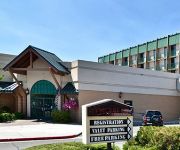
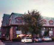
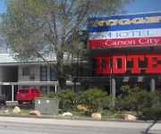
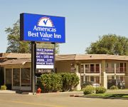
If you need a place to sleep, we compiled a list of available hotels close to the map centre further down the page.
Depending on your travel schedule, you might want to pay a visit to some of the following locations: Carson City, Virginia City, Minden, Reno and Yerington. To further explore this place, just scroll down and browse the available info.
Local weather forecast
Todays Local Weather Conditions & Forecast: 21°C / 69 °F
| Morning Temperature | 11°C / 52 °F |
| Evening Temperature | 18°C / 64 °F |
| Night Temperature | 11°C / 52 °F |
| Chance of rainfall | 0% |
| Air Humidity | 28% |
| Air Pressure | 1011 hPa |
| Wind Speed | Strong breeze with 18 km/h (11 mph) from East |
| Cloud Conditions | Scattered clouds, covering 35% of sky |
| General Conditions | Scattered clouds |
Monday, 20th of May 2024
15°C (60 °F)
9°C (48 °F)
Overcast clouds, moderate breeze.
Tuesday, 21st of May 2024
16°C (60 °F)
12°C (54 °F)
Sky is clear, fresh breeze, clear sky.
Wednesday, 22nd of May 2024
20°C (67 °F)
12°C (53 °F)
Sky is clear, strong breeze, clear sky.
Hotels and Places to Stay
Courtyard Carson City
GOLD DUST WEST CARSON CITY
Holiday Inn Express & Suites CARSON CITY
Hampton Inn - Suites Carson City
Carson City Plaza Hotel and Event Center
WYNDHAM GARDEN CARSON CITY MAX
HARDMAN HOUSE CARSON CITY
Rodeway Inn at Nevada State Capitol
THE NUGGET HOTEL IN CARSON CITY
AMERICAS BEST VALUE INN
Videos from this area
These are videos related to the place based on their proximity to this place.
Carson City Hop Jitterbug Lesson Review - Week 2 May 9, 2014
Quick review of Clay & Cullen's Jitterbug Lesson from May 9, 2014. Carson City Hop is a weekly dance every Friday night in Carson City, Nevada. Drop in lesson at 7 PM and dancing from 8 PM...
Carson City Hop Jitterbug Lesson Review - Week 3 May 16, 2014
Quick review of Clay & Cullen's Jitterbug Lesson from May 16, 2014. Carson City Hop is a weekly dance every Friday night in Carson City, Nevada. Drop in lesson at 7 PM and dancing from 8 PM...
Lens flare shot of Capital in Carson City, Nevada.
Cinematography equipment: http://www.videoslider.com Kickstarter: https://www.kickstarter.com/projects/dortch/autobot-timelapse-and-video-slider-tough-and-intel Purchase this clip here: (http://www...
Right pan shot of Carson City Capitol.
Cinematography equipment: http://www.videoslider.com Kickstarter: https://www.kickstarter.com/projects/dortch/autobot-timelapse-and-video-slider-tough-and-intel Purchase this clip here: (http://www...
Static shot of front of Capital building in Carson City, Nevada.
Cinematography equipment: http://www.videoslider.com Kickstarter: https://www.kickstarter.com/projects/dortch/autobot-timelapse-and-video-slider-tough-and-intel Purchase this clip here: (http://www...
Time-lapse of Capital Building of Carson City.
Cinematography equipment: http://www.videoslider.com Kickstarter: https://www.kickstarter.com/projects/dortch/autobot-timelapse-and-video-slider-tough-and-intel Purchase this clip here: (http://www...
Trip To Co Co Grave
This is a short clip of my Wife and I. We took a drive to Brunswick Canyon to visit the Greve of our Dog Coco. He died from antifreeze poisoning 10 years ago when the power company was doing...
Canyon River Run
Playing in Brunswick Canyon, located near Carson City, Nevada, in a Pioneer Flightstar with Pilot Al Mulford Sept 26th 2008.
Videos provided by Youtube are under the copyright of their owners.
Attractions and noteworthy things
Distances are based on the centre of the city/town and sightseeing location. This list contains brief abstracts about monuments, holiday activities, national parcs, museums, organisations and more from the area as well as interesting facts about the region itself. Where available, you'll find the corresponding homepage. Otherwise the related wikipedia article.
Indian Hills, Nevada
Indian Hills is a census-designated place (CDP) in Douglas County, Nevada, United States. It lies on the south side of the Carson City metropolitan area. The population was 5,627 at the 2010 census.
Ormsby County, Nevada
Ormsby County was a county of Nevada from 1861 until 1969. It contained Carson City, the county seat and later state capital, founded two years earlier. It was named after Major William M. Ormsby, one of the original settlers of Carson City, killed along with seventy-five other white men in 1860, in an unsuccessful attempt to subdue a perceived uprising of Paiute Indians near Pyramid Lake, Nevada, which was at the time part of Utah Territory.
Denver S. Dickerson
Denver Sylvester Dickerson (January 24, 1872 – November 28, 1925) was an American politician. He was the 11th Governor of Nevada from 1908 to 1911. A member of the Silver – Democratic coalition party, he had previously held office as the 13th Lieutenant Governor of Nevada from 1907 to 1908. During his governorship, Dickerson worked to reform the state prison system.
KTHX-FM
KTHX-FM is a commercial radio station located in Dayton, Nevada broadcasting to the Reno and Lake Tahoe area on 100.1 FM. KTHX-FM airs an adult album alternative music format branded as "The X".
Moonlite BunnyRanch
The Moonlite BunnyRanch (often misspelled Moonlight, though that is the correct spelling of the road on which it is addressed) is a legal, licensed brothel in Mound House, Nevada, United States, 6 miles east of Carson City. The ranch is owned and operated by Dennis Hof. The Love Ranch (previously known as the BunnyRanch Two), a separately licensed brothel, is located about a mile south of the Moonlite BunnyRanch, near two other brothels.
Carson High School (Carson City, Nevada)
Carson High School is a high school (grades 9–12) in Carson City, Nevada, United States.
Ormsby House
The Ormsby House is a hotel/casino in Carson City, Nevada. Originally opened in 1971, it closed in 2000 for extensive renovations. It was planned to reopen on July 4, 2001, but the opening date has been pushed back many times due to construction delays, and management changes. No re-opening date has been announced, as of April 8, 2009.
Nevada Assembly
The Nevada Assembly is the lower house of the Nevada Legislature, the state legislature of the US state of Nevada. The body consists of 42 members, elected to two-year terms from single-member districts. Each Assembly district contained approximately 64,299 people as of the 2010 census. Term limits, limiting assembly members to six 2-year terms (12 years), took effect in 2010. Twelve members of the Assembly were termed out with the 2010 election serving their last legislative session in 2011.
Nevada Senate
The Nevada Senate is the upper house of the Nevada Legislature, the state legislature of U.S. state of Nevada. The Senate currently (2012-2021) consists of 21 members from 21 districts. In the previous redistricting (2002-2011) there were 19 districts, two of which were multimember. Each senator represented approximately 128,598 as of the 2010 census. Article Four of The Nevada Constitution sets that Senators serve staggered four-year terms.
Kit Kat Guest Ranch
The Kit Kat Guest Ranch is a legal, licensed brothel located about 7 miles east of Carson City in the unincorporated town of Mound House, in Lyon County, at 51 Kit Kat Drive . It sits along the east side of a loop at the south end of Kit Kat Drive, which also is the home to two competing brothels: The Love Ranch and the Sagebrush Ranch. The name of this brothel is often shortened to the Kit Kat Ranch. It is one of the few brothels in Nevada to regularly feature porn stars.
Sagebrush Ranch
The Sagebrush Ranch is a legal, licensed brothel located about 7 miles east of Carson City, Nevada in the unincorporated town of Mound House, in Lyon County, at 50 Kit Kat Drive. It sits along the west side of a loop at the south end of Kit Kat Drive, which also is the home to two competing brothels: The Love Ranch and the Kit Kat Guest Ranch. The Sagebrush is now owned and operated by a Nevada corporation.
The Love Ranch
This article is about The Love Ranch, a legal Nevada brothel, formerly known as BunnyRanch Two (as well as under several variations of the name Kitty's). For the parent Moonlite BunnyRanch see this article. The Love Ranch (formerly the BunnyRanch Two) is a legal, licensed brothel located about 7 miles east of Carson City, Nevada in the unincorporated town of Mound House, in Lyon County, at 95 Kit Kat Drive.
Carson Airport
Carson Airport, also known as Carson City Airport, is a public use airport located three nautical miles (6 km) northeast of the central business district of Carson City, the capital of the U.S. state of Nevada. It is operated by the Carson City Airport Authority. According to the FAA's National Plan of Integrated Airport Systems for 2009–2013, it is categorized as a reliever airport. Although most U.S.
Nevada State Railroad Museum
The Nevada State Railroad Museum, located in Carson City, Nevada, preserves the railroad heritage of Nevada, including locomotives and cars of the famous Virginia and Truckee Railroad. Much of the museum equipment was obtained from Hollywood studios, where they were often featured in movies and television. The museum is operated by the Nevada Department of Tourism and Cultural Affairs.
KZTQ
KZTQ is a commercial radio station located in Sun Valley, Nevada, broadcasting to the Reno, Nevada area on 93.7 FM. KZTQ airs an adult hits music format branded as "Bob 93.7".
KNEV
KNEV is a commercial radio station located in Reno, Nevada, broadcasting on 95.5 FM. KNEV airs a Lite Rock music format branded as "Magic 95.5". The station rebroadcasts on translators at 92.1 FM in Winnemucca, Nevada, 99.3 FM in Battle Mountain, Nevada, and at 103.5 FM in Eureka, Nevada.
KBUL-FM
KBUL-FM is a commercial radio station located in Reno, Nevada, broadcasting to the Western Nevada and Lake Tahoe areas on 98.1 FM. KBUL-FM airs a country music format and is under ownership of Cumulus Media.
Jack C. Davis Observatory
The Jack C. Davis Observatory is an astronomical observatory at Western Nevada College in Carson City, Nevada. The facility has three telescopes: two 0.4 m reflecting telescopes and one 0.25 m reflector. One telescope is equipped with a spectrograph. Outside the building, a 0.12 m refractor has been installed under a robotic dome and is used for studying sunspots.
KNIS
KNIS is a radio station broadcasting a Contemporary Christian format. Licensed to Carson City, Nevada, USA, it serves the Reno area. The station is currently owned by Western Inspirational Broadcasters, Inc. and features programing from Salem Communications.
KCMY
KCMY (1300 AM with a translator K273AF at 102.5 FM serving Reno) is a radio station broadcasting a classic country format, branding itself as "My Country". Licensed to Carson City, Nevada, USA. The station is currently owned by The Evans Broadcast Company, Inc. and features programing from Fox News Radio. There is local news also
Nevada State Prison
Nevada State Prison (NSP) was a penitentiary located in Carson City. The prison was in continuous operation since its establishment in 1862 and was managed by the Nevada Department of Corrections. It was one of the oldest prisons still operating in the United States- The high security facility housed 219 inmates in September 2011. It was designed to hold 841 inmates and employs a staff of 211.
Nevada Public Utilities Commission
The Nevada Public Utilities Commission supervises and regulates the operation and maintenance of utility services in Nevada. The agency has two headquarters, one in Carson City and one in Las Vegas .
Eagle Valley (Nevada)
Eagle Valley is the area encompassing Carson City, Nevada. The valley was first settled during the California Gold Rush of 1848. The discovery of Nevada's Comstock Lode in 1859 established the economic importance of the area, which would become the site of the Nevada State Capitol.
Northern Nevada Correctional Center
Northern Nevada Correctional Center (NNCC) and Stewart Conservation Camp (SCC) are part of a prison complex located in Carson City. The correctional center was established in 1964 and is managed by the Nevada Department of Corrections. The medium security center housed 1,444 male and 9 female inmates as of September 2010. It is designed with a capacity for 1,619 inmates and employs a staff of 373 as of 2008.
Virginia and Truckee Railway Motor Car 22
Virginia and Truckee Railway Motor Car 22, also called McKeen Motor Car 70, is a gasoline-powered railcar at the Nevada State Railroad Museum in Carson City in the U.S. state of Nevada. It was built for the Virginia and Truckee Railroad in 1910 by the McKeen Motor Car Company. Motor Car 22 was operated by the Virginia and Truckee until 1945, when it was sold off and became a diner until 1955.


