Safety Score: 2,7 of 5.0 based on data from 9 authorites. Meaning we advice caution when travelling to United States.
Travel warnings are updated daily. Source: Travel Warning United States. Last Update: 2024-05-06 08:04:52
Explore North Highlands
North Highlands in Sacramento County (California) with it's 42,694 inhabitants is located in United States about 2,363 mi (or 3,804 km) west of Washington DC, the country's capital.
Local time in North Highlands is now 11:02 PM (Monday). The local timezone is named America / Los Angeles with an UTC offset of -7 hours. We know of 8 airports in the wider vicinity of North Highlands, of which 4 are larger airports. The closest airport in United States is Sacramento International Airport in a distance of 12 mi (or 19 km), West. Besides the airports, there are other travel options available (check left side).
Also, if you like golfing, there are multiple options in driving distance. We found 4 points of interest in the vicinity of this place. If you need a place to sleep, we compiled a list of available hotels close to the map centre further down the page.
Depending on your travel schedule, you might want to pay a visit to some of the following locations: Sacramento, Auburn, Woodland, Marysville and Yuba City. To further explore this place, just scroll down and browse the available info.
Local weather forecast
Todays Local Weather Conditions & Forecast: 20°C / 68 °F
| Morning Temperature | 10°C / 49 °F |
| Evening Temperature | 19°C / 67 °F |
| Night Temperature | 13°C / 56 °F |
| Chance of rainfall | 0% |
| Air Humidity | 48% |
| Air Pressure | 1016 hPa |
| Wind Speed | Gentle Breeze with 8 km/h (5 mph) from South |
| Cloud Conditions | Few clouds, covering 17% of sky |
| General Conditions | Few clouds |
Tuesday, 7th of May 2024
23°C (73 °F)
16°C (60 °F)
Sky is clear, moderate breeze, clear sky.
Wednesday, 8th of May 2024
27°C (81 °F)
19°C (66 °F)
Sky is clear, light breeze, clear sky.
Thursday, 9th of May 2024
29°C (84 °F)
20°C (68 °F)
Sky is clear, light breeze, clear sky.
Hotels and Places to Stay
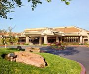
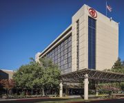
DoubleTree by Hilton Sacramento
Hilton Sacramento Arden West
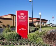
Crowne Plaza SACRAMENTO NORTHEAST
La Quinta Inn Sacramento North
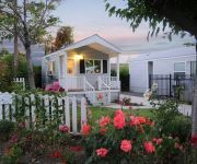
Arden Acres Executive Suites and Cottages
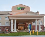
Holiday Inn Express & Suites SACRAMENTO NE CAL EXPO
Hampton Inn - Suites Sacramento-Cal Expo CA
Canterbury Village Hotel & Suites
SUPER 8 SACRAMENTO
The Greens Hotel
Videos from this area
These are videos related to the place based on their proximity to this place.
UP 844 west of Antelope, California
Union Pacific 844 along Roseville Road west of Antelope, California on 24 April 2009. 844 ran from Stockton to Roseville on the 24th and this shows it almost at the end of its run. Antelope...
(Star Smiles Dental Group of Antelope) A Antelope Dentist
http://www.fastlaunchsolutions.com/Site/StarSmilesDentalGroup/) is a Antelope Dentist. We care for our consumers and we are open until 7PM nighttime and closed on Sundays. Please subscribe...
March 2015 - Packet Radio (Raw Video)
At our March 3rd 2015 River City ARCS meeting, ARRL Sacramento Valley SEC Greg Kruckewitt KG6SJT presented the third in our Mini-series "Get on the Air with Digital" - an introduction and live...
April 2015 - Hidden Transmitter (Fox) Hunting
At our April 7, 2015 River City ARCS General Meeting, Sacramento Sheriff Amateur Radio Project (SHARP) President Rick McCusker WF6O presented an Introduction to Fox Hunting. In this competitive.
February 2013 - Cheap and Easy Software Defined Radio
Sample of reception with the SDR Sharp freeware program and the $20 RTL2832 - E4000 based Newsky TV301U USB dongle receiver demonstrated at the February 5, 2013 meeting of the River City ...
April 2013 Tri-Band Portable HF Antenna
At the April 2, 2013 River City ARCS meeting, Mike Abernathy, NM3S, presented a homebrew portable tri-band trap vertical antenna project for 10, 15 and 20 meters suitable for Field Day and...
RTL-SDR as a $20 Spectrum Analyzer
The $20 RTL2832 - E4000 based Newsky TV301U USB dongle receiver can be used as a Poor Man's Spectrum Analyzer. The SDR# program is zoomed to display about 20 kHz of RF spectrum ...
North Highlands Community Project - Part 1
Live in North Highlands, Antelope, Foothill Farms? Great! Share this video, then grab your camera and help out. See an unpainted wall? Broken down bench? Messy park? Snap a quick pic and send...
Bed Bug Spraying in North Highlands CA 916-226-4836 Free Bed Bug Inspection
Visit http://northhighlandspestcontrol.com/ Bed Bug Treatments by Official Pest Control in North Highlands CA 916-226-4836 Free Bed Bug Inspection Serving Northern California since 2000 with...
Pest Control North Highlands CA 916-226-4836 Animal & Rodent Removal
Visit: http://northhighlandspestcontrol.com/ Pest Control 916-226-4836 North Highlands CA 95660 Official Pest Control Serving Sacramento County California Since 2000. Pest control company,...
Videos provided by Youtube are under the copyright of their owners.
Attractions and noteworthy things
Distances are based on the centre of the city/town and sightseeing location. This list contains brief abstracts about monuments, holiday activities, national parcs, museums, organisations and more from the area as well as interesting facts about the region itself. Where available, you'll find the corresponding homepage. Otherwise the related wikipedia article.
Foothill Farms, California
Foothill Farms is a census-designated place (CDP) and unincorporated community in Sacramento County, California, USA. It is part of the Sacramento–Arden-Arcade–Roseville Metropolitan Statistical Area. The population was 33,121 at the 2010 census, up from 17,426 at the 2000 census. Foothill Farms is part of the greater North Highlands-Foothill Farms community, and comprises the zip codes 95841 and 95842.
North Highlands, California
North Highlands is a census-designated place (CDP) in Sacramento County, California, United States. It is part of the Sacramento–Arden-Arcade–Roseville Metropolitan Statistical Area. The population was 42,694 at the 2010 census, down from 44,187 at the 2000 census.
McClellan Air Force Base
McClellan Air Force Base (1935–2001) is a former United States Air Force base located in the North Highlands area of Sacramento County, 7 miles northeast of Sacramento, California. For the vast majority of its operational lifetime, McClellan was a logistics and maintenance facility for a wide variety of military aircraft, equipment and supplies, primarily under the cognizance of the Air Force Logistics Command (AFLC) and later the Air Force Materiel Command (AFMC).
McClellan Airfield
For the United States Air Force use of this faciity before 2001, see McClellan Air Force Base Not to be confused with McClellan-Palomar Airport. McClellan Airfield, known officially as McClellan Airport, is a county-owned public-use airport located six miles (10 km) northeast of the central business district of Sacramento, a city in Sacramento County, California, United States. The airport is on the former site of McClellan Air Force Base, which existed as a military base from 1939 to 2000.
Watt/I-80 (Sacramento RT)
The Watt/I-80 is a side platformed Sacramento RT light rail station in North Highlands, California, United States. The station was opened on March 12, 1987, and is operated by the Sacramento Regional Transit District. As part of the Blue Line, it has service to Downtown Sacramento, South Sacramento, California State University, Sacramento, Rancho Cordova, Gold River and Folsom.
Aerospace Museum of California
The Aerospace Museum of California is an aviation museum located in North Highlands, California on the grounds of the former McClellan Air Force Base. It features displays of authentic military and civilian aircraft as well as space vehicle replicas. It preserves the history and mission of this former base as well as those of neighboring bases like Beale (active) and Mather (closed) Air Force Bases. McClellan Air Force Base closed in 2001 and became McClellan Airfield, a civil aviation airport.
Epic Bible College
Epic Bible College (formerly known as Trinity Life Bible College or TLBC) is a private Bible college located in Sacramento, CA.
Antelope High School
Antelope High School is one the of the five high schools in the Roseville Joint Union High School District. This school is located at 7801 Titan Drive, in Antelope, California, United States. Antelope High School opened up for 9th and 10th grade students at the beginning of the 2008-2009 school year. From the year of 2010- all grade levels were embarked. Class of 2011 Antelope students had attended Oakmont High School or Center High School. Class of 2011 is the first graduating class.


