Safety Score: 2,7 of 5.0 based on data from 9 authorites. Meaning we advice caution when travelling to United States.
Travel warnings are updated daily. Source: Travel Warning United States. Last Update: 2024-05-20 08:01:38
Discover Soda Springs
Soda Springs in Placer County (California) is a town in United States about 2,299 mi (or 3,701 km) west of Washington DC, the country's capital city.
Current time in Soda Springs is now 07:26 PM (Monday). The local timezone is named America / Los Angeles with an UTC offset of -7 hours. We know of 11 airports near Soda Springs, of which 5 are larger airports. The closest airport in United States is Lake Tahoe Airport in a distance of 30 mi (or 49 km), South-East. Besides the airports, there are other travel options available (check left side).
Also, if you like playing golf, there are a few options in driving distance. We discovered 1 points of interest in the vicinity of this place. Looking for a place to stay? we compiled a list of available hotels close to the map centre further down the page.
When in this area, you might want to pay a visit to some of the following locations: Carson City, Reno, Downieville, Minden and Virginia City. To further explore this place, just scroll down and browse the available info.
Local weather forecast
Todays Local Weather Conditions & Forecast: 15°C / 59 °F
| Morning Temperature | 1°C / 35 °F |
| Evening Temperature | 16°C / 60 °F |
| Night Temperature | 5°C / 42 °F |
| Chance of rainfall | 0% |
| Air Humidity | 17% |
| Air Pressure | 1014 hPa |
| Wind Speed | Gentle Breeze with 8 km/h (5 mph) from East |
| Cloud Conditions | Clear sky, covering 2% of sky |
| General Conditions | Sky is clear |
Tuesday, 21st of May 2024
17°C (63 °F)
5°C (42 °F)
Sky is clear, moderate breeze, clear sky.
Wednesday, 22nd of May 2024
15°C (59 °F)
4°C (40 °F)
Light rain, gentle breeze, broken clouds.
Thursday, 23rd of May 2024
16°C (62 °F)
4°C (39 °F)
Sky is clear, moderate breeze, clear sky.
Hotels and Places to Stay
Squaw Valley Lodge
Donner Lake Village
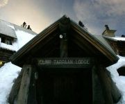
CLAIR TAPPAAN LODGE
Videos from this area
These are videos related to the place based on their proximity to this place.
California Zephyr rouding Stanford Curve
The California Zephyr rounding Stanford Curve as it leaves the truckee area which you can see from the top of the curve. ©SF3751.
AMTRAK 6 Passing UP 844 at Norden
Old and new together at Norden, UP 844 stopped to let Amtrak #6 get ahead of it on the way over to Truckee and then Sparks. Kind of a special look at what once was and what now is in the way...
UP 844 Departing From East Norden at Donner Pass
Heading into "The Big Hole" tunnel 41 through Donner Pass today. Amtrak #6 passed 844 here and then 844 followed them into Truckee.
Rock Me Baby played by Spotted Dog
"Rock Me Baby" played by Spotted Dog at Sugar Bowl in Norden CA on 3/27/10. Visit www.spotteddogmusic.com for more!
Donner Pass Snow Sheds 4 wheeling through the abandoned sheds
See link at bottom. Video shot going from the East end of the old Union Pacific snow sheds that crossed Donner Summit. This route was replaced by a tunnel called "The Big Hole" that eliminated...
Downhill Kick-Turn for Backcountry Skiers
The key points of doing a downhill kick-turn when backcountry skiing.
Best of Sugar Bowl ski season 2013-2014
a compilation of all the best snow of one of the worst ski seasons in Sugar Bowl history.
Fun on Donner Pass
This was just PART of a truly awesome day. Check out the whole thing!!! http://www.youtube.com/watch?v=hqCB7sIWu8Q.
Videos provided by Youtube are under the copyright of their owners.
Attractions and noteworthy things
Distances are based on the centre of the city/town and sightseeing location. This list contains brief abstracts about monuments, holiday activities, national parcs, museums, organisations and more from the area as well as interesting facts about the region itself. Where available, you'll find the corresponding homepage. Otherwise the related wikipedia article.
Mount Lincoln
American River
The American River (Río de los Americanos during the Mexican-ruled period before 1846) is a California watercourse river system which runs from the crest of the Sierra Nevada mountain range to its confluence with the Sacramento River in Sacramento, California. The Sacramento River continues to eventually empty into the San Francisco Bay and the Pacific Ocean at San Francisco, California. The American River flows entirely within California.


