Safety Score: 2,7 of 5.0 based on data from 9 authorites. Meaning we advice caution when travelling to United States.
Travel warnings are updated daily. Source: Travel Warning United States. Last Update: 2024-05-20 08:01:38
Explore Union Mills
Union Mills in Nevada County (California) is a city in United States about 2,286 mi (or 3,680 km) west of Washington DC, the country's capital.
Local time in Union Mills is now 10:44 PM (Monday). The local timezone is named America / Los Angeles with an UTC offset of -7 hours. We know of 11 airports in the vicinity of Union Mills, of which 5 are larger airports. The closest airport in United States is Reno Tahoe International Airport in a distance of 21 mi (or 33 km), North-East. Besides the airports, there are other travel options available (check left side).
There is one Unesco world heritage site nearby. It's Yosemite National Park in a distance of 144 mi (or 232 km), South-East. Also, if you like golfing, there are multiple options in driving distance. If you need a place to sleep, we compiled a list of available hotels close to the map centre further down the page.
Depending on your travel schedule, you might want to pay a visit to some of the following locations: Reno, Carson City, Virginia City, Minden and Downieville. To further explore this place, just scroll down and browse the available info.
Local weather forecast
Todays Local Weather Conditions & Forecast: 15°C / 59 °F
| Morning Temperature | 1°C / 35 °F |
| Evening Temperature | 16°C / 60 °F |
| Night Temperature | 5°C / 42 °F |
| Chance of rainfall | 0% |
| Air Humidity | 17% |
| Air Pressure | 1014 hPa |
| Wind Speed | Gentle Breeze with 8 km/h (5 mph) from East |
| Cloud Conditions | Clear sky, covering 2% of sky |
| General Conditions | Sky is clear |
Tuesday, 21st of May 2024
17°C (63 °F)
5°C (42 °F)
Sky is clear, moderate breeze, clear sky.
Wednesday, 22nd of May 2024
15°C (59 °F)
4°C (40 °F)
Light rain, gentle breeze, broken clouds.
Thursday, 23rd of May 2024
16°C (62 °F)
4°C (39 °F)
Sky is clear, moderate breeze, clear sky.
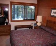
Hotels and Places to Stay
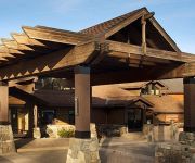
Tahoe Mountain Resorts Lodging Old Greenwood
BEST WESTERN PLUS TRUCKEETAHOE
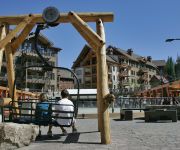
Northstar California Resort
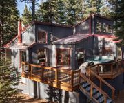
Northstar Getaway Pet Friendly Hot Tub by RedAwning
Rocky Point Northstar Condo by RedAwning
Mill Camp by RedAwning
Redlight Historic Bunk Hotel and Speakeasy
Videos from this area
These are videos related to the place based on their proximity to this place.
Calyn dirt biking at Boca Reservoir Truckee, CA
Calyn's last ride on his first day dirt biking at Boca Reservoir Truckee, CA. Until this ride he was learning on a 125, in this film he is riding a 230 for the first time.
Truckee Bike Park Pump Track Edit
The Truckee Bike Park Project is a grass roots effort by the Tahoe mountain biking community to build a world class bike park in Truckee, California. It's free and located at the Riverview...
Truckee Touch and Go
GoPro Hero 2 video of a touch and go landing at the Truckee, California airport. Aircraft is an experimental trike. Shot in 1080p, 30 fps, and 127 degree FOV.
I-80 Eastbound, California
Driving east on I-80 among the mountains, about 10 miles or so west of the Nevada state line.
Cedar House Conference Center
The Cedar House Sport Hotel is the ideal place for meetings, conferences and special events. Located in Truckee, CA just minutes from Lake Tahoe and the region's world class ski resorts. For...
Videos provided by Youtube are under the copyright of their owners.
Attractions and noteworthy things
Distances are based on the centre of the city/town and sightseeing location. This list contains brief abstracts about monuments, holiday activities, national parcs, museums, organisations and more from the area as well as interesting facts about the region itself. Where available, you'll find the corresponding homepage. Otherwise the related wikipedia article.
Truckee Tahoe Airport
Truckee Tahoe Airport is a public use airport located two nautical miles (3.7 km) east of the central business district of Truckee, California, United States. The airport is situated in both Nevada County and Placer County. It is owned by Truckee Tahoe Airport District, a bi-county special district. According to the FAA's National Plan of Integrated Airport Systems for 2009–2013, it is categorized as a general aviation airport. Although many U.S.
Boca Reservoir
Boca Reservoir is an artificial lake in the Tahoe National Forest of Nevada County, California, created by the construction of Boca Dam across Little Truckee River, approximately 10 km northeast of Truckee.
Martis Valley
Martis Valley is a geographic area of 70 square miles in the United States, extending northward from the North Shore of Lake Tahoe, California, to the west of the California-Nevada border. It is located in Placer and Nevada Counties and is bisected by Martis Creek which flows north to the Truckee River.
Prosser Creek Dam
Prosser Creek Dam (National ID # CA10179) is a dam in Placer County, California. The earthen and rockfill dam was constructed from 1959 to 1962 by the United States Bureau of Reclamation with a height of 163 feet and 1830 feet long at its crest. It impounds Prosser Creek for irrigation storage and winter and spring flood control, part of the Bureau's larger Washoe Project in the Tahoe region. The dam is owned and operated by the Bureau.


