Safety Score: 2,7 of 5.0 based on data from 9 authorites. Meaning we advice caution when travelling to United States.
Travel warnings are updated daily. Source: Travel Warning United States. Last Update: 2024-05-13 08:03:22
Delve into Relief
Relief in Nevada County (California) is a town located in United States about 2,325 mi (or 3,742 km) west of Washington DC, the country's capital town.
Time in Relief is now 08:37 PM (Monday). The local timezone is named America / Los Angeles with an UTC offset of -7 hours. We know of 11 airports closer to Relief, of which 5 are larger airports. The closest airport in United States is Gansner Field in a distance of 41 mi (or 65 km), North. Besides the airports, there are other travel options available (check left side).
Also, if you like the game of golf, there are some options within driving distance. In need of a room? We compiled a list of available hotels close to the map centre further down the page.
Since you are here already, you might want to pay a visit to some of the following locations: Nevada City, Downieville, Auburn, Quincy and Placerville. To further explore this place, just scroll down and browse the available info.
Local weather forecast
Todays Local Weather Conditions & Forecast: 26°C / 78 °F
| Morning Temperature | 14°C / 57 °F |
| Evening Temperature | 22°C / 71 °F |
| Night Temperature | 15°C / 59 °F |
| Chance of rainfall | 0% |
| Air Humidity | 28% |
| Air Pressure | 1010 hPa |
| Wind Speed | Gentle Breeze with 6 km/h (4 mph) from East |
| Cloud Conditions | Clear sky, covering 8% of sky |
| General Conditions | Sky is clear |
Tuesday, 14th of May 2024
27°C (80 °F)
17°C (62 °F)
Broken clouds, gentle breeze.
Wednesday, 15th of May 2024
27°C (81 °F)
16°C (61 °F)
Sky is clear, gentle breeze, clear sky.
Thursday, 16th of May 2024
27°C (80 °F)
15°C (59 °F)
Sky is clear, light breeze, clear sky.
Hotels and Places to Stay
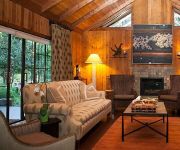
Harmony Ridge Lodge
Videos from this area
These are videos related to the place based on their proximity to this place.
Humbug Creek Waterfalls, Malakoff Diggins
Humbug Creek, which flows through Malakoff Diggins State Historic Park, has several waterfalls with unique sculpted rock from the water. This is compilation of some of the rushing water over...
Where the Pavement Ends- Dual Sport Loop Nevada City to North Bloomfield
Dual Sport loop Travelogue approx 40 miles R.T. on plated XR600- Dec 09. Temp low 40's. Canon Powershot camera.
Driving Bloomfield/Graniteville Road in the snow
This was our first trip down Bloomfield/Graniteville road in the snow.
A Bridge to Forest City, CA - Forest Trails Alliance (Short Edit)
Forest City,CA is located just above Downieville, CA on the Pliocene Ridge. It is a historic mining town that hosted thousands of people during the Gold Rush and has miles of old pikes, flumes...
Midwinter Motorcycle Ride -Nevada City to Alleghany, Ca.
Jan 2010. Nevada City, Pike, Forest City, Alleghany to "Casey's Place" Honda Gold Wing, BMW twin, Electra Glide Sport. Temp mid 40's, cloudy. Tune-"Hangman's Reel"
11702 Incline Shaft Rd Nevada City CA 95959
View full virtual tour: http://www.justsnooping.com/tours/2725495/
11809 Caroline Lane Nevada City CA 95959
View full virtual tour: http://www.justsnooping.com/tours/2533207/
Videos provided by Youtube are under the copyright of their owners.


