Safety Score: 2,7 of 5.0 based on data from 9 authorites. Meaning we advice caution when travelling to United States.
Travel warnings are updated daily. Source: Travel Warning United States. Last Update: 2024-05-20 08:01:38
Delve into Bear River Pines
Bear River Pines in Nevada County (California) is a town located in United States about 2,334 mi (or 3,756 km) west of Washington DC, the country's capital town.
Time in Bear River Pines is now 12:52 AM (Tuesday). The local timezone is named America / Los Angeles with an UTC offset of -7 hours. We know of 11 airports closer to Bear River Pines, of which 5 are larger airports. The closest airport in United States is Sacramento International Airport in a distance of 47 mi (or 75 km), South-West. Besides the airports, there are other travel options available (check left side).
Also, if you like the game of golf, there are some options within driving distance. In need of a room? We compiled a list of available hotels close to the map centre further down the page.
Since you are here already, you might want to pay a visit to some of the following locations: Nevada City, Auburn, Downieville, Placerville and Marysville. To further explore this place, just scroll down and browse the available info.
Local weather forecast
Todays Local Weather Conditions & Forecast: 24°C / 75 °F
| Morning Temperature | 11°C / 51 °F |
| Evening Temperature | 21°C / 70 °F |
| Night Temperature | 13°C / 55 °F |
| Chance of rainfall | 0% |
| Air Humidity | 20% |
| Air Pressure | 1012 hPa |
| Wind Speed | Gentle Breeze with 8 km/h (5 mph) from East |
| Cloud Conditions | Clear sky, covering 3% of sky |
| General Conditions | Sky is clear |
Tuesday, 21st of May 2024
23°C (74 °F)
14°C (57 °F)
Sky is clear, gentle breeze, clear sky.
Wednesday, 22nd of May 2024
21°C (70 °F)
13°C (55 °F)
Overcast clouds, light breeze.
Thursday, 23rd of May 2024
23°C (73 °F)
11°C (52 °F)
Sky is clear, gentle breeze, clear sky.
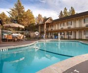
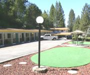
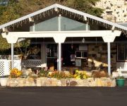
Hotels and Places to Stay
BEST WESTERN GOLD COUNTRY INN -GRASS VLY
NEVADA CITY INN
Golden Chain Resort Motel
HOLIDAY LODGE GRASS
Videos from this area
These are videos related to the place based on their proximity to this place.
CDF Air Attack S-2 Trackers & OV-10 at Grass Valley
Cal Fire S-2 Tracker tankers 88 and 89 , and OV-10 230 returning to their base at Grass Valley.
Paris London Travel Journal 2
This is a hand constructed book made from tea-dyed paper, handmade papers, ephemera, travel brochures, painted papers, sewn papers, office supplies like clear binder-pockets, and more. I love...
Aerial Tour of Historic Colfax Calif. - Demunseed
Local artist/photographer takes you along on aerial tour of this small Sierra Nevada Town. Subscribe Now! I'm giving away GREAT prizes to random Subscribers! (We've ALREADY given away over...
Bear River Between Colfax and Grass Valley
Bear river bridge on hwy 174 between colfax,ca and grass valley, ca in beautiful Nevada County. The is the Bear River below Rollins Lake.
Truckee to Colfax over Donner Pass on AMTRAK Train #5
In approximate sequence, this leg covers Truckee, Stanford Flats, Donner Lake, Norden, Soda Springs, Emigrant Gap, Gold Run, and the entrance to Colfax are covered. Sorry to say that the many...
Bear River @ Colfax | Kyle Uclary TD run (Oct. 17, 2014)
Game-tying 12 yard touchdown run by Bear River Bruins running back Kyle Uclary in a Pioneer Valley League football game at the Colfax Falcons. After scoring, the Bruins' Ben O'Lena kicked the...
Colfax train Derailment Removing the Cars
Finally had equipment in place to remove the derailed cars and the containers on them. The entire route over Donner Pass was shut down for about 9 hours while this mess was partially cleaned...
Trains at Cape Horn near Colfax, CA
Two westbound trains at Cape Horn - one on the outside track, the other through the tunnel.
Colfax to Truckee on AMTRAK Train #6
Train 5 leaves and there's about an hour wait around Colfax for Train 6. Train six arrives at the station.Recorded staying on the right hand side, generally facing upslope, so there's not much...
Colfax Derailment Down Town Crossing
Positioning the CAT equipment from Jim Dobbas to remove the damaged cars.
Videos provided by Youtube are under the copyright of their owners.
Attractions and noteworthy things
Distances are based on the centre of the city/town and sightseeing location. This list contains brief abstracts about monuments, holiday activities, national parcs, museums, organisations and more from the area as well as interesting facts about the region itself. Where available, you'll find the corresponding homepage. Otherwise the related wikipedia article.
Rollins Dam
Rollins Dam (National ID # CA00255) is a dam on the border of Nevada and Placer Counties in northern California. The earthen dam was constructed in 1965 by the Nevada Irrigation District, with a height of 228 feet, and a length of 1840 feet at its crest. It impounds the Bear River, a tributary of the Feather River, for hydropower, flood control, irrigation water storage, and municipal water use. The dam is one of the ten facilities owned and operated by the Nevada Irrigation District.


