Safety Score: 2,7 of 5.0 based on data from 9 authorites. Meaning we advice caution when travelling to United States.
Travel warnings are updated daily. Source: Travel Warning United States. Last Update: 2024-05-16 08:19:50
Delve into Castle Rock Springs
Castle Rock Springs in Lake County (California) is located in United States about 2,432 mi (or 3,914 km) west of Washington DC, the country's capital town.
Current time in Castle Rock Springs is now 06:14 PM (Thursday). The local timezone is named America / Los Angeles with an UTC offset of -7 hours. We know of 8 airports close to Castle Rock Springs, of which 4 are larger airports. The closest airport in United States is Sacramento International Airport in a distance of 61 mi (or 98 km), East. Besides the airports, there are other travel options available (check left side).
Also, if you like playing golf, there are some options within driving distance. If you need a hotel, we compiled a list of available hotels close to the map centre further down the page.
While being here, you might want to pay a visit to some of the following locations: Santa Rosa, Lakeport, Ukiah, Napa and San Rafael. To further explore this place, just scroll down and browse the available info.
Local weather forecast
Todays Local Weather Conditions & Forecast: 29°C / 83 °F
| Morning Temperature | 13°C / 56 °F |
| Evening Temperature | 23°C / 74 °F |
| Night Temperature | 16°C / 60 °F |
| Chance of rainfall | 0% |
| Air Humidity | 34% |
| Air Pressure | 1010 hPa |
| Wind Speed | Light breeze with 3 km/h (2 mph) from North-East |
| Cloud Conditions | Clear sky, covering 0% of sky |
| General Conditions | Sky is clear |
Friday, 17th of May 2024
27°C (80 °F)
10°C (51 °F)
Sky is clear, gentle breeze, clear sky.
Saturday, 18th of May 2024
27°C (81 °F)
14°C (56 °F)
Sky is clear, gentle breeze, clear sky.
Sunday, 19th of May 2024
27°C (81 °F)
15°C (59 °F)
Sky is clear, light breeze, clear sky.
Hotels and Places to Stay
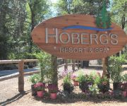
Hoberg's Resort & Spa
Videos from this area
These are videos related to the place based on their proximity to this place.
San Diego MTS Trolley ride from County Center/Little Italy to Middletown - View of SAN runway
May 20 2014 2:45pm View of the San Diego International Airport from the Trolley.
Middletown Days Ranch Rodeo 2012 Part Two
The Middletown Days celebration is organized to raise money to build, develop and maintain the park for the people of Middletown.
Soaring Flight at Crazy Creek Gliderport
In the mid to late 1990's I flew gliders, mainly over Lake and Napa counties in California. This is one such flight out of Crazy Creek Gliderport in Middletown, Lake County. In the last third...
10650 Gifford Springs Road, Cobb CA
Breathtaking property nestled among the majestic trees atop Cobb Mountain. Minutes from a 9-hole golf course, Napa, and Clear Lake. This structural masterpiece provides over 5300 square feet...
Climbing Cobb Mountain: Davis Double Century 2012
Quick sample of the video I shot at yesterday's Davis Double Century. Cobb Mountain is a tough climb!
2012 Swarming Ants
Came across this mound of carpenter ants swarming outside their mound. This was on a cold morning up in Boggs demonstration forest near the town of Cobb, CA. Definitely watch this in HD....
How to make at least $1000 per month while living anywhere worldwide
http://www.amazon.com/least-living-anywhere-worldwide-ebook/dp/B005HKD83O/ Download on Amazon now! 9 to 5, 9-5, work, job opportunities, jobs hiring, work, travel, computer...
The Pine Grove Inn...
http://www.tourfactory.com/s733310/r_www.youtube.com ----- For more information, contact: Lori Vernon Gagetta, 707 967-4650, Coldwell Banker - Brokers of the Valley ----- The Pine Grove Inn...
Videos provided by Youtube are under the copyright of their owners.
Attractions and noteworthy things
Distances are based on the centre of the city/town and sightseeing location. This list contains brief abstracts about monuments, holiday activities, national parcs, museums, organisations and more from the area as well as interesting facts about the region itself. Where available, you'll find the corresponding homepage. Otherwise the related wikipedia article.
The Geysers
The Geysers is a complex of 22 geothermal power plants, drawing steam from more than 350 wells, located in the Mayacamas Mountains 72 mi (116 km) north of San Francisco, California. The largest in the world, the Geysers has 1517 MW of active installed capacity with an average production factor of 63%. Calpine Corporation operates and owns 19 of the 22 active plants in the Geysers and is currently the United States' largest producer of geothermal energy.
Cobb Mountain
Cobb Mountain is the tallest mountain in the Mayacamas Mountains of California. Its 4720+ feet, (1439+ m) main summit is located in Lake County, west of the town of Cobb. Like nearby Mount Saint Helena, Cobb Mountain is tall enough to receive winter snowfall. The mountain also has a sub-peak named Cobb Mountain – Southwest Peak with an elevation of about 4480+ feet, (1366+ m); Southwest Peak lies on the Sonoma-Lake county line and is the highest point in Sonoma County.


