Safety Score: 2,7 of 5.0 based on data from 9 authorites. Meaning we advice caution when travelling to United States.
Travel warnings are updated daily. Source: Travel Warning United States. Last Update: 2024-05-20 08:01:38
Discover Marble Mountain
Marble Mountain in El Dorado County (California) is a town in United States about 2,346 mi (or 3,776 km) west of Washington DC, the country's capital city.
Current time in Marble Mountain is now 10:44 PM (Monday). The local timezone is named America / Los Angeles with an UTC offset of -7 hours. We know of 10 airports near Marble Mountain, of which 4 are larger airports. The closest airport in United States is Sacramento International Airport in a distance of 30 mi (or 49 km), West. Besides the airports, there are other travel options available (check left side).
Also, if you like playing golf, there are a few options in driving distance. We discovered 2 points of interest in the vicinity of this place. Looking for a place to stay? we compiled a list of available hotels close to the map centre further down the page.
When in this area, you might want to pay a visit to some of the following locations: Placerville, Auburn, Jackson, Sacramento and San Andreas. To further explore this place, just scroll down and browse the available info.
Local weather forecast
Todays Local Weather Conditions & Forecast: 26°C / 78 °F
| Morning Temperature | 12°C / 54 °F |
| Evening Temperature | 24°C / 75 °F |
| Night Temperature | 15°C / 58 °F |
| Chance of rainfall | 0% |
| Air Humidity | 20% |
| Air Pressure | 1012 hPa |
| Wind Speed | Light breeze with 5 km/h (3 mph) from East |
| Cloud Conditions | Clear sky, covering 2% of sky |
| General Conditions | Sky is clear |
Tuesday, 21st of May 2024
25°C (78 °F)
16°C (60 °F)
Sky is clear, light breeze, clear sky.
Wednesday, 22nd of May 2024
24°C (75 °F)
13°C (55 °F)
Overcast clouds, light breeze.
Thursday, 23rd of May 2024
25°C (76 °F)
12°C (53 °F)
Sky is clear, gentle breeze, clear sky.
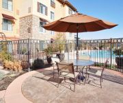
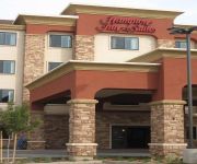
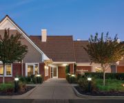
Hotels and Places to Stay
Holiday Inn Express & Suites EL DORADO HILLS
Fairfield Inn & Suites Sacramento Folsom
Hampton Inn - Suites Folsom
Courtyard Sacramento Folsom
Residence Inn Sacramento Folsom
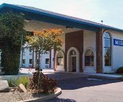
Quality Inn & Suites Cameron Park
MOTEL 6 CAMERON PARK
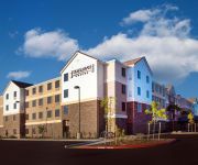
Staybridge Suites SACRAMENTO - FOLSOM
Videos from this area
These are videos related to the place based on their proximity to this place.
4293 Arenzano Way, El Dorado Hills
Gorgeous Serrano, El Dorado Hills home w/ 4 bedrooms, 3 bathrooms, 3377 sq. ft. Beautiful hardwood floors, designer paint & fixtures, chef's kitchen w/ stain...
Sky dancing at dusk with the Xieda 9958 in El Dorado Hills, CA
"This Park Is Mine" Just me flying the Xieda 9958, 4 channel, 2.4ghz at dusk at my local park. No mods other than using a new Turnigy NANO-TECH 3.7v 160mah 2...
SOLD | Connie Barnes | 3348 Chasen Dr., Cameron Park CA
Dare to Compare! Neighborhood, Features, Construction, Design, Materials, $/SqFt! This Custom design blends Style and Comfort while featuring almost 3300 sq.ft. of on the main floor with a...
Find Reliable Real Estate Agent Testimonials Here - El Dorado Hills-Folsom-Placer County-Granite Bay
OakTree Real Estate Services is a boutique real estate company specializing in the El Dorado Hills, Granite Bay & North East Sacramento County area of Northern California. Jill Berni, Broker/Owner...
Listed by Connie Barnes | 212 Tarquina Ct. SERRANO | El Dorado Hills, CA
http://conniebarnes.com/212-tarquina-ct/ Cozy Serrano residence situated on a quiet cul-de-sac offers a private rear yard with a beautiful salt water ready swimming pool. Close proximity to...
bsaoc 2010 ml part 1.
Part one of the BSA Owner's Club Of Northen California's "Motherlode Ride". May 5th 2010. Starts and ends at the Starbucks parking lot on Latrobe road in Eldorado Hills. 100 miles through...
Fundamental Jiu Jitsu in El Dorado Hills, near Cameron Park
Jiu-Jitsu students of El Dorado Hills Brazilian Jiu Jitsu train on a Friday evening class at EDH BJJ. The fundamental jiujitsu class is designed to help new students learn the necessary techniques...
First Day of 2014, First Jiu-Jitsu Workout. Jiu-Jitsu / Martial Arts for Kids and Adults
If you have an interest in martial arts classes for yourself or a child, you can do no better than travel to El Dorado Hills BJJ (Brazilian Jiu-Jistu, for classes under the knowledgable, kind,...
Open Guard Private Lesson with Eliot Kelly at El Dorado Hills Brazilian Jiu Jitsu
Matt, visiting from Australia worked on a few open guard strategies with Eliot while on holiday. Matt is a California native who now lives in Sydney and enjoys training jiujitsu on a daily...
Videos provided by Youtube are under the copyright of their owners.
Attractions and noteworthy things
Distances are based on the centre of the city/town and sightseeing location. This list contains brief abstracts about monuments, holiday activities, national parcs, museums, organisations and more from the area as well as interesting facts about the region itself. Where available, you'll find the corresponding homepage. Otherwise the related wikipedia article.
Briarwood Canyon, California
Briarwood Canyon is an unincorporated community in El Dorado County, California. It lies at an elevation of 1240 feet (378 m).
Cambridge Oaks, California
Cambridge Oaks is an unincorporated community in El Dorado County, California. It lies at an elevation of 1158 feet (353 m).
Clarksville, California
Clarksville (formerly, Clarksburg and Tong Ranch) is an unincorporated community in El Dorado County, California. It is located 14 miles west-southwest of Placerville, at an elevation of 676 feet (206 m). A post office operated at Clarksville from 1855 to 1924 and from 1927 to 1934.
Marble Mountain, California
Marble Mountain is an unincorporated community in El Dorado County, California. It lies at an elevation of 1129 feet (344 m).
Oak Ridge Village, California
Oak Ridge Village is an unincorporated community in El Dorado County, California. It lies at an elevation of 804 feet (245 m).
Park Village, El Dorado County, California
Park Village is an unincorporated community in El Dorado County, California. It lies at an elevation of 709 feet (216 m).
Springfield Meadows, California
Springfield Meadows is an unincorporated community in El Dorado County, California. It lies at an elevation of 577 feet (176 m).
Faith Episcopal Church
Faith Episcopal Church is located in Cameron Park, California, United States, just off of U.S. Route 50 in the California Gold Country foothills region. Parishioners come from Sacramento, Folsom, El Dorado Hills and the Placerville area. The parish is located in a modern church building completed in 2003, housing a congregation that started as a mission group in the home of Father Kent S. McNair. In the spring of 2001 Faith Church became a parish of the Episcopal Diocese of Northern California.


