Safety Score: 2,7 of 5.0 based on data from 9 authorites. Meaning we advice caution when travelling to United States.
Travel warnings are updated daily. Source: Travel Warning United States. Last Update: 2024-05-02 08:23:34
Explore Oroville East
Oroville East in Butte County (California) with it's 8,280 inhabitants is located in United States about 2,355 mi (or 3,790 km) west of Washington DC, the country's capital.
Local time in Oroville East is now 11:32 PM (Thursday). The local timezone is named America / Los Angeles with an UTC offset of -7 hours. We know of 11 airports in the wider vicinity of Oroville East, of which 5 are larger airports. The closest airport in United States is Gansner Field in a distance of 41 mi (or 66 km), North-East. Besides the airports, there are other travel options available (check left side).
Also, if you like golfing, there are multiple options in driving distance. We found 1 points of interest in the vicinity of this place. If you need a place to sleep, we compiled a list of available hotels close to the map centre further down the page.
Depending on your travel schedule, you might want to pay a visit to some of the following locations: Oroville, Marysville, Yuba City, Nevada City and Colusa. To further explore this place, just scroll down and browse the available info.
Local weather forecast
Todays Local Weather Conditions & Forecast: 23°C / 74 °F
| Morning Temperature | 11°C / 52 °F |
| Evening Temperature | 21°C / 69 °F |
| Night Temperature | 16°C / 61 °F |
| Chance of rainfall | 0% |
| Air Humidity | 35% |
| Air Pressure | 1011 hPa |
| Wind Speed | Light breeze with 5 km/h (3 mph) from West |
| Cloud Conditions | Scattered clouds, covering 45% of sky |
| General Conditions | Scattered clouds |
Friday, 3rd of May 2024
9°C (48 °F)
7°C (44 °F)
Heavy intensity rain, moderate breeze, overcast clouds.
Saturday, 4th of May 2024
14°C (58 °F)
8°C (46 °F)
Light rain, light breeze, scattered clouds.
Sunday, 5th of May 2024
17°C (63 °F)
11°C (51 °F)
Sky is clear, light breeze, clear sky.
Hotels and Places to Stay
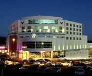
Gold Country Casino & Hotel
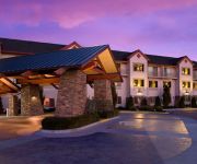
LODGE AT FEATHER FALLS CASINO
Videos from this area
These are videos related to the place based on their proximity to this place.
Unearthing Your Why @ Successful Thinkers Network (Oroville)
In 2010 Simon Sinek exploded on the speaking circuit with his book Start with Why. His TED talk on the topic is the 3rd most viewed TED talk ever and for good reason – it defines the foundation...
Railfanning Oroville, California: March 26, 2009
Train #1) Beautiful sunny spring weather sets the scene as an eastbound Union Pacific KLTG1 double stack intermodal rolls by with GE C45ACCTE #5292 leading. EMD SD90/43MAC #8121 serves as ...
Railfanning Oroville, California: 20 Dec 2008
Train #1) GE C45ACCTE #5310 and two EMD SD70M's lead a Union Pacific IOAG2 double stack intermodal train east at the Feather River Nature Center in Oroville, California on December 20, 2008....
Railfanning Oroville, California: 20 Nov 2008
Train #1) EMD SD70M #4316 and EMD SD70ACe #8323 lead an IOAG2 intermodal east along the Feather River Nature Center in Oroville, California on November 20, 2008. Train #2) GE C45ACCTE...
Railfanning Oroville, California: March 22, 2009
Train #1) GE C44-9W #4382, GE ES44DC #7707, GE C44-9W #4773, and GE C44-9W #4807 lead a 55-car H-BARPAS, Barstow, CA to Pasco, WA mixed manifest freight east along the Feather River ...
Lot 7 Potters Ravine and Lake Oroville
First half of video shows this 20 acre parcel in Potters Ravine subdivision and second half showing Lake Oroville directly below the property (approx. 100-150 yard walk from the property to...
BNSF 7706 Leads H-VAWBAR West
GE ES44DC #7706 leads train H-VAWBAR west on a high yellow signal at Mitchell Avenue in Oroville, California in dense fog on December 6, 2008. As soon as the train reaches the east end of the...
Videos provided by Youtube are under the copyright of their owners.
Attractions and noteworthy things
Distances are based on the centre of the city/town and sightseeing location. This list contains brief abstracts about monuments, holiday activities, national parcs, museums, organisations and more from the area as well as interesting facts about the region itself. Where available, you'll find the corresponding homepage. Otherwise the related wikipedia article.
Oroville East, California
Oroville East or Kelly Ridge is a census-designated place (CDP) in Butte County, California, United States. The population was 8,280 at the 2010 census, down from 8,680 at the 2000 census. Most citizens are dependent on the commerce of Oroville, and the vast majority of high school students in Kelly Ridge (Oroville East) attend Las Plumas High School.
Oroville, California
Oroville (formerly, Ophir City) is the county seat of Butte County, California. The population was 15,506 at the 2010 census, up from 13,004 at the 2000 census. The Berry Creek Rancheria of Maidu Indians of California is headquartered here.
Lake Oroville
Lake Oroville, also known as Lake Edmonston, is a reservoir in the U.S. state of California, formed by the Oroville Dam across the Feather River. The lake is situated in the foothills of the Sierra Nevada about 5 miles northeast of Oroville. At over 3,500,000 acre feet, it is one of the largest reservoirs in California, after Shasta Lake. The lake is fed by the North Fork, Middle Fork, West Branch and South Forks of the Feather River. The lake has a 9,000 ft diameter landing area for seaplanes.
Bidwell Bar Bridge
The Bidwell Bar Bridge, in Oroville, California, refers to two suspension bridges that cross different parts of Lake Oroville. The original Bidwell Bar Bridge was the first steel suspension bridge in California. The $35,000, 240-foot (73 m) -long original was completed in December 1855, and was built of materials transported from Troy, New York, via Cape Horn. Most of the money was put up by Judge Joseph Lewis, a Virginian who moved to Bidwell's Bar in 1849.
Hawk Ravine, California
Hawk Ravine is a former settlement in Butte County, California. It lay at an elevation of 1266 feet (386 m). It still appeared on maps as of 1897.
Land, California
Land is a former settlement in Butte County, California, United States. It was located 1.5 miles west-southwest of Bidwell's Bar on the Western Pacific Railroad, at an elevation of 902 feet (275 m). Land is now covered by Lake Oroville. The place was named for A.H. Land, a lumber company president.
Quartz, California
Quartz is a former settlement in Butte County, California. It lay at an elevation of 262 feet (80 m). It still appeared on maps as of 1947.


