Safety Score: 2,7 of 5.0 based on data from 9 authorites. Meaning we advice caution when travelling to United States.
Travel warnings are updated daily. Source: Travel Warning United States. Last Update: 2024-05-20 08:01:38
Explore Helltown
Helltown in Butte County (California) is located in United States about 2,360 mi (or 3,798 km) west of Washington DC, the country's capital.
Local time in Helltown is now 08:56 PM (Monday). The local timezone is named America / Los Angeles with an UTC offset of -7 hours. We know of 11 airports in the wider vicinity of Helltown, of which 5 are larger airports. The closest airport in United States is Gansner Field in a distance of 39 mi (or 63 km), East. Besides the airports, there are other travel options available (check left side).
There is one Unesco world heritage site nearby. It's Redwood National and State Parks in a distance of 109 mi (or 176 km), North. Also, if you like golfing, there are multiple options in driving distance. We found 1 points of interest in the vicinity of this place. If you need a place to sleep, we compiled a list of available hotels close to the map centre further down the page.
Depending on your travel schedule, you might want to pay a visit to some of the following locations: Oroville, Willows, Marysville, Yuba City and Red Bluff. To further explore this place, just scroll down and browse the available info.
Local weather forecast
Todays Local Weather Conditions & Forecast: 26°C / 78 °F
| Morning Temperature | 13°C / 55 °F |
| Evening Temperature | 23°C / 74 °F |
| Night Temperature | 16°C / 61 °F |
| Chance of rainfall | 0% |
| Air Humidity | 18% |
| Air Pressure | 1012 hPa |
| Wind Speed | Gentle Breeze with 9 km/h (5 mph) from East |
| Cloud Conditions | Clear sky, covering 6% of sky |
| General Conditions | Sky is clear |
Tuesday, 21st of May 2024
25°C (76 °F)
16°C (61 °F)
Sky is clear, gentle breeze, clear sky.
Wednesday, 22nd of May 2024
23°C (73 °F)
15°C (59 °F)
Overcast clouds, light breeze.
Thursday, 23rd of May 2024
24°C (76 °F)
15°C (59 °F)
Few clouds, gentle breeze.
Hotels and Places to Stay
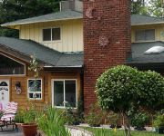
Lantern Inn
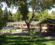
Ponderosa Gardens Motel
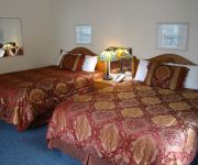
PARADISE INN MOTEL
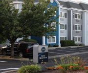
BEST WESTERN PARADISE HOTEL
Videos from this area
These are videos related to the place based on their proximity to this place.
7023 Montna Drive, Paradise, CA * Cindy Haskett Homes, Coldwell Banker Ponderosa
Wow, where do I start. From the moment you drive up, it feels like your own private sanctuary on over 3/4 of an acre. Large circle driveway. Home nestled deep amongst the trees features...
Paradise Lake - Cindy Haskett w/Coldwell Banker Ponderosa
Short Video of Paradise Lake located between Paradise and Magalia, CA.
Paradise Bike Trail in Paradise, California
This is my first attempt at filming my ride on the Paradise Bike Trail. This is a beautiful trail and the jewel of Paradise, in my humble opinion. The video is VERY bumpy. I did have the image...
bille1.wmv Bille Park in Paradise, CA - Views of Butte Creek Canyon & Creek within the Park
Bille Park in Paradise, CA. Beautiful views of Butte Creek Canyon and creeks within the park. Narrated by Cindy Haskett at Coldwell Banker Ponderosa Real Estate.
A/C Repair Paradise, CA | 800-474-8413 | Air Conditioning & Heating Repair - Paradise, CA
A/C Repair Paradise, CA | 800-474-8413 | Air Conditioning & Heating Repair - Paradise, CA Please call us Now: 800-474-8413 Welcome to the 24 hour Air Conditioning & Heating Repair Service...
Memorial Day in Paradise, CA
On all the national holidays, Independence Day, Flag Day, Veterans Day, Paradise,CA puts out at least 1000 flags along Skyway. It is sure a sight to see.
Videos provided by Youtube are under the copyright of their owners.
Attractions and noteworthy things
Distances are based on the centre of the city/town and sightseeing location. This list contains brief abstracts about monuments, holiday activities, national parcs, museums, organisations and more from the area as well as interesting facts about the region itself. Where available, you'll find the corresponding homepage. Otherwise the related wikipedia article.
KZFR
KZFR 90.1 FM is a non-profit, community radio station located in Chico, California. The idea started out as a translator for KPFA in Berkeley in 1981, but when it began transmitting in July 1990 it was locally originated content. KZFR broadcasts local Internet station Radio Paradise from midnight to 6 AM. KZFR features diverse programming. Music programs include shows devoted to reggae, rock and roll, folk, Celtic, blues, jazz, country, zydeco and spiritual music.
Centerville, Butte County, California
Centerville is an unincorporated community in Butte County, California along Butte Creek. It was midway between Helltown and Diamondville. The area is about one and three quarters miles, straight-line distance, west of Paradise.
KBQB
KBQB is a commercial radio station located in Chico, California. KBQB airs an adult hits music format.
Helltown, California
Helltown (formerly, Butte Creek and Hilltown) is an unincorporated community in Butte County, California. It lies 4 miles north-northwest of Paradise, at an elevation of 873 feet (266 m).
Irish Town, California
For the place in Amador County, see Irishtown, California.
Mineral Slide, California
Mineral Slide is an unincorporated community in Butte County, California. It lies at an elevation of 1099 feet (335 m).
Nimshew, California
Nimshew is an unincorporated community in Butte County, California. It lies at an elevation of 2507 feet (764 m). A post office operated at Nimshew from 1880 to 1923.
Whiskey Flat (Paradise West), California
Whiskey Flat is a former settlement in Butte County, California, United States. It was located on Butte Creek 5.25 miles north-northwest of Paradise.


