Safety Score: 2,7 of 5.0 based on data from 9 authorites. Meaning we advice caution when travelling to United States.
Travel warnings are updated daily. Source: Travel Warning United States. Last Update: 2024-05-23 08:16:57
Delve into Pleasant Acres
The district Pleasant Acres of Mount Carmel in Madison County (Alabama) is a subburb in United States about 595 mi south-west of Washington DC, the country's capital town.
If you need a hotel, we compiled a list of available hotels close to the map centre further down the page.
While being here, you might want to pay a visit to some of the following locations: Huntsville, Fayetteville, Athens, Washington Street Courthouse Annex and Lynchburg. To further explore this place, just scroll down and browse the available info.
Local weather forecast
Todays Local Weather Conditions & Forecast: 25°C / 78 °F
| Morning Temperature | 21°C / 69 °F |
| Evening Temperature | 25°C / 78 °F |
| Night Temperature | 21°C / 69 °F |
| Chance of rainfall | 13% |
| Air Humidity | 74% |
| Air Pressure | 1015 hPa |
| Wind Speed | Light breeze with 4 km/h (3 mph) from North-East |
| Cloud Conditions | Overcast clouds, covering 99% of sky |
| General Conditions | Moderate rain |
Friday, 24th of May 2024
20°C (68 °F)
21°C (71 °F)
Moderate rain, gentle breeze, overcast clouds.
Saturday, 25th of May 2024
28°C (83 °F)
21°C (69 °F)
Heavy intensity rain, moderate breeze, few clouds.
Sunday, 26th of May 2024
30°C (86 °F)
24°C (75 °F)
Light rain, moderate breeze, broken clouds.
Hotels and Places to Stay
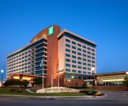
Embassy Suites by Hilton Huntsville Hotel - Spa
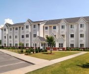
MICROTEL INN & SUITES BY WYNDH
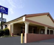
Americas Best Value Inn
Americas Best Inn Huntsville
Videos from this area
These are videos related to the place based on their proximity to this place.
US 72 East/Moores Mill Road Project Faces a Decade Delay from ALDOT
July 11, 2013 (Huntsville, AL) -- Road improvements scheduled for construction next year at the end of I-565 on Highway 72 from Moores Mill Road to Dug Hill Road won't take place until 2024,...
Kay Doby Testifies: DOJ/USDA Antitrust Hearing on Poultry
Former North Carolina poultry producer Kay Doby testifies at the DOJ / USDA joint workshop on antitrust / competition issues in the poultry industry. The workshop was held at Alabama A&M University...
101 Hill Grass .
For more details: http://www.visualtour.com/showvt.asp?t=3324178 101 HILL GRASS CIRCLE HUNTSVILLE / RYLAND, AL 35811 $265000, 4 bed, 3.0 bath, 2683 SF, MLS...
3010 High Mountain Road - Picturesque home
For more details click here: http://www.visualtour.com/showvt.asp?t=2900538 3010 High Mountain Road Huntsville, AL 35811 $599900, 4 bed, 4.0 bath, 4290 SF,...
Lousiana style home just minutes from I-565!
For more details click here: http://www.visualtour.com/showvt.asp?t=2800804 2870 High Mountain Road Huntsville, AL 35811 $999900, 5 bed, 4.5 bath, 4960 SF,...
176 Riverside Drive, Huntsville, Alabama 35811
This home offers country living just minutes from the city. A list of the Numurous Updates is attached. Featuring 3 bedrooms, 2 baths, large kitchen with bre...
Event Center Huntsville AL Rocket City Event Center
Event Center Huntsville AL Rocket City Event Center (256) 417-1390 When you think of a perfect place to celebrate the night away, think Rocket City Event Center! Our local event center is convenien...
4 BT Cummins Powered 1998 Ford Explorer
This 1998 Ford Explorer belongs to a fellow co-worker, he liked my 4BT Powered 71 Dodge, and thought he would like to do a similar conversion to his. We took some measurements, and began ...
Videos provided by Youtube are under the copyright of their owners.
Attractions and noteworthy things
Distances are based on the centre of the city/town and sightseeing location. This list contains brief abstracts about monuments, holiday activities, national parcs, museums, organisations and more from the area as well as interesting facts about the region itself. Where available, you'll find the corresponding homepage. Otherwise the related wikipedia article.
Madison County, Alabama
Madison County is a county of the U.S. state of Alabama, and is a major part of the Huntsville Metropolitan Area. It is also included in the merged Huntsville-Decatur Combined Statistical Area. The county is named in honor of James Madison, fourth President of the United States of America, and the first to visit the state of Alabama. According to the 2010 Census, the population was 334,811. Its county seat is Huntsville. Madison County covers parts of the former Decatur County.
Meridianville, Alabama
Meridianville is an unincorporated community and census-designated place in Madison County, Alabama, United States, and is included in the Huntsville-Decatur Combined Statistical Area. As of the 2010 census, the population of the community is 6,021.
Moores Mill, Alabama
Moores Mill is a census-designated place (CDP) in Madison County, Alabama, United States, and is included in the Huntsville-Decatur Combined Statistical Area. The population was 5,682 at the 2010 census.
Alabama Agricultural and Mechanical University
Alabama Agricultural and Mechanical University, also known as Alabama A&M University or AAMU, is a public, historically black university, land-grant university located in Normal, Madison County, Alabama, United States. AAMU is a member-school of the Thurgood Marshall College Fund.
Normal, Alabama
Normal, Alabama is the site of Alabama Agricultural and Mechanical University. AAMU is situated in the city limits and northern part of Huntsville, Alabama, USA in Madison County. Normal was established in 1890, when AAMU was then known as "State Normal and Industrial School of Huntsville". It was also designated a land grant college of Alabama. At that time student enrollment was 300 with 11 teachers. That same year, a United States Post Office was established there.
Louis Crews Stadium
Louis Crews Stadium is a 21,000-seat multi-purpose stadium in Huntsville, Alabama. It opened in 1996 and is home to the Alabama A&M University Bulldogs football team. It was named in honor of former Head Football Coach Louis Crews who served from 1960 to 1975. Built in 1996 at a price of $10 Million, Louis Crews Stadium has a current capacity of 21,000, and is the sixth largest stadium in Alabama. The home-side grand stands has a capacity of 14,000 and the visitors side holds 7,000.
Elmore Gymnasium
T.M. Elmore Gymnasium is a 6,000-seat multi-purpose arena in Normal, Alabama. It is home to the Alabama A&M University Bulldogs basketball team and is informally known as "The Dog House". The venue is also the site for special events, such as the International Student Association's annual Food and Culture Fair. In February 1996, Elmore Gymnasium was ranked the "fourth-toughest place to play" in NCAA Division II basketball by Division II Bulletin.
WZDX
WZDX is the Fox-affiliated television station for North Alabama's Tennessee Valley. Licensed to Huntsville, it broadcasts a high definition digital signal on UHF channel 41 from a transmitter on Monte Sano Boulevard Southeast in Madison County (east of Huntsville). The station can also be seen on Knology channel 4 as well as Charter and Comcast channel 5. There is a high definition feed offered on Comcast digital channel 434, Charter digital channel 705, and Knology digital channel 905.
WAAY-TV
WAAY-TV is the ABC-affiliated television station for the Tennessee Valley area of North Alabama that is licensed to Huntsville. It broadcasts a high definition digital signal on UHF channel 32 from a transmitter at its Monte Sano Boulevard studios on top of Monte Sano Mountain. Calkins Media owns the station. It airs its daily 4 p.m. newscast from local lifestyle center Bridge Street Town Centre.
WHNT-TV
WHNT-TV is the CBS-affiliated television station for the Tennessee Valley area of North Alabama that is licensed to Huntsville. It broadcasts a high definition digital signal on UHF channel 19 from a transmitter on Monte Sano. Owned by Local TV, the station has studios on Holmes Avenue Northwest in downtown Huntsville. It also has three bureaus: Decatur, Sand Mountain (Albertville), and Shoals (Florence). Syndicated programming on WHNT includes: Rachael Ray, Ellen, and The Dr. Oz Show.
WLRH
WLRH (89.3 FM, "89.3 FM Public Radio") is a National Public Radio-affiliated radio station in Huntsville, Alabama. It primarily features news and classical music programming on weekdays and news, humor, and other musical genres on weekends. WLRH serves the northern counties of Alabama and several counties in southern middle Tennessee. WLRH is the state's oldest public radio station.
Five Points Historic District (Huntsville, Alabama)
Five Points Historic District was the third historic district to be designated in Huntsville, Alabama. It features homes built around the turn of the 20th Century in several styles, including California Bungalow, Queen Anne and other modest Victorian styles dating from the late 1890s through the early 1900s. The district was listed on the National Register of Historic Places in August 2012.
Goldsmith–Schiffman Field
Goldsmith–Schiffman Field is a multi-purpose stadium in Huntsville, Alabama. From 1934 through 2012, it was used mainly for middle school and high school football. It was also home to the now-defunct Alabama Renegades of the National Women's Football Association.
WAMY-TV
"WAMY-TV" is the MyNetworkTV-affiliated television station for the Tennessee Valley area of Northeastern Alabama. In most areas, the station broadcasts on Comcast and Charter cable channel 8. As a result, its logo refers to this although it is known on-air as My WAMY. There some locations, including Decatur, where the station is located on other cable systems and channels.
Buckhorn High School (New Market, Alabama)
Buckhorn High School is a public high school in New Market, Alabama, United States. Buckhorn received the State Department of Education's National Blue Ribbon in 2001. Buckhorn is located at the site of the American Civil War Skirmish of Buckhorn Tavern, fought on October 12, 1863, between General Phillip D. Roddey's Alabama Cavalry Brigade and a Union cavalry brigade commanded by General Robert Mitchell.
Madison County Executive Airport
Madison County Executive Airport, also known as Tom Sharp Jr. Field, is a public-use airport in Madison County, Alabama, United States. It is owned by the Madison County Executive Airport Authority and located one nautical mile (1.85 km) northeast of the central business district of Huntsville. According to the FAA's National Plan of Integrated Airport Systems for 2009–2013, it is categorized as a general aviation facility. Although most U.S.
KIH20
KIH20 (162.400 MHz,sometimes referred to as Huntsville All Hazards) is a NOAA Weather Radio station that serves the greater Huntsville, Alabama, area. It broadcasts weather forecasts and hazard information for Jackson, Lawrence, Limestone, Madison, Marshall, and Morgan Counties in Alabama plus Giles and Lincoln Counties in Tennessee.
Moontown Airport
Moontown Airport is a privately owned public-use airport located seven nautical miles (13 km) east of the central business district of Huntsville, a city in Madison County, Alabama, United States. It is 16 miles miles east of Huntsville International Airport (HSV).
Lee High School (Huntsville, Alabama)
Lee High School is a four-year public high school that serves students in grades 9-12 from Huntsville, in Madison County, Alabama in the United States, as a part of Huntsville City Schools.
Brush Mountain
Chase, Alabama
Chase is an unincorporated community in Madison County, Alabama, in the southern United States. The community was a railroad stop.
Ryland, Alabama
Ryland is an unincorporated community in eastern Madison County, Alabama. The community borders Maysville.
Cooper Estates
Cooper Estates is a subdivision community in Northeastern Madison County, Alabama, and is in the United States. Cooper Estates is in the Maysville and Ryland area with the zip code 35811. The subdivision was built in 1991.
Dead Children's Playground
Hidden amongst the old beech trees within the limits of Maple Hill Cemetery lies the Dead Children's Playground, which in local stories is said to be haunted by the children buried nearby. Maple Hill Park was founded in 1822 and with its hundreds of acres of land it's the oldest and largest cemetery in Alabama, US. Some people say that it is the spirits of the cemetery's children that come out to play.
J. F. Drake State Technical College
J. F. Drake State Technical College is a community college in Huntsville, Alabama. As of the Fall 2010 semester, Drake State has an enrollment of 1,258 students. The college was founded in 1961 as the Huntsville State Vocational Technical College. In 1966, the school was renamed J. F. Drake State Technical Trade School in honor of Joseph Fanning Drake, a long-serving president of Alabama A&M University. After desegregating in 1967, the school took its current name in 1973.


