Safety Score: 2,7 of 5.0 based on data from 9 authorites. Meaning we advice caution when travelling to United States.
Travel warnings are updated daily. Source: Travel Warning United States. Last Update: 2024-05-13 08:03:22
Discover Whiteside
Whiteside in Limestone County (Alabama) is a city in United States about 622 mi (or 1,001 km) south-west of Washington DC, the country's capital city.
Local time in Whiteside is now 11:13 AM (Monday). The local timezone is named America / Chicago with an UTC offset of -5 hours. We know of 9 airports in the vicinity of Whiteside, of which 5 are larger airports. The closest airport in United States is Huntsville International Carl T Jones Field in a distance of 10 mi (or 16 km), East. Besides the airports, there are other travel options available (check left side).
Also, if you like golfing, there are a few options in driving distance. We discovered 1 points of interest in the vicinity of this place. Looking for a place to stay? we compiled a list of available hotels close to the map centre further down the page.
When in this area, you might want to pay a visit to some of the following locations: Decatur, Athens, Washington Street Courthouse Annex, Moulton and Huntsville. To further explore this place, just scroll down and browse the available info.
Local weather forecast
Todays Local Weather Conditions & Forecast: 18°C / 64 °F
| Morning Temperature | 17°C / 63 °F |
| Evening Temperature | 20°C / 67 °F |
| Night Temperature | 18°C / 65 °F |
| Chance of rainfall | 1% |
| Air Humidity | 93% |
| Air Pressure | 1013 hPa |
| Wind Speed | Moderate breeze with 11 km/h (7 mph) from North |
| Cloud Conditions | Overcast clouds, covering 100% of sky |
| General Conditions | Light rain |
Monday, 13th of May 2024
22°C (71 °F)
17°C (63 °F)
Moderate rain, gentle breeze, overcast clouds.
Tuesday, 14th of May 2024
23°C (74 °F)
16°C (61 °F)
Light rain, moderate breeze, broken clouds.
Wednesday, 15th of May 2024
26°C (80 °F)
21°C (70 °F)
Broken clouds, light breeze.
Hotels and Places to Stay
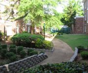
DoubleTree by Hilton Decatur Riverfront
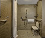
AL AMBERLEY SUITE HOTEL-DECATUR
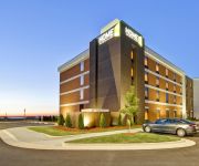
Home2 Suites By Hilton Decatur
La Quinta Inn Decatur
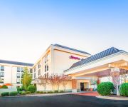
Hampton Inn Decatur
Residence Inn Decatur
Courtyard Decatur
Stay Lodge
MOTEL 6 DECATUR
PARKWAY INN AND SUITES
Videos from this area
These are videos related to the place based on their proximity to this place.
23rd annual Decatur (AL) Open Table Tennis Tournam
23rd annual Decatur (AL) Open Table Tennis Tournament Venue: Calhoun Community College Date: Aug. 16, 2014.
ZenWindowsAlabama.com | Replacement Windows | Decatur Alabama | Window Replacement 256-732-4036
Replacement Windows Decatur AL | Window Replacement http://www.zenwindowsalabama.com/ Having trouble with your monthly energy bills? Do you have some non-working or broken windows in ...
Decatur, Alabama Small Towns and Downtowns
Decatur, Alabama. Decatur is celebrating The Year of Alabama Small Towns and Downtowns in 2010. Hear about the history, culture, recreation and attractions that Decatur has to offer. The city...
AC Repair Decatur Alabama Call (256) 686-1433 | HVAC Repair Decatur AL
AC Repair Decatur AL Call (256) 686-1433 . Air Conditioning Repair Decatur Alabama! Best Decatur AL Air Conditioning Repair. Best HVAC company in Decatur! Air Conditioning Installation done...
Norfolk Southern Westbound Mixed Freight in Decatur, Alabama
An NS freight train continues west after crossing the Tennessee River and passing the Decatur passenger station, last used for Amtrak's Floridian in 1979. The river bridge and track by the...
CSX Manifest Freight Passing the Depot In Decatur, Al
March 16, 2008 10:00 AM CDT Here we have another long manifest freight passing the depot in Decatur, Al. This is "Decatur Junction". The line the CSX train is coming from Birmingham...
The Twister -Understanding Jiu Jitsu Injuries -10th Planet Jiu Jitsu Decatur & Dr. Michael Cantrell
This week we look at different finishes from the Truck position including the Twister, the Banana Split, and the Crotch Ripper. Dr. Michael Cantrell is here to explain what these submissions...
BNSF Coal Train Over Tennessee River & Into Decatur, Al
March 15, 2008 10:35 AM CDT Here's an BNSF coal train coming over the Tennessee River in Decatur, Al. The train has trackage rights over the NS/ CSX shared bridge. The sun became...
NS Freight with High Nose GP38-2 at Decatur, AL Depot
A short Norfolk Southern train passes the depot in Decatur, Alabama. The second locomotive has a high nose, something that is becoming increasingly rare as older locomotives are rebuilt or...
50/50 Inverted Heel Hook - Brandon Mccaghren - 10th Planet Jiu Jitsu Decatur AL
50/50 Guard with an Inverted Heel Hook finish Brandon Mccaghren of 10th Planet Jiu Jitsu in Decatur AL hits a spinning entry into 50/50 Guard with an Inverted Heel Hook finish. 2012 Ardmore...
Videos provided by Youtube are under the copyright of their owners.
Attractions and noteworthy things
Distances are based on the centre of the city/town and sightseeing location. This list contains brief abstracts about monuments, holiday activities, national parcs, museums, organisations and more from the area as well as interesting facts about the region itself. Where available, you'll find the corresponding homepage. Otherwise the related wikipedia article.
Battle of Decatur
The Battle of Decatur was a demonstration conducted from October 26 to October 29, 1864, as part of the Franklin-Nashville Campaign of the American Civil War. Union forces of 3–5,000 men under Brig. Gen. Robert S. Granger prevented the 39,000 men of the Confederate Army of Tennessee under Gen. John B. Hood from crossing the Tennessee River at Decatur, Alabama.
Calhoun Community College
Calhoun Community College is a two-year institution of higher learning, located in Decatur, Alabama, United States. The largest of the 27 two-year institutions comprising the Alabama Community College System, Calhoun is an open-admission, coeducational, comprehensive community college dedicated to providing education to individuals in its four-county service area.
Decatur High School (Alabama)
Decatur High School is a public high school in Decatur, Alabama, United States. It is one of two high schools in the Decatur City School District. Decatur High offers technical, academic, and International Baccalaureate programs, as well as dual enrollment with the John C. Calhoun Community College System. Decatur High, along with southwestern Decatur's Austin High School, were the first International Baccalaureate schools in Alabama north of Birmingham, Alabama.
Captain William J. Hudson "Steamboat Bill" Memorial Bridges
The "Steamboat Bill" Memorial Bridges are two bridges that span one of the widest points along the Tennessee River within the City of Decatur, Alabama, between Morgan County, and Limestone County. One is a cantilever truss, and the other is a reinforced concrete. The bridges carry US 31, Alternate US 72, and Alabama State Route 20 from the intersection of Wilson Street (Alternate US 72, and Alabama 20), and 6th Avenue (US 31) in Northeast Decatur.
Norfolk Southern Tennessee River Bridge
The Norfolk Southern Tennessee River Bridge is a lift bridge operated by the Norfolk Southern Railway over the Tennessee River at Decatur in the north central part of Alabama in the United States. While it is owned and operated by Norfolk Southern, the majority of the railroad traffic over the bridge is from another company, CSX Transportation. There has been a railroad bridge or ferry at this location since the late 1850s.
Delano Park (Decatur)
The Delano Park, operated by the Decatur Parks and Recreation Board, is the oldest park in the city of Decatur, Alabama. It was created in 1887, as part of a master plan to "re-invent" the City of Decatur, then New Decatur. The city created the "Decatur Land Improvement and Furnace Company" for this specific purpose. The company employed a landscape architect by the name of Nathan Franklin Barrett to design a whole new city that had been ravaged by a Yellow Fever epidemic and the Civil War.
Ogle Stadium
Ogle Stadium is an 9,000-seat stadium in Decatur, Alabama, located on the southern end of Decatur High School's campus, and is owned by the Decatur City Schools. Prior to 1949, the Decatur football team played at the 3,000 person capacity Benson Field that is now a part of Rhodes Ferry Park along the shores of the Tennessee River next to the old Riverview High School. The stadium is named after former coach, and Alabama Sports Hall of Famer, H.L.
WWTM
WWTM (1400 AM, "1400 The Team") is a sports/talk formatted radio station licensed to Decatur, Alabama, that serves Decatur, Huntsville, and the northwest Alabama region. The station is owned by R & B Communications, Inc.


