Safety Score: 2,7 of 5.0 based on data from 9 authorites. Meaning we advice caution when travelling to United States.
Travel warnings are updated daily. Source: Travel Warning United States. Last Update: 2024-05-04 08:22:41
Explore Murphree Place
Murphree Place in Limestone County (Alabama) is a city in United States about 620 mi (or 998 km) south-west of Washington DC, the country's capital.
Local time in Murphree Place is now 03:44 AM (Saturday). The local timezone is named America / Chicago with an UTC offset of -5 hours. We know of 9 airports in the vicinity of Murphree Place, of which 5 are larger airports. The closest airport in United States is Huntsville International Carl T Jones Field in a distance of 11 mi (or 18 km), East. Besides the airports, there are other travel options available (check left side).
Also, if you like golfing, there are multiple options in driving distance. We found 1 points of interest in the vicinity of this place. If you need a place to sleep, we compiled a list of available hotels close to the map centre further down the page.
Depending on your travel schedule, you might want to pay a visit to some of the following locations: Decatur, Athens, Washington Street Courthouse Annex, Huntsville and Moulton. To further explore this place, just scroll down and browse the available info.
Local weather forecast
Todays Local Weather Conditions & Forecast: 26°C / 78 °F
| Morning Temperature | 19°C / 66 °F |
| Evening Temperature | 26°C / 78 °F |
| Night Temperature | 19°C / 66 °F |
| Chance of rainfall | 13% |
| Air Humidity | 70% |
| Air Pressure | 1015 hPa |
| Wind Speed | Light breeze with 5 km/h (3 mph) from East |
| Cloud Conditions | Broken clouds, covering 58% of sky |
| General Conditions | Moderate rain |
Saturday, 4th of May 2024
27°C (80 °F)
19°C (67 °F)
Moderate rain, gentle breeze, few clouds.
Sunday, 5th of May 2024
27°C (81 °F)
20°C (68 °F)
Moderate rain, gentle breeze, broken clouds.
Monday, 6th of May 2024
28°C (82 °F)
21°C (70 °F)
Light rain, moderate breeze, overcast clouds.
Hotels and Places to Stay
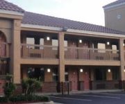
Home2 Suites By Hilton Decatur
TRAVEL INN - ATHENS
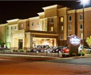
Hampton Inn - Suites Athens-I-65 -Huntsville Area- AL
Holiday Inn Express & Suites ATHENS
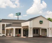
Quality Inn Athens
AL AMBERLEY SUITE HOTEL-DECATUR
Sleep Inn Athens
DAYS INN ATHENS
Videos from this area
These are videos related to the place based on their proximity to this place.
Norfolk Southern Westbound Mixed Freight in Decatur, Alabama
An NS freight train continues west after crossing the Tennessee River and passing the Decatur passenger station, last used for Amtrak's Floridian in 1979. The river bridge and track by the...
CSX Manifest Freight Passing the Depot In Decatur, Al
March 16, 2008 10:00 AM CDT Here we have another long manifest freight passing the depot in Decatur, Al. This is "Decatur Junction". The line the CSX train is coming from Birmingham...
BNSF Coal Train Over Tennessee River & Into Decatur, Al
March 15, 2008 10:35 AM CDT Here's an BNSF coal train coming over the Tennessee River in Decatur, Al. The train has trackage rights over the NS/ CSX shared bridge. The sun became...
NS Freight with High Nose GP38-2 at Decatur, AL Depot
A short Norfolk Southern train passes the depot in Decatur, Alabama. The second locomotive has a high nose, something that is becoming increasingly rare as older locomotives are rebuilt or...
CSX Manifest Freight Crossing The Tennessee At Decatur, Al
March 15, 2008 10:50 AM CDT Here's a long CSX freight train making its way over the Tennessee River in Decatur, Al. This bridge is owned by NS and CSX has trackage rights (as long...
CSX Works Car Interchange with NS at Decatur, Alabama Depot
A CSX train comes north from Oakworth Yard in Decatur to work the interchange with NS next to the old passenger depot. NS and CSX share track at the depot for the Tennessee River crossing...
NS Local Passes Decatur Depot Undergoing Restoration (With Bird Attack)
After decades of standing unused the Decatur, Alabama depot is being restored. This depot once served L&N and Southern. It was last used for Amtrak's Floridian, which ended in 1979 when Jimmy...
CSX Oakworth Yard Engine Working NS Interchange - Decatur, AL
A yard engine from CSX Oakworth Yard in Decatur, Alabama is working the NS interchange, next to the old passenger depot and just south of the Tennessee River bridge. After the crew finishes...
Athens Motorcycle Wreck - Part 1 (09.04.2010)
As I was driving west toward I-65 in Athens, Alabama, there were many emergency vehicle sirens and smoke rising from the road. At this point, it was difficult to tell exactly what had happened.
Videos provided by Youtube are under the copyright of their owners.
Attractions and noteworthy things
Distances are based on the centre of the city/town and sightseeing location. This list contains brief abstracts about monuments, holiday activities, national parcs, museums, organisations and more from the area as well as interesting facts about the region itself. Where available, you'll find the corresponding homepage. Otherwise the related wikipedia article.
Pryor Field Regional Airport
Pryor Field Regional Airport is a public airport located three miles (5 km) northeast of the central business district of Decatur and south of Athens, in Limestone County, Alabama, United States. It is owned by Decatur/Athens Airport Authority. Situated next to Calhoun Community College, the airport serves the western portion of the Huntsville-Decatur Combined Statistical Area and most of the Decatur Metropolitan Area. Pryor Field is currently the busiest regional airport in Alabama.
Tanner, Alabama
Tanner is an unincorporated community in central southern Limestone County, Alabama, United States, and is included in the Huntsville-Decatur Combined Statistical Area. It lies along the Tennessee River, next to the city of Athens. Tanner is home to Tanner High School (The Rattlers), a 2A school in the state's classification system. The school's basketball boys and girls teams both won state titles in 1985 and 2011 and are the only school in Alabama to do so.
Tanner High School
Tanner High School is a K–12 school located in Limestone County, Alabama. The principal is Billy Owens. The closest town is Tanner, Alabama. It is a part of the Limestone County School District. Tanner has various extracurricular activities including athletics, marching/concert band, Student Council, cheer-leading, and many clubs/organizations.


