Safety Score: 2,7 of 5.0 based on data from 9 authorites. Meaning we advice caution when travelling to United States.
Travel warnings are updated daily. Source: Travel Warning United States. Last Update: 2024-05-17 08:07:57
Discover Midway
The district Midway of Fenton in Etowah County (Alabama) is a district in United States about 600 mi south-west of Washington DC, the country's capital city.
Looking for a place to stay? we compiled a list of available hotels close to the map centre further down the page.
When in this area, you might want to pay a visit to some of the following locations: Gadsden, Guntersville, Oneonta, Centre and Fort Payne. To further explore this place, just scroll down and browse the available info.
Local weather forecast
Todays Local Weather Conditions & Forecast: 18°C / 64 °F
| Morning Temperature | 17°C / 63 °F |
| Evening Temperature | 23°C / 73 °F |
| Night Temperature | 20°C / 67 °F |
| Chance of rainfall | 15% |
| Air Humidity | 94% |
| Air Pressure | 1011 hPa |
| Wind Speed | Moderate breeze with 9 km/h (6 mph) from North-West |
| Cloud Conditions | Overcast clouds, covering 100% of sky |
| General Conditions | Moderate rain |
Saturday, 18th of May 2024
25°C (78 °F)
17°C (63 °F)
Moderate rain, moderate breeze, overcast clouds.
Sunday, 19th of May 2024
23°C (74 °F)
19°C (65 °F)
Light rain, moderate breeze, overcast clouds.
Monday, 20th of May 2024
28°C (82 °F)
20°C (69 °F)
Overcast clouds, light breeze.
Hotels and Places to Stay
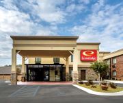
Econo Lodge Boaz
Knights Inn Boaz
KEY WEST INN BOAZ
Videos from this area
These are videos related to the place based on their proximity to this place.
2010 Pontiac G6 Used Cars Sardis City AL
http://www.brownskar2.com This 2010 Pontiac G6 is available from Browns Kar Mart. For details, call us at 256-281-9800.
2006 Mazda MAZDA3 Used Cars Sardis City AL
http://www.brownskar2.com This 2006 Mazda MAZDA3 is available from Browns Kar Mart. For details, call us at 256-281-9800.
2002 Toyota Camry Used Cars Sardis City AL
http://www.brownskar2.com This 2002 Toyota Camry is available from Browns Kar Mart. For details, call us at 256-281-9800.
2001 Toyota Avalon Used Cars Sardis City AL
http://www.brownskar2.com This 2001 Toyota Avalon is available from Browns Kar Mart. For details, call us at 256-281-9800.
2006 Pontiac G6 Used Cars Sardis City AL
http://www.brownskar2.com This 2006 Pontiac G6 is available from Browns Kar Mart. For details, call us at 256-281-9800.
2007 Chevrolet Cobalt Used Cars Sardis City AL
http://www.brownskar2.com This 2007 Chevrolet Cobalt is available from Browns Kar Mart. For details, call us at 256-281-9800.
2005 Chevrolet SILVERADO Used Cars Sardis City AL
http://www.brownskar2.com This 2005 Chevrolet SILVERADO is available from Browns Kar Mart. For details, call us at 256-281-9800.
2006 Toyota Corolla Used Cars Sardis City AL
http://www.brownskar2.com This 2006 Toyota Corolla is available from Browns Kar Mart. For details, call us at 256-281-9800.
2006 Chevrolet TrailBlazer Used Cars Sardis City AL
http://www.brownskar2.com This 2006 Chevrolet TrailBlazer is available from Browns Kar Mart. For details, call us at 256-281-9800.
2007 Chevrolet Tahoe Used Cars Sardis City AL
http://www.brownskar2.com This 2007 Chevrolet Tahoe is available from Browns Kar Mart. For details, call us at 256-281-9800.
Videos provided by Youtube are under the copyright of their owners.
Attractions and noteworthy things
Distances are based on the centre of the city/town and sightseeing location. This list contains brief abstracts about monuments, holiday activities, national parcs, museums, organisations and more from the area as well as interesting facts about the region itself. Where available, you'll find the corresponding homepage. Otherwise the related wikipedia article.
Etowah County, Alabama
Etowah County is a county of the U.S. state of Alabama. Its name is from the Cherokee language, which means "edible tree". It is the center of the Gadsden Metropolitan Area which includes Etowah and Cherokee Counties. As of the 2010 census the population was 104,430. Its county seat is Gadsden. In total area, it is the smallest county in Alabama.
Crossville, Alabama
Crossville is a town in DeKalb County, Alabama, United States. At the 2000 census the population was 1,431. Crossville is located on top of Sand Mountain.
Attalla, Alabama
Attalla is a city in Etowah County, Alabama, United States. It is part of the Gadsden Metropolitan Statistical Area. According to the 2005 U.S. Census estimates, the city had a population of 6,474. http://www. census. gov/popest/cities/files/SUB-EST2005-all. csv
Boaz, Alabama
Boaz is a city in Etowah and Marshall Counties in the US state of Alabama. It is part of the 'Gadsden, Alabama Metropolitan Statistical Area'. As of the 2010 census, the population of the city is 9,551. http://www. census. gov/popest/cities/files/SUB-EST2005-all. csv Boaz is known mainly for its outlet shops.
Gadsden, Alabama
The city of Gadsden is the county seat of Etowah County in the U.S. state of Alabama, and it is located about 56 miles northeast of Birmingham, Alabama. It is the primary city of the Gadsden Metropolitan Statistical Area, which has a population of 104,440. As of the U.S. Census Bureau estimate in 2011, the population of the city was about 36,860.
Mountainboro, Boaz
Mountainboro is a neighborhood of the city of Boaz in Etowah County, Alabama, United States. Once a separate town, it is part of the Gadsden Metropolitan Statistical Area. Its population was 338 at the 2000 census, at which time it was still separate.
Reece City, Alabama
Reece City is a town in Etowah County, Alabama, United States. It is part of the Gadsden Metropolitan Statistical Area. At the 2000 census the population was 634.
Ridgeville, Alabama
Ridgeville is a town in Etowah County, Alabama, United States. It is part of the Gadsden Metropolitan Statistical Area. At the 2000 census the population was 158.
Sardis City, Alabama
Sardis City is a town in Etowah and Marshall counties in the U.S. state of Alabama. It is part of the Gadsden Metropolitan Statistical Area. At the 2010 census the population was 1,704.
Walnut Grove, Alabama
Walnut Grove is a town in Etowah County, Alabama, United States. It is part of the Gadsden Metropolitan Statistical Area. At the 2000 census the population was 710.
Albertville, Alabama
Albertville is a city in Marshall County, Alabama, United States, and is included in the Huntsville-Decatur Combined Statistical Area. As of the 2010 census, the population of the city was 21,160.
Noccalula Falls Park
Noccalula Falls Park is a 250-acre (101-ha) public park located in Gadsden, Alabama (USA). The falls are located on land once owned by R.A. Mitchell, who gave the site to the city of Gadsden, so that the area could be improved, and everyone could enjoy the majestic falls. Across the street from the falls you will find R.A. Mitchell Elementary School, named in his honor.
Albertville City Schools
Albertville City Schools is the public school district of Albertville, Alabama. The district includes the following schools: Big Spring Lake Kindergarten School (Kindergarten) Albertville Primary School (grades 1-2) Albertville Elementary School (grades 3-4) Evans Elementary School (grades 5-6) Alabama Avenue Middle School (grades 7-8) Albertville High School (grades 9-12)
Area codes 256 and 938
Area codes 256 and 938 are telephone numbering plan codes in the northern portion of the state of Alabama. The main area code, 256, was created on March 23, 1998, as a split from area code 205. In order to allow people time to reprogram electronics such as computers, cell phones, pagers and fax machines, use of the 205 area code continued in the 256 areas through September 28, 1998.
Gadsden Metropolitan Statistical Area
Gadsden Metropolitan Statistical Area covers all of Etowah County, parts of Cherokee County, Alabama and DeKalb County, Alabama located in Northeast Alabama. As of 2010, the population was 104,440. It consists of Gadsden and its surrounding towns.
Emma Sansom High School
Emma Sansom High School (opened 1929 - closed 2006) was a high school located in Gadsden, Alabama. It was named for a young girl who was credited with helping General Nathan Bedford Forrest to cross Black Creek in Gadsden, Alabama and get his troops ahead of the Union troops thus stopping the impending attack upon Rome, Georgia during the Civil War.
Gilliland-Reese Covered Bridge
The Gilliland-Reese Covered Bridge, more simply known as Gilliland's Covered Bridge, is a locally owned wooden covered bridge that spans a small pond near Black Creek in Etowah County, Alabama, United States. It is located at Noccalula Falls Park off Noccalula Road in the city of Gadsden. Coordinates are {{#invoke:Coordinates|coord}}{{#coordinates:34|02|21.79|N|86|01|26.93|W|type:city | |name= }} (34.039386, -86.024147).
WQSB
WQSB is a radio station licensed to serve Albertville, Alabama, USA. The station is owned by Sand Mountain Broadcasting Service, Inc. It broadcasts a country music format to the greater Gadsden, Alabama,area. WQSB currently is known as the Country Giant in Albertville, Alabama at 105.1 fm.
WAVU
WAVU is a radio station licensed to serve Albertville, Alabama, USA. The station, founded in 1948, is owned by Sand Mountain Broadcasting Service, Inc. WAVU broadcasts a Southern Gospel music format and includes some news programming from AP Radio.
WTDR (AM)
WTDR is an American radio station licensed to serve Gadsden, Alabama, USA. The station, established in 1947, is operated by Gadsden Radio Media Inc. and the broadcast license is held by The DR Group LLC. An FCC-approved sale to Gadsden Radio Media Inc. is pending formal consummation.
WBSA
WBSA (1300 AM, "Total Christian Radio") is a radio station licensed to serve Boaz, Alabama. The station is owned by Watkins Broadcasting, Inc. It airs a Christian radio format featuring Southern Gospel music. WBSA is the only radio station licensed to Boaz, Alabama, by the Federal Communications Commission. WBSA plays southern gospel and bluegrass gospel music. They also have on-air devotions. On air personalities include Dale Johnson, Chris Watkins, James Cornelius, and Regina Leeth.
WWGC
WWGC AM 1090 is a radio station licensed to serve Albertville, Alabama. The station is owned by The Jeff Beck Broadcasting Group, LLC. It airs a Latino Music programming format. The station has been assigned the WWGC call letters by the Federal Communications Commission since April 24, 2002.
Albertville Regional Airport
Albertville Regional Airport, also known as Thomas J. Brumlik Field, is a city-owned, public-use airport located three nautical miles (5 km) southwest of the central business district of Albertville, in Marshall County, Alabama, United States. It was formerly known as Albertville Municipal Airport. This airport is included in the FAA's National Plan of Integrated Airport Systems for 2011–2015 and 2009–2013, both of which categorized it as a general aviation facility.
Aroney, Alabama
Aroney is an unincorporated community located on Sand Mountain in far southwestern DeKalb County, Alabama, United States. It is located about five miles east of the city of Boaz.
Albertville High School
Albertville High School is a four-year public high school in Albertville, Alabama. It has an enrollment of 918 students and is accredited by the Alabama Department of Education. In 2008, 50% of Albertville High School students were female and 50% of students were male. Albertville High School made AYP in 2007.


