Safety Score: 3,0 of 5.0 based on data from 9 authorites. Meaning we advice caution when travelling to Spain.
Travel warnings are updated daily. Source: Travel Warning Spain. Last Update: 2024-04-26 08:02:42
Explore Frontera
Frontera in Santa Cruz de Tenerife (Canary Islands) with it's 4,010 inhabitants is a city in Spain about 1,195 mi (or 1,923 km) south-west of Madrid, the country's capital.
Local time in Frontera is now 09:09 PM (Friday). The local timezone is named Atlantic / Canary with an UTC offset of one hour. We know of 5 airports in the vicinity of Frontera, of which two are larger airports. The closest airport in Spain is Hierro Airport in a distance of 8 mi (or 13 km), North-East. Besides the airports, there are other travel options available (check left side).
There is one Unesco world heritage site nearby. It's Garajonay National Park in a distance of 80 mi (or 129 km), East. We found 3 points of interest in the vicinity of this place. If you need a place to sleep, we compiled a list of available hotels close to the map centre further down the page.
Depending on your travel schedule, you might want to pay a visit to some of the following locations: Valverde, Tazacorte, Brena Baja, Hermigua and Agulo. To further explore this place, just scroll down and browse the available info.
Local weather forecast
Todays Local Weather Conditions & Forecast: 18°C / 64 °F
| Morning Temperature | 16°C / 60 °F |
| Evening Temperature | 15°C / 60 °F |
| Night Temperature | 15°C / 60 °F |
| Chance of rainfall | 0% |
| Air Humidity | 66% |
| Air Pressure | 1014 hPa |
| Wind Speed | Fresh Breeze with 17 km/h (11 mph) from South-West |
| Cloud Conditions | Few clouds, covering 24% of sky |
| General Conditions | Few clouds |
Saturday, 27th of April 2024
15°C (59 °F)
15°C (59 °F)
Sky is clear, fresh breeze, clear sky.
Sunday, 28th of April 2024
15°C (58 °F)
15°C (59 °F)
Sky is clear, fresh breeze, clear sky.
Monday, 29th of April 2024
15°C (59 °F)
15°C (59 °F)
Sky is clear, strong breeze, clear sky.
Hotels and Places to Stay
Parador de El Hierro
Hotel Ida Inés
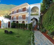
Frontera Apartamentos
Casa Rural Aborigen Bimbache
Hotel Villa el Mocanal
Videos from this area
These are videos related to the place based on their proximity to this place.
Los Carneros de La Frontera
En el municipio de La Frontera, El Hierro, se celebra una de las fiestas más antiguas y originales de los carnavales canarios.
Radioactive, Imagine Dragons, cover by Ultima Nota (Live)
Plaza de Tigaday, Frontera, El Hierro Islas Canarias, 30 de mayo de 2014 Cierre de la Concentración de Parapente de El Hierro 2014 Grupo Musical Juvenil "Última Nota"
Canción El Moco - Cover by La Fábrica de Cuentos (Cuenca)
Versión de la canción "El moco" de Luis Pescetti, interpretada por los trabajadores de LFDC-Workshop en el contexto del Bimbache Open Art Festival (Frontera, isla de El Hierro 24-08-2014)....
20150304 El Hierro Etapa 2 El Golfo
Segunda etapa más tranquila después de la dura de ayer. Hoy recorrimos todo el Golfo de Frontera. Muy rompepiernas, bellas playas y montañas en una isla tan pequeña.
La Pisada, El Hierro, 1996
trozo de video con sonido ambiente de una pisada de uvas en la Casa Del Miedo, Frontera, lo subí en baja calidad.
LOS ANALISTAS TV. Deborah Pruneda en Entrevistada Por Adoniram Hernández
La cantante de música cristiana fue entrevistada en su visita a la ciudad de Frontera, Coahuila. México por Adoniram Hernández. Edición. Juan Soto. Producción. Ernesto Sifuentes. Abril 2013.
RU7A 2012 - ¿Cómo ducharse durante la expedición? (El Hierro)
Laura explica cómo nos duchabamos con mangueras en el colegio de Tigaday donde nos alojábamos, ubicado en el municipio de La Frontera, en la isla de El Hierro. Inscríbete: http://bit.ly/inscrib...
Videos provided by Youtube are under the copyright of their owners.
Attractions and noteworthy things
Distances are based on the centre of the city/town and sightseeing location. This list contains brief abstracts about monuments, holiday activities, national parcs, museums, organisations and more from the area as well as interesting facts about the region itself. Where available, you'll find the corresponding homepage. Otherwise the related wikipedia article.
El Hierro
El Hierro, nicknamed Isla del Meridiano (the "Meridian Island"), is the smallest and farthest south and west of the Canary Islands, in the Atlantic Ocean off the coast of Africa, with a population of 10,162 (2003).
El Pinar, Canary Islands
El Pinar is a Spanish municipality on the island of El Hierro (nicknamed Isla del Meridiano ]. It was created in 2007.


