Safety Score: 3,0 of 5.0 based on data from 9 authorites. Meaning we advice caution when travelling to Panama.
Travel warnings are updated daily. Source: Travel Warning Panama. Last Update: 2024-04-26 08:02:42
Delve into Balboa
Balboa in Provincia de Panamá with it's 807 habitants is located in Panama a little south-west of Panama, the country's capital town.
Current time in Balboa is now 09:11 PM (Friday). The local timezone is named America / Panama with an UTC offset of -5 hours. We know of 8 airports close to Balboa, of which one is a larger airport. The closest airport in Panama is Marcos A. Gelabert International Airport in a distance of 2 mi (or 3 km), North-East. Besides the airports, there are other travel options available (check left side).
There are several Unesco world heritage sites nearby. The closest heritage site in Panama is Archaeological Site of Panamá Viejo and Historic District of Panamá in a distance of 76 mi (or 122 km), East. If you need a hotel, we compiled a list of available hotels close to the map centre further down the page.
While being here, you might want to pay a visit to some of the following locations: Panama, Veracruz, Arraijan, Vista Alegre and San Miguelito. To further explore this place, just scroll down and browse the available info.
Local weather forecast
Todays Local Weather Conditions & Forecast: 30°C / 85 °F
| Morning Temperature | 24°C / 75 °F |
| Evening Temperature | 26°C / 79 °F |
| Night Temperature | 25°C / 77 °F |
| Chance of rainfall | 25% |
| Air Humidity | 71% |
| Air Pressure | 1010 hPa |
| Wind Speed | Gentle Breeze with 6 km/h (4 mph) from South-East |
| Cloud Conditions | Broken clouds, covering 71% of sky |
| General Conditions | Moderate rain |
Saturday, 27th of April 2024
30°C (85 °F)
24°C (76 °F)
Moderate rain, gentle breeze, overcast clouds.
Sunday, 28th of April 2024
28°C (82 °F)
25°C (77 °F)
Moderate rain, light breeze, overcast clouds.
Monday, 29th of April 2024
29°C (84 °F)
25°C (77 °F)
Moderate rain, calm, broken clouds.
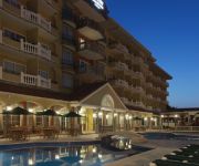
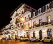
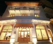
Hotels and Places to Stay
Ojos Del Rio
Panama Canal Country Inn and Suites by Radisson
LAS CLEMENTINAS
American Trade Hotel
Villa Palma Boutique Hotel
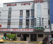
Hotel Bellavista
COSTA INN
Hotel Latino
HOTEL CENTROAMERICANO
Hotel Bahia Suites
Videos from this area
These are videos related to the place based on their proximity to this place.
Cerro Ancon Panama City
Cerro Ancon is a short 20 minute hike up a hill outside Panama City that gives a beautiful panoramic view of the city. For more information, check out http://mytanfeet.com/panama/cerro-ancon/...
Panama City - City Scenes
I made this quick video while trying out Cyberlink Powerdirector 12. It crashed 5 time while trying to output the video.
Panama City, Panama - Crossing the Bridge of the Americas HD (2014)
The Panama Canal (Spanish: Canal de Panamá) is a 77.1-kilometre (48 mi) ship canal in Panama that connects the Atlantic Ocean (via the Caribbean Sea) to the Pacific Ocean. The canal cuts across...
Panama City, Panama - Ancon Hill HD (2014)
Ancon Hill is a 654-foot hill that overlooks Panama City, Panama, adjacent to the township of Ancón. It was under US jurisdiction as part of the Panama Canal Zone for much of the 20th century...
Panama Canal, Panama - Transit - Puerto de Balboa HD (2014)
The Panama Canal (Spanish: Canal de Panamá) is a 77.1-kilometre (48 mi) ship canal in Panama that connects the Atlantic Ocean (via the Caribbean Sea) to the Pacific Ocean. The canal cuts across...
Pacific Puddle Jump at Balboa Yacht Club
March 2015 Pacific Puddle Jump Sendoff Party at Balboa Yacht Club, Panama.
Driving The Bridge of Americas - Panama City, Panama
The Bridge of the Americas crosses the Pacific approach to the Panama Canal at Balboa, near Panama City. It was built between 1959 and 1962 by the United States at a cost of 20 million U.S....
S.A.R. el Príncipe de Asturias homenajea a Núñez de Balboa en Panamá
Su Alteza Real el Príncipe de Asturias estuvo presente en el acto conmemorativo del V Centenario del Descubrimiento del Océano Pacífico en Cinta Costera, que contó con la presencia del...
9 Passenger Britten Norman BN2/Islander Landing, Albrook, Panama City
9 Passenger Britten Norman BN2/Islander Landing, Albrook, Panama City.
PANAMA WATERFALLS, PANAMA CITY TOUR VIDEO X VILLA MICHELLE `PANAMA TOUR GUIDE
PANAMA WATERFALLS, CASCADAS DE PANAMA, PANAMA CITY TOURS VIDEO BY VILLA MICHELLE A TOURIST TRANSPORTATION IN PANAMA KNOWS THE ATTRACTIVENESS THAT OFFERS ...
Videos provided by Youtube are under the copyright of their owners.
Attractions and noteworthy things
Distances are based on the centre of the city/town and sightseeing location. This list contains brief abstracts about monuments, holiday activities, national parcs, museums, organisations and more from the area as well as interesting facts about the region itself. Where available, you'll find the corresponding homepage. Otherwise the related wikipedia article.
Balboa, Panama
Balboa is a district of Panama City, located at the Pacific entrance to the Panama Canal.
Bridge of the Americas
The Bridge of the Americas (Spanish: Puente de las Américas; originally known as the Thatcher Ferry Bridge) is a road bridge in Panama, which spans the Pacific entrance to the Panama Canal. Completed in 1962, at a cost of US$20 million, it was the only non-swinging bridge (there are two other bridges, one at the Miraflores locks and one at the Gatun locks) connecting the north and south American land masses until the opening of the Centennial Bridge in 2004.
Panama Canal Authority
The Panama Canal Authority (Spanish: Autoridad del Canal de Panamá) is the agency of the government of Panama responsible for the operation and management of the Panama Canal. The ACP took over the administration of the Panama Canal from the Panama Canal Commission, the joint US–Panama agency that managed the Canal, on December 31, 1999, when the canal was handed over from the United States to Panama as the Torrijos-Carter Treaties stated.
Martyrs' Day (Panama)
Martyrs' Day is a Panamanian holiday which commemorates the January 9, 1964 riots over sovereignty of the Panama Canal Zone. The riot started after a Panamanian flag was torn during conflict between Panamanian students and Canal Zone Police officers, over the right of the Panamanian flag to be flown alongside the U.S. flag. U.S. Army units became involved in suppressing the violence after Canal Zone police were overwhelmed, and after three days of fighting, about 21 Panamanians and four U.S.
Ancon Hill
Ancon Hill is a steep 654-foot hill which overlooks Panama City, Panama adjacent to the township of Ancón. It was under U.S. jurisdiction as part of the Panama Canal Zone for much of the 20th century and therefore was never developed like most of the surrounding urbanized parts of the city. As a result, it became a kind of an "island" of jungle in an urban area, where wildlife still survives cut off from other jungle areas.
Estadio Municipal de Balboa
Estadio Municipal de Balboa is a multi-purpose stadium in Balboa, Panama. It is currently used mostly for football matches and is the home stadium of Municipal Chorrillo. The stadium holds 2,000 people. The stadium was originally part of the Balboa High School campus, and was used mostly to play football and baseball. Currently the field is administered by the Panama Canal Authority.
Balboa Heights, Panama
Balboa Heights was more or less part of the Panama Canal township of Balboa, existing on the edge of it towards Ancón, with some of it on the lower slopes of Ancon Hill. It wasn't really a proper township in terms of having anything other than residential neighborhoods, but it got its own map page in the Canal Zone telephone book.
Balboa High School (Panama)
Balboa High School was a public high school in the former Canal Zone on the isthmus of Panama. {{#invoke:Coordinates|coord}}{{#coordinates:8|57|32.35|N|79|33|26.47|W| |primary |name= }}


