Safety Score: 3,0 of 5.0 based on data from 9 authorites. Meaning we advice caution when travelling to Panama.
Travel warnings are updated daily. Source: Travel Warning Panama. Last Update: 2024-04-23 08:18:23
Delve into Diablo Heights
Diablo Heights in Provincia de Panamá is located in Panama a little south-west of Panama, the country's capital town.
Current time in Diablo Heights is now 01:51 AM (Wednesday). The local timezone is named America / Panama with an UTC offset of -5 hours. We know of 8 airports close to Diablo Heights, of which one is a larger airport. The closest airport in Panama is Marcos A. Gelabert International Airport in a distance of 0 mi (or 1 km), North-East. Besides the airports, there are other travel options available (check left side).
There are several Unesco world heritage sites nearby. The closest heritage site in Panama is Archaeological Site of Panamá Viejo and Historic District of Panamá in a distance of 75 mi (or 121 km), East. If you need a hotel, we compiled a list of available hotels close to the map centre further down the page.
While being here, you might want to pay a visit to some of the following locations: Panama, Arraijan, Veracruz, San Miguelito and Vista Alegre. To further explore this place, just scroll down and browse the available info.
Local weather forecast
Todays Local Weather Conditions & Forecast: 30°C / 85 °F
| Morning Temperature | 25°C / 76 °F |
| Evening Temperature | 26°C / 78 °F |
| Night Temperature | 24°C / 76 °F |
| Chance of rainfall | 14% |
| Air Humidity | 70% |
| Air Pressure | 1012 hPa |
| Wind Speed | Gentle Breeze with 6 km/h (4 mph) from South-East |
| Cloud Conditions | Overcast clouds, covering 94% of sky |
| General Conditions | Moderate rain |
Wednesday, 24th of April 2024
24°C (76 °F)
24°C (75 °F)
Heavy intensity rain, gentle breeze, overcast clouds.
Thursday, 25th of April 2024
28°C (83 °F)
24°C (76 °F)
Moderate rain, light breeze, overcast clouds.
Friday, 26th of April 2024
29°C (84 °F)
25°C (76 °F)
Moderate rain, light breeze, few clouds.
Hotels and Places to Stay
American Trade Hotel
Ojos Del Rio
Panama Canal Country Inn and Suites by Radisson
LAS CLEMENTINAS
GM Lodge
La Isabela Suites
HOTEL VIA ESPANA
COSTA INN
HOTEL CENTROAMERICANO
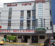
Hotel Bellavista
Videos from this area
These are videos related to the place based on their proximity to this place.
Cerro Ancon Panama City
Cerro Ancon is a short 20 minute hike up a hill outside Panama City that gives a beautiful panoramic view of the city. For more information, check out http://mytanfeet.com/panama/cerro-ancon/...
Panama City, Panama - Ancon Hill HD (2014)
Ancon Hill is a 654-foot hill that overlooks Panama City, Panama, adjacent to the township of Ancón. It was under US jurisdiction as part of the Panama Canal Zone for much of the 20th century...
Panama - La Chorrera por Vía Puente Centenario
Recorrido por la tarde, en la Kawasaki Ninja, entre el tráfico que se dirige al Puente Centenario. Muy buen recorrido para relajarse, en moto por supuesto, pues hay variedad de cosas para...
Panama Canal, Panama - Transit - Puerto de Balboa HD (2014)
The Panama Canal (Spanish: Canal de Panamá) is a 77.1-kilometre (48 mi) ship canal in Panama that connects the Atlantic Ocean (via the Caribbean Sea) to the Pacific Ocean. The canal cuts across...
S.A.R. el Príncipe de Asturias homenajea a Núñez de Balboa en Panamá
Su Alteza Real el Príncipe de Asturias estuvo presente en el acto conmemorativo del V Centenario del Descubrimiento del Océano Pacífico en Cinta Costera, que contó con la presencia del...
9 Passenger Britten Norman BN2/Islander Landing, Albrook, Panama City
9 Passenger Britten Norman BN2/Islander Landing, Albrook, Panama City.
Panama - The Final Shrine Bowl November 7th 1998.mpg
Here is a few short clip of the very last Shrine Bowl in Balboa, Panama which was November 7th, 1998. I just arrived in Panama that night and was fortunate enough to catch the last Shrine Bowl....
Save The Diablo Rojo
I hope you will help us to save the Diablo Rojo. These important cultural symbols are in danger of disappearing forever. Together we can make a difference. Seriously though Panama Cities...
3. Bus en la Ciudad de Panamá, Panamá / Bus in Panama City, Panama
Gran Terminal Nacional de Transporte de Albrook, Ciudad de Panamá. Panamá / Albrook Bus Terminal, Panama City. Panama.
On-board camera on a nitro Stampede!
I attached an in-car video camera to my RC Stampede and tested it in a parking lot in the City of Knowledge (Clayton, Panama). It worked! The vibration is very notorious while driving on...
Videos provided by Youtube are under the copyright of their owners.
Attractions and noteworthy things
Distances are based on the centre of the city/town and sightseeing location. This list contains brief abstracts about monuments, holiday activities, national parcs, museums, organisations and more from the area as well as interesting facts about the region itself. Where available, you'll find the corresponding homepage. Otherwise the related wikipedia article.
Panama Canal Railway
The Panama Canal Railway Company is a railway line that links the Atlantic Ocean to the Pacific Ocean across Panama in Central America. It is jointly owned by Kansas City Southern and Mi-Jack Products. The route stretches 47.6 miles across the Isthmus of Panama from Colón (Atlantic) to Balboa.
Panama Canal Authority
The Panama Canal Authority (Spanish: Autoridad del Canal de Panamá) is the agency of the government of Panama responsible for the operation and management of the Panama Canal. The ACP took over the administration of the Panama Canal from the Panama Canal Commission, the joint US–Panama agency that managed the Canal, on December 31, 1999, when the canal was handed over from the United States to Panama as the Torrijos-Carter Treaties stated.
Martyrs' Day (Panama)
Martyrs' Day is a Panamanian holiday which commemorates the January 9, 1964 riots over sovereignty of the Panama Canal Zone. The riot started after a Panamanian flag was torn during conflict between Panamanian students and Canal Zone Police officers, over the right of the Panamanian flag to be flown alongside the U.S. flag. U.S. Army units became involved in suppressing the violence after Canal Zone police were overwhelmed, and after three days of fighting, about 21 Panamanians and four U.S.
Ancon Hill
Ancon Hill is a steep 654-foot hill which overlooks Panama City, Panama adjacent to the township of Ancón. It was under U.S. jurisdiction as part of the Panama Canal Zone for much of the 20th century and therefore was never developed like most of the surrounding urbanized parts of the city. As a result, it became a kind of an "island" of jungle in an urban area, where wildlife still survives cut off from other jungle areas.
Instituto Oncologico Nacional
The National Oncologic Institute or ION is a specialized hospital for cancer treatment, located in Panama City, Panama. Between August 2000 and March 2001, patients receiving radiation treatment for prostate cancer and cancer of the cervix received lethal doses of radiation, resulting in 17 fatalities.
Estadio Municipal de Balboa
Estadio Municipal de Balboa is a multi-purpose stadium in Balboa, Panama. It is currently used mostly for football matches and is the home stadium of Municipal Chorrillo. The stadium holds 2,000 people. The stadium was originally part of the Balboa High School campus, and was used mostly to play football and baseball. Currently the field is administered by the Panama Canal Authority.
Diablo, Panama
Diablo was one of many townships in the Panama Canal Zone. It was established in 1905 by William Luke Jenkins. It was located directly across from the entrance to Albrook AFB, on a low hill overlooking the canal just past Balboa Harbor. The Diablo clubhouse was a center for social activity, and included a restaurant and a number of other services.
Albrook Air Force Station
Albrook Air Force Station is a former United States Air Force facility in Panama. It was closed on 30 September 1997 as a result of the Torrijos-Carter Treaties which specified that United States military facilities in the former Panama Canal Zone be closed and the facilities be turned over to the Panamanian government. It was located on the east side of the Panama Canal just south of Fort Clayton and north of the township of Balboa, Panama.
Balboa High School (Panama)
Balboa High School was a public high school in the former Canal Zone on the isthmus of Panama. {{#invoke:Coordinates|coord}}{{#coordinates:8|57|32.35|N|79|33|26.47|W| |primary |name= }}
Anton Army Airfield
Anton Army Airfield is a former United States Army Air Forces World War II airfield in Panama used as an auxiliary of Howard Field as part of the defense of the Panama Canal. Wartime units assigned to the station were: 30th Fighter Squadron, 3 January-10 February 1943 (P-40 Warhawk) 29th Bombardment Squadron, 29 March-13 May 1943 (Northrup A-17 Nomad) Today there is little or no trace of the airfield.


