Safety Score: 3,6 of 5.0 based on data from 9 authorites. Meaning please reconsider your need to travel to Mexico.
Travel warnings are updated daily. Source: Travel Warning Mexico. Last Update: 2024-05-01 08:01:32
Delve into Colonia Acres
Colonia Acres in Matamoros (Estado de Tamaulipas) is located in Mexico about 457 mi (or 735 km) north of Mexico City, the country's capital town.
Current time in Colonia Acres is now 11:06 AM (Wednesday). The local timezone is named America / Matamoros with an UTC offset of -5 hours. We know of 8 airports close to Colonia Acres, of which one is a larger airport. The closest is airport we know is Brownsville South Padre Island International Airport in United states in a distance of 5 mi (or 7 km). The closest airport in Mexico is General Servando Canales International Airport in a distance of 7 mi (or 7 km), North-East. Besides the airports, there are other travel options available (check left side).
Also, if you like playing golf, there are some options within driving distance. We encountered 6 points of interest near this location. If you need a hotel, we compiled a list of available hotels close to the map centre further down the page.
While being here, you might want to pay a visit to some of the following locations: Brownsville, Raymondville, Edinburg, Reynosa and Sarita. To further explore this place, just scroll down and browse the available info.
Local weather forecast
Todays Local Weather Conditions & Forecast: 31°C / 87 °F
| Morning Temperature | 26°C / 78 °F |
| Evening Temperature | 28°C / 82 °F |
| Night Temperature | 25°C / 77 °F |
| Chance of rainfall | 0% |
| Air Humidity | 63% |
| Air Pressure | 1008 hPa |
| Wind Speed | Fresh Breeze with 16 km/h (10 mph) from North-West |
| Cloud Conditions | Overcast clouds, covering 91% of sky |
| General Conditions | Overcast clouds |
Wednesday, 1st of May 2024
33°C (91 °F)
26°C (78 °F)
Few clouds, fresh breeze.
Thursday, 2nd of May 2024
32°C (89 °F)
25°C (78 °F)
Overcast clouds, moderate breeze.
Friday, 3rd of May 2024
32°C (90 °F)
25°C (78 °F)
Broken clouds, fresh breeze.
Hotels and Places to Stay
Pure All Suites Riviera Maya
Pure Mareazul Riviera Maya
Hilton Villahermosa - Conference Center
BW HOTEL PLAZA MATAMOROS
City Express Matamoros
ROSE GARDEN INN
Hotel Alameda Express
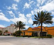
Holiday Inn MATAMOROS
Senses Quinta Avenida By Artisan Adults Only
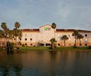
Holiday Inn Express & Suites BROWNSVILLE
Videos from this area
These are videos related to the place based on their proximity to this place.
Puente USA-Mexico (de Brownsville a Matamoros). Un dia sin Trafico!!
Cruzando uno de los 4 puentes que unen a mi ciudad Matamoros, Tamps (MX) con Brownsville, Texas (USA). Por debajo del puente pasa el Rio Bravo que divide ambas ciudades. Puente ...
Grupo Mojado: Matamoros es
Grupo: Mojado matamoros es video donde les dejo algunos lugares para ir en pareja o en familia de matamoros tamaulipas.
Alabatón| Génesis Televisión | Barbara Zayas & Memo Castro Jr. | Un Segundo En Tu Espacio | Aby
Alabatón de Génesis Televisión es un evento producido con artistas, ministros y talento local de H.Matamoros, Tamaulipas México y sus alrededores. Barbara Zayas & Memo Castro Jr. nos presenta...
Alabatón| Génesis Televisión | Ricardo Romero | Que lindo es mi Cristo | Marcos Witt
Alabatón de Génesis Televisión es un evento producido con artistas, ministros y talento local de H.Matamoros, Tamaulipas México y sus alrededores. Ricardo Romero nos presenta su versión...
Tesoros Escondidos - Abel Cardona - Invitado Especial Evangelista José Luis Silva
Génesis Televisión: El canal de la familia se sostiene gracias al apoyo voluntario de nuestros televidentes, seguidores y patrocinadores, estas invitado a apoyar nuestra transmisión, da...
Casi pierde a su familia por los vicios - Libros Abiertos
En este nuevo episodio de libros abiertos, David Gutiérrez nos comparte su impactante testimonio de como dejo la vida de la fiesta, el alcohol, las drogas y todo por amor a su familia. Génesis...
¡Esta mujer canceló el divorcio! - Libros Abiertos - Génesis Televisión
En este episodio de libros abiertos, Hilda Guadalupe Torres de Gutiérrez nos cuenta su impactante testimonio de como cambio de piel, de vida y renovó su matrimonio al borde del fracaso. ...
Alcaldesa Lety Salazar en salto de cuerda
Muy buena su presentación en el Primer Concurso de Rondas Infantiles y Salto de Cuerda. 19-Mar-14.
Las 3 etapas de la Prehistoria, Obra de Teatro Esc. Niños Heroes Matamoros
Las 3 etapas de la Prehistoria, Obra de Teatro Representada por alumnosde 6to B, de la Esc. Niños Heroes Matamoros.
Videos provided by Youtube are under the copyright of their owners.
Attractions and noteworthy things
Distances are based on the centre of the city/town and sightseeing location. This list contains brief abstracts about monuments, holiday activities, national parcs, museums, organisations and more from the area as well as interesting facts about the region itself. Where available, you'll find the corresponding homepage. Otherwise the related wikipedia article.
The University of Texas at Brownsville and Texas Southmost College
The University of Texas at Brownsville (abbreviated as UTB and formerly known as the University of Texas at Brownsville and Texas Southmost College) is an educational institution located in Brownsville, Texas. The university is on the land once occupied by Fort Brown. It is a member of the University of Texas System. The institution was formed from a partnership between Texas Southmost College and the University of Texas-Pan American at Brownsville.
Fort Brown
Fort Brown was a military post of the United States Army in Texas during the later half of 19th century and the early part of the 20th century.
Gateway International Bridge
Gateway International Bridge is one of three international bridges that cross the U.S. -Mexico border between the cities of Brownsville, Texas, and Matamoros, Tamaulipas. It is owned and operated by Cameron County. Over the past century, it has developed the nickname of "The New Bridge" when the bridge was remodeled back in the 20th century. Despite the fact that the Veteran's International Bridge is newer than Gateway, it still retains its nickname.
Brownsville & Matamoros International Bridge
The Brownsville & Matamoros International Bridge, also known as B&M International Bridge, Brownsville-Matamoros International Bridge and Express Bridge, is one of three international bridges that cross the U.S. -Mexico border between the cities of Brownsville, Texas, and Matamoros, Tamaulipas. This international bridge unites the Matamoros–Brownsville Metropolitan Area, which counts with a population of 1,136,995, making it the 4th largest metropolitan area in the Mexico-US border.
Veterans International Bridge at Los Tomates
The Veterans International Bridge at Los Tomates is one of three international bridges that span the Mexico–United States border between the cities of Brownsville, Texas, and Matamoros, Tamaulipas. It is also known as simply as the Veterans Bridge, the Los Tomates Bridge, or on the Mexico side as the Puente Internacional Ignacio Zaragoza. The bridge is owned and operated by Cameron County.
Matamoros Municipality, Tamaulipas
Matamoros is a municipality located in the Mexican state of Tamaulipas.
Battle of Matamoros
The Battle of Matamoros was a naval engagement during the Texas Revolution on April 3, 1836 between one ship of the Mexican Navy and one of the Texas Navy. The Mexican ship was outmaneuvered and repeatedly hit before running aground and abandoned. The Port of Matamoros, also known as LOS BRAZOS DE SANTIAGO, was the Mexican army's primary resupply base for the operations of General Santa Anna, who was finally defeated on April 21, 1836, outside of Houston at the battle of San Jacinto.
Brownsville – Veterans Port of Entry
The Brownsville Veterans Port of Entry opened in 1909 with the completion of the Veterans International Bridge at Los Tomates. The bridge was built primarily to divert commercial freight traffic away from the busy downtown bridges, but about a third of the passenger vehicles also cross at this point. The Veterans Port of Entry is the easternmost US-Mexico border crossing, and is by far the newest of the three crossings between Brownsville and Matamoros.


