Safety Score: 2,8 of 5.0 based on data from 9 authorites. Meaning we advice caution when travelling to Japan.
Travel warnings are updated daily. Source: Travel Warning Japan. Last Update: 2024-05-14 08:25:02
Explore Kōnoue
Kōnoue in Kumano-shi (Mie-ken) is a city in Japan about 241 mi (or 387 km) south-west of Tokyo, the country's capital.
Local time in Kōnoue is now 01:41 AM (Wednesday). The local timezone is named Asia / Tokyo with an UTC offset of 9 hours. We know of 8 airports in the vicinity of Kōnoue, of which 3 are larger airports. The closest airport in Japan is Nanki Shirahama Airport in a distance of 42 mi (or 68 km), South-West. Besides the airports, there are other travel options available (check left side).
There are several Unesco world heritage sites nearby. The closest heritage site in Japan is Sacred Sites and Pilgrimage Routes in the Kii Mountain Range in a distance of 16 mi (or 25 km), South-West. If you need a place to sleep, we compiled a list of available hotels close to the map centre further down the page.
Depending on your travel schedule, you might want to pay a visit to some of the following locations: Kumano, Owase, Shingu, Kihoku and Gojo. To further explore this place, just scroll down and browse the available info.
Local weather forecast
Todays Local Weather Conditions & Forecast: 20°C / 67 °F
| Morning Temperature | 13°C / 56 °F |
| Evening Temperature | 16°C / 60 °F |
| Night Temperature | 15°C / 59 °F |
| Chance of rainfall | 7% |
| Air Humidity | 69% |
| Air Pressure | 1016 hPa |
| Wind Speed | Light breeze with 4 km/h (3 mph) from North-West |
| Cloud Conditions | Overcast clouds, covering 100% of sky |
| General Conditions | Moderate rain |
Thursday, 16th of May 2024
22°C (71 °F)
11°C (52 °F)
Moderate rain, moderate breeze, few clouds.
Friday, 17th of May 2024
21°C (70 °F)
14°C (57 °F)
Few clouds, light breeze.
Saturday, 18th of May 2024
23°C (74 °F)
16°C (60 °F)
Broken clouds, light breeze.
Hotels and Places to Stay
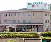
Business Hotel Hiratani
Business Hotel Kawakami
Videos from this area
These are videos related to the place based on their proximity to this place.
EXTENDED TRAILER for ROCK THE QUAKE. A film by Mario Cuzic
ARTISTS REWARD Hurricane Sally ( Bass vocal) YU-YAH!!! ( Guitar) AX GX (Drums) THE GHOSTARS S-Guy ( guitar vocal) Daisuke ( Bass ) Toyoshima ( Guitar) Damian ( Drums ) NIOROZE ...
国道425寺垣内-白谷TN・奈良県下北山村bad road Route425 Japan
国道425号線は三重県尾鷲から和歌山県御坊まで紀伊半島を縦断する山岳路線です。 道幅は狭く落石も多いため、日本三大酷道にもなっています。...
名古屋高校×大阪朝鮮高校(後半) 第19回熊野ラグビーフェス 2014
第19回熊野市ラグビーフットボールフェスティバル 20分ハーフ 名古屋高校×大阪朝鮮高校 2014年6月14日(日)晴れ 熊野市山崎運動公園多目的グラン...
名古屋高校×東海大仰星高校(後半) 第19回熊野ラグビーフェス 2014
第19回熊野市ラグビーフットボールフェスティバル 30分ハーフ 決勝 名古屋高校×東海大仰星高校 2014年6月15日(日)曇り 熊野市山崎運動公園多目...
北山川観光筏下り (北山村) Kitayamamura-Ikadakudari (Kitayama village rafting)
切立った岩の間を、澄んだ北山川が流れています。川幅は5~60メートル。聞けば、深いところは25メートルもあるそうでした。行ったその日は晴れ...
美しい日本の原風景「丸山千枚田」 Maruyama Rice Terraces ( Shot on RED EPIC )
丸山千枚田は、三重県熊野市紀和町にある日本最大級の棚田です。 日本の棚田百選に選ばれています。 世界遺産の熊野古道「通り峠」展望台より...
Videos provided by Youtube are under the copyright of their owners.
Attractions and noteworthy things
Distances are based on the centre of the city/town and sightseeing location. This list contains brief abstracts about monuments, holiday activities, national parcs, museums, organisations and more from the area as well as interesting facts about the region itself. Where available, you'll find the corresponding homepage. Otherwise the related wikipedia article.
Nanairo Dam
The Nanairo Dam is a concrete gravity-arch dam located in Kumano, Mie Prefecture, Japan. The dam crosses the Kitayama River, a tributary of the Kumano River near the border of Mie Prefecture with Wakayama Prefecture. The dam was constructed by Obayashi Corporation, with construction starting in 1963, and completed by 1965. It is currently owned maintained by the Electric Power Development Company.


